From bike superhighways to autonomous vehicles, cities around the world are rethinking the way people move. This post explores how ten leading urban centers have introduced transformative transportation strategies—each addressing unique local challenges while advancing broader goals of sustainability, efficiency, and urban livability.
Below are ten case studies that illustrate this global shift in motion:
Singapore – Intelligent Transport System (ITS)
Stockholm – Mobility as a Service (MaaS)
London – Congestion Charging Scheme
New York City – Smart Traffic Signal System (ASCS)
Copenhagen – Bike Superhighway Network
Dubai – Autonomous Vehicle Program
Helsinki – Mobility on Demand (MoD) System
Barcelona – Integrated Mobility Platform (PMIB)
Songdo (South Korea) – Smart City Mobility Model
Los Angeles – Adaptive Traffic Control System (ATCS)
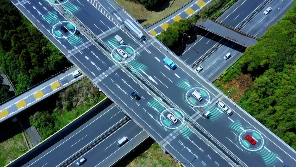
Singapore's Intelligent Transport System
Confronted with the perennial challenge of limited land and high population density, Singapore has emerged as a global exemplar of mobility innovation through its Intelligent Transport System (ITS). This integrated, multi-modal framework leverages real-time data analytics, predictive modeling, and adaptive signal control to optimize urban mobility. Anchored in the city-state’s tradition of transit-oriented development (TOD), the ITS acts as a spine for high-capacity public transit while disincentivizing car dependency through dynamic road pricing and electronic congestion management. The planning imperative here is clear: to reconcile efficient intra-urban connectivity with spatial constraints, without compromising environmental performance or social equity.
To future-proof its infrastructure, Singapore’s Land Transport Authority (LTA) has prioritized anticipatory governance—investing in electric vehicle (EV) ecosystems, autonomous mobility R&D, and AI-driven traffic orchestration systems. Notably, cybersecurity has emerged as a core concern amid the increasing digitization of mobility, prompting the deployment of robust encryption protocols and decentralized data systems. Beyond its technical prowess, the ITS showcases how governance continuity, institutional capacity, and evidence-based transport policy can synergize to generate positive urban externalities—manifested in modal shift gains, lowered emissions, and enhanced economic throughput. Singapore’s experience reinforces a critical urban planning axiom: intelligent mobility is not merely about smart technologies, but about orchestrating systems that embed resilience, adaptability, and inclusivity into the very fabric of urban life.
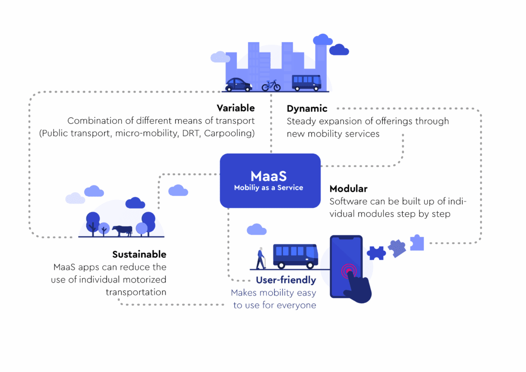
Stockholm’s Mobility-as-a-Service (MaaS) initiative exemplifies the city’s strategic pivot toward a post-carbon mobility paradigm. Embedded within its overarching climate action and urban sustainability agendas, MaaS seeks to consolidate diverse transport services—public transit, e-bikes, car-sharing, and micro-mobility—into a unified, user-centric digital platform. The objective is not simply modal integration but behavioral transformation: encouraging residents to transition from private car dependency to an ecosystem of low-impact, shared mobility options. Yet the path has not been frictionless. Planners have had to reconcile fragmented service operators, legacy infrastructure, and regulatory inertia to operationalize this digitally layered, demand-responsive mobility model.
Stockholm’s approach reveals the critical role of regulatory innovation and infrastructure retrofitting in enabling MaaS at scale. From differentiated congestion pricing and parking incentives for high-occupancy and electric vehicles to the deployment of AI-driven predictive maintenance for public transit fleets, the city has systematically embedded sustainability metrics into its transportation governance. The results are compelling: 46% of daily trips now occur via walking, cycling, or public transport; transport emissions have dropped by 43%; and user satisfaction remains high. With its pledge to become net-zero by 2030, Stockholm underscores a key urban planning insight: that digital mobility frameworks, when embedded in climate-conscious policy and supported by interoperable infrastructure, can be powerful catalysts for urban decarbonization and equitable access.
A net zero city
Source: Website Link
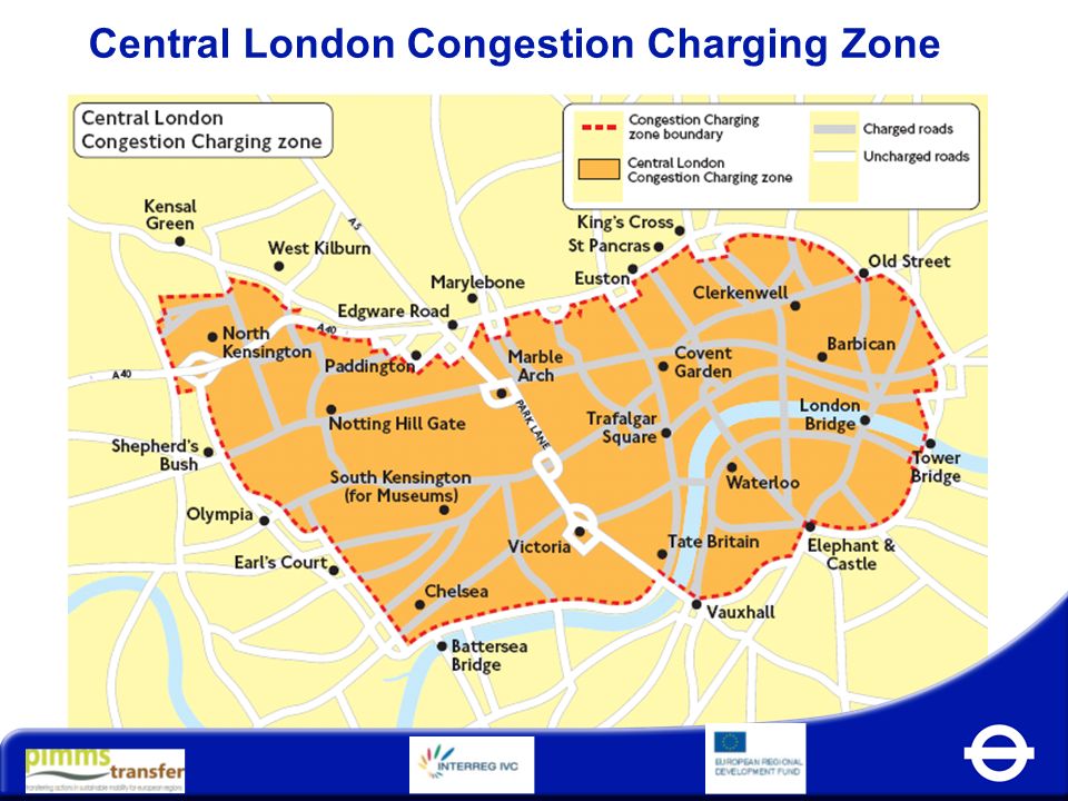
London's Congestion Charging Scheme
In the early 2000s, London faced a critical urban mobility crisis—chronic congestion in its central core resulted in estimated productivity losses exceeding £2–4 million per week. The Congestion Charging Scheme, launched in 2003, marked a paradigmatic shift in demand management and road pricing policy. It introduced a cordon-based congestion fee during peak hours, targeting vehicular saturation through economic disincentives. Despite initial public resistance, the scheme’s rollout was underpinned by strong mayoral leadership, a unified regulatory vision, and institutional coordination via Transport for London (TfL), the centralized transit authority. This consolidation of agency responsibility enabled seamless implementation of a complex system of ANPR (Automatic Number Plate Recognition) cameras, dynamic pricing, and digital enforcement infrastructure.
The scheme catalyzed measurable modal shifts and environmental benefits: traffic volume in the central zone dropped by 26%, bus ridership surged by 37% during charge hours in its inaugural year, and the initiative generated over £122 million in fiscal surplus (2005–06), all reinvested into sustainable transit upgrades. More importantly, the pricing mechanism has proven adaptable—evolving in scope, fee structure, and operational timing to retain its deterrent efficacy in a changing urban landscape. London’s experience underscores a critical planning tenet: that congestion is not merely a transportation issue, but a governance challenge demanding calibrated fiscal tools, public trust, and iterative policy design. As cities worldwide grapple with urban externalities, London’s congestion charge remains a seminal case of monetizing access to public space to prioritize environmental justice, accessibility, and urban resilience.
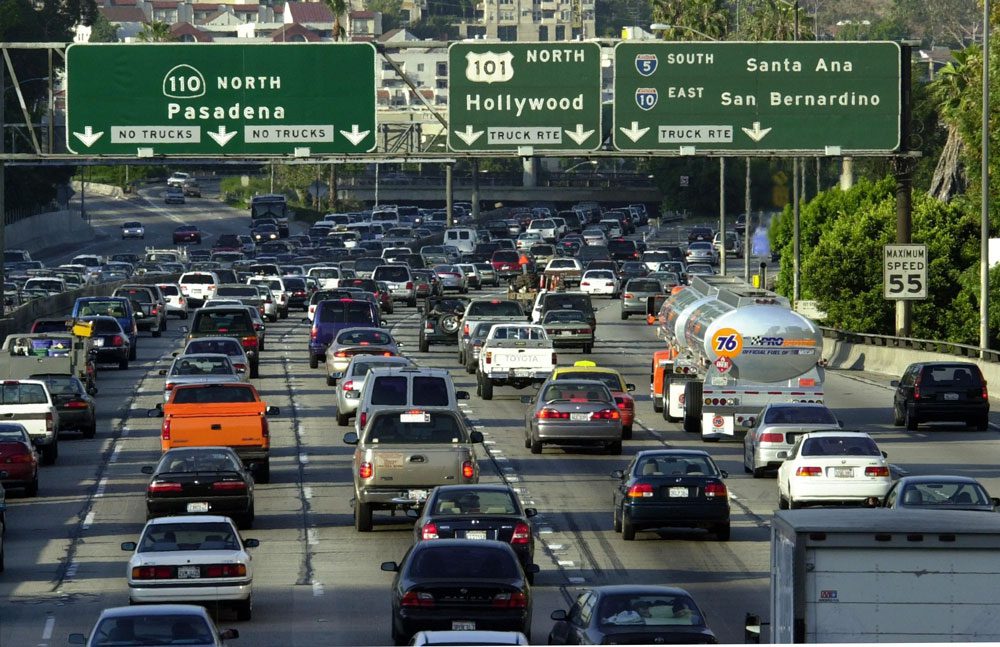
In a city defined by vertical density, multimodal congestion, and perpetual motion, New York’s transportation ecosystem demands surgical precision in real-time traffic management. Midtown Manhattan, in particular, presents one of the most challenging traffic environments globally—an urban theatre where street grids intersect with pedestrian surges, freight logistics, and emergency response needs. To confront this, New York has deployed an advanced Adaptive Signal Control System (ASCS), anchored by TransCore’s TransSuite software and supported by the NYC Wireless Network (NYCWiN)—a high-speed, broadband communications grid. This digital spine collects and synthesizes data from an array of embedded sensors, RFID tags, and surveillance cameras, allowing for dynamic signal retiming based on real-time demand and disruptions such as roadworks, special events, or collisions.
The impacts are measurable and multidimensional: travel times in Midtown have improved by approximately 10%, while the fluidity of intersections has bolstered emergency response times and overall public safety. Unlike traditional signal systems, which rely on static time-of-day plans, New York’s ASCS exemplifies responsive governance—where algorithmic feedback loops replace fixed timetables with machine-learned adaptability. Critically, the project underscores the importance of interoperable infrastructure and centralized command in managing complex urban traffic ecosystems. New York’s experience affirms a growing consensus in transportation planning: that real-time, data-driven signal optimization is no longer a luxury but a foundational layer of resilient, smart urbanism.
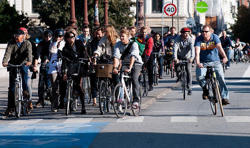
Copenhagen’s ambition to become the world’s premier bicycle city by 2025 is not merely an act of branding—it reflects a deep structural rethinking of urban mobility through a “velocentric” planning lens. With 36% of daily trips already made by bike as of 2018, the city’s expansive Bike Superhighway Network exemplifies a paradigm shift from auto-centric to human-scaled infrastructure. The superhighways are designed as high-capacity, regionally connected corridors with physically separated lanes, smart signalization, and cyclist-prioritized intersections. This spatial reallocation—from vehicular to non-motorized modes—has required deft management of limited road space and a recalibration of urban street hierarchies, prioritizing safety, continuity, and comfort.
What distinguishes Copenhagen’s model is its integration of data-driven governance and participatory planning. Through workshops, citizen assemblies, and digital feedback loops, planners have cultivated a culture of cycling ownership among residents. Meanwhile, the deployment of adaptive traffic signals and real-time flow analytics ensures that infrastructure responds to user demand with precision. The outcomes extend beyond modal shift: improved public health metrics, increased patronage of local businesses along cycling corridors, and measurable reductions in carbon emissions. Copenhagen’s success illustrates a core urban planning principle: transformative mobility systems are not solely technological or spatial interventions—they are socio-political projects, requiring trust, transparency, and iterative engagement to reshape how cities breathe, move, and thrive.
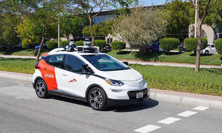
Launched in 2016 as part of a sweeping urban mobility transformation, Dubai’s Autonomous Transportation Strategy envisions a city where 25% of all trips will be conducted via autonomous modes by 2030. This ambition reflects more than a technological pivot; it signals a systemic recalibration of infrastructure, regulation, and public engagement to accommodate post-driver urbanism. The transition poses considerable challenges—chief among them are upgrading legacy road networks to support vehicle-to-infrastructure (V2I) communication, and achieving societal trust in a radically reimagined public realm. Integrating autonomous vehicles (AVs) into an already complex multimodal transport system also demands high levels of system interoperability, real-time coordination, and regulatory foresight.
Dubai’s strategy has advanced through iterative pilot programs, concentrated investment in intelligent transport infrastructure, and robust public awareness campaigns. Connected traffic signals, embedded sensors, and dedicated AV corridors are being rolled out to create an ecosystem where AVs can safely and efficiently navigate alongside traditional transport modes. Beyond safety benefits—such as reduced collision rates due to human error—planners anticipate gains in accessibility, tourism mobility, and economic diversification, particularly through attracting high-tech investment. The initiative encapsulates a vital planning insight: in rapidly evolving urban contexts, institutional flexibility and anticipatory governance are prerequisites for integrating disruptive technologies into the built environment. Dubai’s model represents a nascent but compelling case for how cities can transition toward autonomous futures while maintaining spatial coherence, economic viability, and public confidence.
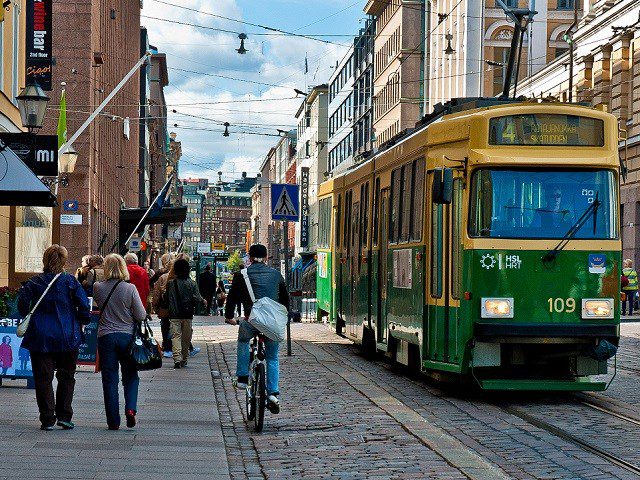
Amid mounting pressure to reduce greenhouse gas emissions, alleviate urban congestion, and elevate quality of life, Helsinki pioneered one of the world’s most forward-thinking Mobility on Demand (MoD) systems. At the heart of this model is Whim, a multi-modal mobility-as-a-service (MaaS) platform that integrates public transit, bike-share, taxis, car rentals, and more into a single, user-centric app. Rather than promoting fragmented service offerings, Helsinki has positioned digital mobility as a systemic urban utility—adaptive, equitable, and climate-responsive. Yet, the planning challenges were formidable: managing the regulatory frameworks for multi-operator integration, driving behavioral change away from private car ownership, and transforming the raw volume of mobility data into actionable, user-focused insights.
What sets Helsinki apart is its planning ethos of co-creation and digital stewardship. By partnering with private providers and embedding public interest into the platform’s architecture, the city has ensured interoperability, accountability, and scalability. The results have been tangible: modal shifts toward shared and active transport, improved urban accessibility, and higher user satisfaction. Just as importantly, Helsinki’s MoD system exhibits real-time adaptability—responding to shifting user behaviors, urban development pressures, and policy landscapes. For urban planners, Helsinki offers a template for how digital mobility ecosystems—when grounded in inclusive governance and designed for continuous evolution—can reconfigure the mobility experience as a service, not a burden, and chart a scalable path toward sustainable urbanism.
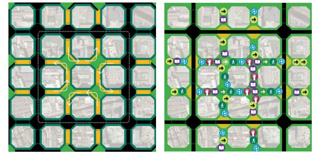
arcelona, long heralded as a leader in smart city innovation, embedded its mobility ambitions within the broader framework of digital governance and urban sustainability. Launched in 2012, the Plataforma de Mobilitat Integrada de Barcelona (PMIB) exemplifies the city’s shift from siloed transport operations to an interoperable, user-centric system. As a core pillar of Barcelona’s smart city strategy, PMIB integrates real-time data from public transit, bike-share, car-share, and traffic flow sensors into a single, responsive platform. The goal: to streamline multimodal journeys, reduce vehicular dependency, and promote sustainable urban mobility. However, integration came with layered challenges—technical, behavioral, and regulatory. Chief among them was fostering citizen adoption amid rising concerns over data privacy, and ensuring cohesive data sharing across a fragmented institutional landscape.
Barcelona’s response was both technical and cultural. The city deployed wide-reaching public engagement campaigns to build trust in the platform and paired them with real-time travel tools, personalized mobility suggestions, and incentives for modal shift. The platform’s open architecture, coupled with robust data governance protocols, ensures that PMIB remains both adaptive and secure. The results are impressive: over 200 million journeys were made through the platform in 2022, with notable growth in active transportation due to its seamless integration of cycling infrastructure and real-time route optimization. Critically, PMIB underscores a foundational planning lesson for smart cities: digital platforms must be not only technologically sophisticated but also socially inclusive, institutionally coordinated, and privacy-forward to truly reshape urban mobility ecosystems.
-1
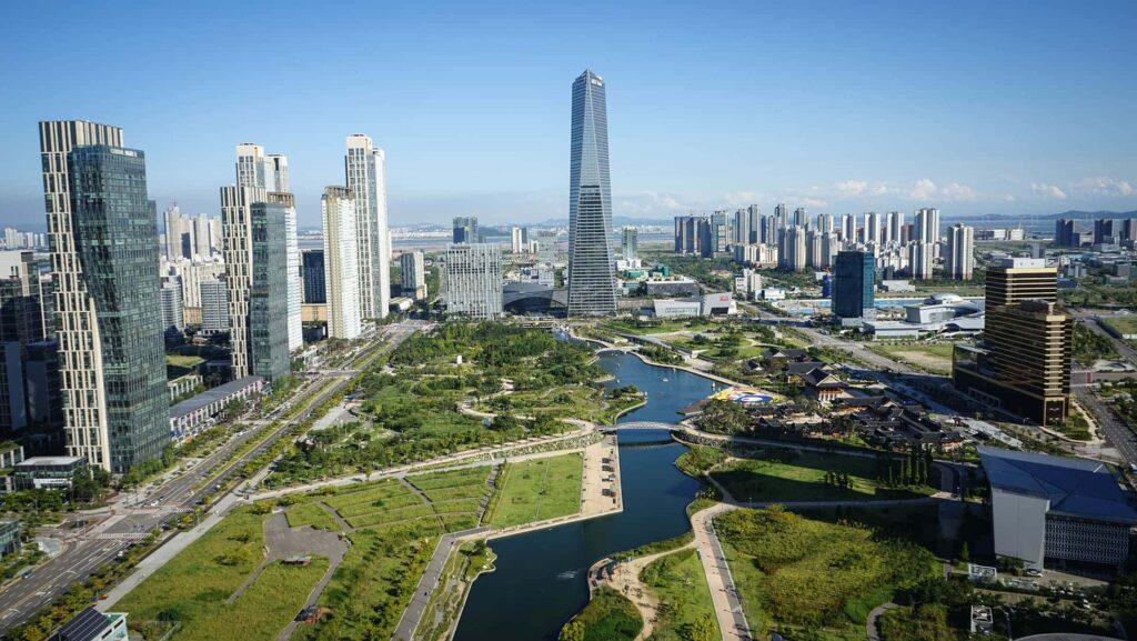
Songdo, South Korea's Integrated Smart City
Conceived as a greenfield experiment in smart urbanism, Songdo International Business District in Incheon, South Korea, was designed from the ground up to be a prototype for 21st-century sustainable living. With a master plan that integrates ubiquitous digital infrastructure, LEED-certified architecture, and multimodal transport connectivity, Songdo aspires to fuse environmental efficiency with global urban competitiveness. Yet the project is not without its contradictions. The very construction of this hyper-modern enclave raised questions about embodied energy, land reclamation, and the ecological costs of large-scale urbanization. Compounding this were the financial risks tied to its capital-intensive nature, which initially made private investment cautious and long-term fiscal viability uncertain.
Despite these challenges, Songdo has pioneered several notable urban mobility interventions. Its city-wide bike-sharing network, walkable grids, and seamless transit links—including direct connectivity to Incheon International Airport—embody the principles of car-free accessibility. Moreover, the integration of ICT into mobility systems enables real-time monitoring, traffic optimization, and personalized route planning. These features have not only enhanced urban livability but have also positioned Songdo as a magnet for multinational firms seeking innovation-friendly environments. More than a technological showcase, Songdo reinforces a nuanced planning insight: the success of smart cities hinges not solely on digital infrastructure but on the choreography of livability, inclusivity, and economic resilience. Whether Songdo ultimately becomes a blueprint or a cautionary tale remains debated, but its bold experiment continues to shape the global discourse on planned urban futures.
-1
Los Angeles' Adaptive Traffic Control System
As the archetype of postwar auto-centric urbanism, Los Angeles has long been synonymous with congestion, where peak-hour traffic slows to a crawl and freeway bottlenecks impair both economic productivity and environmental quality. In response, the city has embraced a phased strategy of technological urbanism, evolving from its legacy ATSAC (Automated Traffic Surveillance and Control) system to the more advanced Adaptive Traffic Control System (ATCS). Initiated in 2018, ATCS brings real-time signal optimization to LA’s sprawling roadway network through intelligent controllers, AI-driven predictive analytics, and a decentralized architecture that continuously recalibrates intersection timing based on live traffic flow.
This shift from static timing to algorithmically adaptive signalization has yielded measurable improvements: average travel times have decreased by approximately 10% citywide, while safety metrics—particularly related to intersection collisions—have shown positive trends. The deployment also highlights a critical planning insight: legacy infrastructure can be incrementally modernized when guided by data-driven governance, scalable system design, and institutional readiness. By layering machine learning on top of embedded traffic sensors and integrating feedback loops into signal timing protocols, Los Angeles demonstrates how smart mobility ecosystems can emerge even within heavily car-dependent urban fabrics. In a city where modal shift remains politically fraught, ATCS does not replace cars—it makes them flow smarter, safer, and with a lighter urban footprint.
-1
Conclusion
In conclusion, the case studies of smart transportation systems across various global cities illustrate the transformative potential of innovative technologies and integrated approaches to urban mobility. From Singapore’s cutting-edge Intelligent Transport System to Stockholm’s pioneering Mobility as a Service model, each city has tailored its strategies to meet specific challenges and goals. Initiatives like London’s Congestion Charging Scheme and New York City’s Smart Traffic Signal System highlight the effectiveness of data-driven traffic management in reducing congestion and improving safety. Meanwhile, Copenhagen’s Bike Superhighway Network and Helsinki’s Mobility on Demand System showcase the importance of promoting sustainable modes of transport. As cities like Dubai and Los Angeles explore autonomous vehicles and adaptive traffic control, they pave the way for a future where mobility is seamless, efficient, and environmentally friendly. Collectively, these case studies underscore the need for collaboration, public engagement, and continuous innovation as urban areas strive to create smarter, more sustainable transportation networks that enhance the quality of life for all residents.
Nadine Ahmed is an architecture engineering student at Ain Shams University. She finds the field of architecture generally interesting because it affects everything around us and is an everyday developing field.
I find this article very interesting. How every city has to start planning the future but also the present. It’s very interesting seeing how each project focuses in a general purpose, making cities more livable and sustainable. However, each party decides how to tackle this reality.
I am a graduate student at Northeastern University in the urban Informatics master program. I am always excited to learn and know more about how cities plan their strategy and how we can all be part of it by participating and applying our knowledge.
Thank you for your thoughtful comment. I appreciate your perspective—it’s true that while goals may be shared, the approaches vary widely. Best of luck with your Urban Informatics studies; it’s a field with so much potential to shape better cities.
“Let’s explore the new avenues of Urban environment together “
We use cookies on our website to give you the most relevant experience by remembering your preferences and repeat visits. By clicking “Accept”, you consent to the use of all the cookies. Read More
This website uses cookies to improve your experience while you navigate through the website. Out of these, the cookies that are categorized as necessary are stored on your browser as they are essential for the working of basic functionalities of the website. We also use third-party cookies that help us analyze and understand how you use this website. These cookies will be stored in your browser only with your consent. You also have the option to opt-out of these cookies. But opting out of some of these cookies may affect your browsing experience.
Necessary cookies are absolutely essential for the website to function properly. These cookies ensure basic functionalities and security features of the website, anonymously.
Cookie
Duration
Description
cookielawinfo-checkbox-analytics
11 months
This cookie is set by GDPR Cookie Consent plugin. The cookie is used to store the user consent for the cookies in the category "Analytics".
cookielawinfo-checkbox-performance
11 months
This cookie is set by GDPR Cookie Consent plugin. The cookie is used to store the user consent for the cookies in the category "Performance".
viewed_cookie_policy
11 months
The cookie is set by the GDPR Cookie Consent plugin and is used to store whether or not user has consented to the use of cookies. It does not store any personal data.
cookielawinfo-checkbox-necessary
11 months
This cookie is set by GDPR Cookie Consent plugin. The cookies is used to store the user consent for the cookies in the category "Necessary".
cookielawinfo-checkbox-others
11 months
This cookie is set by GDPR Cookie Consent plugin. The cookie is used to store the user consent for the cookies in the category "Other.
cookielawinfo-checkbox-functional
11 months
The cookie is set by GDPR cookie consent to record the user consent for the cookies in the category "Functional".
Functional cookies help to perform certain functionalities like sharing the content of the website on social media platforms, collect feedbacks, and other third-party features.
Performance cookies are used to understand and analyze the key performance indexes of the website which helps in delivering a better user experience for the visitors.
Analytical cookies are used to understand how visitors interact with the website. These cookies help provide information on metrics the number of visitors, bounce rate, traffic source, etc.
Advertisement cookies are used to provide visitors with relevant ads and marketing campaigns. These cookies track visitors across websites and collect information to provide customized ads.


2 Comments
I find this article very interesting. How every city has to start planning the future but also the present. It’s very interesting seeing how each project focuses in a general purpose, making cities more livable and sustainable. However, each party decides how to tackle this reality.
I am a graduate student at Northeastern University in the urban Informatics master program. I am always excited to learn and know more about how cities plan their strategy and how we can all be part of it by participating and applying our knowledge.
Congratulations on the article.
Thank you for your thoughtful comment. I appreciate your perspective—it’s true that while goals may be shared, the approaches vary widely. Best of luck with your Urban Informatics studies; it’s a field with so much potential to shape better cities.