
Best Urban Design and Planning Software | Urban Design Lab
When you see a great city with attractive aesthetics and functional systems, it implies that a lot of work has gone into its architectural design. Like a house, every component of a town, from the transport system to public parks, has to be conceptualized and then implemented to make the city functional and enjoyable for all. Urban designers do comprehensive urban analysis and then use advanced architect design software for city plans. This post is a closer look at urban design and will answer the main question, “What software do urban designers use for their projects?
We have compiled the list of best Urban Design and Planning Software to conceptualize your design to the next level.
List of best Urban Design and Planning Software:
General Information
2. Lumion
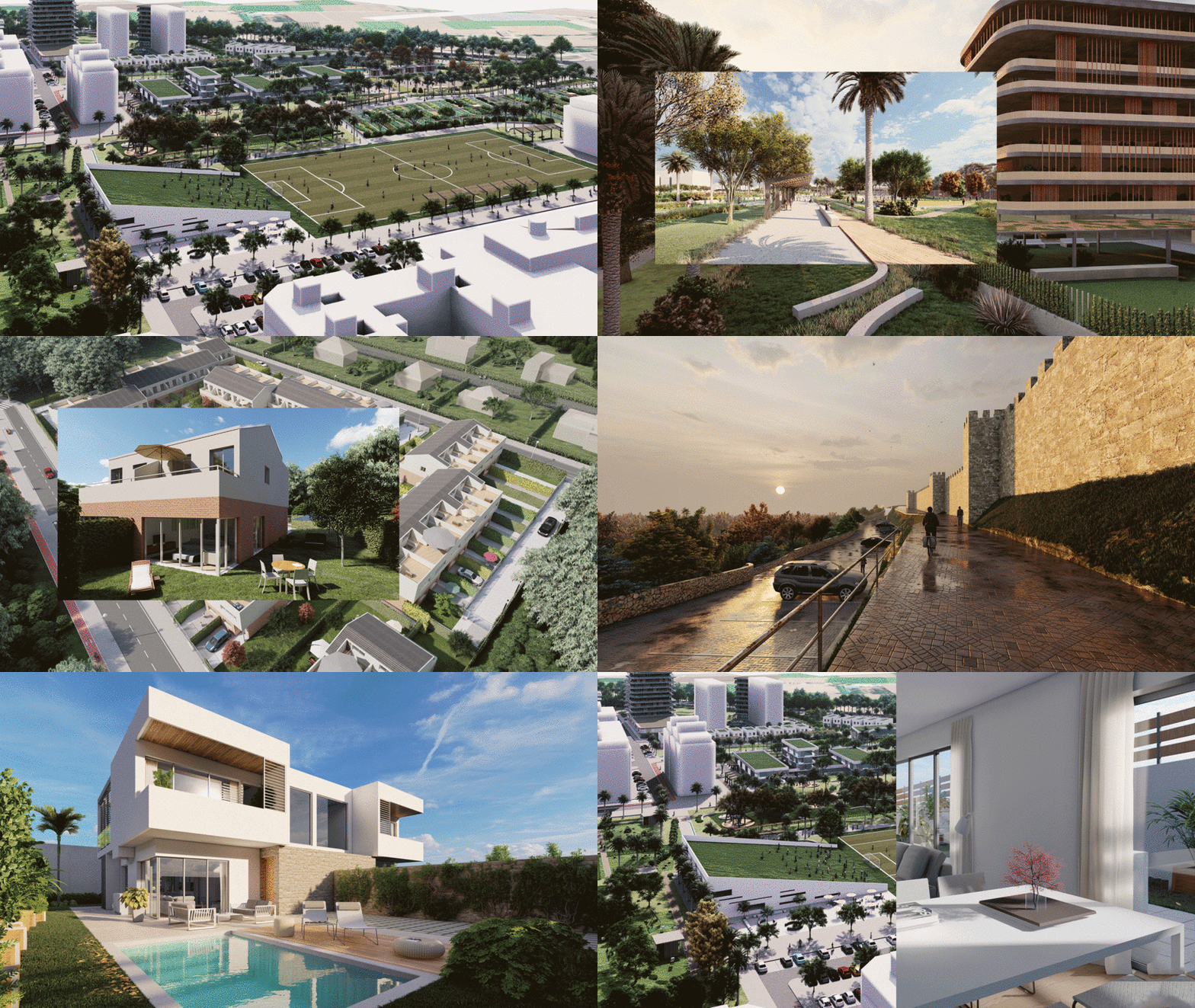
Architectural software is Lumion. Create an image, a movie, or a 360-degree panorama to view with VR glasses. Render really quickly. Make modifications on a regular basis.
Upload a 3D design (created in Revit, SketchUp Rhino, Archicad, or a variety of other 3D modelling tools) into Lumion.
Lumion comes with a wide library of lovely materials and items. Add effects to your model by adding sky, grass, glass, materials, people, lighting, furniture, and cars, among other things. Take in the atmosphere. It’s simple to pick up. This render engine is the world’s quickest.
General Information
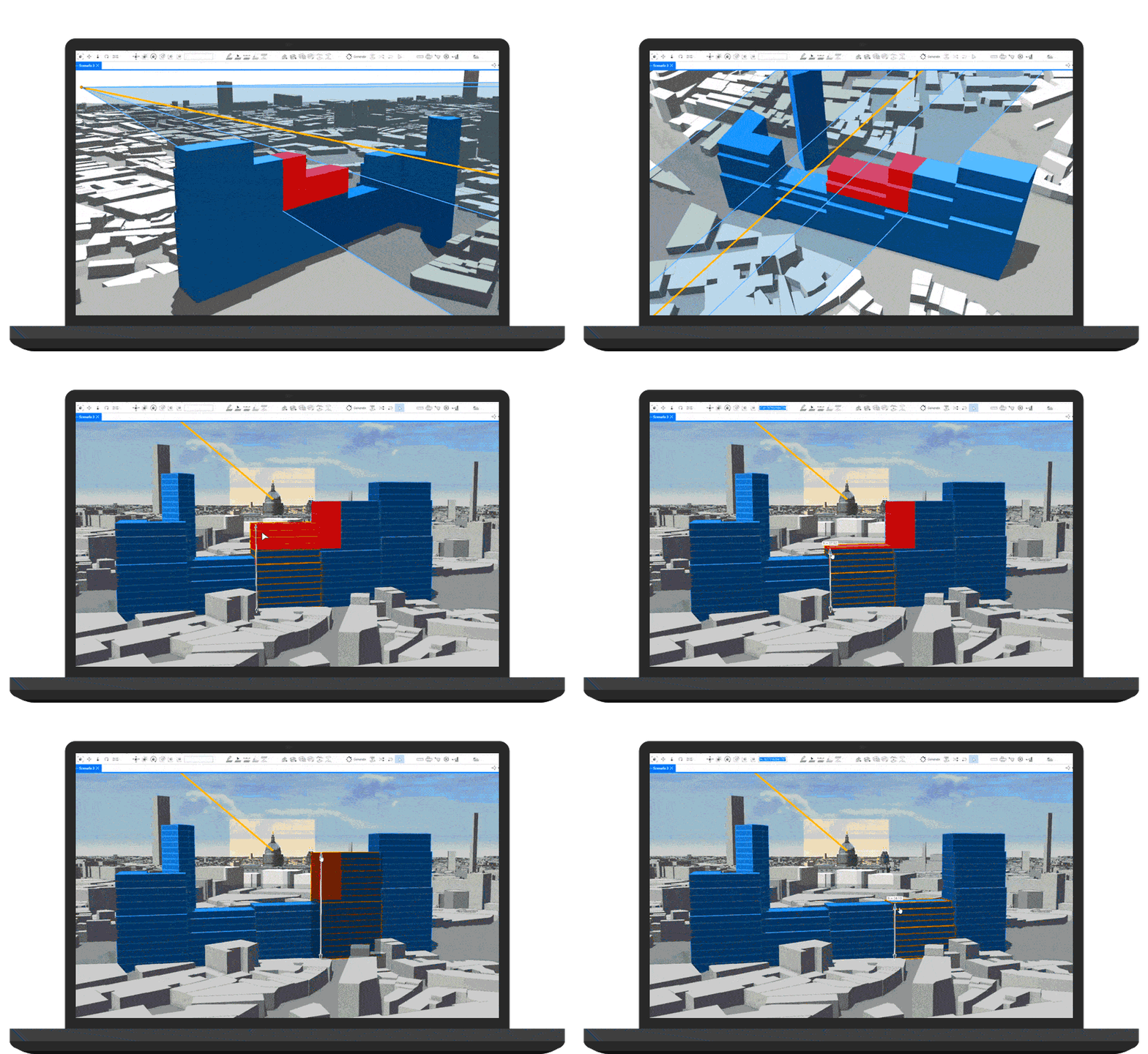
Esri CityEngine is a 3D modeling program that allows you to swiftly create massive metropolitan landscapes. You can construct environments that are based on real-world facts or that are entirely hypothetical. CityEngine saves you time by creating the urban environment depending on your input utilizing rules. You can add context to 3D models made in other software and export your entire scene to visualization tools, game engines, and virtual reality experiences.
General Information
Archicad is a professional BIM software system that complies with all digital-delivery criteria and provides an easy design environment, accurate BIM management, open collaboration, and automatic documentation. Archicad has become even more powerful as a tool for bringing architects and engineers together in a shared model, thanks to improvements in the Integrated Design workflow and greater cooperation between project stakeholders.
General Information
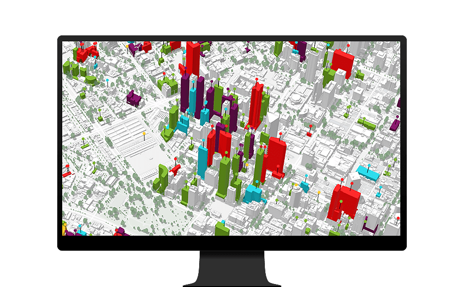
ArcGIS Urban is an immersive 3D experience designed to improve urban planning and decision-making. Quickly visualize projects in your local context and leverage location intelligence to drive better decisions. Be more proactive and less reactive in your planning process. Simplify project collaboration across internal agencies and public stakeholders.
General Information
Languages Supported:
Czech, German, Greek, English, Finnish, French, Hungarian, Italian, Japanese, Korean, Polish, Portuguese, Russian, Spanish, Turkish, Chinese (Simplified)
Google Earth is a crucial tool that lends itself to a variety of professional applications. Particularly useful to urban planners and urban designers alike is the ability to explore cities from an axonometric view (from the perspective of a low flying plane). Other settings provide the ability to experience a 3D perspective, accurately measure distance, and integrate with GIMP and SketchUp. Beyond these practical aspects, the potential to explore cities and landscapes around the world makes Google Earth a ground-breaking resource.
General Information
QGIS is a free, open source Geographic Information System with powerful capabilities. Compatible with Esri (the industry standard maker of ArcGIS), QGIS is perfect for the planner looking to expand their design capabilities. Use QGIS to view multiple layers of mapped data relative to one another, group locations or elements with sets of criteria, determine distance calculations, examine proximities, and quickly create figure ground maps. QGIS makes it simple to quickly get up to speed with the program with an extremely active support community.
General Information
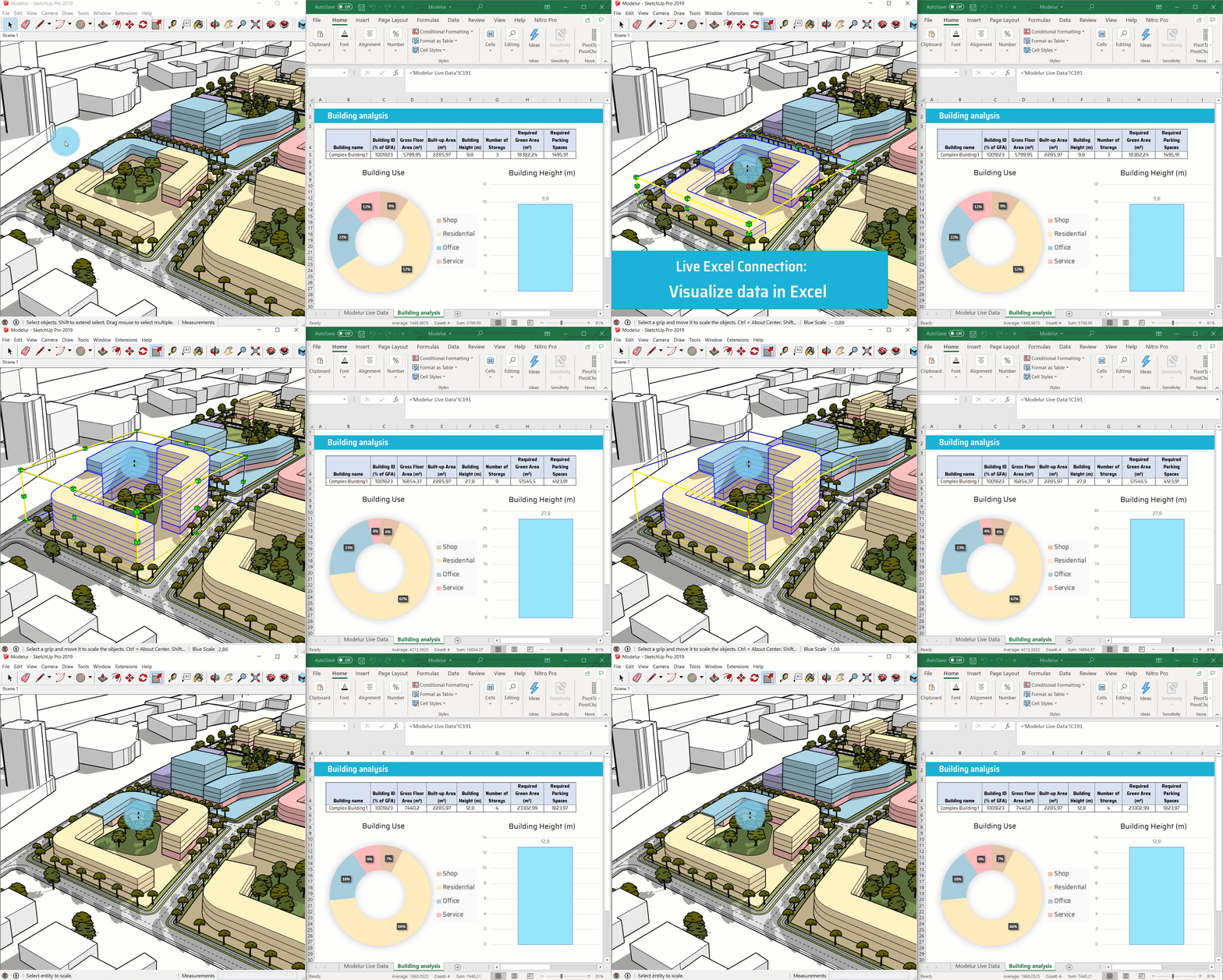
Modelur is an easy-to-use, yet very powerful parametric urban design software tool, developed to help you quickly create conceptual urban massing. It calculates key urban control parameters on the fly (e.g. FAR or required number of parking lots), delivering important information while design is still evolving. This way it fosters well-informed decision making during the earliest stages, when design decisions have the highest impact.
General Information
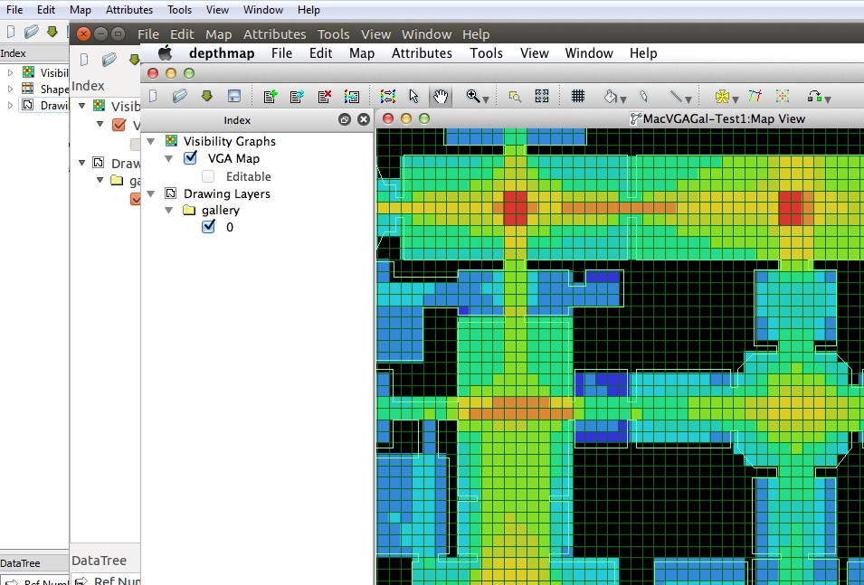
UCL and Space Syntax Limited have developed a “Space Syntax Online Training Platform” to facilitate the dissemination of Space Syntax principles, methodologies and software.
The comprehensive handbook ‘Space Syntax Methodology‘, authored by Kinda Al-Sayed et al (2014), which is used in teaching at UCL offers an introduction and step-by-step tutorials for newbies to learn the techniques and methods of Space Syntax analysis based on depthmapX. Space Syntax Limited also provide training for individuals and organisations in the use of their evidence-informed tools and techniques.
General Information
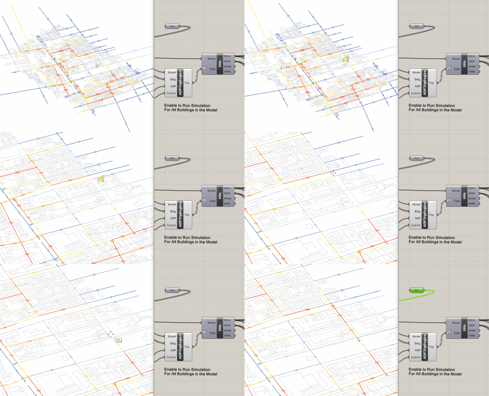
Urbano is a new, easy-to-use, urban design tool that allows you to load urban data from OSM into Rhino. This enables you to build contextual models that can be used for simple visualization and site analysis to complex mobility simulations using the loaded street grids. With v1.2, Urbano supports terrain and allows you to build site models with 3D terrain, buildings, and streets with a single click.
The motivation behind the development of Urbano is to facilitate the design of walkable neighborhoods. Urbano allows you to understand the consequences of design choices regarding the street network and the allocation of density, program, and amenities within the urban fabric. Urbano introduces three new urban design metrics (Walkscore, Streetscore, and Amenityscore) and novel and fast ways to import and translate urban data into actionable design feedback using a simple trip sending algorithm.
General Information
Author: Urban Design Lab
Program: Urban Planning and Design
Publisher: Urban Design Lab
Year: 2022
Related articles


Architecture Professional Degree Delisting: Explained
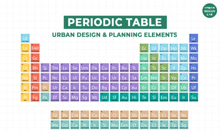
Periodic Table for Urban Design and Planning Elements

History of Urban Planning in India

Best Landscape Architecture Firms in Canada
UDL GIS
Masterclass
GIS Made Easy – Learn to Map, Analyse, and Transform Urban Futures
Session Dates
23rd-27th February 2026

Urban Design Lab
Be the part of our Network
Stay updated on workshops, design tools, and calls for collaboration
Curating the best graduate thesis project globally!

Free E-Book
From thesis to Portfolio
A Guide to Convert Academic Work into a Professional Portfolio”
Recent Posts
- Article Posted:
- Article Posted:
- Article Posted:
- Article Posted:
- Article Posted:
- Article Posted:
- Article Posted:
- Article Posted:
- Article Posted:
- Article Posted:
- Article Posted:
Sign up for our Newsletter
“Let’s explore the new avenues of Urban environment together “












One Comment
I started fetching https://www.cornbreadhemp.com/collections/thc-drinks a smidgin while ago ethical to discover what the hype was thither, and contemporary I in reality look cheeky to them before bed. They don’t finish me at liberty or anything, but they make a show it so much easier to depress and crumple asleep naturally. I’ve been waking up perception nature more rested and not sluggish at all. Even-handedly, kind of disposition I’d tried them sooner.