This book review delves into the enormous field of urban and regional design in a way that is equally valuable to architects, design professionals, and city students. Paul is striving to create a synthesis of design across different fields, each of which is composed of smaller design spheres. It traces the history of urban architecture from its Mesopotamian origins to the present. It also covers urban visual survey techniques, town layout design ideas, the various land uses within a town, an overview of urban regional concepts, and how legislative controls impact urban planning.
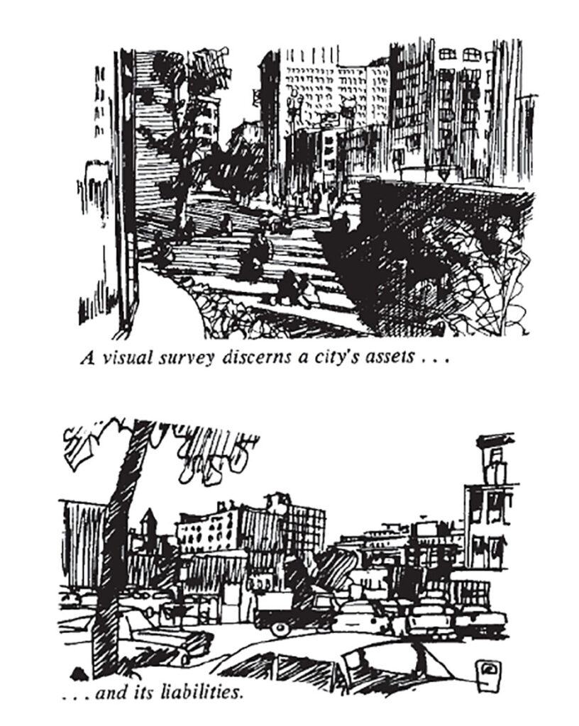
Before planning or redesigning a city, we must do an analysis, which is research to diagnose the city’s component pieces, expose their relationships, and analyze their current status. A visual survey in urban design studies a city’s form, appearance, and composition to assess its advantages and disadvantages. A visual survey also informs the urban designer about where the city needs to be altered. Any city or town, regardless of size, can be visually surveyed. It can also be produced in different sizes. Paul emphasizes the need to know the fundamentals of urban form. It is also necessary to connect the elements to understand their function, form, and appearance.
Introduction
In 1965, the ‘American Institute of Architects’ Committee published ‘Urban Design: The Architecture of Towns And Cities. It is the first and most notable attempt to investigate the vast field of urban and regional design in a single volume in a way that will be equally useful to architects, all design professionals, and all city students. This work was originally published as a series of twelve articles in the ‘American Institute of Architects’ Journal, by Paul D. Spreiregen, but it has been significantly altered and rewritten for this book. Paul is attempting to develop a synthesis of design across multiple disciplines, each of which is an amalgam of lesser design spheres. In this extensive review, we will cover the important themes provided in the book, giving vital insights for experts and enthusiasts alike.
Paul Spreiregen is a Boston native and an MIT School of Architecture and Planning graduate. He led the American Institute of Architects’ pioneering Urban Design program and was the inaugural Director of Architecture and Design Programmes at the National Endowment for the Arts. He has written, co-written, and edited around a dozen books on architecture and urban planning, as well as several essays in professional lay magazines. His architectural and planning work is based on the characteristics of the host site, with a focus on how it will improve the lives and experiences of those who live there, all while utilizing the most appropriate contemporary technology for its realization – buildings that are respectful of their sites, buildings that improve the lives of their users, and buildings that reflect their time.
The Book Contains 12 Chapters-
The first two of the twelve chapters provided a history of urban design from its Mesopotamian origins to the present. The topics covered in the remaining ten chapters include urban visual survey techniques, town layout design principles, the component land uses within a town, an overview of urban regional concepts, and how legislative controls relate to urban planning.
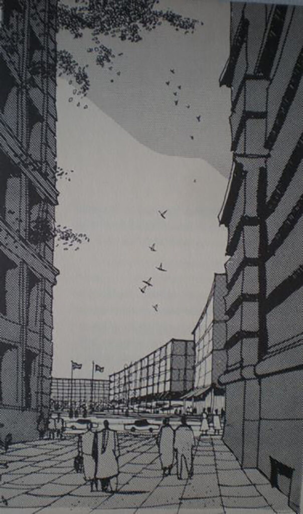
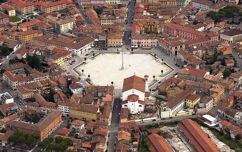
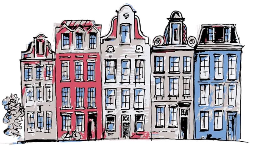
Approaching the plaza from the alley alongside the old City Hall (R)-Adams-Howard-Greely-et-al plan from 1959
Source: Website Link
Visual Survey
A Working Vocabulary of Urban Form
Paul believes that before designing or redesigning a city, we must do an analysis. The study is a diagnosis of the city’s component elements, revealing their relationships and assessing their status. In urban design, a visual survey examines a city’s form, appearance, and composition, evaluating its advantages and liabilities. A visual survey also shows the urban planner where the city needs to be reshaped.
Conducting A Visual Survey
Paul highlights the need for a fundamental understanding of the principles of urban form. Next, the city must be examined and described using this vocabulary. It is also vital to connect the elements to grasp their workings, form, and appearance. It is critical to continually analyze when conducting a visual survey.
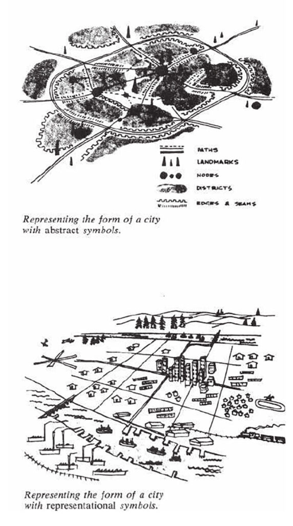
City Plans: A Visual Survey of Key Elements of the City
To sustain the City’s appeal and economic vitality, create a distinct sense of place in the City of Sandusky, and reinforce a comfortable, human-scale environment, consideration must be given to the shape, placement, design, and quality of the built environment (building design, placement, and composition).
Pathways: They are the major and smaller circulation paths that people take to get around.
Districts: A city is made up of neighborhoods or districts, such as the center, uptown, midtown, in-town residential areas, trainyards, factory areas, suburbs, college campuses, etc.
Edges: A district’s edge is where it ends. Some districts have no apparent boundaries and eventually fade off into another district.
Landmarks: The city’s most conspicuous visual characteristics are its landmarks.
Nodes: Nodes are centers of activity. It is a type of landmark, however it differs from a landmark because of its active purpose.
Landform And Nature
Paul believes that every city is established on a plot of land. The form of the land and its features are the primary factors of a city’s form. When we gaze at a landscape, we are looking for character. As urban designers, we pay attention to the shape of the terrain–flat, gently rolling, hilly, mountainous.
Indigenous flora should be evaluated in terms of shape, size, personality, practicability, and seasonal variation. An urban designer must be familiar with the native flora and its suitability for a variety of uses.
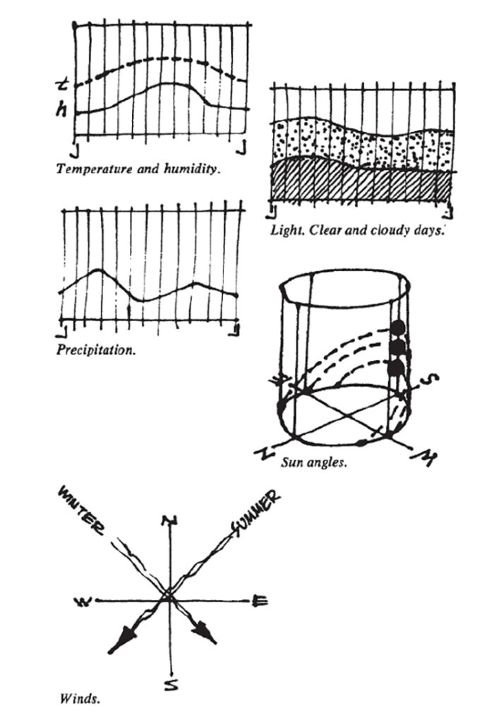
The character and look of the environment and structures are largely determined by the local climate.
Temperature: effects of humidity and temperature variations throughout the year, averages and extremes, comfort zones and times, and reduction of discomfort and extremes.
Light: consequences of overcast and clear days.
Precipitation: snow and rain
Sun: The sun’s angles, or solar height, vary depending on the season, affecting visibility and the length of sunny days.
Winds: the direction and strength of the seasonal winds, both hot and cold.
Climates: Micro-Macro.
City Shape
Every city has a general layout. Shape is categorized in multiple ways.
Radio centric
Rectilinear
Star
Ring
Linear
Branch
Sheet – (Articulated Sheet)
Satellite
Constellation
Local Street
We survey them to see if vehicular and pedestrian mobility are in conflict or helping each other.
Paths, districts, and open spaces, for example, may be the most prominent features in a large-scale assessment of the entire city. However, at all levels, investigating the city’s districts will most likely need the most work.
Every city is divided into sections known as districts, enclaves, or sectors—or even quarters, precincts, or territories.
Components: What are the city’s primary component districts? What are their characteristics?
Size: What are the dimensions of a district, including its shape, density, texture, landmarks, and space?
Appearance: What physical qualities do building forms, building density, signs, materials, greenery, topography, and route-pattern landmarks share?
Activity: In terms of visible activity, what are the most important indicators of an area’s activity—the types of people, when and how they move about?
Visual aspects: What are the major visual components, the items that are most visible and define the character of a district?
Threats: What are the possible threats to a district? What external factors, such as a through road, put the district’s health and survival at risk? How is the district evolving? Is an edge spreading, possibly into a periphery district?
Emergence: Are there any latent districts attempting to develop, such as a new in-town residential section?
Relation: How do all of these parts relate to one another, particularly the city’s route patterns? What are the sections of a city that are difficult to classify due to a lack of cohesiveness, information, or character?
The city pattern refers to the spatial distribution and mixing of various functions and aspects of the settlement form. It can be determined by the size of its grain.
The design pattern of the city’s surrounding neighborhoods is more informal than in the city center. Their image is shaped more by architecture, scale, tree cover, and topography than by grand vistas.
It can be of several types:
Radial Pattern
Grid Pattern
Linear Pattern
Urban Grain
Urban grain illustrates the relationship between a city’s street plan, block sizes, and building pattern.
The goal is to create an appealing and approachable precinct with a fine urban texture.
The design should strike a balance between a high-quality permanent landscape and adaptable urban spaces that can accommodate diverse activities and events.
Grains can be fine and coarse.
Urban Texture
Urban texture encompasses space patterns, including structure and organization of linked elements.
Urban texture was initially employed to analyze space and has since gained importance in historic preservation, design, and landscape studies.
Urban texture at the macroscale investigates a city’s primary landscape characteristics.
Patterns can be even and uneven.
Review And Analysis of Book
Holistic Approach: The book takes a complete approach to city planning, covering not only urban visual survey techniques, but also town layout design principles, the component land uses within a town, and an overview of urban regional concepts.
Visionary Concepts: Paul’s vision is based on the peculiarities of the host site, with an emphasis on how it will improve the lives and experiences of the residents.
Cultural Context: The book’s emphasis on different components of land uses within a town, according to regional and cultural concepts.
Practicality: Some critics believe that this book merely addresses the techniques and concepts of urban form, not the design issues.
-1
Conclusion
This seminal work remains a valuable resource for urban planners, architects, and anyone interested in the fabric of our cities. While some examples may feel dated, the core principles and insights are as relevant today as when first published. The author’s holistic approach, emphasizing the interplay between buildings, public spaces, and human activity, offers a timeless framework for creating vibrant urban environments. As our cities face new challenges in sustainability, technology integration, and social equity, the lessons in this book provide a solid foundation for innovative solutions. “Urban Design: The Architecture of Towns and Cities” reminds us that thoughtful, people-centered design is crucial for building communities that are not just functional, but truly livable and enriching.
References
Travis, A.S. (1967) ‘Spreiregen, Paul D., “Urban design”: The Architecture of Towns and cities (Book review)’, Town Planning Review, 38(3), p. 245. doi:10.3828/tpr.38.3.u0p1487747760847.
Spreiregen, P.D. (1965) Urban design the architecture of towns and cities Paul D. Spreiregen. written and ill. by … for the American Institute of. New York u.a.: McGraw-Hill.
Marium Dua
About the author
Architect in practice with a desire for new ideas and a distinct design perspective. A meticulous architect who blogs about her poetic experiences. Always willing to take a chance, whether it’s tackling a challenge at work or speaking to a friend, a wanderer at heart who carefully observes how people and environments interact to uncover the essence. A critical thinker that enjoys injecting original nuances and novel viewpoints into everything.
“Let’s explore the new avenues of Urban environment together “
We use cookies on our website to give you the most relevant experience by remembering your preferences and repeat visits. By clicking “Accept”, you consent to the use of all the cookies. Read More
This website uses cookies to improve your experience while you navigate through the website. Out of these, the cookies that are categorized as necessary are stored on your browser as they are essential for the working of basic functionalities of the website. We also use third-party cookies that help us analyze and understand how you use this website. These cookies will be stored in your browser only with your consent. You also have the option to opt-out of these cookies. But opting out of some of these cookies may affect your browsing experience.
Necessary cookies are absolutely essential for the website to function properly. These cookies ensure basic functionalities and security features of the website, anonymously.
Cookie
Duration
Description
cookielawinfo-checkbox-performance
11 months
This cookie is set by GDPR Cookie Consent plugin. The cookie is used to store the user consent for the cookies in the category "Performance".
cookielawinfo-checkbox-others
11 months
This cookie is set by GDPR Cookie Consent plugin. The cookie is used to store the user consent for the cookies in the category "Other.
cookielawinfo-checkbox-necessary
11 months
This cookie is set by GDPR Cookie Consent plugin. The cookies is used to store the user consent for the cookies in the category "Necessary".
cookielawinfo-checkbox-functional
11 months
The cookie is set by GDPR cookie consent to record the user consent for the cookies in the category "Functional".
cookielawinfo-checkbox-analytics
11 months
This cookie is set by GDPR Cookie Consent plugin. The cookie is used to store the user consent for the cookies in the category "Analytics".
viewed_cookie_policy
11 months
The cookie is set by the GDPR Cookie Consent plugin and is used to store whether or not user has consented to the use of cookies. It does not store any personal data.
Functional cookies help to perform certain functionalities like sharing the content of the website on social media platforms, collect feedbacks, and other third-party features.
Performance cookies are used to understand and analyze the key performance indexes of the website which helps in delivering a better user experience for the visitors.
Analytical cookies are used to understand how visitors interact with the website. These cookies help provide information on metrics the number of visitors, bounce rate, traffic source, etc.
Advertisement cookies are used to provide visitors with relevant ads and marketing campaigns. These cookies track visitors across websites and collect information to provide customized ads.