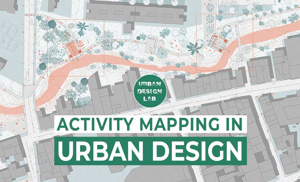
Activity mapping is a critical tool in urban design for analysing and comprehending the patterns and interactions of human activities in a city or town. The technique entails mapping and visualising the various activities that take place in a given urban area, such as shopping, eating, working, and recreational activities. This data is then used to inform urban space design, making them more accessible, functional, and appealing to a diverse range of users.
Source: Grande Parco Forlanini
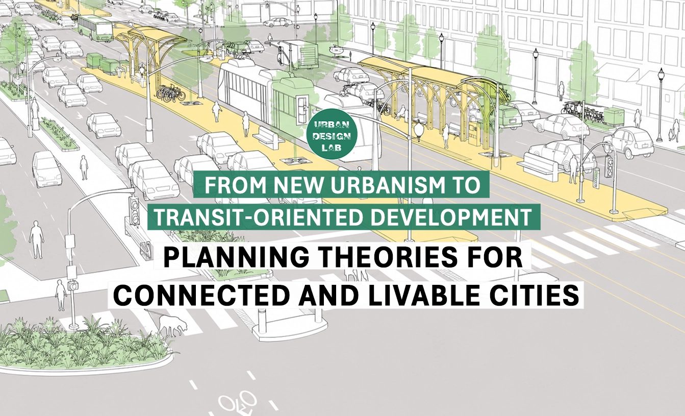
Urban design is the art and science of shaping the physical form, organization, and use of cities, towns, and other urban areas. It encompasses a wide range of disciplines, including architecture, landscape architecture, planning, engineering, and sociology, and is concerned with all aspects of the built environment, including buildings, streets, parks, and public spaces.
Activity mapping is particularly useful in urban design because it provides an in-depth understanding of how people use and interact with the urban environment. Urban designers can learn more about the patterns of human behaviour by visualising the various activities occurring in a certain location. They can then utilise this knowledge to influence the design of new or existing venues. This may contribute to the development of urban areas that are more livable, sustainable, and tailored to the needs and preferences of their inhabitants.
Isometric activity mapping By Harshil Panchal
Urban designers can use activity mapping to find underused or underdeveloped sections of the city, which is one of its main advantages. A lack of amenities, public areas, or access to public transportation, for instance, could deter people from using a certain region if it has low levels of activity. Urban planners can improve the region and make it more appealing to users by taking action based on their understanding of these patterns of human behaviour.
Activity mapping can also help to identify areas where there is a high concentration of specific types of activities. For example, if a particular area has a high concentration of restaurants and cafes, this may indicate a vibrant and dynamic street life, which could be further enhanced by improving public spaces and pedestrian connections. On the other hand, if a particular area has a high concentration of offices and other commercial buildings, this may indicate a more sedentary and less dynamic use of the space, which could be improved by adding parks, public spaces, and other amenities.
Activity mapping By Shruti Rajagopalan
Activity mapping By Shruti Rajagopalan
Mental Mapping in Urban Design:
Mental mapping refers to the cognitive process of creating a mental representation of a physical space, such as an urban environment. In urban design, mental mapping is important because it affects how people perceive and navigate through a city. Mental maps help individuals form mental images of their surroundings and provide a sense of orientation and familiarity with the environment. Good urban design should aim to create a clear and legible mental map for inhabitants, making it easier for them to navigate and understand the city. This can be achieved through various design elements, such as creating clear boundaries, visible landmarks, and a hierarchy of streets and spaces.
One of the key elements in creating a legible mental map is the creation of clear boundaries. This can be achieved through the use of physical elements such as walls, fences, or even changes in ground level. Clear boundaries help individuals understand the limits of a space and provide a sense of structure and organization. They also help create distinct areas within the city, making it easier for individuals to understand and navigate.
Visible landmarks are another important aspect of mental mapping in urban design. Landmarks serve as reference points that individuals can use to orient themselves and navigate through the environment. They can be physical structures such as buildings, monuments, or statues, or they can be more abstract, such as parks or plazas. Visible landmarks help individuals form a mental image of their surroundings and provide a sense of familiarity with the environment.
Mental Mapping
Mental mapping is a critical aspect of urban design. It affects how individuals perceive and navigate through their environment, and is influenced by various design elements such as clear boundaries, visible landmarks, a hierarchy of streets and spaces, the use of color and texture, and personal experiences and preferences. A well-designed city should aim to create a clear and legible mental map for its inhabitants, making it easier for them to understand and navigate the environment.
Cognitive mapping and Activity Mapping:
Cognitive mapping and Activity Mapping are two important tools in urban design. They allow designers to better understand the needs of their communities and create designs that are more in line with those needs. Cognitive mapping helps designers understand how people perceive their environment, while Activity Mapping helps them determine what activities people perform in a given area. Both of these tools can help urban designers create better designs for the cities they serve, making them more livable and enjoyable for everyone.
Cognitive mapping, or a technique for exploring spaces, is actually based on the research of Carl Wieman. Wieman is a researcher that has been working on human perception, cognitive mapping, and many other areas of psychology. Wieman has been involved in the research and development of several new technologies, including an autonomous vehicle. Wieman’s research into cognitive mapping is used to examine how people perceive different places in the world and how that perception affects their decision making. His research shows that people are constantly looking at different places to judge how well they fit together. The best example of this was demonstrated by a study done in San Francisco.
There are several different methods for conducting activity mapping, including field observations, structured interviews, and online surveys. Field observations involve visiting a particular area and observing the different activities taking place, while structured interviews involve talking to people who live or work in the area and asking them about their activities. Online surveys involve gathering information from people via the internet, which can be a fast and convenient way to gather information from a large number of people. Some of the most common types of activity mapping include:
Surveys:
Surveys are one of the most common methods used to collect information for activity mapping. This can include paper or online surveys, as well as in-person interviews. Surveys can be used to collect information about land use, movement patterns, time-use patterns, social interactions, accessibility, and environmental conditions.
Survey Map by Fletcher Foti
GIS:
Geographic Information Systems (GIS) is a powerful tool for activity mapping. This technology allows for the integration of spatial and non-spatial data to create maps that visualize different types of information. GIS can be used to create land use maps, movement maps, time-use maps, social maps, accessibility maps, and environmental maps.
GIS SITE ANALYSIS MALBORK by Ksenia Orlova
Remote Sensing:
Remote sensing is a method of collecting information about a given area from a distance. This can include aerial photography or satellite imagery, as well as other forms of remote sensing data. Remote sensing can be used to create maps that visualize the physical and environmental conditions of different parts of the city, such as topography, vegetation, and climate.
Unban analysis in QGIS by Daria Pilipak
Crowdsourcing:
Crowdsourcing is a method of collecting information from a large number of people, typically through the internet. This can include online surveys or other forms of online engagement, as well as mobile apps and other tools that allow people to collect and share information. Crowdsourcing can be used to collect information about land use, movement patterns, time-use patterns, social interactions, accessibility, and environmental conditions.
Observation:
Observation is a direct method of collecting information about a given area. This can include on-site observations by urban designers, as well as more structured methods such as pedestrian counts or vehicle counts. Observation can be used to collect information about land use, movement patterns, time-use patterns, social interactions, accessibility, and environmental conditions.
There are several different types of activity mapping in urban design, each of which serves a specific purpose and provides different types of information. Some of the most common types of activity mapping include:
Land Use Mapping:
This type of mapping focuses on the different types of land use in a given area, including residential, commercial, industrial, and public spaces. The information is typically visualized on a map and can provide insight into the distribution and intensity of different types of land use, as well as the relationships between different uses.
Master Thesis Project by Daria Pilipak
Movement Mapping:
This type of mapping focuses on the patterns of movement of people and vehicles in a given area. It can help to identify areas of high pedestrian traffic, as well as areas where there are significant traffic congestion problems. The information is typically visualized on a map and can provide insight into the accessibility and efficiency of different parts of the city.
Time-Use Mapping:
This type of mapping focuses on the different activities taking place in a given area at different times of the day and week. It can help to identify areas where there is a high concentration of specific types of activities, such as shopping, eating, or working, as well as areas where there is low levels of activity. The information is typically visualized on a map and can provide insight into the patterns of human behavior in different parts of the city.
Social Mapping:
This type of mapping focuses on the social patterns and interactions of people in a given area. It can help to identify areas where there are high levels of social interaction, as well as areas where there are low levels of interaction. The information is typically visualized on a map and can provide insight into the social dynamics of different parts of the city.
Accessibility Mapping:
This type of mapping focuses on the accessibility of different parts of the city, including the ease of access to public transportation, pedestrian and bicycle routes, and public spaces. The information is typically visualized on a map and can provide insight into the accessibility of different parts of the city, as well as the potential for improvement in this area.
Source: Sasaki
Environmental Mapping:
This type of mapping focuses on the physical and environmental conditions of different parts of the city, including topography, vegetation, and climate. The information is typically visualized on a map and can provide insight into the environmental conditions of different parts of the city, as well as the potential for improvement in this area.
Conclusion:
Regardless of the method used, activity mapping should be conducted over a sufficient period of time to capture the full range of activities taking place in a particular area. This may involve conducting mapping over several days or even weeks, in order to gain a comprehensive understanding of the patterns of human behavior. Once the mapping is complete, the information should be analyzed and visualized in a way that makes it easy to understand and interpret.
This is the admin account of Urban Design Lab. This account publishes articles written by team members, contributions from guest writers, and other occasional submissions. Please feel free to contact us if you have any questions or comments.
Hello Sir/Madam,I am Priyambada , currently doing my master’s in Urban Design.I have gone through the above article which was useful to me.I would like to write articles infact so as to boost my knowledge.Waiting for your approval if it is possible to share new articles and getting in touch with new ones
This post on activity mapping in urban design is incredibly insightful! I love how it highlights the importance of understanding community needs and behaviors in creating vibrant public spaces. The examples you provided really bring the concepts to life. I’m excited to see how these ideas could transform urban areas into more engaging and inclusive environments!
This post on activity mapping in urban design is incredibly insightful! I appreciate how you highlighted the importance of understanding social dynamics in shaping public spaces. The examples provided really illustrate how thoughtful planning can enhance community engagement. Looking forward to more discussions on this topic!
This post on activity mapping in urban design is incredibly insightful! I love how it highlights the importance of understanding community dynamics and the role of public spaces in fostering engagement. It’s inspiring to think about how thoughtful design can enhance the interaction between people and their environment. Can’t wait to see how these principles are implemented in future urban projects!
I really enjoyed this post on activity mapping in urban design! The examples you provided illustrate how thoughtful planning can enhance community engagement and improve the overall livability of spaces. It’s fascinating to see how mapping can influence not just design but also social interactions in urban areas. Thank you for sharing these insights!
This post on activity mapping in urban design is incredibly insightful! I love how it highlights the importance of understanding human behavior and social interactions in creating vibrant spaces. The examples you provided really illustrate how thoughtful planning can enhance community engagement. Looking forward to seeing more on this topic!
This article on activity mapping in urban design is incredibly insightful! I love how it emphasizes the importance of understanding community needs and behaviors to create more vibrant public spaces. The examples you provided really illustrate the concept clearly. Looking forward to seeing more posts on this topic!
This post on activity mapping in urban design is incredibly insightful! I love how it highlights the importance of understanding community needs and behaviors. It’s fascinating to see how mapping can influence the development of more vibrant and inclusive public spaces. Looking forward to seeing more examples of successful implementations!
This post on activity mapping in urban design was incredibly insightful! I appreciate how it highlights the importance of understanding community dynamics and tailoring spaces to encourage interaction. It’s fascinating to see how such mapping can really transform urban environments for the better. Looking forward to more discussions on this topic!
This post on activity mapping in urban design is incredibly insightful! I love how it highlights the importance of understanding community behaviors and patterns. It’s fascinating to see how effective mapping can lead to better urban planning and more vibrant public spaces. I’m curious about what tools or software you recommend for getting started with this approach!
This post on activity mapping in urban design is incredibly insightful! I love how it emphasizes the importance of understanding community needs and behaviors to create vibrant public spaces. It’s fascinating to see how mapping can inform better design choices that promote social interaction and sustainability. Looking forward to more discussions on implementing these strategies!
This article on activity mapping in urban design is fascinating! It really highlights how thoughtfully planned spaces can greatly enhance community interaction and well-being. I loved the examples you provided; they illustrate just how impactful a well-designed urban environment can be. Looking forward to seeing more on this topic!
This was a fascinating read! I love how activity mapping can reveal the true dynamics of urban spaces. It’s amazing to see how different activities can inform better design choices and foster community engagement. Looking forward to seeing more examples of successful implementations!
Pelota Libre has become a familiar name among online football platforms. Pelota Libre TV focuses on user accessibility, and HDFull Original streams improve quality. Futbol Pelota fans value platforms that prioritize smooth and reliable football content.
This article on activity mapping in urban design is insightful! I love how it highlights the importance of understanding user behavior to create more vibrant and inclusive spaces. The examples provided really illustrate the impact of thoughtful design on community engagement. Looking forward to seeing more innovative ideas in urban planning!
I found this blog post on activity mapping in urban design incredibly insightful! The way you’ve highlighted the importance of understanding human behavior and interactions within spaces truly resonates. It’s fascinating to see how thoughtful mapping can lead to more vibrant and inclusive urban environments. Thank you for sharing these valuable insights!
“Let’s explore the new avenues of Urban environment together “
We use cookies on our website to give you the most relevant experience by remembering your preferences and repeat visits. By clicking “Accept”, you consent to the use of all the cookies. Read More
This website uses cookies to improve your experience while you navigate through the website. Out of these, the cookies that are categorized as necessary are stored on your browser as they are essential for the working of basic functionalities of the website. We also use third-party cookies that help us analyze and understand how you use this website. These cookies will be stored in your browser only with your consent. You also have the option to opt-out of these cookies. But opting out of some of these cookies may affect your browsing experience.
Necessary cookies are absolutely essential for the website to function properly. These cookies ensure basic functionalities and security features of the website, anonymously.
Cookie
Duration
Description
cookielawinfo-checkbox-analytics
11 months
This cookie is set by GDPR Cookie Consent plugin. The cookie is used to store the user consent for the cookies in the category "Analytics".
cookielawinfo-checkbox-functional
11 months
The cookie is set by GDPR cookie consent to record the user consent for the cookies in the category "Functional".
cookielawinfo-checkbox-necessary
11 months
This cookie is set by GDPR Cookie Consent plugin. The cookies is used to store the user consent for the cookies in the category "Necessary".
cookielawinfo-checkbox-others
11 months
This cookie is set by GDPR Cookie Consent plugin. The cookie is used to store the user consent for the cookies in the category "Other.
cookielawinfo-checkbox-performance
11 months
This cookie is set by GDPR Cookie Consent plugin. The cookie is used to store the user consent for the cookies in the category "Performance".
viewed_cookie_policy
11 months
The cookie is set by the GDPR Cookie Consent plugin and is used to store whether or not user has consented to the use of cookies. It does not store any personal data.
Functional cookies help to perform certain functionalities like sharing the content of the website on social media platforms, collect feedbacks, and other third-party features.
Performance cookies are used to understand and analyze the key performance indexes of the website which helps in delivering a better user experience for the visitors.
Analytical cookies are used to understand how visitors interact with the website. These cookies help provide information on metrics the number of visitors, bounce rate, traffic source, etc.
Advertisement cookies are used to provide visitors with relevant ads and marketing campaigns. These cookies track visitors across websites and collect information to provide customized ads.


16 Comments
Hello Sir/Madam,I am Priyambada , currently doing my master’s in Urban Design.I have gone through the above article which was useful to me.I would like to write articles infact so as to boost my knowledge.Waiting for your approval if it is possible to share new articles and getting in touch with new ones
This post on activity mapping in urban design is incredibly insightful! I love how it highlights the importance of understanding community needs and behaviors in creating vibrant public spaces. The examples you provided really bring the concepts to life. I’m excited to see how these ideas could transform urban areas into more engaging and inclusive environments!
This post on activity mapping in urban design is incredibly insightful! I appreciate how you highlighted the importance of understanding social dynamics in shaping public spaces. The examples provided really illustrate how thoughtful planning can enhance community engagement. Looking forward to more discussions on this topic!
This post on activity mapping in urban design is incredibly insightful! I love how it highlights the importance of understanding community dynamics and the role of public spaces in fostering engagement. It’s inspiring to think about how thoughtful design can enhance the interaction between people and their environment. Can’t wait to see how these principles are implemented in future urban projects!
I really enjoyed this post on activity mapping in urban design! The examples you provided illustrate how thoughtful planning can enhance community engagement and improve the overall livability of spaces. It’s fascinating to see how mapping can influence not just design but also social interactions in urban areas. Thank you for sharing these insights!
This post on activity mapping in urban design is incredibly insightful! I love how it highlights the importance of understanding human behavior and social interactions in creating vibrant spaces. The examples you provided really illustrate how thoughtful planning can enhance community engagement. Looking forward to seeing more on this topic!
This article on activity mapping in urban design is incredibly insightful! I love how it emphasizes the importance of understanding community needs and behaviors to create more vibrant public spaces. The examples you provided really illustrate the concept clearly. Looking forward to seeing more posts on this topic!
This post on activity mapping in urban design is incredibly insightful! I love how it highlights the importance of understanding community needs and behaviors. It’s fascinating to see how mapping can influence the development of more vibrant and inclusive public spaces. Looking forward to seeing more examples of successful implementations!
This post on activity mapping in urban design was incredibly insightful! I appreciate how it highlights the importance of understanding community dynamics and tailoring spaces to encourage interaction. It’s fascinating to see how such mapping can really transform urban environments for the better. Looking forward to more discussions on this topic!
This post on activity mapping in urban design is incredibly insightful! I love how it highlights the importance of understanding community behaviors and patterns. It’s fascinating to see how effective mapping can lead to better urban planning and more vibrant public spaces. I’m curious about what tools or software you recommend for getting started with this approach!
This post on activity mapping in urban design is incredibly insightful! I love how it emphasizes the importance of understanding community needs and behaviors to create vibrant public spaces. It’s fascinating to see how mapping can inform better design choices that promote social interaction and sustainability. Looking forward to more discussions on implementing these strategies!
This article on activity mapping in urban design is fascinating! It really highlights how thoughtfully planned spaces can greatly enhance community interaction and well-being. I loved the examples you provided; they illustrate just how impactful a well-designed urban environment can be. Looking forward to seeing more on this topic!
This was a fascinating read! I love how activity mapping can reveal the true dynamics of urban spaces. It’s amazing to see how different activities can inform better design choices and foster community engagement. Looking forward to seeing more examples of successful implementations!
Pelota Libre has become a familiar name among online football platforms. Pelota Libre TV focuses on user accessibility, and HDFull Original streams improve quality. Futbol Pelota fans value platforms that prioritize smooth and reliable football content.
This article on activity mapping in urban design is insightful! I love how it highlights the importance of understanding user behavior to create more vibrant and inclusive spaces. The examples provided really illustrate the impact of thoughtful design on community engagement. Looking forward to seeing more innovative ideas in urban planning!
I found this blog post on activity mapping in urban design incredibly insightful! The way you’ve highlighted the importance of understanding human behavior and interactions within spaces truly resonates. It’s fascinating to see how thoughtful mapping can lead to more vibrant and inclusive urban environments. Thank you for sharing these valuable insights!