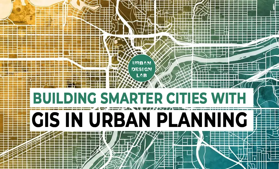
GIS mapping is rapidly redefining how urban environments respond to the complex forces of climate stress, rapid migration, aging infrastructure, and accelerating digital transformations. In today’s planning landscape, Geospatial Urban Systems (GUS)—anchored by GIS mapping—function as the core intelligence framework for urban designers, planners, and policy-makers. These systems consolidate spatial data, remote sensing outputs, and participatory mapping inputs into governance processes, empowering cities to move from reactive responses to predictive, scenario-driven planning.
This article provides practical, data-backed insights into how GIS mapping and geospatial tools are transforming workflows across critical urban sectors—from land use and infrastructure to mobility, environment, and informality.
1. Land Use Optimization through Spatial Indexing and Predictive Modelling
Uncoordinated or legacy land use planning often results in fragmented urban forms, unsustainable commute patterns, displacement of ecological buffers, and inefficient service delivery. In fast-growing cities, where land is a scarce and politically contested resource, geospatial urban systems (GUS) help planners quantitatively assess development potential, suitability, and risk, thereby enabling evidence-based land allocation and proactive zoning decisions.
Spatial optimization also supports land value capture strategies, ecological corridor preservation, peri-urban regulation, and compact urban form development, aligning with the SDG 11.3 target: “inclusive and sustainable urbanization and capacity for participatory, integrated and sustainable human settlement planning.
Useful Tools, Methods, and Datasets
Case Insight:
In Hefei, East China, researchers employed the SLEUTH urban growth model to simulate urban expansion from 2015 to 2040 under three distinct scenarios: historical growth, urban planning, and land suitability. The study revealed that the historical growth scenario could lead to the highest loss of farmland and ecological land. In contrast, the land suitability scenario, which integrated ecological and agricultural considerations, projected a more compact urban form with reduced environmental impact. This approach provided valuable insights for sustainable urban planning in rapidly developing regions.
Liu Y, Li L, Chen L, Cheng L, Zhou X, Cui Y, et al. (2019) Urban growth simulation in different scenarios using the SLEUTH model: A case study of Hefei, East China. PLoS ONE 14(11): e0224998. https://doi.org/10.1371/journal.pone.0224998
UDL Thesis Publication | 2025
Curating the best Graduate Thesis Projects Globally!
Infrastructure—both above and below ground—serves as the operational backbone of urban life. Yet, over 80% of Indian cities and many Global South urban centers report underperformance in water supply, waste management, and mobility systems due to outdated, fragmented, or non-digitized infrastructure records. This results in poor service delivery, uncoordinated urban growth, and increased maintenance costs. Geospatial Urban Systems (GUS) enable integrated infrastructure diagnostics and forward-planning using both remote and ground-based data.
Useful Tools, Methods, and Datasets
Case Insight:
In Cape Town, South Africa, the city deployed a geospatial infrastructure audit using LIDAR scans and GIS-linked asset databases to manage over 11,000 km of underground piping and 1,600 km of road networks. By integrating asset age, failure risk, and real-time usage data into a central GIS platform, the city reduced its average maintenance response time by 36% and targeted reinvestments in historically underserved townships.
Map showing overlaps between water management areas, CMA areas and groundwater resources (specific to Cape Town's water supply); Source: Flugel (2021) from Faragher (2022). Cape Town is located within the Berg Catchment.
3. Urban Mobility and Travel Behavior Analysis
Urban transportation accounts for nearly 25% of city-level GHG emissions, with higher exposure in rapidly urbanizing regions. Poorly planned transit systems increase commute times, exacerbate mobility inequities, and exclude vulnerable populations from essential services. By applying Geospatial Urban Systems (GUS), cities can spatially optimize multi-modal networks to promote sustainable, inclusive, and low-emission mobility futures.
Useful Tools, Methods, and Datasets
Case Insight:
In Medellín, Colombia, the city combined GIS-based O-D matrices with ethnographic studies to redesign its mobility infrastructure. The integration of informal transport mapping, aerial cable cars (Metrocable), and enhanced walkability zones in low-income hillside barrios reduced average travel time by 42 minutes/day for 400,000+ residents and increased public transit ridership by 30%. This transformation was driven by spatial justice principles and localized mobility insights.
This map illustrates the proposed phases for the growth of Medellín's metro and cable car (Metrocable) infrastructure across the Aburrá Valley. It highlights current operational lines and 16 future corridors categorized by planning stages—from initial characterization (Phase 0) to detailed design and construction (Phase 3). Source: Metro de Medellín / El Colombiano (2019)
In a time of intensifying climate stress, environmental planning must be data-driven, predictive, and spatially sensitive. Remote sensing offers a cost-effective, repeatable, and large-scale diagnostic toolkit to assess ecological health, identify urban heat risks, monitor deforestation, and guide nature-based solutions in cities. These tools are crucial for developing urban resilience strategies, especially in climate-vulnerable regions.
Useful Tools, Methods, and Datasets
Case Insight:
Singapore has proactively addressed urban heat challenges through its Landscape Replacement Policy, mandating that new developments in strategic areas replace greenery lost at ground level with equivalent or greater amounts of greenery in other parts of the building, such as rooftops or vertical gardens. This policy aims to mitigate the Urban Heat Island (UHI) effect and enhance urban biodiversity.
“Urban Heat Vulnerability Mapping in Singapore (Afternoon, 14:00–16:00 hrs)” This composite map illustrates the spatial distribution of urban heat vulnerability across Singapore using a range of environmental and socio-spatial indicators. Source- Ghayathiri Sondarajan
5. Informal Settlements & Participatory GIS
Globally, over 1 billion people live in informal settlements, often excluded from official planning maps, cadastral records, and basic infrastructure services. This data invisibility leads to policy neglect, tenure insecurity, and uneven urban development. Participatory GIS (PGIS) empowers communities to contribute to spatial data creation, bridging the gap between lived realities and formal planning frameworks.
Useful Tools, Methods, and Datasets
Case Insight:
In 2009, the Map Kibera initiative was launched to address the lack of accurate maps for Kibera, Nairobi’s largest informal settlement. Residents were trained to use GPS devices and open-source tools like OpenStreetMap and QGIS to map their community’s infrastructure, including roads, schools, clinics, water points, and sanitation facilities.
This participatory approach not only filled a critical data gap but also empowered the community to advocate for their needs. The mapping data has been instrumental in urban planning, disaster response, and improving service delivery in Kibera.
This map illustrates the detailed infrastructure of Kibera, highlighting water and sanitation service points across its various village.
Conclusion: From Static Maps to Dynamic Urban Systems
GUS is not just about better maps—it’s about creating spatial ecosystems of decision-making. The integration of remote sensing, ground truthing, spatial modeling, and participatory engagement leads to urban intelligence that is inclusive, anticipatory, and actionable.
Whether you’re a planner mapping post-disaster recovery zones, a designer seeking solar-optimal building orientation, or a policymaker allocating urban health budgets, spatial intelligence is the anchor of future-ready urbanism.
“Let’s explore the new avenues of Urban environment together “
We use cookies on our website to give you the most relevant experience by remembering your preferences and repeat visits. By clicking “Accept”, you consent to the use of all the cookies. Read More
This website uses cookies to improve your experience while you navigate through the website. Out of these, the cookies that are categorized as necessary are stored on your browser as they are essential for the working of basic functionalities of the website. We also use third-party cookies that help us analyze and understand how you use this website. These cookies will be stored in your browser only with your consent. You also have the option to opt-out of these cookies. But opting out of some of these cookies may affect your browsing experience.
Necessary cookies are absolutely essential for the website to function properly. These cookies ensure basic functionalities and security features of the website, anonymously.
Cookie
Duration
Description
cookielawinfo-checkbox-functional
11 months
The cookie is set by GDPR cookie consent to record the user consent for the cookies in the category "Functional".
viewed_cookie_policy
11 months
The cookie is set by the GDPR Cookie Consent plugin and is used to store whether or not user has consented to the use of cookies. It does not store any personal data.
cookielawinfo-checkbox-necessary
11 months
This cookie is set by GDPR Cookie Consent plugin. The cookies is used to store the user consent for the cookies in the category "Necessary".
cookielawinfo-checkbox-others
11 months
This cookie is set by GDPR Cookie Consent plugin. The cookie is used to store the user consent for the cookies in the category "Other.
cookielawinfo-checkbox-performance
11 months
This cookie is set by GDPR Cookie Consent plugin. The cookie is used to store the user consent for the cookies in the category "Performance".
cookielawinfo-checkbox-analytics
11 months
This cookie is set by GDPR Cookie Consent plugin. The cookie is used to store the user consent for the cookies in the category "Analytics".
Functional cookies help to perform certain functionalities like sharing the content of the website on social media platforms, collect feedbacks, and other third-party features.
Performance cookies are used to understand and analyze the key performance indexes of the website which helps in delivering a better user experience for the visitors.
Analytical cookies are used to understand how visitors interact with the website. These cookies help provide information on metrics the number of visitors, bounce rate, traffic source, etc.
Advertisement cookies are used to provide visitors with relevant ads and marketing campaigns. These cookies track visitors across websites and collect information to provide customized ads.