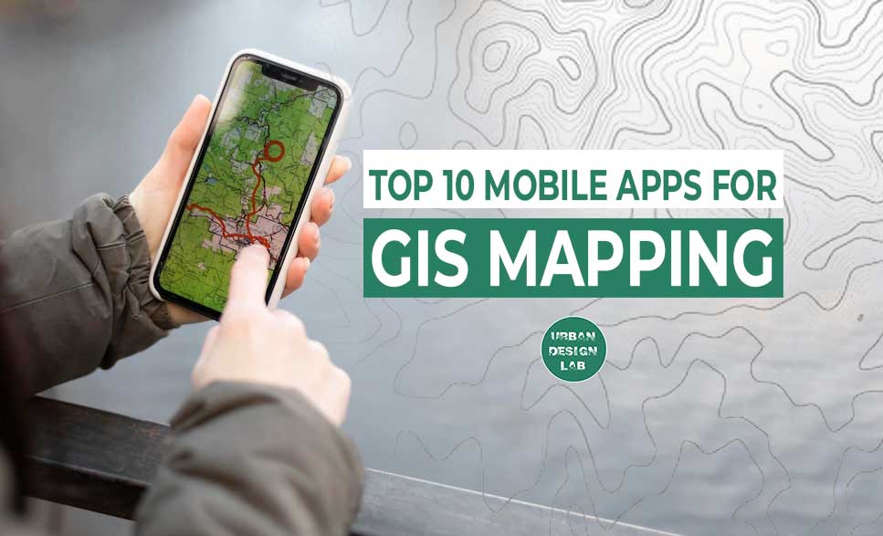
Geographic Information System (GIS) mapping has become a vital component of our daily lives. With the growing popularity of mobile phones, we can access several GIS programmes on our mobile phones that allow us to effortlessly travel and explore the world around us. GIS mapping allows us to make educated decisions by providing us with a visual depiction of the world around us. In this post, we will examine the best 10 mobile applications for GIS mapping that you may download on your phone to view the world in a different way.
The popular and frequently used smartphone software Google Maps provides users with thorough and accurate maps of the entire planet. Users can quickly search for various destinations and get directions to their desired location because to its user-friendly layout. In addition, Google Maps offers satellite imagery, transportation schedules, and real-time traffic updates, all of which improve the user experience.
Google Maps is available for both iOS and Android smartphones, and it is free to download and use. Turn-by-turn navigation is one of its many functions, which enables users to get precise and thorough directions when driving or walking. Also, the app offers details about the hotels, restaurants, and petrol stations that are close by.
Google Maps also includes real-time traffic reports as a crucial feature. Users can use this to view the local traffic conditions in real time and modify their route as necessary. Users may easily plan their travel thanks to the application’s additional transit schedules for public transportation.
Moreover, Google Maps has satellite imagery that enables users to see a location from above. Those who want to travel and discover new places or who want to make advance travel plans may find this option to be especially helpful.
To create, manage, and share maps and data, users can utilise the mobile application ArcGIS. The application offers a variety of features that let users examine geographic data and design unique maps. ArcGIS, which is well-liked by academics and professionals that use GIS mapping for study, planning, and analysis, is a crucial tool for anybody in need of precise and current geographic information.
ArcGIS is a free app that can be downloaded for both Android and iOS smartphones, and it offers a user-friendly layout. The programme comes with a number of mapping capabilities, including the capacity to design unique maps and incorporate data layers. Users can get insights and make wise decisions by analysing geographic data using the application’s built-in analytical features.
For individuals who need accurate and thorough geographic information, ArcGIS is a necessity. Professionals from a range of disciplines, such as urban planning, environmental science, and emergency management, use the application. Academics that need GIS mapping for their study and analysis also use it.
For Android users, MapIt is a robust and well-liked mobile GIS application. It is a common tool for carrying out surveys, including environmental, woodland, land, tree, and site surveys. It is also used to collect soil samples and facilitate road construction. The software is packed with features that appeal to different industries, making it a flexible tool for gathering and analysing data.
The capability of MapIt to export data directly to Dropbox or FTP locations is one of its most noteworthy features. For teams who must work remotely together and share data, this functionality is helpful. The ability to record many points, lines, and polygons on a single layer is another noteworthy feature. For customers who need to graphically present complex data on a map, this capability is crucial. It allows for the import and export of properties from files, which makes working with data from other sources simpler. The software also has address and location search capabilities, enabling users to easily locate particular locations on a map.
With available measurement information like area or length, the software enables users to construct new polygon or line features. For users who need to do precise measurements in their surveys, this capability is essential. Moreover, MapIt has the capability to divide data into various layers, making it simpler to manage huge datasets.
An offline land surveying programme called Locus GIS enables users to gather and manage spatial data while out in the field. Land surveyors, engineers, and other professionals who need to gather and analyse geospatial data in off-the-grid regions without internet connection can utilise the programme. The Google Play Store is where Android users may get the software, which is available for those devices.
The ability to use Locus GIS offline is one of its key advantages. The software is a useful tool for fieldwork in remote areas since it enables users to gather and manage data without an internet connection. A number of tools for gathering and managing geographical data are also included in the software, including the capacity to create and edit point, line, and polygon features as well as import and export data in a number of different formats.
The user-friendly interface of Locus GIS is an additional advantage. Even for those with no GIS or surveying experience, the software is made to be simple to use and intuitive. Additionally, the programme offers a variety of customization options that let users mould it to their unique requirements and preferences.
Moreover, Locus GIS comes with a variety of mapping and analysis tools, including the capacity to make personalised maps, calculate areas and distances, and conduct spatial analysis. The software is a useful tool for fieldwork in remote or unknown regions because it supports GPS tracking and navigation.
In order to help drivers plan their routes and avoid congestion, Waze is a mobile application that provides real-time updates on traffic conditions, accidents, and road closures. Waze is a must-have app for drivers since it provides turn-by-turn directions and a variety of features to improve the driving experience.
The app is free to download and is accessible for both iOS and Android devices. Waze employs GIS mapping to deliver precise traffic updates, aid users in navigating traffic, and help them save time. Drivers may stay safe and avoid potential hazards with the help of the application’s additional capabilities, which include speed limit alerts and information on local police.
Waze also features a social component that enables users to exchange information with other nearby vehicles and report traffic problems and accidents. Drivers may more easily plan their journeys and steer clear of congested regions because to the application’s utilisation of this data to deliver real-time updates on traffic conditions.
A full suite of mapping tools are available to users of the mobile application MapQuest so they may explore their surroundings. The programme improves the user experience for both Android and iOS devices with turn-by-turn directions, real-time traffic updates, and satellite imagery.
In order to give consumers precise and trustworthy information about their surroundings, MapQuest uses GIS mapping. The user-friendly interface of the app makes it simple for users to find locations and get driving instructions. The satellite imagery gives users a visual depiction of their surroundings, while the real-time traffic updates assist users avoid congested regions and save time.
Anybody who wants to learn more about their surroundings has access to the app thanks to its free download. MapQuest offers the resources people require to get there without difficulty, whether they are travelling to new locations or exploring their immediate surroundings.
Urban commuters can use Citymapper, a mobile app that provides real-time information on local transportation options like bike share programmes and transit schedules. For both Android and iOS users, Citymapper improves the commute experience with turn-by-turn guidance and a variety of features.
Commuters may easily search for transit choices in their region using the application’s user-friendly interface, including bus and train schedules, bike share stations, and ride-sharing services. Users can plan their trip and choose their mode of transportation with the assistance of the real-time updates.
In addition, Citymapper provides a number of tools to aid users in navigating the city, such as turn-by-turn directions, detailed instructions, and real-time traffic information. The app even has a “rain safe” feature that recommends other routes or public transportation to help travellers avoid the rain.
Everyone who wishes to improve their commute can use the application because it is free to download. Citymapper offers the resources people require to get there without difficulty, whether they are travelling to work, performing errands, or simply visiting the city.
An application called Planimeter GPS Area Calculator enables users to calculate the area of any area using GPS data. This programme can be used for a number of tasks, such as calculating the square footage of a house or structure or measuring the size of an agricultural field. The Google Play Store is where Android users may get the software, which is available for those devices.
It’s easy to use the Planimeter GPS area calculator. You must give the app permission to access your device’s GPS data after you launch it. Following that, you can use the programme to trace the space’s boundary. The space’s area will subsequently be determined by the app using the GPS information.
The accuracy of the Planimeter GPS area calculator is one of its advantages. The software can provide accurate measurements of even irregularly shaped spaces since it uses GPS data. This makes it a useful tool for many uses, such as farming, building, and landscaping.
The Planimeter GPS area calculator’s simplicity of use is another advantage. The app’s user-friendly design makes it simple to sketch a space’s perimeter and obtain precise measurements. Also, the app lets you save and share your measurements, which makes it simple to manage your data and work with others.
A smartphone application called TopoXpress GIS & Survey offers customers sophisticated GIS and surveying capabilities. Professionals in the field, such as engineers, GIS technicians, and land surveyors, are intended users of the programme. The Google Play Store is where you can download it if you have an Android device.
Users of the app may gather and analyse spatial data while out in the field thanks to a variety of capabilities included. In addition to the capacity to get GPS data and carry out distance and area calculations, this also offers the capacity to generate and edit point, line, and polygon features. Additionally, the software has sophisticated surveying functions like the capacity to set up traverse networks, change survey control points, and carry out staking calculations.
The user-friendly interface of TopoXpress GIS & Survey is one of its advantages. Even for those with no GIS or surveying experience, the software is made to be simple to use and intuitive. Additionally, the programme offers a variety of customization options that let users mould it to their unique requirements and preferences.
Gaia GPS is a mobile application that is tailored for outdoor enthusiasts such as hikers and bikers. The app provides users with comprehensive mapping tools to explore different outdoor environments. One of the unique features of the app is the provision of offline maps which can be beneficial for users who find themselves in areas with limited internet connectivity. Gaia GPS also provides real-time updates on weather conditions, and users can track their progress on various trails.
The mobile application is popular among outdoor enthusiasts and is available for both Android and iOS devices. It is free to download, but users have the option to upgrade to a premium version for additional features such as the ability to download more maps and access to advanced tools for route planning.
The offline map feature in Gaia GPS is a significant advantage for outdoor enthusiasts. In areas with no network coverage, users can still access the maps and navigate their way through different trails. Additionally, the app’s real-time updates on weather conditions help users plan their outdoor activities better.
Another feature of Gaia GPS that makes it stand out is its ability to track users’ progress on different trails. With this feature, users can track the distance covered, elevation, and time taken to complete a trail. The app also allows users to save their favorite routes for future reference.
Gaia GPS provides users with access to a large library of maps covering different parts of the world. The maps are regularly updated, and users can download the maps they need for offline use. The app also allows users to create custom maps, mark waypoints, and import data from other sources. You can download the app here.
GIS mapping has become an essential tool in our daily lives. With the growing popularity of mobile phones, GIS mapping has become more accessible and convenient for users. The mobile applications discussed in this article provide users with a range of mapping tools that allow them to explore different environments and make informed decisions. From hikers and bikers to urban commuters and drivers, there is a mobile application that caters to the needs of different users. Whether you are looking for turn-by-turn directions, real-time updates on traffic and weather, or information on hiking and biking routes, these mobile applications have got you covered. The applications are free to download, but some offer premium versions with additional features. With these mobile applications, you can experience the world in a different way and make the most of your outdoor and urban experiences.
This is the admin account of Urban Design Lab. This account publishes articles written by team members, contributions from guest writers, and other occasional submissions. Please feel free to contact us if you have any questions or comments.
“Let’s explore the new avenues of Urban environment together “
We use cookies on our website to give you the most relevant experience by remembering your preferences and repeat visits. By clicking “Accept”, you consent to the use of all the cookies. Read More
This website uses cookies to improve your experience while you navigate through the website. Out of these, the cookies that are categorized as necessary are stored on your browser as they are essential for the working of basic functionalities of the website. We also use third-party cookies that help us analyze and understand how you use this website. These cookies will be stored in your browser only with your consent. You also have the option to opt-out of these cookies. But opting out of some of these cookies may affect your browsing experience.
Necessary cookies are absolutely essential for the website to function properly. These cookies ensure basic functionalities and security features of the website, anonymously.
Cookie
Duration
Description
cookielawinfo-checkbox-analytics
11 months
This cookie is set by GDPR Cookie Consent plugin. The cookie is used to store the user consent for the cookies in the category "Analytics".
cookielawinfo-checkbox-functional
11 months
The cookie is set by GDPR cookie consent to record the user consent for the cookies in the category "Functional".
cookielawinfo-checkbox-necessary
11 months
This cookie is set by GDPR Cookie Consent plugin. The cookies is used to store the user consent for the cookies in the category "Necessary".
cookielawinfo-checkbox-others
11 months
This cookie is set by GDPR Cookie Consent plugin. The cookie is used to store the user consent for the cookies in the category "Other.
cookielawinfo-checkbox-performance
11 months
This cookie is set by GDPR Cookie Consent plugin. The cookie is used to store the user consent for the cookies in the category "Performance".
viewed_cookie_policy
11 months
The cookie is set by the GDPR Cookie Consent plugin and is used to store whether or not user has consented to the use of cookies. It does not store any personal data.
Functional cookies help to perform certain functionalities like sharing the content of the website on social media platforms, collect feedbacks, and other third-party features.
Performance cookies are used to understand and analyze the key performance indexes of the website which helps in delivering a better user experience for the visitors.
Analytical cookies are used to understand how visitors interact with the website. These cookies help provide information on metrics the number of visitors, bounce rate, traffic source, etc.
Advertisement cookies are used to provide visitors with relevant ads and marketing campaigns. These cookies track visitors across websites and collect information to provide customized ads.


One Comment