Urban Design Terminology

What is Urban Design?
The process of urban design is the process of developing cities, and it involves elements of architecture, engineering, landscape design, art, and science. Here are some common terms used in urban design.
Urban Design Terminology
1. Accessibility
The ease with which locations can be reached. People of any age, skill, or financial level can easily access a wide range of activities and destinations in an area with high accessibility, but those living in less accessible areas can only get to a small number of locations in the same amount of time. An area’s accessibility is measured in terms of travel speed and distance to the number of locations (‘destination opportunities’). Travel costs, route safety, and topography gradient may also be taken into consideration.
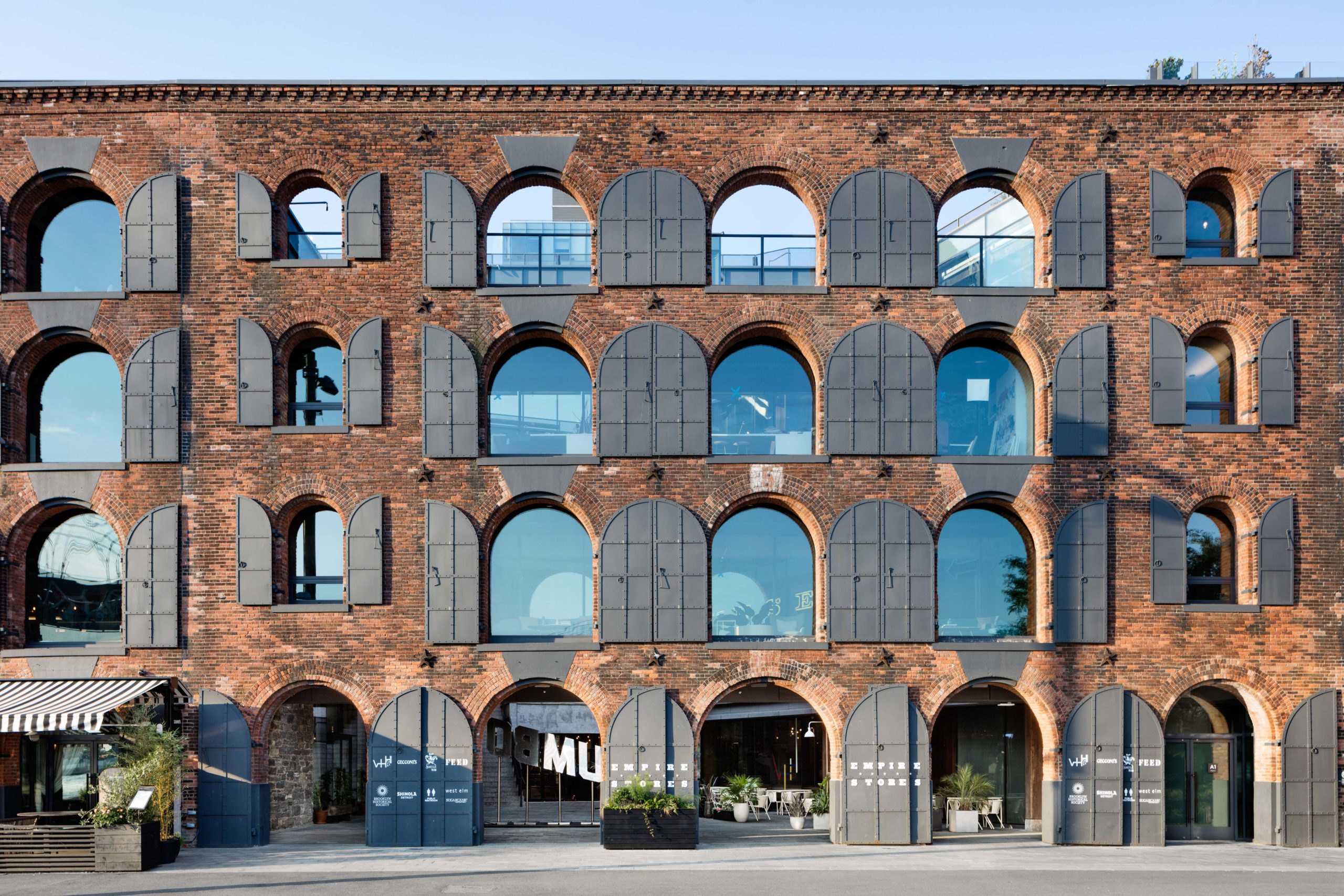
2. Adaptability or Adaptive Re-use
The capacity of a building or space to respond to changing social, technological, economic and market conditions and accommodate new or changed uses such as changing a warehouse into gallery space or housing or any old historic building.
3. Amenity
Urban amenities means urban facilities such as parks, playgrounds, green spaces, parking facilities, public wi-fi facilities, public bus transport, bus shelters, taxi and rickshaw stands, libraries, affordable hospitals, cultural centres, recreation centres, stadium, sports complex and any other urban facility that the State Government may, on the recommendation of the Authority, specify to be an urban amenity, but does not include infrastructure development work.
4. Arterial road
An arterial road or arterial thoroughfare is a high-capacity urban road. The primary function of an arterial road is to deliver traffic from collector roads to freeways or expressways, and between urban centres at the highest level of service possible. As such, many arteries are limited-access roads, or feature restrictions on private access. Because of their relatively high accessibility, many major roads face large amounts of land use and urban development, making them significant urban places

5. Activity centre
Activity centres within cities and towns are a focus for enterprises, services, shopping, employment and social interaction. They are where people meet, relax, work and often live. Usually well-served by public transport, they range in size and intensity of use from local neighbourhood strip shopping centres to traditional town centres and major regional centres. An activity centre generally has higher intensity uses at its central core with smaller street blocks and a higher density of streets and lots. The structure of activity centres should allow for higher intensity development, street frontage exposure for display and pedestrian access to facilities.
6. Articulation
“Articulation” means to make something — a process, a function, or a form — readable, so people can interact with it through their perceptions. Previous literature has linked urban form to the function it enables, the way of life that its function connotes, and the overall ambience that people feel.
7. Built Form
Built form refers to the function, shape and configuration of buildings as well as their relationship to streets and open spaces. Built form refers to the function, shape and configuration of buildings as well as their relationship to streets and open spaces.
8. Background Buildings
Buildings that lack individual architectural merit but contribute to the overall character of an area or district;
simple commercial buildings in a historic district function as background buildings.
9.Barriers and fences
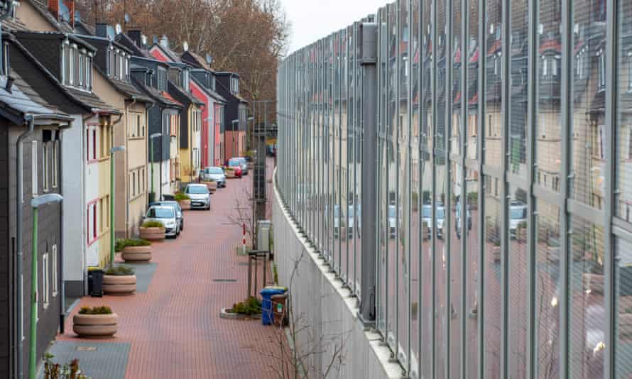
Barriers such as bollards and fences can define boundaries and protect people from traffic hazards and level changes. They also protect trees and shrubs from people and vehicles. A barrier may be made as bollards, screens, rails, fences, kerbs and walls. Barriers and fences can provide an opportunity for public art or to communicate local stories. They may also provide opportunities for seating.
10. Building line
A line usually set with respect to the frontage of a plot of land which is fixed by statute or by deed or contract and beyond which the owner of the land may not build.
11. Build-to-line
A zoning device which controls the location of buildings to create consistent streetwalls or define public
spaces; unlike a set back, which establishes a minimum distance from a property line or street, a build-to-line
establishes the maximum permitted set back or exact location of a building facade
12. Building Cap
Maximum allowable construction in a designated area or city; for example, San Francisco limits annual
downtown office space construction to 475,000 square feet and Petaluma, CA, limits the number of residential
building permits issued annually.
13. Blue Space
Blue space is an urban design term for visible water. Attractive blue spaces such as waterfront parks, harbors, ports, marinas, rivers, open air streams, canals, lakes, ponds and fountains are thought to improve quality of life and help to moderate urban heat islands. Many cities have highly industrialized waterfront zones that are built out with artificial land. Other cities have disrupted access to the sea with poorly designed seawalls and other barriers.
14. Brownfield
Brownfield is a term for land that has been previously used for industrial or commercial purposes that is polluted or feared to be polluted. Such sites often require an expensive clean up and it is common for governments to require the parties responsible to pay such costs.

15. City
A city is a large human settlement. It can be defined as a permanent and densely settled place with administratively defined boundaries whose members work primarily on non-agricultural tasks
16. Character
Character areas are an important tool in helping to deliver contextually responsive urban design, allowing the urban designer to understand and respond to the unique qualifies of any parficular site or neighbourhood.
17. Circulation Space
Circulation spaces are part of the common area of a commercial, mixed use or higher density residential building and are used by occupants, residents and other building users. These spaces include foyers, corridors, car parking areas, and garden and recreation areas.
18.Connectivity
The number of connecting routes within a particular area, often measured by counting the number of intersection equivalents per unit of area. An area may be measured for its ‘connectivity’ for different travel modes – vehicle, cyclist or pedestrian. An area with high connectivity has an open street network that provides multiple routes to and from destinations.
19. Cul-de-sac
A street with only one inlet/outlet connected to the wider street network. A closed cul-de-sac provides no possible passage except through the single road entry. An open cul-de-sac allows cyclists, pedestrians or other non- automotive traffic to pass through connecting paths at the cul-de-sac head.

20. Culture
Culture are the aspects of life that people value and enjoy. It is considered a defining characteristic of humanity that includes things like language, art, music, architecture, customs, rituals, pastimes, festivals, cuisine, fashion, history, stories and myth. The following are elements and variants of culture.
21. Community
A community is social group that are bound together by geography, profession, lifestyle, circumstances, believe or interests.
22. Design response
Explanation and demonstration of how a proposed building development or public space design is informed by and responds to the site and context analysis.
23. Desire-line (or 'pedestrian desire-line')
The desire-line path usually represents the preferred route and the shortest or most easily navigated route between an origin and destination. Desire- lines can often be seen as alternative shortcut tracks in places where constructed pathways take a circuitous route. They are almost always the most direct and the shortest route between two points.
24. Development
Urban development covers infrastructure for education, health, justice, solid waste, markets, street pavements and cultural heritage protection. These constructions usually form part of specific sector programmes, including capacity building measures.
25. Density
Urban density is a term used in urban planning and urban design to refer to the number of people inhabiting a given urbanized area.

26. Demolition
Demolition is the tearing-down of buildings which involves taking a building apart while preserving the valuable elements for re-use. There are various methods of demolition. The building is brought down either manually or mechanically depending upon the method used for demolition of buildings
27. Enclosure
Enclosure refers to the extent to which buildings, walls, trees and other vertical items frame a street and public space. Public spaces that are framed by vertical elements in relative proportion to the width of the space between the elements have a room-like quality that is comfortable for people
27. Efficiency
Efficiency is the output of something in comparison to its maximum potential. It is the opposite of waste. Calculating efficiency requires a measurement of maximum potential. As such, it is used to describe highly measurable processes and machines. The work of people is described by a similar term, productivity. The following are common business efficiency terms.
28. Encroachment
Or Urban Encroachment or Urban sprawl is defined as “the spreading of urban developments on undeveloped land near a city”. Urban sprawl has been described as the unrestricted growth in many urban areas of housing, commercial development, and roads over large expanses of land, with little concern for urban planning.
29. Facade
The principal wall of a building that is usually facing the street and visible from the public realm. It is the face of the building and helps inform passers-by about the building and the activities within.
30. Form follows nature
Form follows nature is an architecture and design technique that uses shapes and forms found in nature such as plants, animals, insects, geological and astronomical shapes. Such techniques may achieve highly functional designs or may be purely aesthetic as a means of integrating with natural surroundings. Form follows nature is a central principle of organic architecture along with other principles of sustainable design and natural aesthetics.
31. Fabric or Urban Fabric
The term ‘urban fabric’ describes the physical characteristics of urban areas, that is, cities, and towns. This includes the streetscapes, buildings, soft and hard landscaping, signage, lighting, roads and other infrastructure. Urban fabric can be thought of as the physical texture of an urban area
32. FAR (floor area ratio)
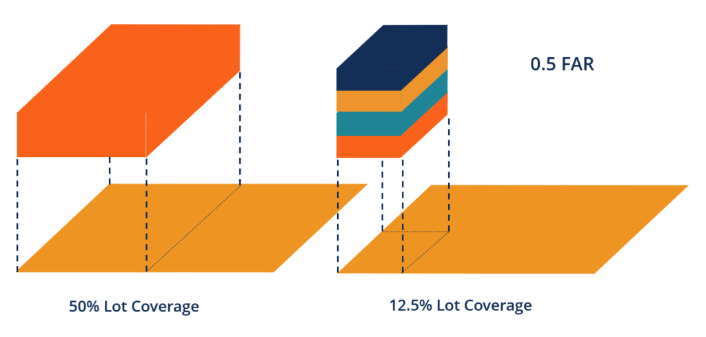
A formula for determining permitted building volume as a multiple of the area of the lot; the FAR is determined
by dividing the gross floor area of buildings on a lot by the area of the lot; for example, a FAR of 6 on a 5,000 square foot lot would allow a building with gross area of 30,000 square feet
33. Fenestration
34. Figure-ground diagram
A drawing which shows only building footprints, rendered in black, with the ground plane left white, providing an
abstract representation of development density and the extent that buildings define public spaces. A figure-ground diagram is a two-dimensional map of an urban space that shows the relationship between built and unbuilt space. It is used in analysis of urban design and planning.
35. Form-based code
Form Based Codes (FBC) is a planning and zoning tool that is used for regulating development using physical form rather than land use segregation as the organizing principle for the code. It aims at contributing to better quality of life by fostering a high-quality public realm.
36. Gentrification
Gentrification is the transformation of a city neighborhood from low value to high value. Gentrification is also viewed as a process of urban development in which a neighborhood or portion of a city develops rapidly in a short period of time, often as a result of urban-renewal programs.
37. Genius loci
Genius loci is the spirit of a place. Historically this was taken quite literally as the term extends from classical Roman religion and the belief that districts of Roman had their own protective spirits. In its modern usage, genius loci is a design or practice that matches the culture, environment, traditions, society and economics of a place. The following are common examples.
38. Green Wall
A green wall is an architecture and gardening technique that places soil and water delivery mechanisms into a wall in order to grow vegetation. A green facade is a wall covered in climbing vegetation with soil at the base of the wall.
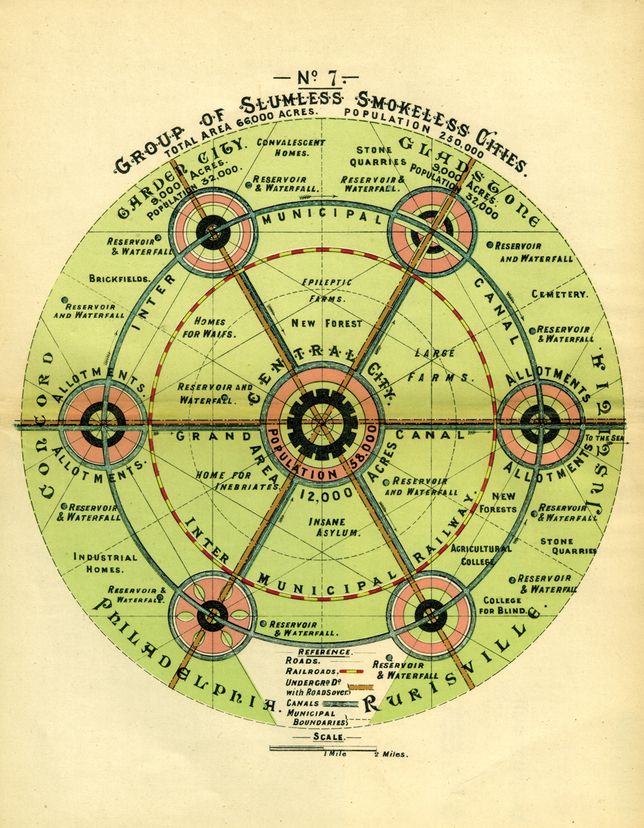
40. Garden city movement
The garden city movement was a 20th century urban planning movement promoting satellite communities surrounding the central city and separated with greenbelts. These Garden Cities would contain proportionate areas of residences, industry, and agriculture.
41. Greenbelt
A green belt is a policy and land-use zone designation used in land-use planning to retain areas of largely undeveloped, wild, or agricultural land surrounding or neighboring urban areas.
42. Genetic urban quarter
Those parts of a town that were planned as a unit at any time from the medieval period to the present day. Genetic urban quarters usually have particular functional, administrative or social characteristics represented within a plan-unit or layout. Examples may include planned medieval extensions; occupational quarters of early modern towns; factory suburbs; garden suburbs; villa districts; or building society estates. The term is found in the Germanic literature; this working definition was used during the Third Anglo-German Conference on Urban Historical Geography, 1988. The relationship between genetic urban quarters and morphological regions is, as yet, unresolved.
43. Grid plan
In urban planning, the grid plan, grid street plan, or gridiron plan is a type of city plan in which streets run at right angles to each other, forming a grid. The infrastructure cost for regular grid patterns is generally higher than for patterns with discontinuous streets.
44. Growth Management
The process of regulating the pace and character of development in a community; several states including
Florida, Washington, and Oregon for example, require local governments to develop, adopt, and implement
some form of a growth management plan.
45. Historic District
A geographically definable area with a significant concentration of buildings, structures, sites, spaces, or objects unified by past events, physical development, design, setting, materials, workmanship, sense of cohesiveness, or related historical and aesthetic associations; the significance of a district may be recognized through listing in
a local, state, or national landmarks register and may be protected legally through enactment of a local historic district ordinance administered by a historic district board or commission
46. High modernism
High modernism is a school of design and architecture that places complete trust in science and technology. It is characterized by cold logic that views human factors and nature as obstacles to be overcome.
47. Human Scale
The practice of building physical things such as buildings to a scale that is useful to people. Human scale is also a term for units of measure that are designed to be relevant to humans. For example, meters and feet are useful for measure human things. By contrast, a light year is beyond direct human experience.
48. Higher density residential building
Higher density residential buildings house a number of individual apartment dwellings in a single building, and are five or more storeys in height. They may be residential only or residential combined with other uses such as retail, offices or car parking
49. Higher density residential precinct
A higher density residential precinct generally has larger lot sizes that are able to accommodate apartment and mixed-use developments. The precinct may be in or adjacent to an activity centre or within a large development site. The structure of a higher density residential precinct provides a high level of amenity in public spaces, access to facilities and services, while protecting privacy and personal safety.
50. Imageability
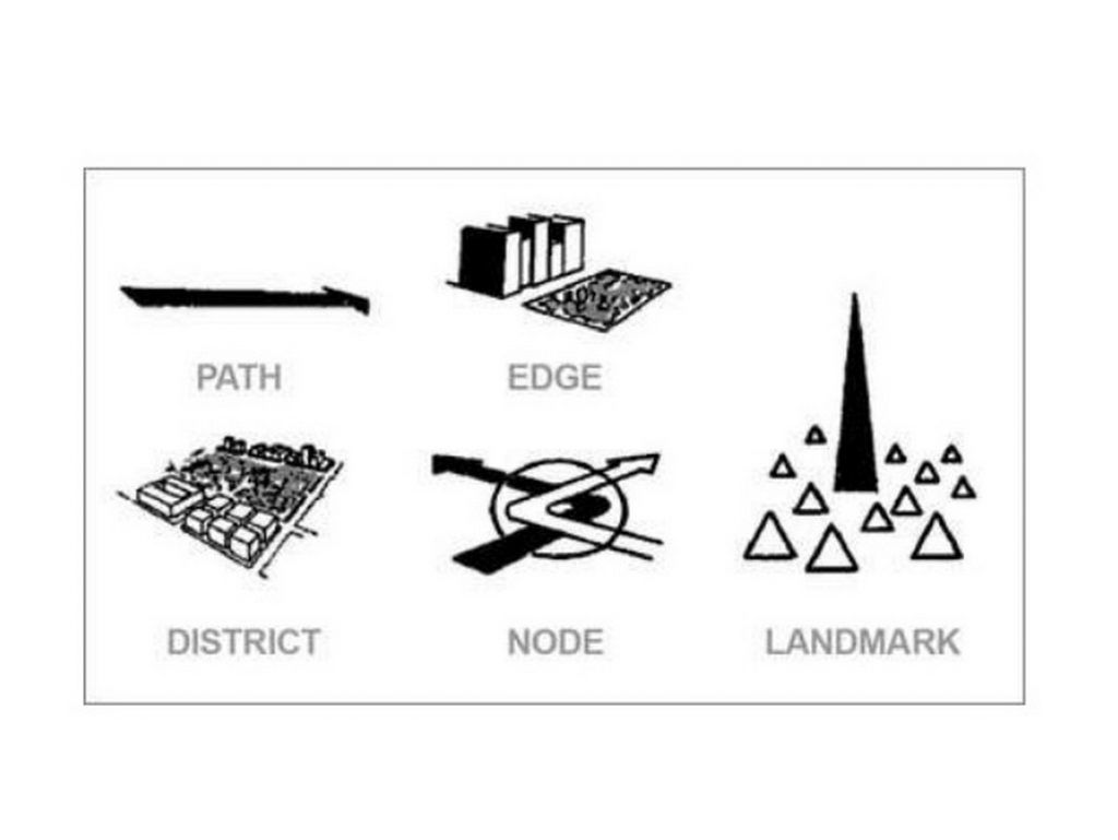
Imageability is the quality of a place that makes it recognizable and memorable. A place has high imageability when specific physical elements and their arrangement evoke distinct images or positive feelings. Imageability is a measure of how easily a physical object, word or environment will evoke a clear mental image in the mind of any person observing it.
51. Infill
A general term used to categorise the increase of densities in a townscape as repletion occurs.
52. Institution
An organisation, commonly civic (eg university) or religious (eg convent) that requires extensive sites and therefore initiates or funds development, usually on the urban fringe. Institutions often continue to undertake development during building cycle slumps, when other developers are less active .
53. Land development
The construction, buildings or works made on a parcel of land to support the use to which the land is put. The construction, buildings or works made on a parcel of land to support the use to which the land is put.
54. Land use
Urban land use comprises which activities are taking place where and their level of spatial accumulation, which indicates their density, intensity, and concentration. In urban planning, land use planning seeks to order and regulate land use in an efficient and ethical way, thus preventing land use conflicts. Governments use land use planning to manage the development of land within their jurisdictions.
55. Leapfrog Development
Development that occurs well beyond the existing limits of urban development and thus leaves the intervening
vacant land behind and results in sprawl.
56. Legibility
The ease with which a person is able to see, understand and find their way around an area, building or development. A ‘legible’ layout is one that people find easy to navigate and move through. Legibility is one of the principles of urban design. Legibility means the possibility of organizing an environment within an imageable and coherent pattern.
57. Landmark
An urban landmark has been defined as an object that provides “external points of orientation, usually an easily identifiable physical object in the urban landscape” (Lynch, 1960). In contemporary metropolises, such landmarks often comprise towers or high-rise buildings.
58. Lane
A travel path for a vehicle as part of a roadway. As in ‘bicycle lane’, ‘traffic lane’, or ‘bus lane’.
59. Linear Park
A linear park is an urban park that is considerably longer than it is wide. They typically result from historical features of a city such as roads that were replaced with green space. Linear parks are often ideal for activities such as walking and jogging. They also allow a large number of people to live within close proximity to a green space as they stretch through a city. The following are common types of linear park.
60. Living Street
A living street is a mixed-use pedestrian street that may provide social space, greenspace and play areas. In many cases, living streets allow low speed vehicle access with the clear rule that pedestrians have absolute priority. Traffic calming is often implemented that is pedestrian friendly.
61. Mixed-use development
A mixed-use building aims to combine three or more uses into one structure such as residential, hotel, retail, parking, transportation, cultural, and entertainment. Whatever the combination, it brings together several uses within either one building or a small area.
62. Master Plan
A Master Plan is a document and policy guide designed to help communities create a vision of what they want to look like in the future. Master Plans help guide communities in their decisions on land use development and preservation. Master Plans are written and adopted by a local Planning Commission and might also be adopted by a local legislative body, although Master Plans are not laws on their own. Many Master Plans are written as one document but they can be and often are more effective when written as multiple documents. A master plan includes analysis, recommendations, and proposals for a site’s population, economy, housing, transportation, community facilities, and land use. It is based on public input, surveys, planning initiatives, existing development, physical characteristics, and social and economic conditions.

63. Master planning
Master planning is the method of developing or improving your property or building through a long-range plan that balances and harmonizes all elements. This process is done at the very beginning of the project and helps you define and unify the vision for the space.
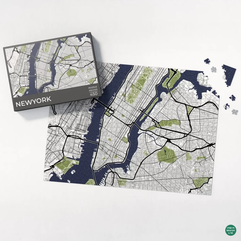
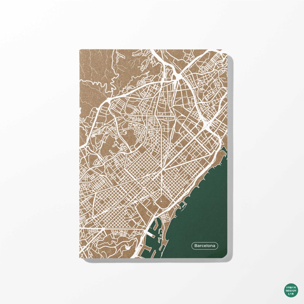
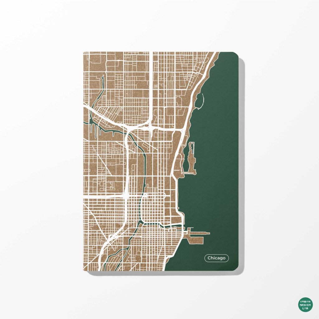
64. Map
In today’s practices of urban design, the map acts as a documentary and design tool as well as a legal document. Its usefulness hinges on its perceived truthfulness and objectivity in the representation of reality. Yet this has not always and everywhere been the case.
65. Massing
Massing describes the relationship of the building’s various parts to each other. Architectural elements such as windows, doors and roofs as well as interior floor plans can affect building mass.
66. Monastic urban elements
Urban elements deriving from monastic influences are important in many European medieval towns. Such influences range from the large plots and extensive ranges of buildings for monastic use, often found on developing fringe belts to individual monastic town houses or Klosterhfe. Monastic elements may also act as pre-urban nuclei.
67. Morphogenesis
The creation of physical forms viewed as a developmental or evolutionary process.
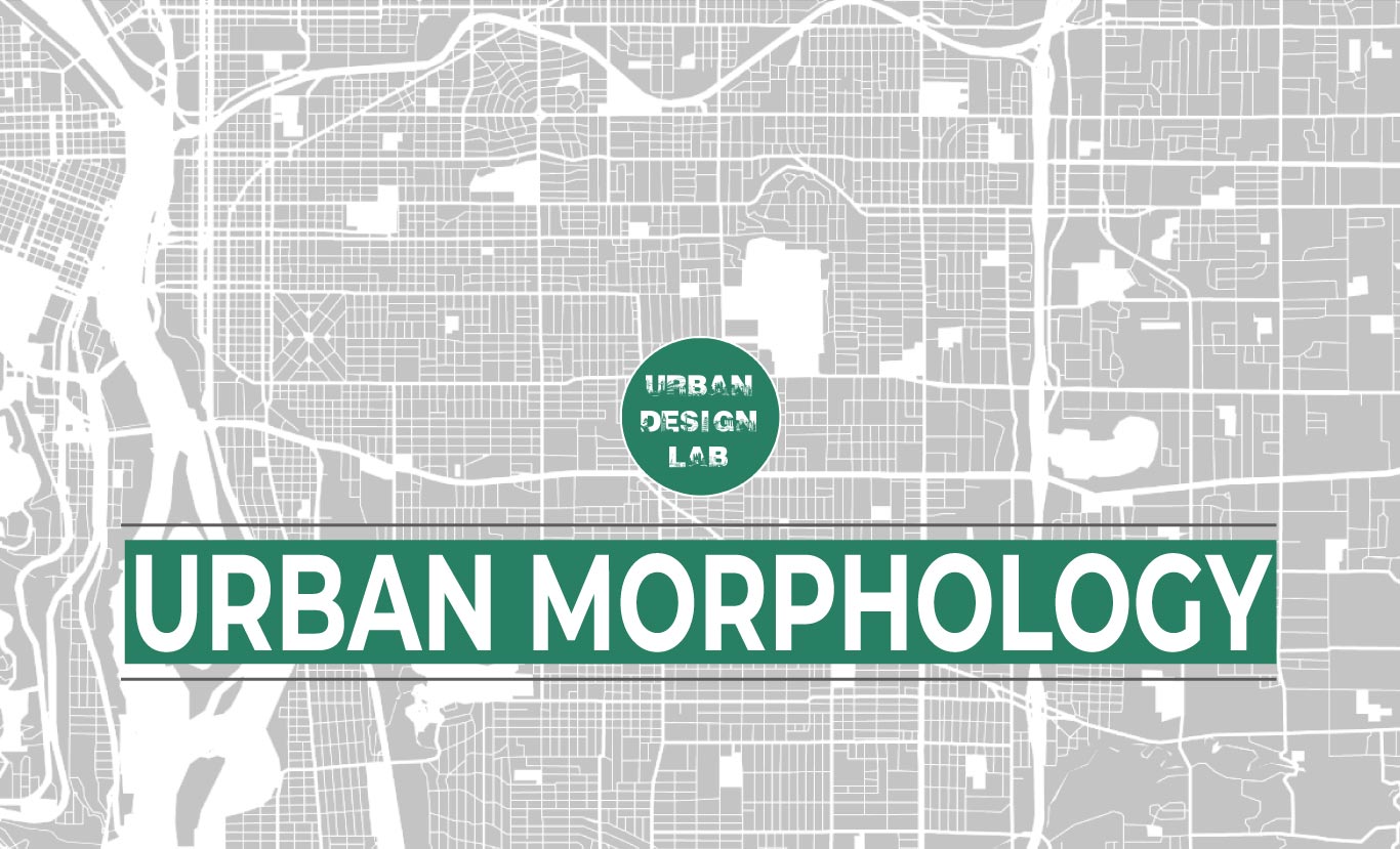
68. Morphology
Urban morphology is the study of urban forms and of the agents and processes responsible for their transformation over time. Urban form refers to the main physical elements that structure and shape the city including streets, squares (the public space), street blocks, plots, and buildings, to name the most important.

69. Modern
Style using clean lines and simple faades to express functional and visual compatibility. Its roots are in the advances made during the industrial revolution, as new and cheaper materials became available, and as a reaction against the neo-Classical styles of the Victorian period.
70. Night Economy
The night economy is a category of economic activity that occurs after 5pm that includes dining, nightlife, arts, music, theatre, entertainment, festivals, events, activities and tourist attractions that are open at night. In cities with a lively nightlife, the night economy is often larger than the single largest daytime industry. For example, the night economy of Japan is larger than the country’s automotive industry.
71. Natural Surveillance
Natural surveillance is an urban design, architecture and landscaping technique that seeks to deter crime with social and highly visible spaces.
72. Open space
Urban open spaces (UOS) are defined as publicly accessible open places designed and built from human activity and enjoyment.
73. Public Space
Public space is an area that is open and accessible to people. Common examples include roads, paths, sidewalks, parks, public squares, natural areas, beaches and public buildings such as libraries.
74. Placemaking
Placemaking is a term for the design of public spaces in close consultation with the residents of a city or neighborhood. It tends to result in spaces that have popular features for recreation, hobbies, socializing and personal reflection.

75. Public Sector
The public sector is the sector of an economy that is controlled by a government. This includes services directly provided by national, regional and city governments and any organizations controlled by a government. The following are common elements of the public sector.
76. Pathway
A pedestrian path, bicycle path or other area for use by people but not by motor vehicles.
77. Pedestrian
The word pedestrian comes from the Latin ped, meaning foot. In urban planning, the term has expanded to include all those who move along sidewalks at a walking or running pace, including those in wheelchairs and scooters. It’s important to consider all the people wending their way through the urban landscape.
78. Parallel street plan
A street layout in which the principal streets are approximately equidistant. Various types of parallel-street system were employed in planned towns created during the German colonisation of east- central Europe.
79. Planning authority
The Planning Authority is a government agency which is responsible for land use and planning in Malta. It was established on 4 April 2016 from the demerger of the Malta Environment and Planning Authority, which also resulted in the creation of the Environment and Resources Authority.
80. Plaza
A plaza is an open space designed for public use and defined by surrounding buildings and/or streets
81.Plan division
“A geographical group of morphogenetic plan-units, a morphogenetic plan `region’ within the town. Urban plan divisions are arrenged in a hierarchy of two or more orders depending upon the size and complexity of the town.
82. Place
The concept of place, in the sense of a space endowed with unique features that is fundamental for establishing the identity of the contemporary city, is meant as a key concept of urban design
83. Quality of Life
Quality of life is the well-being of individuals, communities and societies. It is a comprehensive measure that can be used to evaluate efforts to improve cities and nations. The following are examples of things that impact quality of life.
84. Resilient Cities
A resilient city is the design of a city to endure physical, social and economic shocks and stresses. The definition of the term ‘resilient’ means possessing inner strength and resolve. Thus a resilient city takes into consideration appropriate form and physical infrastructure to be more prepared for the physical, social, and economic challenges that come with depleting carbon-based fuels and climate change.

85. Right of Way
The right of way is the total land area acquired for the construction of the roadway. Its width should be enough to accommodate all the elements of the roadway cross section, any future widening of the road and any public utility facilities that will be installed along the roadway.
86. Rehabilitation
Rehabilitation could be understood as an urban policy, looking at the requalification of the existing city, developing multiple intervention strategies that will result in a vast set of coordinated actions, highlighting the social, economic, and environmental values of certain urban areas.
87. Regeneration
Urban regeneration is an approach to city planning to repair the social and economic problems of an urban area, improving the physical and environmental aspects of the city, as well as the buildings. Urban renewal aims to transform obsolete or blighted areas into economically productive areas of a community.
88. Redevelopment
Urban redevelopment is conceptually similar to land readjustment, with the exception that it happens in existing urban areas and often involves a rezoning by the government of a given area from a low-density (single-family housing) to higher-density (mixed-use or commercial) development.

89. Residential
Residential means a type of building or a portion thereof which is designed for occupancy by not more than four (4) families, a single-family condominium, or a unit in a planned unit development.
90. Residential gross density
Gross and urban residential densities are used at the neighbourhood or district level, and metropolitan density at the city scale.
91. Recession
Phase of the burgage or plot cycles, where building coverage declines from the maximum (climax phase). Recession may end in complete clearance, or urban fallow.
92. Real estate
U.S. term for `land’, including any development upon the land.
93. Slum
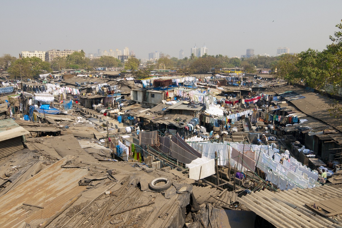
Urban slums are regions accommodating people who lack the basic necessities to sustain a healthy and safe livelihood. The largest slum in the world is Neza-Chalco-Itza in Mexico, housing almost four million people.
94. Superblocks
A superblock is a city block that is much larger than a traditional city block. They occur incidentally in areas with extremely large buildings. They can also be pursued as an urban design strategy to reduce the impact of cars on cities. A superblock can be created by disallowing cars on small roads in a neighborhood. The roads instantly become broad sidewalks. This provides opportunities to use land for bicycle paths, community projects and appealing commercial ventures such as leasing land to cafes to build cafe terraces.
95. Sustainable design
Sustainable design is the practice of designing products, services and processes to be sustainable. This primarily means that designs minimize environmental impact and improve quality of life in communities they touch throughout their entire lifecycle. The following are practices, principles and techniques that are commonly used to create sustainable designs.
96. Sponge City
A sponge city is a city that is designed to passively absorb, clean and use rainfall in an ecologically friendly way that reduces dangerous and polluted runoff. Associated techniques include permeable roads, rooftop gardens, rainwater harvesting, rain gardens, green space and blue space such as ponds and lakes. Properly implemented a sponge city can reduce the frequency and severity of floods, improve water quality and allow cities to use less water per person. Associated strategies such as green space can also improve quality of life, improve air quality and reduce urban heat islands.
97. Structure plan
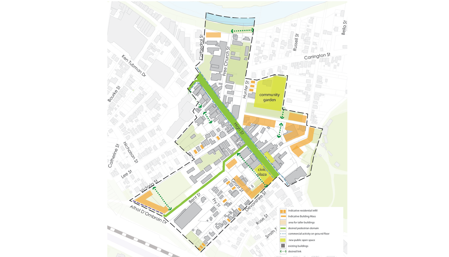
A structure plan is the highest order of local strategic policy. Atlas offers structure planning services which set out a design framework that ensures a local government’s strategic aims are met. It guides and coordinates existing and future local policies such as master plans, development controls and public domain upgrades. Our structure planning is based on an overarching vision for the area and provides a strong basis for decision making with respect to current and future developments. Click through the graphics below to see examples of our Structure Planning projects.
98. Streetscape
The visual character of a street space that results from the combination of street width, curvature, paving, street furniture, plantings and the surrounding built form and detail. The people and activities present in the street also contribute to the streetscape.
99. Street spaces and plazas
Street spaces are that part of the street used for social purposes such as a wide footpath or a pedestrian-only mall. Plazas range from a building forecourt to a large city square. A plaza is often bordered by buildings or streets. Most street spaces and plazas are paved, and can include trees and other planting, but they are distinguished from parks. The spaces may have vehicles running adjacent to the pedestrian zone, be a shared zone, or may be free of vehicles.
100. Street Edge
The interface between building frontage or private property boundary and the street. The way a building, space or wall meets the street affects the character of the street.
101. Street cross-section
A street cross-section is a diagram showing street details, generally from private property boundary to boundary, and includes building frontage, street edge, footpaths, verges, kerbs, services, below ground infrastructure and road space.
102. Street and park furniture
Street and park furniture includes seats, waste bins, drinking fountains, café furniture, bicycle parking hoops, post boxes, parking meters, payphone cabinets, vending and ticket machines. This element also includes public art, play and recreation equipment.
103. Scale
The apparent size of a building, window, or other element as perceived in relation to the size of a human being;
scale refers to the apparent size, not actual size, since it is always viewed in relationship to another building
or element; for instance, the scale of one element may be altered simply by changing the size of an element
nearby, such as windows, doors, or other architectural details; these relationships contribute to the experience
of a place as intimate, vast, “larger than life,” and daunting, etc
104. Sense of place
Sense of place is determined by personal experiences, social interactions, and identities. Understanding sense of place in the urban context would be incomplete without a critical consideration of cities as socially constructed places both inherited and created by those who live there
105. Suburb
The suburb is defined as a residential area situated on the outskirts of a city or urban district
106. Transition Design
Transition design is the practice of designing things that take a significant period of time to achieve, requiring a number of steps. It is associated with complex problems such as sustainability and urban design.
107. Transportation Infrastructure
Transportation infrastructure are foundational structures and systems for transporting people and goods. The following are common types of transportation infrastructure.
108. Tactical Urbanism
The term tactical urbanism refers to a rapid and low-cost and scalable approach to making temporary changes to the urban environment, often in urban gathering areas. The process combines a development process with social interaction.
109. Transit-oriented development (TOD)
Transit-oriented development (TOD) is a planning and design strategy that consists in promoting urban development that is compact, mixed-use, pedestrian- and bicycle-friendly, and closely integrated with mass transit by clustering jobs, housing, services, and amenities around public transport stations.
110. Transfer of Development Rights (TDR)
Transfer of Development Rights (TDR) is a voluntary, incentive- based program that allows landowners to sell development rights from their land to a developer or other interested party who then can use these rights to increase the density of development at another designated location.
111. Townscape
“Townscape” is the visual composition of structures within a town that determine its distinctive character.
112. Town
A built-up area with a name, defined boundaries, and local government, that is larger than a village and generally smaller than a city. A town is a human settlement. Towns are generally larger than villages and smaller than cities, though the criteria to distinguish between them vary considerably in different parts of the world
113. Urban Design
While many assume urban design is about the process of designing and shaping the physical features of cities, and regional spaces, it is also about social design and other larger scale issues. Linking the fields of architecture as well as planning to better organize physical space and community environments.
114. Urban Conservation
Urban conservation is concerned with those parts of the built environment that are of architectural or historic significance. This includes buildings (individually or in groups), localities (streets, blocks, environments or precincts), special gardens or landscapes, and other structures.
115. Urbanism
Urbanism is the way of living or characteristics of lifestyle of people living in urban areas.Lious Wirth (1938:124) has given five characteristics of urbanism: heterogeneity of population, specialization of function, anonymity, impersonality and standardization of life and behaviour. Though these characteristics present an exaggerated picture of the urban man and his life, an analysis there, of is necessary.
116. Urbanization
Urbanization refers to the population shift from rural to urban areas, the corresponding decrease in the proportion of people living in rural areas, and the ways in which societies adapt to this change.
117. Urban fortifications
The walls, towers, bastions, ditches, moats and glacis of the fortified town (see Barley, 1976); includes urban castles, although in many cases the primary function of the castle was not the protection of the town itself. Such fortifications usually ringed the kernel of the town, forming a barrier to development; a fixation line; but, when cleared (often in the C18th-C19th in Europe) afforded an opportunity for certain types of development, including ringstrasse.
118. Urban Fringe
Urban fringe, sometimes also called “urban-rural fringe,” is the area of land where town meets country. The urban fringe is an area most often reserved for urban-based people who wish to be closer to nature and for industries that require large amounts of open land such as airports and wind farms. The size and scope of a city’s urban fringe are influenced by the agricultural needs of the society, the amount of available space, the proximity of other cities, and the value of the land surrounding it.
119. Urban Reforestation
Many cities are located at sites that were once forests. Urban reforestation is an effort to return an area closer to its original state by planting large numbers of trees.
120. Urban Heat Island
An urban heat island is the tendency for cities to be hotter than the countryside surrounding them. It is primarily due to the surfaces found in cities such as pavement. Urban heat islands reduce quality of life, pose health risks and result in increased energy usage to cool buildings. This results in a negative feedback loop as waste heat from air conditioning contributes to urban heat islands.
121. Urban Density
Urban density is a measure of how many people live in an area such as population per square kilometer. It is often used as a sustainable urban design technique as dense cities tend to use less resources per person such as land and energy. Properly designed they are also walkable with access to public space, green spaces, employment, shopping, entertainment, cultural activities and schooling. As such, urban density is a way to accomplish both a high quality of life and a low environmental impact.
122. Urban tissue
Urban tissue refers to the environmental level normally associated with urban design. Tissue comprises coherent neighborhood morphology (open spaces, building) and functions (human activity).
123. Urban Form
Urban form is the physical characteristics that make up built-up areas, including the. shape, size, density and configuration of settlements. It can be considered at different. scales: from regional, to urban, neighbourhood, ‘block’ and street.
124. Vernacular
Vernacular architecture can be defined as a type of local or regional construction, using traditional materials and resources from the area where the building is located.
125. View corridor
View corridor means an open-air space on a lot affording a clear view across the lot to the water from the abutting street.

126. Wetland
Urban wetlands are places within city limits where water and soils mingle. They range from remnants of water bodies that once existed on sites where buildings now stand, to drainage ditches resulting from inadequate development.
127. Water Infrastructure
Water infrastructure is a broad term for systems of water supply, treatment, storage, water resource management, flood prevention and hydropower. The term also includes water based transportation systems such as canals. The following are common types of water infrastructure.
128. Walkability
Walkability is a nebulous term for planning concepts best understood by the mixed-use of amenities in high-density neighborhoods where people can access said amenities by foot. It is based on the idea that urban spaces should be more than just transport corridors designed for maximum vehicle throughput.

129. Walkable Urbanism
The major current development trend is walkable urbanism, in which most daily needs can be met within walking or rail-transit distance of one’s home.
130. Wayfinding
Wayfinding may be defined as all of the ways in which people orient themselves in physical space, navigate from place to place and interpret their surroundings. It is a holistic concept with a focus on making all parts of the urban landscape easy to read and understand.
131. Water efficient urban design
Integrating and managing the water cycle in an area through collection, treatment and reuse technologies, to minimise environmental impacts and improve aesthetic and recreational appeal. It often includes managing both potable water use, and stormwater, groundwater and wastewater. Also known as water sensitive urban design.
132. Walkable catchment
The area within a specified walking distance of a destination and where paths provide a specific level of service and amenity. Often a 400m walking distance is defined as walkable, being about a five minute walk for most people. More important destinations, such as train stations or major centres, may serve a wider walkable catchment.
133. Zoning
Zoning is a method of urban planning in which a municipality or other tier of government divides land into areas called zones, each of which has a set of regulations for new development that differs from other zones.
134. Zoning regulations
Zoning regulations include specifications regarding lot size, density or bulk, height, and floor area ratio (FAR). The zoning ordinance is the formal categorization of land-use policies applicable to land within a municipality. It also sets the legal framework.
135. Zoning Ordinance
The zoning ordinance is the formal categorization of land-use policies applicable to land within a municipality. It also sets the legal framework. The zoning ordinance establishes permitted land uses and distinguishes between different land use types.
References
1. Simplicable Urban Design
2. International Seminar on Urban Form, ISUF
3. Wikipedia
4. THE MAYORS’ INSTITUTE ON CITY DESIGN
5. Urban Design Guidelines for Victoria
Urban Design Lab
About the Author
This is the admin account of Urban Design Lab. This account publishes articles written by team members, contributions from guest writers, and other occasional submissions. Please feel free to contact us if you have any questions or comments.
Related articles

Architecture Professional Degree Delisting: Explained
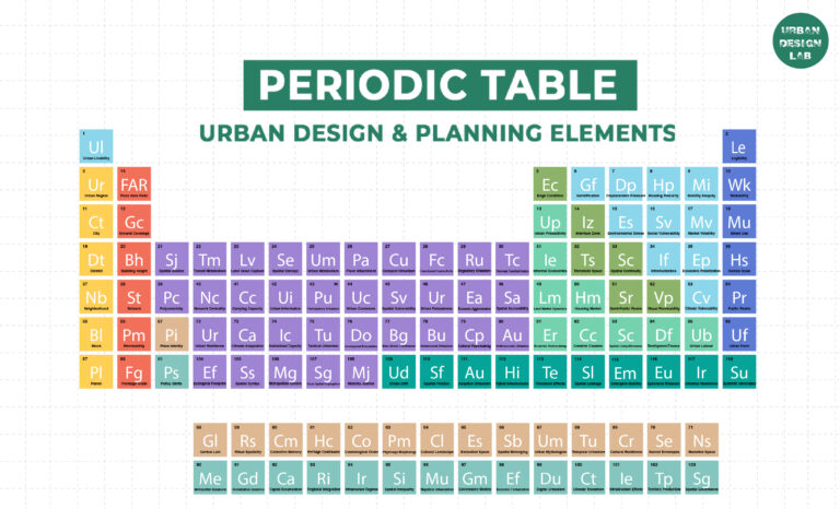
Periodic Table for Urban Design and Planning Elements
History of Urban Planning in India
Kim Dovey: Leading Theories on Informal Cities and Urban Assemblage
UDL GIS
Masterclass
GIS Made Easy – Learn to Map, Analyse, and Transform Urban Futures
Session Dates
23rd-27th February 2026

Urban Design Lab
Be the part of our Network
Stay updated on workshops, design tools, and calls for collaboration
Curating the best graduate thesis project globally!

Free E-Book
From thesis to Portfolio
A Guide to Convert Academic Work into a Professional Portfolio”
Recent Posts
- Article Posted:
- Article Posted:
- Article Posted:
- Article Posted:
- Article Posted:
- Article Posted:
- Article Posted:
- Article Posted:
- Article Posted:
- Article Posted:
- Article Posted:
- Article Posted:
- Article Posted:
Sign up for our Newsletter
“Let’s explore the new avenues of Urban environment together “


