12 Best Mobile Apps for Urban Designers and Planners
Planning and designing urban environments falls under the complex and multifaceted field of urban design. It entails a wide range of tasks, such as assessing and comprehending a city or community’s social, economic, and physical characteristics; identifying and addressing urban design issues; and coming up with original and practical solutions to enhance the quality of life for locals.
There are now many mobile apps available to aid urban designers in their work thanks to smartphones and mobile technology. The creation of maps, data collection and analysis, 3D modelling and visualisation, and community engagement are just a few of the tasks that these apps can be helpful for.
1. SketchUp Viewer
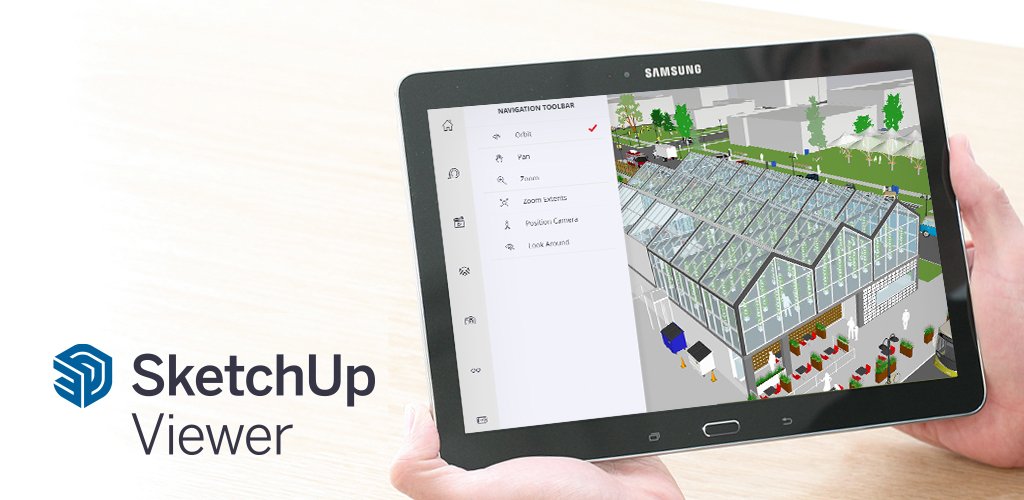
SketchUp Viewer is a powerful 3D modelling app that has revolutionised the way urban designers handle their work. With the help of this app, users can quickly examine and explore 3D models produced by the well-liked 3D design software SketchUp. Urban designers can visualise and explore 3D models using SketchUp Viewer from any location, giving them the mobility to work on projects while on the go.
One of the key features of SketchUp Viewer is its ability to enable multiple users to collaborate on 3D models in real-time. As a result, urban designers can collaborate virtually, exchanging ideas and making real-time design modifications. Comparing this to more conventional forms of collaboration, like in-person meetings, can result in substantial time and resource savings.
Advanced visualisation tools are also available in SketchUp Viewer, enabling users to explore and interact with 3D models with ease. Users can modify the textures, shadows, and lighting of their models, as well as make animations to see how their creations will appear in various contexts. Urban designers who must show their plans to interested parties, such as city planners, community organisations, and residents, may find this to be particularly helpful.
2. ArcGIS Collector
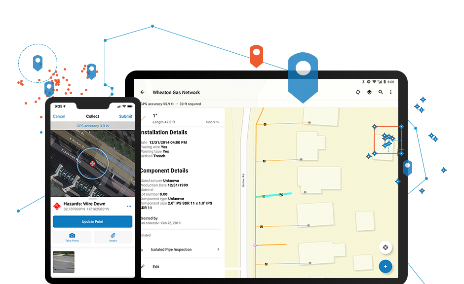
ArcGIS Collector is a smartphone application created to assist urban planners in gathering, updating, and analysing data while on the go. Urban designers who need to collect and analyse information about a specific region, such as population demographics, land use, and transportation patterns, will find this app to be especially helpful. Data gathering and analysis are efficient and simple thanks to the user-friendly interface it offers.
Working offline is one of ArcGIS Collector’s primary benefits. In areas with poor internet connectivity or no connectivity at all, urban designers can now gather and update data. When they are able to connect again, the data is automatically synchronised with the main database to make sure that everything is current and accurate.
Users of ArcGIS Collector can also design unique forms for data collection that are suited to particular tasks or data types. This can help you save time and make sure that all the data is gathered in the right manner.
3. AutoCAD 360
Urban designers can view, modify, and share AutoCAD drawings using the mobile app AutoCAD 360, which was created to help them work on the go. Urban designers who need to work with coworkers or access their AutoCAD drawings while away from their computer will find this app to be of particular use.
The ability to examine and edit AutoCAD drawings on mobile devices is one of AutoCAD 360’s key features. Urban designers can now examine and alter their plans on the go, which can speed up the design process and increase productivity. Additionally, the app allows touch and stylus input, making it simple to navigate and make accurate design changes.
Users of AutoCAD 360 can work together in real-time on designs with coworkers or customers. Users have the option to share their drawings with others so they can watch, comment on, or edit the artwork. Urban designers who must work with stakeholders who are not physically present, such as clients or colleagues in various locations, may find this helpful.

4. iScape
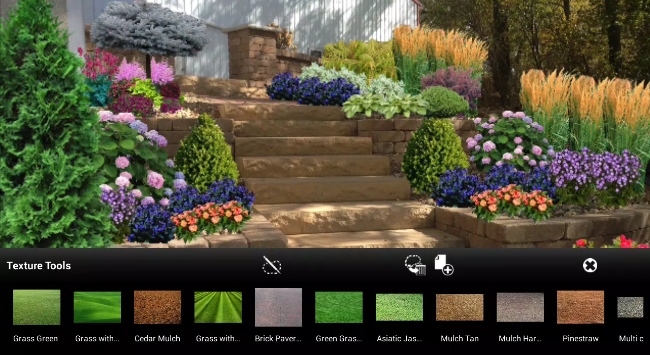
A smartphone software called iScape is intended to assist urban designers in creating 3D virtual designs of outdoor areas. With the help of various design tools, users of the app can turn a picture of an outdoor space into a virtual 3D model of the area. As a result, it helps urban designers who need to picture how a specific location will appear after a redesign.
The capability of iScape to add different design components to the virtual outdoor area is one of its standout features. Users can modify the virtual space by adding plants, trees, furniture, and other design components to get a realistic idea of how the area will appear after the renovation. Additionally, the app offers a library of design components from which to select, making it simple to create a unique and realistic design.
Making a walkthrough of the virtual outdoor space is another helpful element of iScape. This enables users to envision how the area will appear from various angles and views, making it simpler to spot any potential design flaws or problems.
Users of iScape have the option of sharing their virtual creations with customers or coworkers. This can be helpful for urban designers who need to give presentations to stakeholders or solicit input from peers on their designs.
5. GIS Cloud Mobile Data Collection:
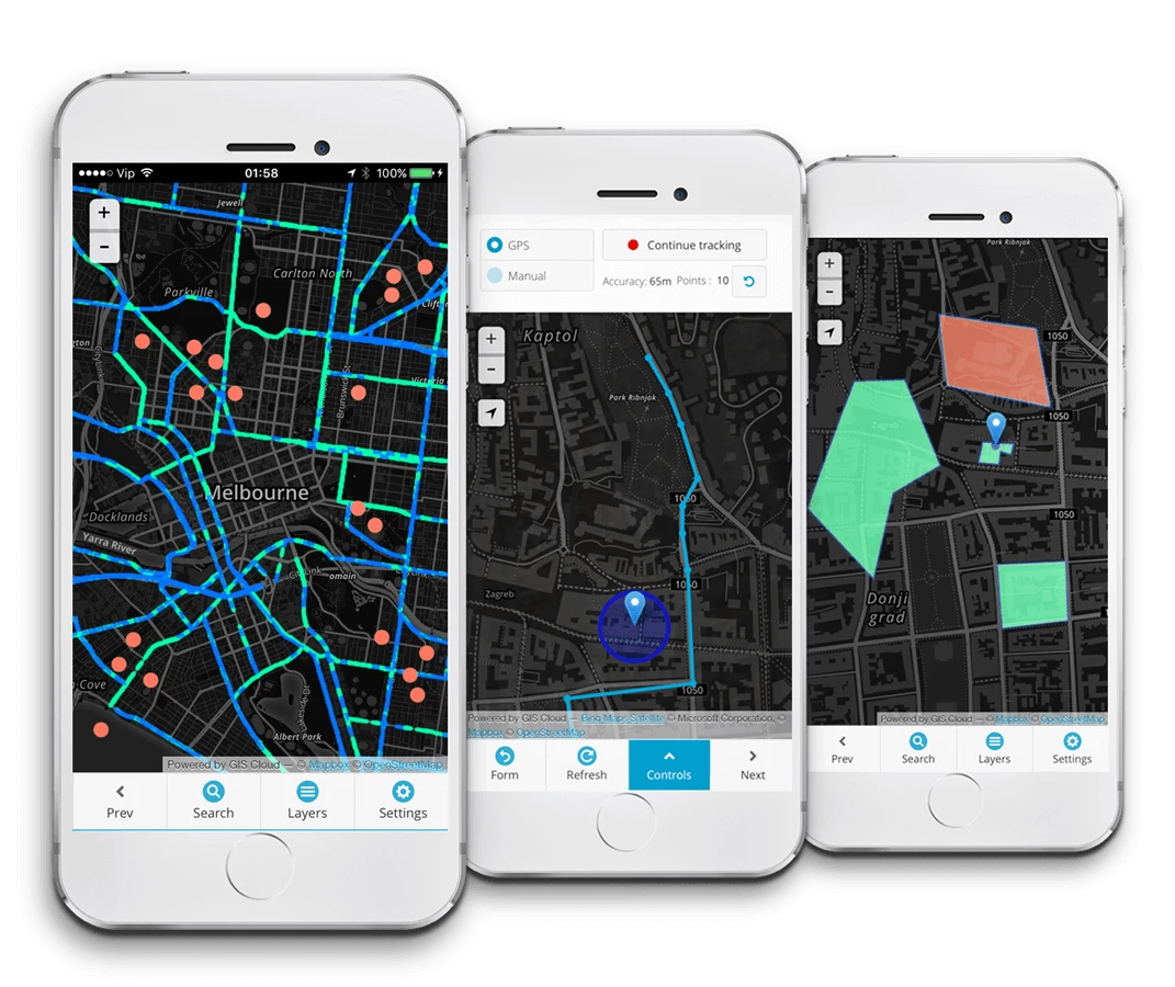
GIS Cloud Mobile Data Collection is a mobile app designed to help urban designers collect and update data in the field. The app allows users to create customized forms and surveys, and use them to collect data about a particular area. This makes it useful for urban designers who need to gather and analyze data about a specific location, such as population density, land use patterns, or environmental factors.
One of the key features of GIS Cloud Mobile Data Collection is its ability to create customized forms and surveys. This allows urban designers to collect the exact data they need, and ensure that the data is accurate and relevant to their project. Users can also add photos, videos, and other multimedia elements to their surveys, making it easier to record and analyze data.
Another useful feature of GIS Cloud Mobile Data Collection is its ability to work offline. This allows users to collect data in areas with limited or no internet connectivity, and then sync the data to the cloud when they have internet access. This makes it ideal for urban designers who need to collect data in remote or rural areas.
6. PlanGrid
PlanGrid is a mobile app designed to help urban designers view and collaborate on construction plans and documents. The app allows users to access and view construction plans, blueprints, specifications, and other construction documents from their mobile devices. This makes it useful for urban designers who need to keep track of construction projects and ensure that they are progressing according to plan.
One of the key features of PlanGrid is its ability to facilitate collaboration among project team members. Users can share construction plans and documents with other team members, and collaborate on them in real-time. This can help to ensure that everyone is on the same page and that the project is progressing smoothly.
Another useful feature of PlanGrid is its ability to track changes and revisions to construction plans and documents. Users can mark up plans and documents, add notes, and track changes over time. This can help urban designers to identify any design or construction issues early on, and make necessary adjustments to the plans and documents.

7. Mapbox
Mapbox creates building blocks for mobile developers to add beautiful maps, location search, and navigation to their mobile applications. Companies like Pinterest, Lonely Planet, Uber, The Weather Channel, Under Armour, Human, GitHub, CNN and National Geographic use our tools to create beautiful maps.
Mapbox is a mobile app designed to help urban designers create custom maps and integrate them into their own applications. The app allows users to access a wide range of mapping data, including satellite imagery, street maps, and terrain data, and use this data to create custom maps that meet their specific needs.
One of the key features of Mapbox is its ability to provide users with complete control over the design and style of their maps. Users can customize the colors, fonts, and symbols used on their maps, and even add their own custom data layers. This can be useful for urban designers who need to create maps that reflect specific design concepts or highlight particular features of an area.
.jpeg)
8. Streetmix
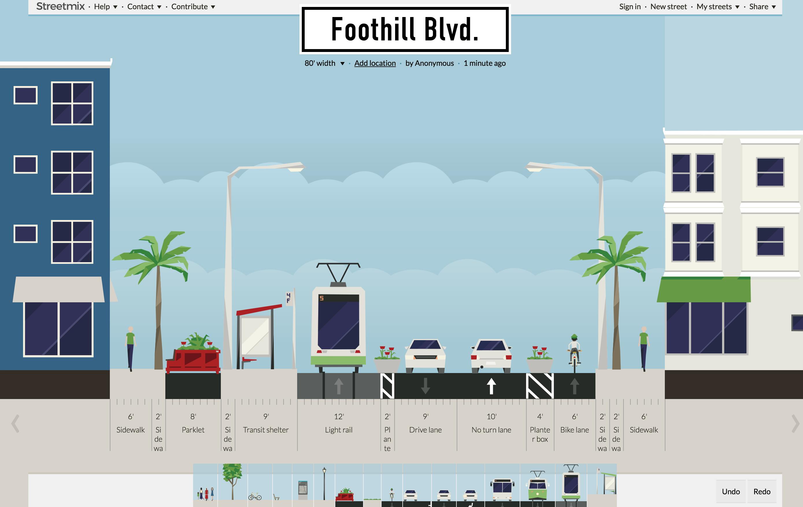
Streetmix is a mobile app designed to help urban designers design and visualize street layouts. The app allows users to create custom street configurations and layouts, including the placement of buildings, sidewalks, bike lanes, and public transportation infrastructure.
One of the key features of Streetmix is its ability to provide users with a visual representation of their street design. Users can see their street layout in 3D, which can help them to better understand how their design will look and function in real life. This can be useful for urban designers who need to communicate their ideas to other team members or stakeholders.
Another useful feature of Streetmix is its ability to facilitate collaboration among project team members. Users can share their street layouts with other team members, and collaborate on them in real-time. This can help to ensure that everyone is on the same page and that the street design is progressing smoothly.
Streetmix also provides users with powerful data analysis tools. Users can input data on traffic flow, pedestrian and bike traffic, and other factors that can impact street design, and use this information to inform their design decisions. This can be useful for urban designers who need to create street layouts that are safe and functional for all users.
9. Maptionnaire
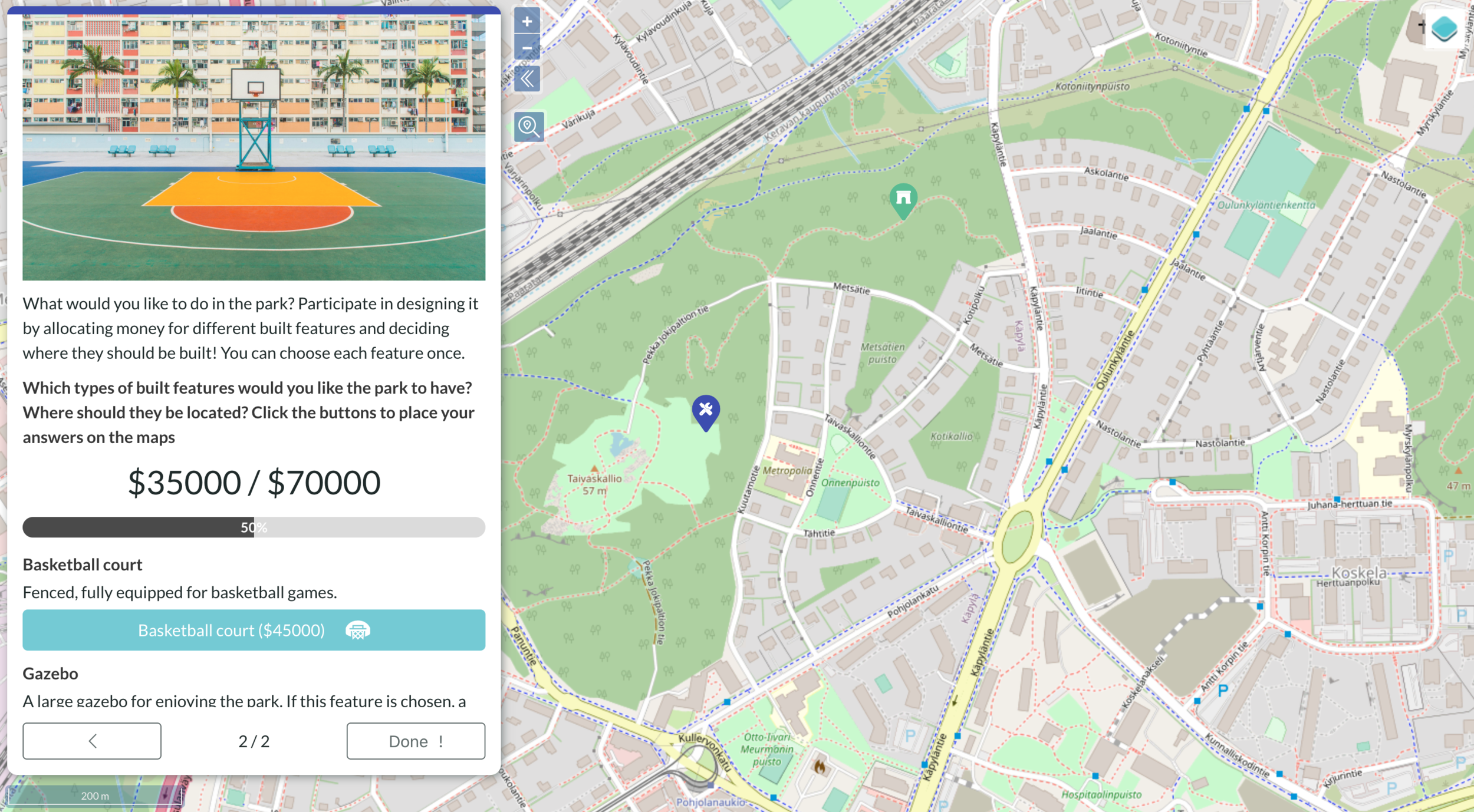
Maptionnaire is a mobile app designed to help urban designers collect feedback from residents about their urban planning projects. With Maptionnaire, users can create and distribute surveys to collect feedback on a variety of topics, including transportation, land use, public spaces, and more.
One of the key features of Maptionnaire is its ability to gather input from a large number of people quickly and easily. Users can distribute their surveys through a variety of channels, including social media, email, and QR codes. This can help to ensure that a diverse range of people are able to provide feedback on the project, which can help to ensure that the final design reflects the needs and desires of the community.
Another useful feature of Maptionnaire is its ability to provide users with powerful data analysis tools. The app allows users to easily analyze the data they collect, including the ability to filter and visualize responses based on specific demographics or areas. This can help urban designers to better understand the needs and preferences of different groups within the community, and to create designs that are inclusive and responsive to these needs.
Maptionnaire also provides users with tools for collaboration and communication. Users can share their survey results with other project team members, stakeholders, and community members, which can help to build support for the project and ensure that everyone is on the same page.
10. What3Words
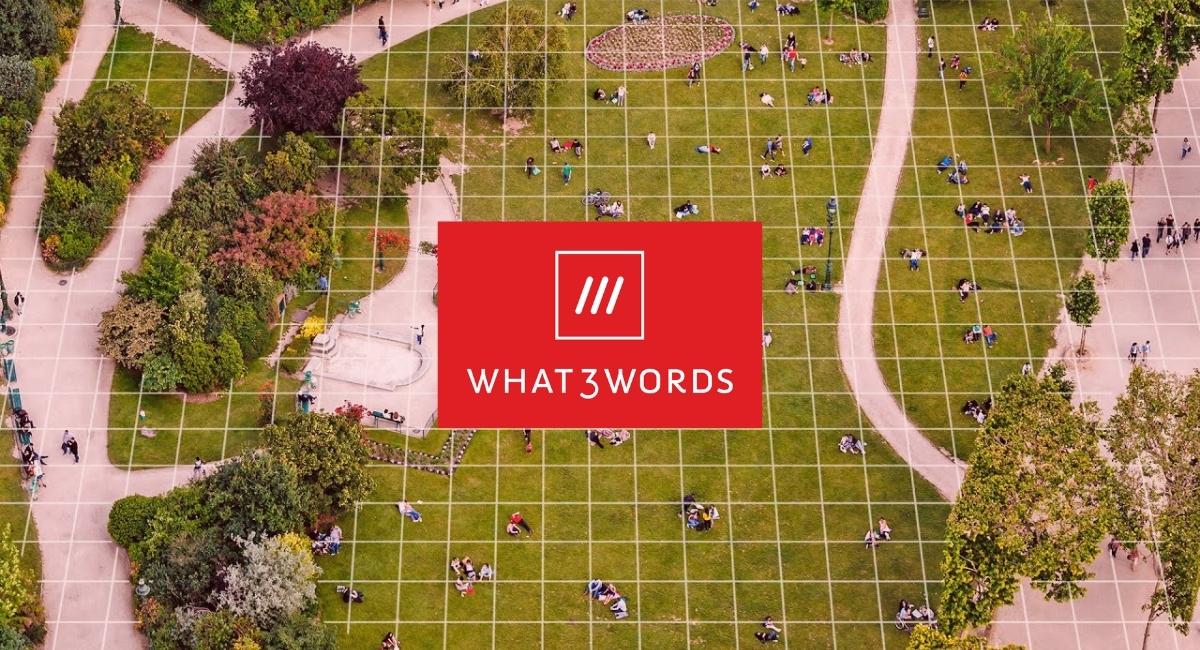
What3Words is a mobile app that provides a unique approach to location mapping and addressing. Rather than using traditional geographic coordinates, the app divides the world into 3m x 3m squares, with each square assigned a unique three-word address. This system allows users to easily identify and share precise locations, even in areas that do not have traditional addresses or are difficult to navigate.
For urban designers, What3Words can be an incredibly useful tool for identifying specific locations within a city or community. This can be especially valuable for projects that involve complex urban environments or areas where traditional addressing systems may be inadequate or non-existent. By using the app to identify precise locations, urban designers can ensure that their plans and designs are tailored to the unique needs of the specific area.
One of the key advantages of What3Words is its simplicity and ease of use. The three-word address system is intuitive and easy to understand, even for those who are not familiar with traditional geographic coordinates. This can help to improve communication and collaboration among project team members, stakeholders, and community members, as everyone is able to easily identify and discuss specific locations.
Another benefit of What3Words is its global coverage. The app covers the entire world, and the three-word address system is available in over 40 languages. This can be incredibly valuable for urban designers who are working on international projects or in areas where multiple languages are spoken.
11. Transit
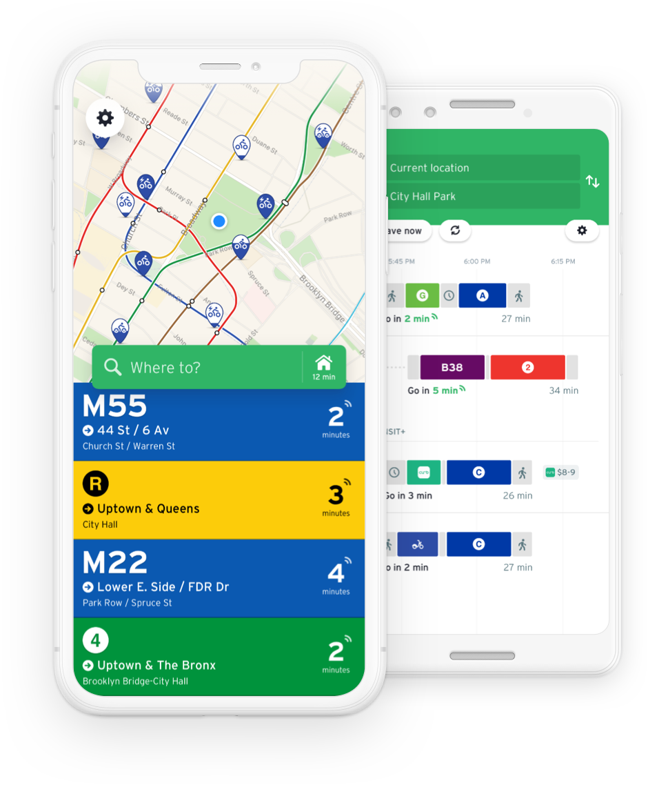
Transit is a mobile app that provides real-time information about public transportation systems. It allows users to track buses, trains, and other forms of public transportation, view schedules and routes, and plan trips. The app uses GPS technology to provide accurate and up-to-date information, which can be incredibly valuable for urban designers who need to understand how people move around a city.
For urban designers, Transit can be a useful tool for analyzing transportation patterns and identifying areas where improvements may be needed. By tracking the movement of people through a city, designers can gain insights into traffic flow, bottlenecks, and other factors that may impact the design of streets, sidewalks, and other transportation infrastructure.
The real-time nature of the information provided by Transit is particularly valuable for urban designers. By having access to up-to-the-minute information about public transportation systems, designers can make more informed decisions about how to design transportation infrastructure. For example, they may be able to identify areas where additional bus stops or train stations are needed, or where pedestrian walkways could be improved to make it easier for people to access public transportation.
12. Citymapper
Citymapper is a public transit app and mapping service which displays transport options, usually with live timing, between any two locations in a supported city. It integrates data for all urban modes of transport, including walking, cycling and driving, in addition to public transport. It is free of charge to users, and is supported by a mobile app on devices such as mobile phones, and by an Internet website.
The underlying data is pulled from a variety of sources, including open data (usually GTFS-files provided by transport authorities) and local transit authorities. Some data is user-generated or collected by local employed personnel.
Citymapper started in 2011 in London. Its second city was New York. In August 2020 travel in 58 cities and metropolitan areas was covered. Citymapper was founded by Azmat Yusuf, a former Google employee, who also serves as Citymapper’s CEO.

These apps can assist urban designers and planners with tasks ranging from data collection and analysis to creating custom maps and visualizations. They can also be helpful for tracking construction progress, gathering community feedback, and understanding how people move around a city. With the increasing availability of mobile technology, these apps are becoming an essential part of the urban designer and planner’s toolkit.
Urban Design Lab
About the Author
This is the admin account of Urban Design Lab. This account publishes articles written by team members, contributions from guest writers, and other occasional submissions. Please feel free to contact us if you have any questions or comments.
Related articles


Architecture Professional Degree Delisting: Explained
Periodic Table for Urban Design and Planning Elements
History of Urban Planning in India

Best Landscape Architecture Firms in Canada
UDL GIS
Masterclass
GIS Made Easy – Learn to Map, Analyse, and Transform Urban Futures
Session Dates
23rd-27th February 2026

Urban Design Lab
Be the part of our Network
Stay updated on workshops, design tools, and calls for collaboration
Curating the best graduate thesis project globally!

Free E-Book
From thesis to Portfolio
A Guide to Convert Academic Work into a Professional Portfolio”
Recent Posts
- Article Posted:
- Article Posted:
- Article Posted:
- Article Posted:
- Article Posted:
- Article Posted:
- Article Posted:
- Article Posted:
- Article Posted:
- Article Posted:
- Article Posted:
- Article Posted:
Sign up for our Newsletter
“Let’s explore the new avenues of Urban environment together “


