
Spatial Organization of Green Urban Spaces
Introduction to Green Urban Spaces
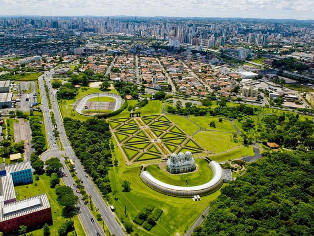
Areas with limited constructions and mostly unsealed, pervious soft surfaces—such as dirt, grass, shrubs, and trees—are referred to as green spaces. In densely populated places with man-made structures, green spaces provide vital natural and cultural resources for city dwellers. In addition to improving air quality and lowering atmospheric carbon dioxide levels, urban green spaces also offer important ecosystem services for entertainment and cultural purposes. But there are less possibilities for people to contact with nature as a result of urbanization, environmental deterioration, and lifestyle changes.
Urban dwellers are encouraged to connect with nature, boost their physical activity levels, and enjoy more leisure and recreation when there are amenities in green places. An increasing amount of research indicates that having green spaces around can improve people’s quality of life. For example, convenient access to green spaces encourages urban inhabitants’ physical and mental well-being and increases their level of physical exercise. More greenery in residential metropolitan settings is linked to lower illness death rates and higher levels of physical activity. Urban green spaces (UGSs) can also promote social networking, social support, social inclusion, and social interactions while also enhancing the mental health of locals.

“Green space“ is an expression that encompasses a broad variety of open spaces, both natural and semi-natural, many of which have an increasingly hybrid nature (Beatley 2012, Waldheim 2012). See for instance Clark (2006, p. 2): “Green space is, of course, not always perfectly green: sometimes it is a frozen grey or muddy brown or wintry white, especially in Nordic countries. But it is ubiquitous even in the biggest cities. For we must remember not only the parks and squares, garden suburbs and green belts, which have attracted most attention from historians and others. But also the infinite multitude of churchyards, cemeteries, hospital grounds, sport and school grounds, riverbanks and little strips of empty land at the end of the streets, as well as fields and woodlands on the edges of the invading Metropolis”
History of Green Urban Spaces
Throughout the history of urban development, a variety of ideas for integrating natural areas into urban planning have been proposed, with some of them remaining relevant to this day. Specialists identify three distinct periods, each characterized by a fundamentally different approach to addressing this challenge.
The first period began with the establishment of cities and extended until the 19th century. During this time, systems of green plantings followed regular geometric patterns (such as circular or concentric layouts) as seen in the schemes developed by J. Perre, G. Sharp, and S. Fure. Cities were planned without taking the external environment into consideration.
The second period is associated with the rise of large industrial centers and the formation of agglomerations, occurring from the late 19th century to the first half of the 20th century. New architectural and planning solutions necessitated the creation of greened areas in the form of green belts, green wedges, diameters, and more, as evident in the designs proposed by T. Fritsch, E. Howard, R. Envin, S. Shestakov, I. Leonidov, Le Corbusier, P. Abercrombie, among others. During this era, efforts were made to strike a balance between urban development and green spaces. Considerable attention was devoted to the sanitary, hygienic, aesthetic, and recreational roles of green plantings. Suburban green areas were incorporated into city development plans.
The third period, which emerged in the second half of the 20th century, distinguishes itself from the previous eras by adopting a comprehensive approach to city and adjacent territory design.
In these cities, over 50% of the territory, and in micro-districts, up to 70% of the total area is designated for green plantings. These green spaces connect individual buildings, structures, and groups into the ensemble of a micro-district or quarter. In combination with terrain improvement, engineering enhancements, and territory irrigation, these green areas contribute to the creation of a modern city.

The rapid development of the city vertically and horizontally sharply reduces the attractiveness of the landscape of the area. Interesting natural objects – groves, picturesque hills, banks of rivers and lakes, terraces above the floodplain can play a significant role in forming the urban environment, if they are preserved and organically included in the system of urban green plantings, and this means in the architectural and planning structure of the city. The picturesqueness of the landscape, the changing in time variety of colours, the aroma of flowers, the rustle of leaves have a beneficial effect on the psychological and physical state of a person, his mood and nervous system, contribute to the creation of comfortable living conditions for a person in the city.
Spatial organisation of Green Urban Spaces
Modern cities apply flexible planning structures that are able to respond to changing needs and conditions, so the systems of green spaces in cities are constantly becoming more complex and their individual elements are increasingly differentiated.
If in a small city there is usually one multifunctional park and several urban gardens, boulevards and squares, then with the growth of the city, the differentiation of its green spaces by type, size and function increases.
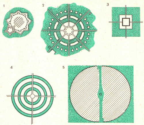
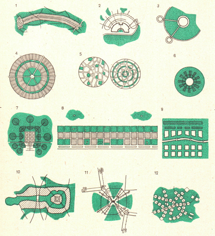
Interconnection of urban organisation systems & green spaces
The selection of greening systems within a city is contingent upon various urban planning considerations, including the city’s location within a settlement network, its economic profile, the size and zoning scheme of the territory, the arrangement of public centers, residential and industrial areas, the architectural and planning design of the territory, transportation routes, and the potential for establishing a cohesive citywide green space system, along with future development prospects. Additionally, natural and climatic, sanitary-hygienic, landscape-ecological, physical-geographical, and other factors play a crucial role in this determination.
The establishment and growth of urban green areas are profoundly influenced by the area’s natural attributes, such as climate, topography, existing vegetation, soil composition, the presence of water bodies, geological and hydrological conditions. Among the climatic factors, radiation, temperature, wind patterns, precipitation levels, wind speed, and direction are of primary significance. The impact of these factors on greening techniques varies according to the specific circumstances. A comprehensive evaluation of the existing urban environment is given special attention.
Depending on the combination of urban planning and natural conditions, a city’s green space system can manifest as scattered green “pockets” distributed throughout the city, several significant green belts extending into the city center, a water-green axis (comprising parks, boulevards, and open spaces along the riverbanks cutting through the city), one or more bands of green plantings running parallel to the development, sometimes dividing the city into segments (especially in the case of linear city development), or green areas surrounding distinct urban districts (commonly seen in decentralized city planning).
Green plantings, when thoughtfully integrated into the urban fabric, enhance the structural, planning, architectural, and artistic qualities of the city, contributing to the creation of an iconic volumetric-spatial identity and picturesque skyline.
Natural factors’ influence on a city’s formation is particularly evident in small, newly established cities with a prominent natural landscape element. For instance, a water-green axis can become the city’s primary compositional feature.
In order to create a balanced urban environment, the city’s greening system should ensure a reasonably even distribution of plantings in rural areas, residential neighborhoods, micro-districts, public and cultural centers, and industrial and sanitary protection zones.
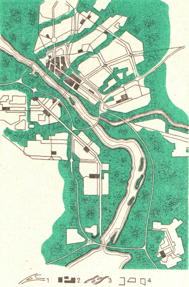
The formation of the urban greening system is influenced by: the ratio of built-up and open urban territories; the proportion of existing plantings, their quality and place in the planning structure of the city; the magnitude and functionality of individual green areas, their functional role; landscape features; transport and pedestrian accessibility.
The interconnection between the arrays of urban and suburban green territories is carried out by means of a continuous chain of boulevards, embankments, pedestrian alleys, green strips along highways, special protective strips, which together with water bodies, forming water-green diameters, green wedges or strips, evenly divide the urban development in the direction of favourable winds and the flow of rivers, connecting the central urban districts with the green belt of the city.
Global Practice of the Spatial Organisation of Green Spaces
Budapest stretches 28 km along the banks of the Danube. The city is first mentioned as the ancient Roman settlement of Aquincum (1st century AD). From the 9th century, two independent cities, Buda and Pest, began to develop here. In 1873, the two cities became one, the Great Budapest, covering an area of 1673 km2. It is one of the most beautiful historical cities, surrounded by a belt of parks. The large green masses on the hills (Lató, Haraszt, János, Szam) on the island of Margit, the zoo, and the Varosliget Park are very popular.
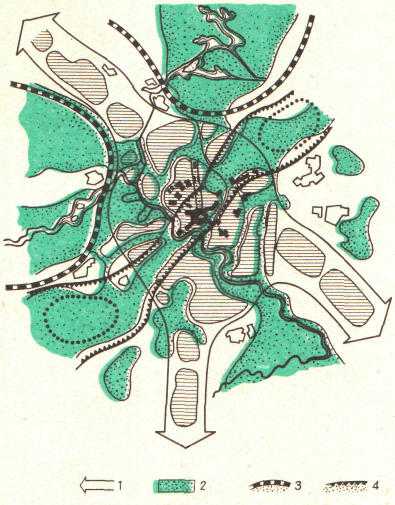
Due to the deterioration of the environmental situation, about 300 enterprises that polluted the environment have been removed from the city since 1970, and green plantations have appeared in their place. Thanks to the greening of streets and squares, the air quality has improved, but due to the high density of construction in the city centre, it is difficult to create large green masses. Therefore, the general plan project provides for significant development of the network of parks both within and outside the construction.
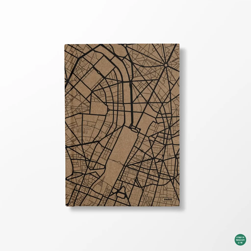
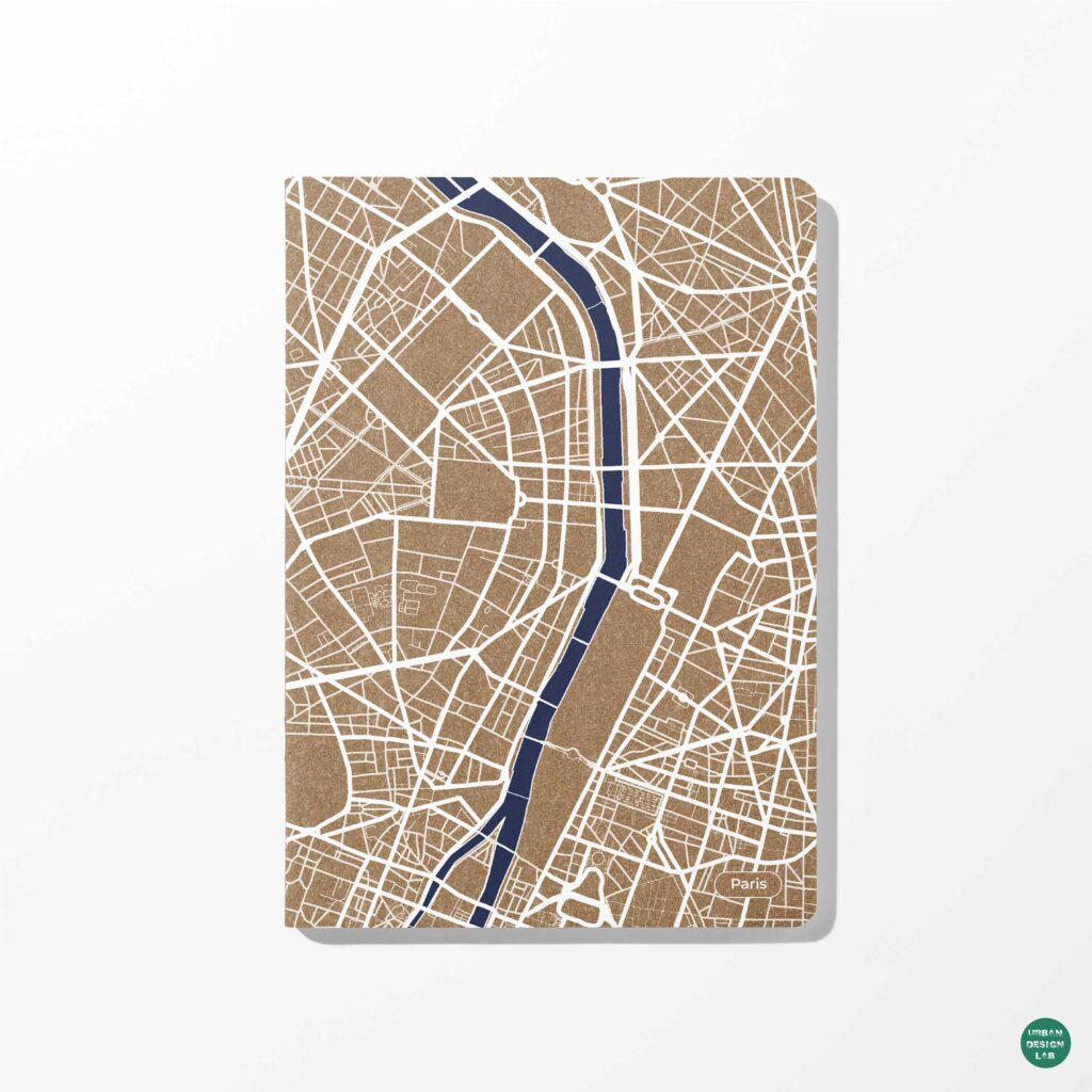
Paris is located in an area with favourable natural conditions: mild climate, the Seine with its tributaries, hilly relief, large forest masses around the city. The centre of the French capital is a solid historical construction with rare spots of green plantations. During the reconstruction of Paris, carried out under the leadership of the prefect of the city from 1852 to 1871, wide avenues crossing the entire city and the creation of squares sharply increased the area of green plantations for public use. 48 km of boulevards, which are still considered a landmark of the city today, were created, and large suburban masses – the Bois de Boulogne and the Bois de Vincennes – were included in the city’s territory, although they are outside the solid construction of the city.
New York, with an area of 82 thousand hectares, is located at the mouth of the Hudson River, flowing into the Atlantic Ocean. Large parks – Central – 300 ha, Prospect – 210 ha, Bronx – 280 ha, Riverside and Inwood – 200 ha and many smaller ones are located throughout the city, both on the mainland and on its islands. New York is famous for its parkways connecting suburban forests and the city centre. Only the Westchester system of suburban parks covers 68 thousand hectares and has 250 km of parkways. The Edirondack and Catskill green masses include an area of 1 million hectares.

Conclusion:
In conclusion, green urban spaces are an important part of modern urban planning and design. They provide important ecosystem services, including air quality improvement, atmospheric carbon dioxide reduction, and recreational and cultural values. Green spaces also have the potential to improve physical and mental health and facilitate social interactions, social networking and social support. The variety of green space systems used in cities is determined by urban planning and natural conditions, as well as the ratio of built-up and open urban territories. Global practice of spatial organisation of green spaces shows that it is important to plan for large green masses in and around cities, as well as create green boulevards and parkways that connect suburban forests with city centres.
References
- Gorokhov, V. (1991) Green city development. Stroyiztat, Moscow.
- Spatial Characteristics of Urban Green Spaces and Human Health: An Exploratory Analysis of Canonical Correlation.
- A process approach to the open green space system planning.
- Principles of forming a system of green areas in the city
Anastasiia Murzaeva is a fourth year student of Altai State University, Barnaul (Russia). Her major is Landscape Architecture and Environmental Design. My most favorite fields of research are Landscape Planning and Urban Development. Improving the quality of life in both rural and urban spaces, through urban planning and landscape architecture is the main goal for Anastasiia. An important part of her interests is the research of climate, ecology, plants and their interconnection in the anthropogenic environment. Anastasiia uses a contemporary approach while designing landscape architecture projects.
Related articles


Architecture Professional Degree Delisting: Explained
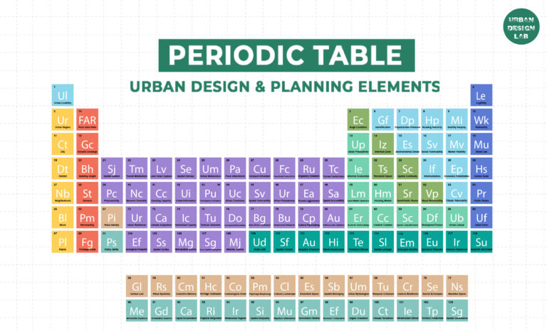
Periodic Table for Urban Design and Planning Elements
History of Urban Planning in India
Best Landscape Architecture Firms in Canada
UDL GIS
Masterclass
GIS Made Easy – Learn to Map, Analyse, and Transform Urban Futures
Session Dates
23rd-27th February 2026

Urban Design Lab
Be the part of our Network
Stay updated on workshops, design tools, and calls for collaboration
Curating the best graduate thesis project globally!

Free E-Book
From thesis to Portfolio
A Guide to Convert Academic Work into a Professional Portfolio”
Recent Posts
- Article Posted:
- Article Posted:
- Article Posted:
- Article Posted:
- Article Posted:
- Article Posted:
- Article Posted:
- Article Posted:
- Article Posted:
- Article Posted:
- Article Posted:
- Article Posted:
- Article Posted:
Sign up for our Newsletter
“Let’s explore the new avenues of Urban environment together “







One Comment