
Top 10 Lake Revitalization Case Studies
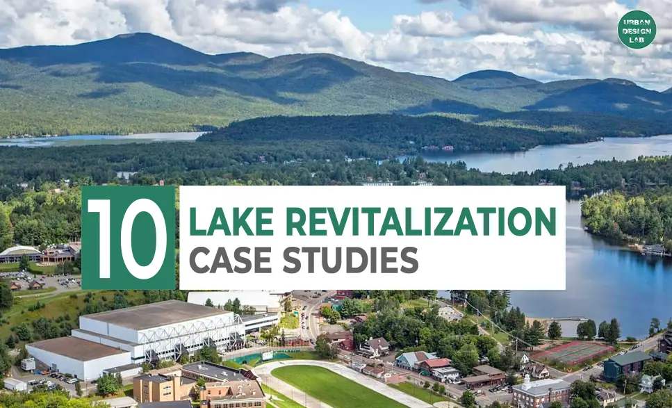
Lake revitalization programmes often aim to restore and improve lake health through various strategies, including pollution prevention, habitat restoration, invasive species control, water quality enhancement, and promotion of sustainable management practices. Successful case studies frequently include community involvement, government backing, scientific study, and novel solutions adapted to each lake’s difficulties. These activities can assist to restore ecosystems, enhance biodiversity, boost local economies, and provide recreational possibilities for communities.
Case 1: Lake Ringsjön in Southern Sweden
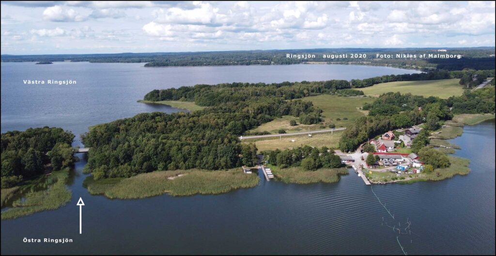
Nestled within the multifaceted landscape of Southern Sweden, Lake Ringsjön offers a dynamic ecosystem that meets both ecological and recreational demands. This iconic lake, lying within the upper Rönne river watershed, spans a diverse catchment area of approximately 1,900 square kilometers. The Rönne River, winding its 90-kilometer path to the Kattegat Sea, draws together a variety of natural and human influences, creating a unique blend of opportunities and challenges for regional stakeholders.
Historically, Lake Ringsjön teemed with iconic species like pike and pikeperch. These predatory fish, once abundant, are the focus of active restoration efforts, with recent improvements in water quality fostering hope for their resurgence. Notably, the return of Elodea canadensis, commonly known as Canadian waterweed, signals a positive shift in the lake’s ecological health, reflecting the lake’s recovery and growing vitality.
The surrounding landscape reveals a balanced mosaic of land use: forests cover nearly half of the area (48%), while arable land occupies 31% and pasture 6%. This diverse terrain not only supports the region’s agricultural base but also fosters a delicate equilibrium between nature and human needs. As urban areas expand, the lake’s water resources are increasingly tapped, with 67% allocated to households and 24% to industrial uses. With a projected annual population growth of 0.7% in the watershed, demands on freshwater services—such as drinking water, fisheries, and recreational outlets—are set to rise, calling for forward-thinking management strategies.
The lake’s governance reflects its multifaceted role in the region, involving a range of key stakeholders. The municipalities of Höör, Hörby, and Eslöv, alongside Sydvatten (a major water supplier), agricultural entities, and sport fishing associations, collaborate through the Ringsjön Water Council. This council orchestrates initiatives that not only prioritize ecological balance but also ensure sustainable access for recreation and economic activities.
Lake Dümmer in Lower Saxony, Germany
Lake Dümmer, the second-largest lake in Lower Saxony, Germany, is a remarkable aquatic landscape defined by its shallow depths and ecological significance. Despite its size—13.5 square kilometers—the lake remains exceptionally shallow, with an average depth of just one meter and a maximum of only 1.4 meters. This unique characteristic, along with its low moor setting, shapes the lake’s distinct ecological profile.
Formed approximately 10,000 years ago during the last ice age, Lake Dümmer rests in a landscape rich in wet meadows, low moors, alder marshes, and alluvial forests, creating a habitat that supports a wide range of flora and fauna. The lake and its surrounding wetlands are safeguarded under the European Habitats Directive (92/43/EEC) and serve as a haven for numerous species of conservation concern. Its waters and shores are home to rare fish like the spined loach (Cobitis taenia) and weatherfish (Misgurnus fossilis), alongside the moor frog (Rana arvalis) and plants such as celery (Apium repens) and bromegrass (Bromus racemosus).
A haven for avifauna, Lake Dümmer attracts up to 50,000 migratory ducks and geese, including the hen harrier, wigeon, and shoveler, transforming the lake into a vibrant landscape of birdlife throughout the year. Restoration efforts have enabled the return of previously absent species like the ruff, redshank, teal, pintail, spotted crake, and corn crake, enriching the lake’s ecological tapestry and underscoring the success of conservation initiatives.
Source: Website Link
Lake St. Charles, Quebec, Canada
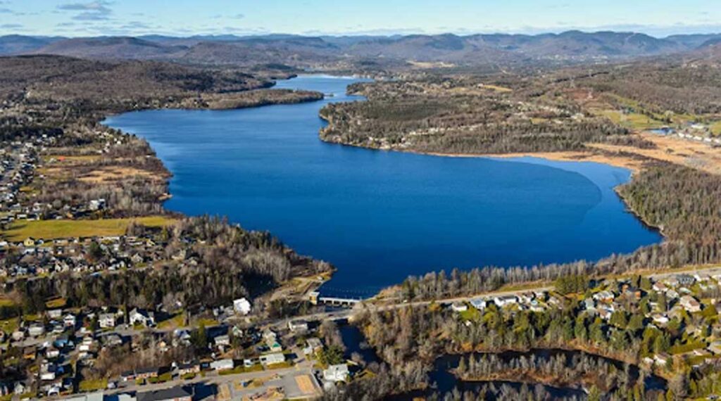
Just 20 kilometers north of Quebec City, Lake St. Charles spans a modest 3.6 square kilometers yet plays a crucial role in Quebec’s water infrastructure. As the main reservoir within the St. Charles River Watershed, it ultimately channels water into the expansive St. Lawrence River, underscoring its significance for the region. The lake’s capacity was boosted to 15 million cubic meters after the 1950 reconstruction of the Cyrille-Delage dam, raising the water level by approximately 3.6 meters and transforming it into a semi-natural reservoir. This enhancement followed the original dam installation in 1934, establishing Lake St. Charles as an indispensable water resource for the area.
Today, however, Lake St. Charles faces intensifying pressures from surrounding urbanization, introducing elevated sediment and salt levels through its tributaries. Aging septic tanks and two municipal treatment plants increasingly release nutrients like nitrogen and phosphorus, alongside emerging contaminants, intensifying concerns for the lake’s water quality. These pollutants, compounded by invasive species, cyanobacteria blooms, rising water demand, and climate change, threaten to disrupt the lake’s delicate ecological balance, jeopardizing the watershed’s ability to provide essential services.
An added challenge is noise pollution from the Valcartier Canadian military base, located within the watershed. During training exercises, the base’s operations contribute significant auditory stress to the lake environment, which can further disturb local wildlife and the overall tranquility of this natural reserve.
Source: author
Lake Washington, USA
Lake Washington, located in Washington State, USA, has become a defining element in shaping the urban planning and development strategies of nearby cities, notably Seattle and Bellevue. The lake’s influence extends across the region, inspiring a blend of accessible public spaces and exclusive residential developments that enhance the area’s urban fabric. Here, we explore how Lake Washington shapes urban planning in ways that resonate with contemporary city design principles, creating a balance between public accessibility and residential allure.
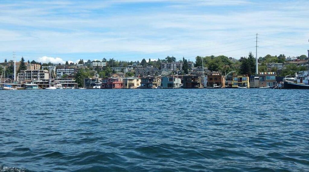
Seattle and Bellevue have capitalized on Lake Washington’s natural beauty by enhancing waterfront areas with thoughtfully designed public spaces. Along Seattle’s South Lake Union and the University of Washington campus, for example, urban planners have incorporated the lake into the city’s identity, creating lush parks, inviting promenades, and expansive green spaces that seamlessly connect the urban environment with nature. These lakefront areas offer citizens a place to unwind, promoting recreation and fostering a sense of community through shared access to waterfront experiences.
Beyond its contribution to public spaces, Lake Washington also influences residential and commercial development. Its scenic waterfront has made nearby properties highly desirable, encouraging the growth of exclusive neighborhoods and upscale communities with waterfront homes and private marinas. Bellevue exemplifies this trend, where the lake’s proximity has driven a surge in premium commercial and residential developments, reinforcing the city’s appeal as a hub of luxury and lifestyle-oriented urban living. This dual approach to Lake Washington’s potential—balancing public accessibility with exclusive residential opportunities—highlights a sophisticated model of urban planning that honors both community engagement and urban growth.
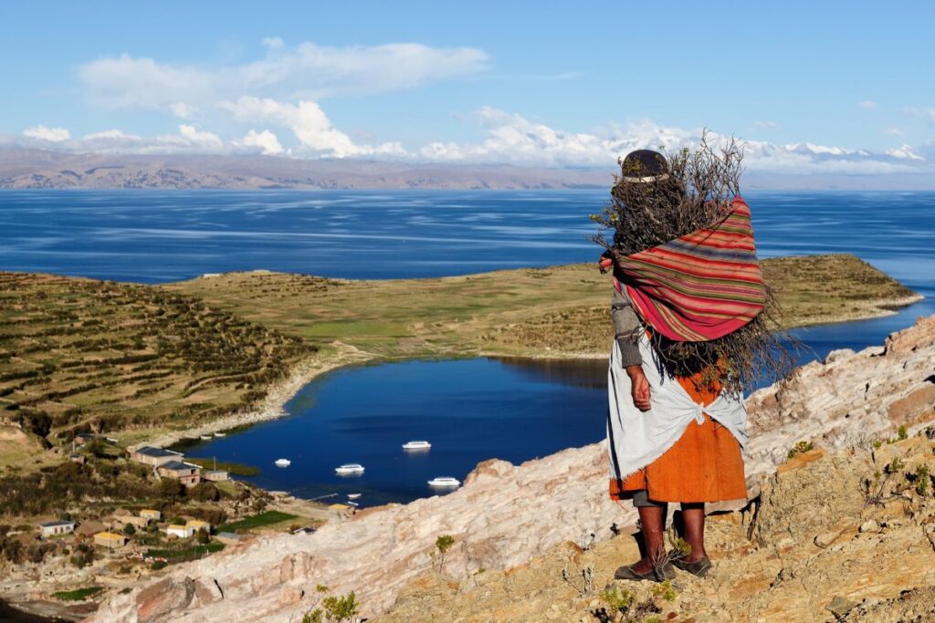
Lake Titicaca, Peru/Bolivia
Nestled in the heart of the Andes Mountains, Lake Titicaca defines the high-altitude landscapes of South America, bridging Peru and Bolivia. This iconic lake shapes not only the geography but also the urban fabric of the surrounding region, where cultural heritage, environmental stewardship, economic vitality, and the unique challenges of altitude intersect to create a distinctive urban landscape.
Urban design around Lake Titicaca is richly informed by the cultural legacy of the indigenous Quechua and Aymara communities. Towns like Puno in Peru and Copacabana in Bolivia are emblematic of this synthesis, where traditional materials and indigenous building techniques meet colonial architectural influences, offering a visual dialogue that speaks to centuries of cultural fusion. Here, architecture is more than form; it’s a storytelling medium that reflects the evolving identity of the region.
Environmental sustainability is also central to urban planning around Lake Titicaca. Given the ecological sensitivity of this high-altitude lake, urban strategies prioritize sustainable waste management, water conservation, and the promotion of eco-tourism. Local initiatives are actively working to safeguard the lake’s ecosystem, aiming to harmonize development with conservation. In doing so, they not only protect the lake for future generations but also support the local economy, where tourism plays an increasingly vital role.
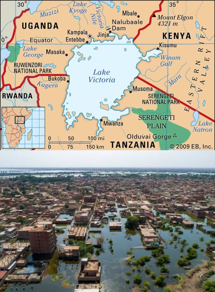
Lake Victoria, East Africa
Nestled within the dramatic contours of the Andes Mountains, Lake Titicaca is more than just a geographic landmark; it is a defining element of South America’s high-altitude landscapes, where the borders of Peru and Bolivia meet. This iconic lake not only shapes the natural environment but also profoundly influences the urban dynamics and cultural identity of the region. Here, environmental stewardship, economic development, and the challenges of altitude converge, forming a unique urban landscape steeped in cultural heritage and resilience.
Urban design surrounding Lake Titicaca is a tapestry woven from the cultural legacies of the indigenous Quechua and Aymara communities. In towns such as Puno in Peru and Copacabana in Bolivia, traditional materials and building techniques are seamlessly interwoven with colonial architectural influences, creating a rich visual narrative of cultural synthesis. Architecture here transcends form, becoming a living testament to centuries of history, adaptation, and fusion—a storytelling medium that captures the region’s evolving identity in its very walls and spaces.
Sustainability is a guiding principle in urban planning efforts around Lake Titicaca. Due to the ecological sensitivity of this high-altitude environment, local strategies emphasize sustainable waste management, water conservation, and the promotion of eco-tourism. Community-driven initiatives actively seek to protect the lake’s delicate ecosystem, aiming to strike a balance between development and conservation. These efforts not only secure the lake’s future for upcoming generations but also fuel the local economy, with tourism emerging as an essential, symbiotic element.
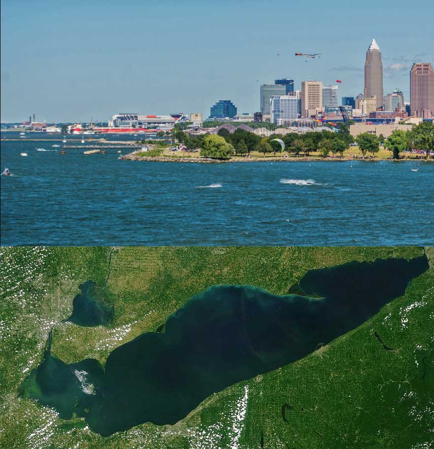
Lake Erie, USA/Canada
Cities like Cleveland (Ohio), Buffalo (New York), and Erie (Pennsylvania) have focused on revitalizing their waterfront areas along Lake Erie. This includes creating parks, promenades, marinas, and recreational facilities to enhance public access to the lake. Waterfront development often integrates green spaces, biking and walking paths, and cultural attractions to attract residents and tourists alike. Urban design around Lake Erie also addresses challenges related to climate change and shoreline erosion. Cities and communities implement strategies for resilience, such as shoreline stabilization projects, flood mitigation measures, and adaptive reuse of waterfront properties. These efforts aim to protect communities from natural hazards while enhancing the sustainability of urban development. urban design around Lake Erie in the USA and Canada reflects a balance between economic development, environmental conservation, recreational opportunities, and community resilience. Efforts to revitalize waterfronts, manage environmental challenges, and promote sustainable growth are essential for ensuring the long-term health and prosperity of communities along Lake Erie’s shores.
-1
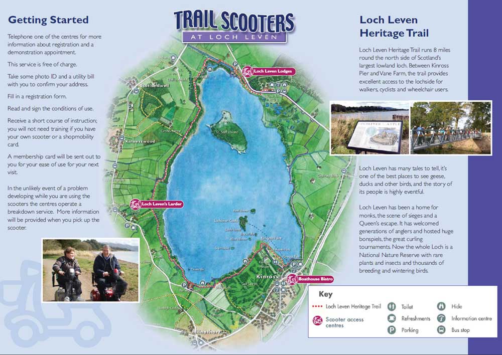
Loch Leven, Scotland
The picturesque scenery and historical attractions around Loch Leven make it a popular destination for tourists and outdoor enthusiasts. The town of Kinross, located on the shores of Loch Leven, has developed tourist infrastructure including hotels, bed and breakfasts, restaurants, and visitor centers. Recreational activities such as boating, fishing, hiking, and birdwatching contribute to the local economy and shape the urban environment. The towns and villages around Loch Leven have community amenities and infrastructure that support local residents and visitors. This includes schools, healthcare facilities, retail stores, and transportation networks that connect the area to larger cities like Edinburgh and Perth. Urban design considerations include managing growth, maintaining the character of rural communities, and enhancing quality of life for residents.
-1
Lake Constance, Germany/Austria/Switzerland
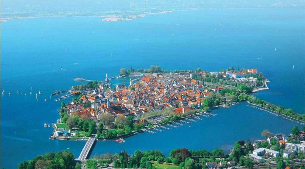
Lake Constance (Bodensee), located on the border of Germany, Austria, and Switzerland, has a variety of effects on urban planning in the cities and villages that surround it. The lake is an important economic and cultural hub, supporting a thriving tourism economy centred on its visual beauty, historic villages, and recreational options like sailing, swimming, and cycling along its shores. Cities such as Konstanz (Germany), Bregenz (Austria), and Kreuzlingen (Switzerland) have created waterfront promenades, marinas, and cultural attractions that appeal to both residents and visitors. To safeguard the lake’s ecosystem, urban planning focuses on sustainable techniques such as wastewater management and natural habitat preservation. Transportation infrastructure, such as ferries and bridges, connects metropolitan areas surrounding the lake, promoting regional movement and trade. Cultural activities include the Bregenz Festival.
Lake Taihu, China
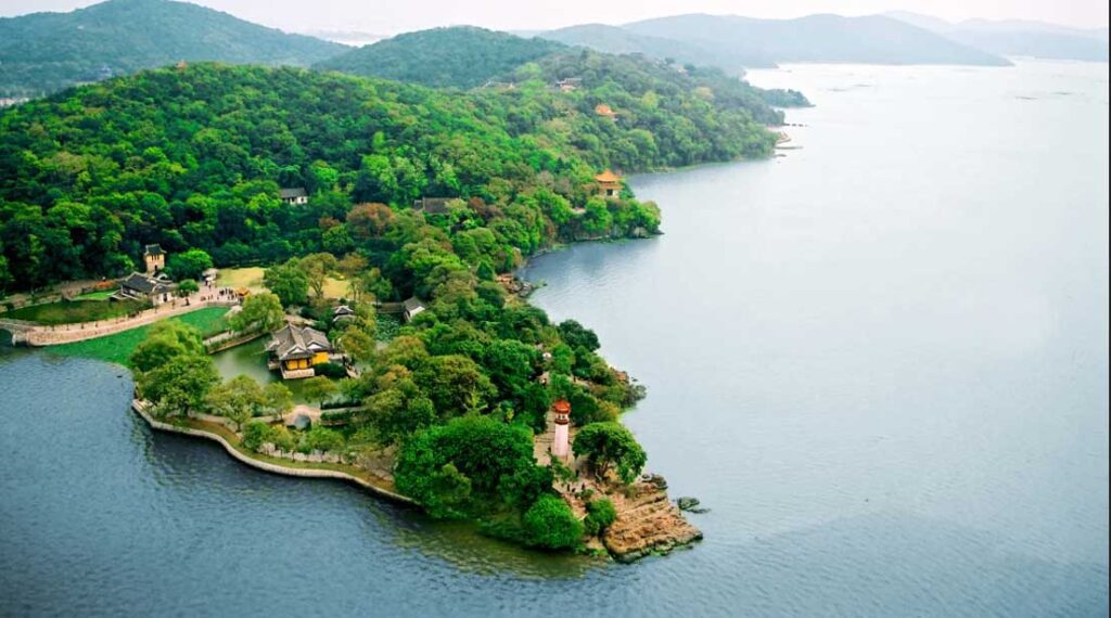
Lake Taihu, located in eastern China near the cities of Suzhou and Wuxi, significantly influences urban design in the region. As one of China’s largest freshwater lakes, Taihu plays a crucial role in water supply, agriculture, tourism, and ecological balance. Urban planning around Lake Taihu focuses on sustainable development practices to address environmental challenges such as water pollution and habitat degradation. Efforts include wastewater treatment facilities, green infrastructure, and conservation initiatives to improve water quality and protect biodiversity. Cities like Suzhou have integrated the lake into their urban fabric with waterfront parks, recreational facilities, and cultural landmarks that attract tourists and enhance quality of life for residents. The lake’s economic importance is bolstered by industries such as fisheries and tourism, driving local economies and influencing infrastructure development. Overall, Lake Taihu’s urban design highlights the delicate balance between urban growth and environmental conservation, aiming to preserve the lake’s natural beauty and ecological functions while promoting sustainable economic development in the region
-1
Conclusion
Lake restoration initiatives typically seek to enhance lake health through diverse approaches such as preventing pollution, restoring habitats, controlling invasive species, improving water quality, and promoting sustainable management practices. Effective examples often involve community engagement, governmental support, scientific research, and innovative solutions tailored to the specific challenges of each lake. These efforts can help rejuvenate ecosystems, increase biodiversity, stimulate local economies, and create recreational opportunities for communities
References
- https://www.ceh.ac.uk/sites/default/files/2021-11/sustainable-water-guide-chap7-urban-lake-v2.pdf
- https://www.sciencedirect.com/science/article/abs/pii/S1618866711000744
- https://una.city/nbs/indore/urban-and-peri-urban-lake-restoration

Mostafa ali
About the author
As an architecture student with a deep passion for art and urban design, he often found himself immersed in sketches, writing. His creative energy is palpable in every stroke and line. his fascination with the interplay between built environments and human experience is evident in his thoughtful designs.
Related articles


Architecture Professional Degree Delisting: Explained
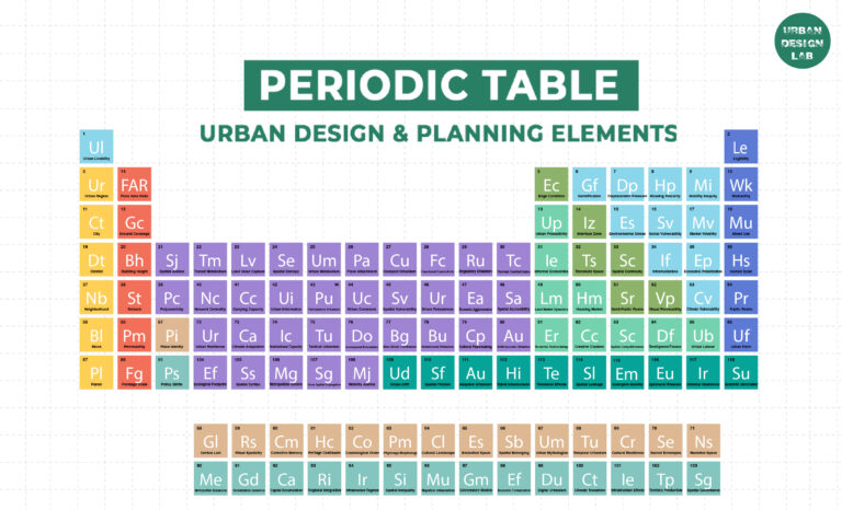
Periodic Table for Urban Design and Planning Elements


History of Urban Planning in India

Kim Dovey: Leading Theories on Informal Cities and Urban Assemblage
UDL GIS
Masterclass
GIS Made Easy – Learn to Map, Analyse, and Transform Urban Futures
Session Dates
23rd-27th February 2026

Urban Design Lab
Be the part of our Network
Stay updated on workshops, design tools, and calls for collaboration
Curating the best graduate thesis project globally!

Free E-Book
From thesis to Portfolio
A Guide to Convert Academic Work into a Professional Portfolio”
Recent Posts
- Article Posted:
- Article Posted:
- Article Posted:
- Article Posted:
- Article Posted:
- Article Posted:
- Article Posted:
- Article Posted:
- Article Posted:
- Article Posted:
- Article Posted:
Sign up for our Newsletter
“Let’s explore the new avenues of Urban environment together “



























2 Comments