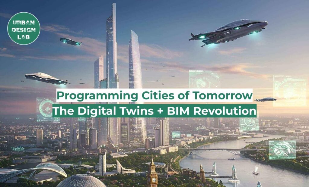
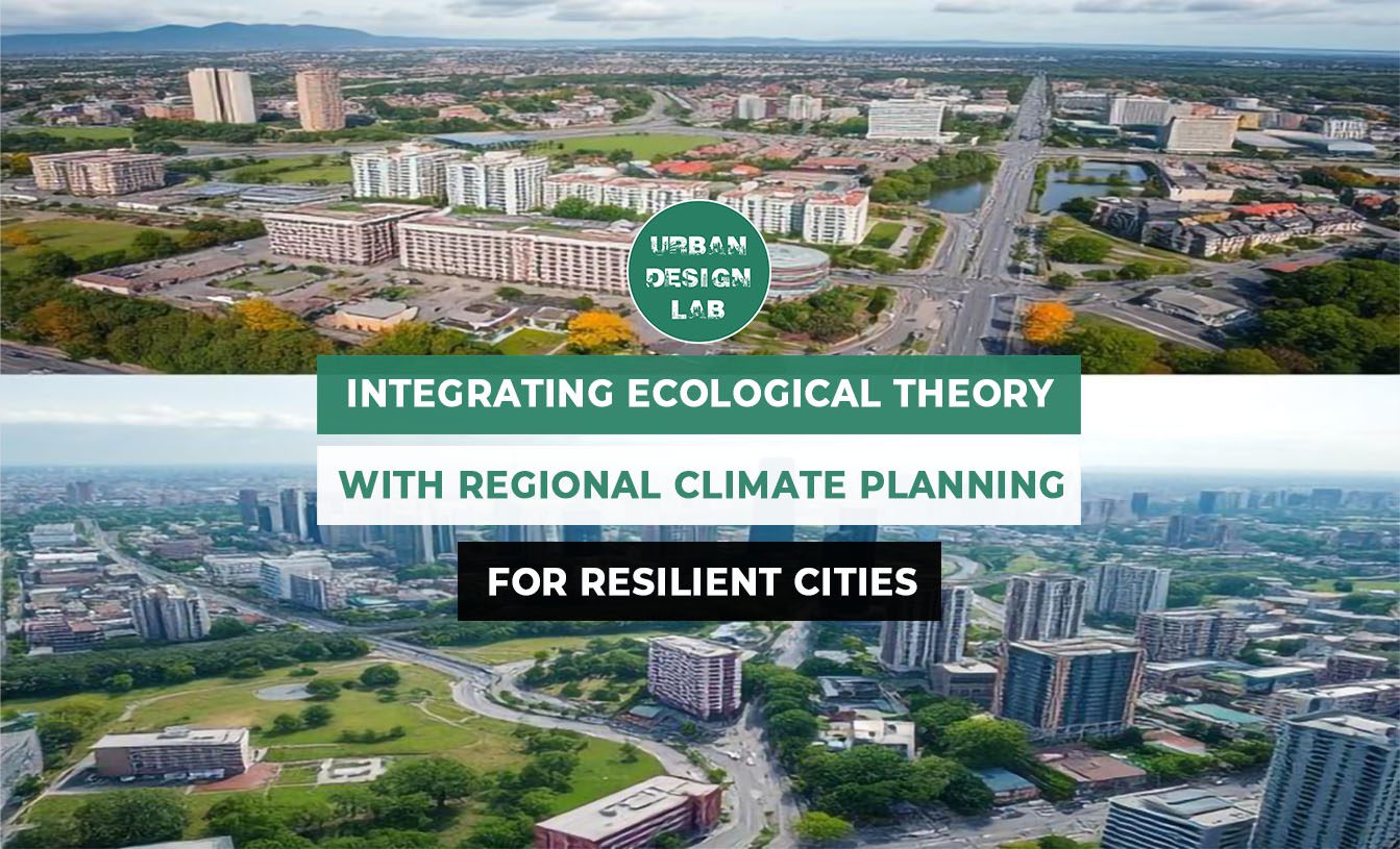
The article explores how Building Information Modelling (BIM) and Digital Twins are revolutionizing urban planning. Drawing on Patrik Schumacher’s concept of architecture as a system of communication, it extends this idea to urban ecosystems where transportation, infrastructure, ecology, and governance operate as interdependent networks. BIM has the potential as a fundamental tool in this framework. Unlike traditional approaches, BIM supports real-time collaboration and reduces inefficiencies through simulations, clash detection, and lifecycle analysis. Digital Twins act as virtual replicas of buildings or cities, incorporating real-time data to monitor and optimize urban systems. Case studies from cities like Singapore, Copenhagen, and Helsinki illustrate the real-world impact of these technologies. From flood prevention to public participation and green urban regeneration, BIM has proven instrumental in shaping intelligent and resilient urban environments. The article concludes by emphasizing the urgent need for such technologies as cities face environmental challenges and rapid urbanization. Leveraging and integrating technologies like BIM, GIS, and computational design is not just beneficial; it is essential for meeting the demands of modern urban development.
The Theory of Autopoiesis
“All design is communication design.”- Patrik Schumacher
In 2010, architect and theorist Patrik Schumacher introduced the concept of autopoiesis in the field of architecture. He viewed architecture as a network of communications, an organism whose components are connected by multiple interrelated processes. This theory laid the groundwork for parametricism, a design style that involves integrating various processes and parameters to create dynamic and adaptive environments.
Extending this idea to larger scales, cities, too, like buildings, can be understood as autopoietic systems. Urban theorists like Patrick Geddes and Nikos Salingaros have long envisioned cities as evolving networks of complex systems that include transportation, infrastructure, ecology, economy, and culture. With the efficient integration of these systems and seamless collaboration among policymakers, planners, engineers, and communities, cities have the potential to function as adaptive, resilient, and sustainable organisms.
But what would it take to make cities truly intelligent and responsive? How can this concept be translated into practice? This is where advanced tools like Building Information Modeling (BIM) play a critical role. BIM brings together diverse stakeholders and systems into a unified digital environment and establishes a data-driven framework for holistic architectural and urban development.
An illustration showing city as an autopoietic system
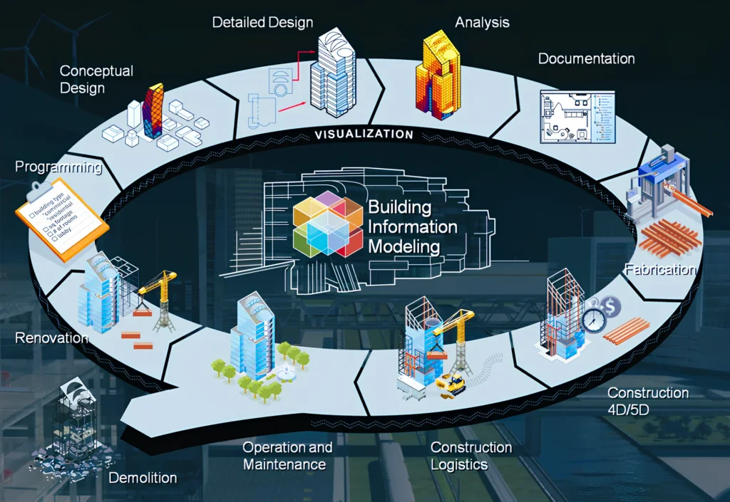
Building Information Modeling: A framework for Design, Construction and Management
Building Information Modeling (BIM) is an intelligent, model-based process used to design, construct, and manage buildings and infrastructure throughout their entire lifecycle. It involves creating a comprehensive digital model that encompasses project information, including 3D geometry, 4D (timeline), 5D (cost), 6D (facility management), 7D (sustainability), and 8D (safety), enabling real-time collaboration and data sharing among stakeholders.
Providing features like clash detection, simulations, and performance analysis, BIM intervenes at every stage of the project and helps resolve inefficiencies found in the traditional methods of design and construction. Furthermore, when integrated with the Internet of Things (IoT), BIM can leverage real-time data from sensors and devices to optimize building performance and enhance occupant experience.
A Digital Twin is an advanced outcome of BIM. It is a virtual replica of a building, infrastructure, or city that integrates real-time data and analytics into a digital model to monitor, simulate, and optimize performance. Digital twins are not just 3D models; they contain detailed non-graphical data related to the project, which makes them a powerful tool for smart urban management.
BIM’s multi-dimensional applications across a project’s lifecycle
Source: Website Link
Role of BIM in Urban Planning
BIM enables the creation of information-rich digital models of cities that include infrastructure like streets, buildings, water bodies, recreational spaces, etc. Here are the advantages of using BIM for urban planning.
Clash Detection: BIM helps identify design flaws and clashes, such as roads overlapping with utility lines, early in the process, avoiding costly changes later.
Improved Efficiency: Accurate models minimize on-site errors, reducing rework, accelerating timelines, and cutting construction costs.
Improved Collaboration: A common data environment allows real-time collaboration, enhancing coordination and transparency among stakeholders.
Predictive Analysis: BIM, when integrated with digital models and GIS, enables advanced simulations to assess factors like sunlight exposure, wind patterns, and pedestrian movement. It allows planners to evaluate how introducing a new building might influence surrounding systems, such as traffic patterns, road congestion, and public transport demand, to make informed decisions.
Improved Data Accessibility for future developments: Centralized BIM data, such as underground utilities and infrastructure, is shared with developers before the onset of a new project. This helps connect different departments and stakeholders efficiently.
Sustainable Urban Planning and Maintenance: BIM helps evaluate building and infrastructure performance, thereby optimizing energy consumption and resource usage.
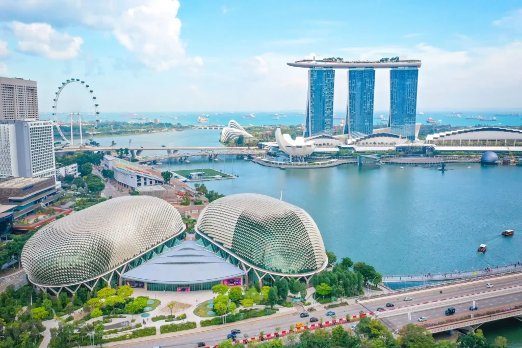
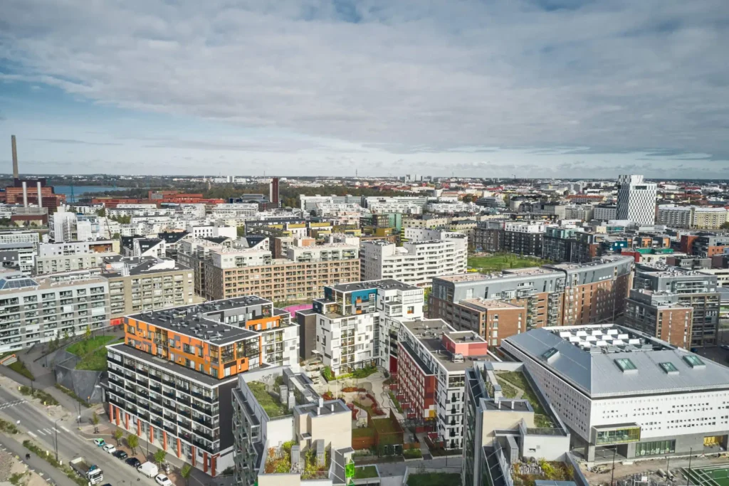
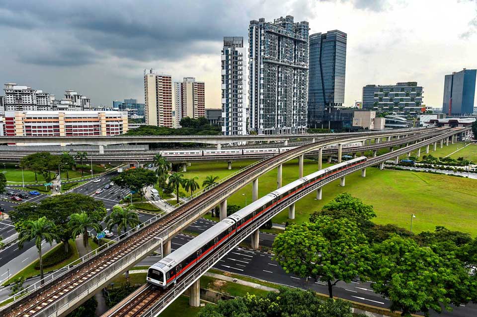
With the help of BIM and GIS, Singapore developed Virtual Singapore, a pioneering digital twin project. Starting in 2012, the Singapore Land Authority (SLA) created a 3D map to optimize land use and identify flood zones. The mapping team captured detailed terrain and surface data, supplemented by street-level information from laser-equipped vehicles. This data was integrated into a single platform, enabling informed urban planning and design decisions. Virtual Singapore was developed using Bentley Systems software. It marked a significant milestone as the world’s first national digital twin, setting a global precedent for intelligent cities.
Cityscape of Singapore implemented using Virtual Singapore digital twin model
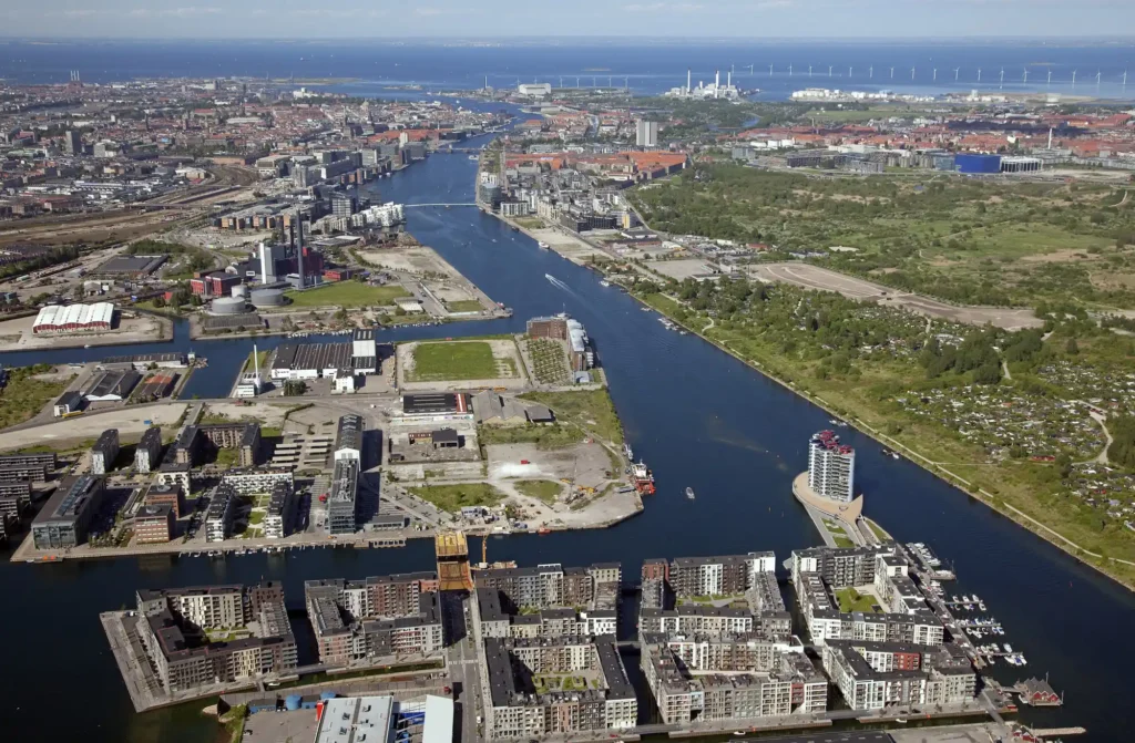
Case Study: The Regeneration Project of Copenhagen, Denmark
Copenhagen’s urban regeneration project in Nordhavn showcases the city’s innovative use of BIM to revitalize its waterfront district. By leveraging BIM, the city facilitated collaboration among architects, engineers, and developers, streamlining the planning process and minimizing conflicts. Sustainability was prioritized by incorporating green spaces and public transportation infrastructure. The integrated approach of BIM enabled more efficient construction, reduced errors, and improved overall project outcomes.
Revitalized waterfront district in Nordhavn, Copenhagen
To meet community needs and Finland’s goal of carbon neutrality by 2035, the Helsinki government launched a project, Helsinki 3D+, to create a digital twin of the city. Helsinki used BIM by implementing Bentley’s reality capture technology to develop a comprehensive digital twin of the city. This enabled them to simulate different development scenarios, facilitating informed decision-making on land use, mobility, and public services. Furthermore, the digital twin platform made data accessible to its citizens, enabling participatory planning, allowing citizens to interact with development plans.
Cityscape of Helsinki, Finland implemented using Helsinki 3D+ digital twin model
The creation of digital twins using BIM has marked a paradigm shift in urban planning. It has enabled cities to transform from static, reactive entities into adaptive, intelligent ecosystems. Predictive analytics and scenario planning have helped stakeholders mitigate risks, reduce costs, and improve the quality of life for all city dwellers. As cities confront rapid urbanization, socioeconomic disparities, and climate change, the adoption of BIM is not merely a technological upgrade. It is an essential strategy for creating inclusive, future-ready urban environments. With its potential to drive innovation and efficiency, BIM will likely reshape the way cities are designed, built, and managed.
Akanksha Sirsat is an architect and published poet based in Mumbai, India. She graduated with a Bachelor of Architecture from the Academy of Architecture, Mumbai. As the former editorial representative and magazine editor of her college, she thrives at the intersection of creativity and communication. Her work is inspired by her strong belief in the interdisciplinary nature of design. She has a profound curiosity about cities and is continually driven to explore new urban landscapes.
“Let’s explore the new avenues of Urban environment together “
We use cookies on our website to give you the most relevant experience by remembering your preferences and repeat visits. By clicking “Accept”, you consent to the use of all the cookies. Read More
This website uses cookies to improve your experience while you navigate through the website. Out of these, the cookies that are categorized as necessary are stored on your browser as they are essential for the working of basic functionalities of the website. We also use third-party cookies that help us analyze and understand how you use this website. These cookies will be stored in your browser only with your consent. You also have the option to opt-out of these cookies. But opting out of some of these cookies may affect your browsing experience.
Necessary cookies are absolutely essential for the website to function properly. These cookies ensure basic functionalities and security features of the website, anonymously.
Cookie
Duration
Description
viewed_cookie_policy
11 months
The cookie is set by the GDPR Cookie Consent plugin and is used to store whether or not user has consented to the use of cookies. It does not store any personal data.
cookielawinfo-checkbox-necessary
11 months
This cookie is set by GDPR Cookie Consent plugin. The cookies is used to store the user consent for the cookies in the category "Necessary".
cookielawinfo-checkbox-analytics
11 months
This cookie is set by GDPR Cookie Consent plugin. The cookie is used to store the user consent for the cookies in the category "Analytics".
cookielawinfo-checkbox-functional
11 months
The cookie is set by GDPR cookie consent to record the user consent for the cookies in the category "Functional".
cookielawinfo-checkbox-others
11 months
This cookie is set by GDPR Cookie Consent plugin. The cookie is used to store the user consent for the cookies in the category "Other.
cookielawinfo-checkbox-performance
11 months
This cookie is set by GDPR Cookie Consent plugin. The cookie is used to store the user consent for the cookies in the category "Performance".
Functional cookies help to perform certain functionalities like sharing the content of the website on social media platforms, collect feedbacks, and other third-party features.
Performance cookies are used to understand and analyze the key performance indexes of the website which helps in delivering a better user experience for the visitors.
Analytical cookies are used to understand how visitors interact with the website. These cookies help provide information on metrics the number of visitors, bounce rate, traffic source, etc.
Advertisement cookies are used to provide visitors with relevant ads and marketing campaigns. These cookies track visitors across websites and collect information to provide customized ads.