


Early humans were generally nomadic, migrating from region to region depending on the season in search of food and water. This form of social organization changed as cultivation techniques and animal farming was discovered, which allowed groups to create permanent settlements. The introduction of agriculture as a human practice resulted in the occupation and transformation of the natural landscape in an attempt to plant and extract everything necessary for survival from the land. The first civilizations developed from agriculture.
The development of technology deeply affected agriculture, especially after the Industrial Revolution. As technology evolved, the possibilities of intervening in the natural environment increased even more, for example, with the mechanization of planting and harvesting, which allowed for increased production, and even more aggressive interventions such as irrigation systems in the desert and inter-basin transfers. So, while agriculture was responsible for connecting mankind with the land, it also became the greatest means of intervention and modification of the landscape.
We are witnessing massive interventions in the landscape to expand productive areas and, at the same time, we are facing increasing numbers of people suffering from food insecurity. The latest UN report, released in 2020, The State of Food Security and Nutrition in the World, estimates that up to 811 million people went hungry in 2020, most of them in Africa and Asia. Having celebrated World Food Day on October 16th, it is important to reflect on these processes of land transformation and their relation to food production. Here we have selected aerial images that show farms, plantations, and human activities related to food production.
Farmland plains meet the Nebraska Sand Hills in Nebraska, United States
Save this picture!

Agricultural fields near the Itaipu Reservoir, forming the border between Brazil and Paraguay
Save this picture!

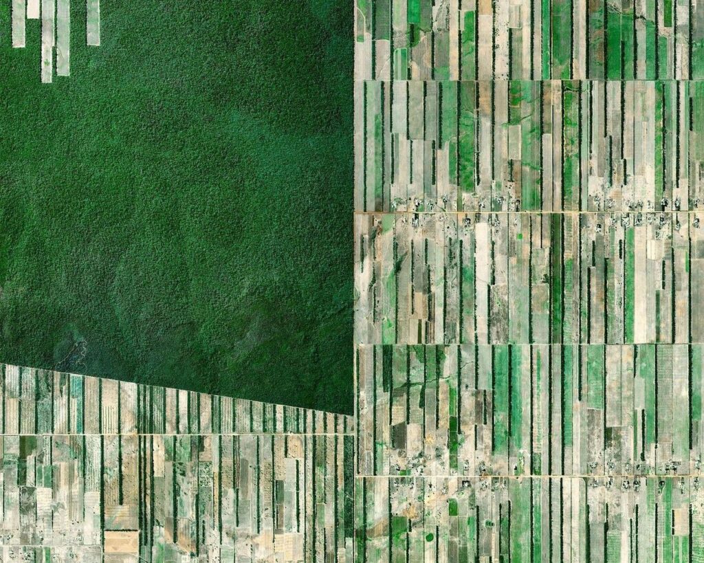
Deforestation immediately next to a relatively untouched section of rainforest in Bolivia
Save this picture!

Rice Terraces in Bali
Save this picture!

A strip of farmland surrounded by desert in the United Arab Emirates
Save this picture!

Pembrokeshire County, Wales
Save this picture!

Citrus trees cover the landscape in Spain
Save this picture!

Deforestation of the rainforest in Bolivia
Save this picture!

Saltwater evaporation ponds in China
Save this picture!

Hutt Lagoon in Australia
Save this picture!

Irrigation circles in Colorado, United States
Save this picture!