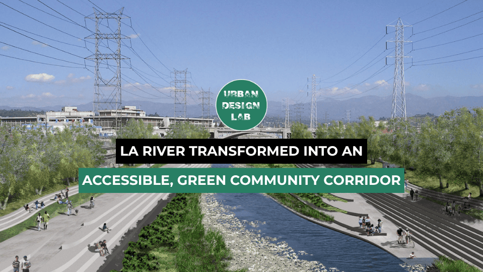
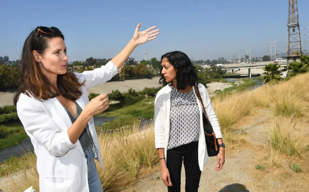
Los Angeles—long defined by its freeways and sprawl—is undertaking a historic transformation of the LA River. Originally channelized in concrete to prevent 20th-century flood disasters, the river became both an environmental fissure and a symbol of urban neglect. Today, a collective of design firms, community groups, and government agencies are reimagining the river as a functional urban spine—one that weaves together ecology, public space, equity, and resilience.

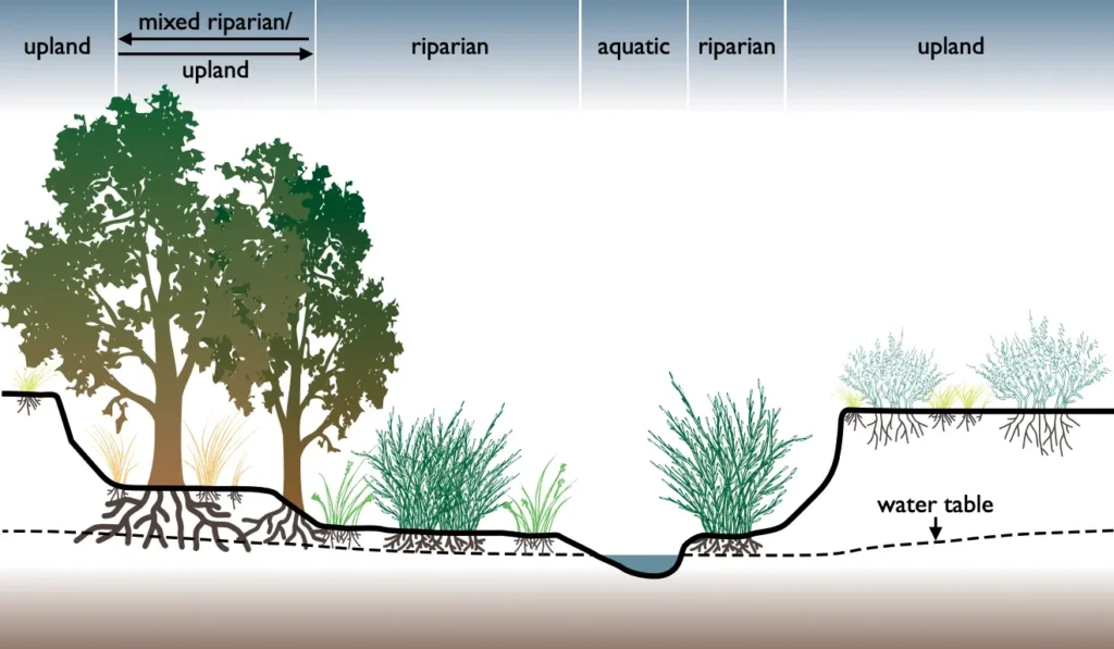
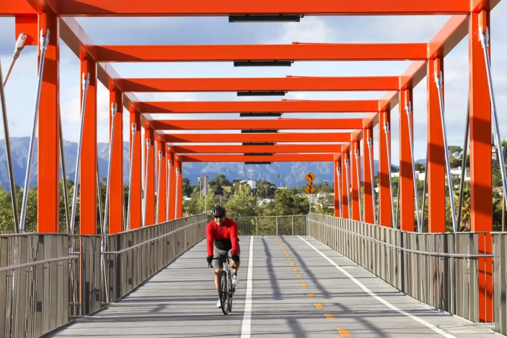
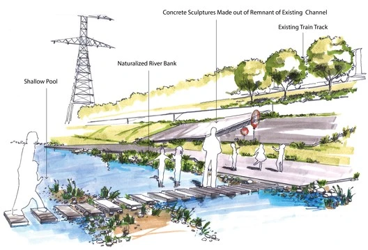
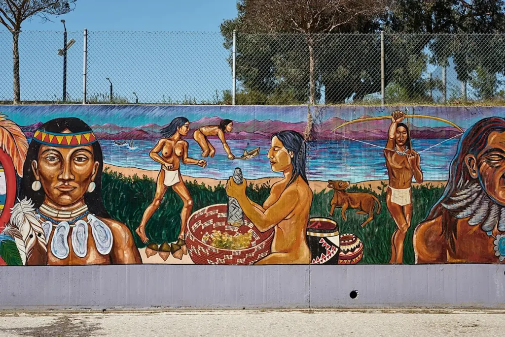
The LA River Revitalization Master Plan, executed by Gehry Partners, OLIN, Geosyntec, and local stakeholders, spans 51 miles and 17 communities, weaving parks, wetlands, bike paths, public art, and affordable housing into a holistic landscape infrastructure. This article explores ten strategic themes: ecological restoration, community access, flood management, mobility, cultural affirmation, equitable housing, public health, governance, climate adaptation, and phased implementation. Each section highlights design principles, co‑creation strategies, and tensions—such as balancing flood control with biodiversity or preventing displacement in Boyle Heights.

Rather than a single visionary project, this initiative is a distributed network of interventions—adaptive over time, reflective of community culture, and capable of addressing 21st-century challenges. It reflects a global shift in riverfront planning, from rigid engineering to green, socially attuned waterways.

Ecological Restoration of Habitat Corridors

The LA River’s concrete banks historically severed ecological continuity. Today, restoration efforts span 1,500 acres of riparian habitat, planted with native willow, sycamore, and cottonwood. Headwater zones at Griffith Park receive special attention as seedbanks to repopulate wildlife habitat downstream. Engineers are introducing fish-friendly structures—boulder placements and riffles that mimic natural flow—to support native steelhead trout. Wetland features are being reintroduced in flood zones, simulating historic wetlands lost to channelization. These ecological strategies aim to reconnect fragmented ecosystems in an urban context, offering residents opportunities for interaction with local fauna and flora. The design reframes the river as living infrastructure, embedding biodiversity into the city’s core while providing environmental attention that compensates for centuries of ecological disruption.

Riparian plantings reconnect wildlife habitat along the revitalized LA River.

Source: Website Link

Reconnecting Neighborhoods Through Public Access

Communities along the river—like Elysian Valley and Atwater Village—were long separated from it by fences and highways. The revitalization plan reclaims access with over 40 parks, plazas, and trails, including accessible ramps and pedestrian boardwalks. In Elysian Valley, existing industrial parcels are being replaced with public plazas that host seasonal markets and festivals. This approach turns the river from inaccessible infrastructure into a public amenity, strengthening civic identity. Community engagement workshops inform design decisions, ensuring that trail connections reflect local mobility patterns. Improved access not only enhances recreation and well-being but also helps bridge social divides. The river corridor becomes a shared civic realm, not just ecological restoration.

Reopened riverbank trail creating public access in Elysian Valley.

Source: Website Link

Balancing Flood Resilience with Ecology

LA’s climate poses intense flood risk during winter storms. The master plan replaces rigid concrete with bioswales, floodplain terraces, and retention wetlands that absorb and slow peak flow. In Reach 8A, naturalized banks are designed to periodically flood, reducing downstream load. Native vegetation filters pollutants while offering habitat, integrating ecology into flood control. This nature-based solution balances protection with biodiversity goals, signaling a shift from hard infrastructure to ecological resilience. Landscape architects and hydrologists worked together to model water behavior under climate change scenarios, ensuring that design supports both ecological and safety imperatives. These strategies transform flood-control infrastructure into equitable green infrastructure.

Wetland terraces absorb floodwaters and support habitat in Reach 8A.

Source: Website Link

Equity through Affordable Housing Measures

Prime riverfront revitalization prompted concerns about gentrification and displacement, especially in Boyle Heights and Maywood. To ensure inclusive benefits, the plan integrates affordable housing mandates, community land trusts, and non-profit partnerships. Local affordable housing advocates successfully secured land-use agreements reserving a portion of new development on riverfront land. In Boyle Heights, community groups co-own parcels managed through community land trusts, ensuring long-term affordability and public access. These measures strive to keep the river corridor from becoming a source of displacement, integrating equitable infrastructure into design. The LA River becomes not just public amenity space, but a source of social justice and affordable living.

Community meeting in Boyle Heights guiding affordable riverfront development.

Source: Website Link

Celebrating Culture and Community Through Art

Public art plays an outsized role in culturally affirming communities along the river. Local Chicanx-led collectives have commissioned murals, sculptures, and performance stages near the corridor in Maywood and Cypress Park. Artists integrate cultural storytelling by depicting neighborhood histories—Chicano-Latino heritage, Indigenous Tongva legacy, and industrial past. Seasonal festivals and performance stages animate plazas, anchoring the river as a dynamic cultural spine. This approach positions the river as reflexive of local identity, democratizing public space. By embedding art, the plan promotes place-making that resonates with residents, elevating forgotten narratives in historic neighborhoods.

Mural reflecting neighborhood heritage along the river corridor.

Source: Website Link

Conclusion

The LA River revitalization transcends physical design—it marks a paradigm shift in how cities can deploy neglected waterways as integrated civic landscapes. By weaving together ecology, mobility, public access, equity, and culture, the project reframes infrastructure as multi-benefit landscape infrastructure. It seeks not motionless beauty, but a river that moves communities toward health, justice, and environmental resilience.

Yet success depends on sustained governance, long-term community investment, and inclusive planning that counters displacement pressures. Equity is not a checkbox but a guiding principle—from habitat planting and climate buffers to affordable housing and public art. What emerges is an infrastructure not of pavement and pipes, but of social fabric and ecosystem connectivity.

LA’s effort joins a global movement reconceiving rivers as urban companions—not stark concrete reliefs. When cities treat rivers as shared ecological and civic commons, they redefine urbanism’s boundaries. The LA River—once enclosed, drowned, and hated—may yet become Los Angeles’s greatest democratic waterway.

References

Muhammad Ovais Kashif

About the author

Muhammad Ovais Kashif is an architecture graduate from Özyeğin University, Istanbul, currently researching at Urban Design Lab. His work focuses on ecological urbanism, landscape infrastructure, and equitable design. Through case-based research and spatial storytelling, he examines how multi-benefit public space can promote environmental justice, civic resilience, and a more inclusive city-making practice.

Leave a Reply

Your email address will not be published. Required fields are marked *

This site uses Akismet to reduce spam. Learn how your comment data is processed.

Related articles

UDL Thesis Publication 2025

Call for Abstracts now open!

5-Days UDL GIS

Masterclass

GIS Made Easy – Learn to Map, Analyse, and Transform Urban Futures

Session Dates

14th-18th July 2025

Curating the best graduate thesis project globally!

Free E-Book

Spatial mapping With GIS

Map, Analyse and Transform Urban Futures !

Free E-Book

From thesis to Portfolio

A Guide to Convert Academic Work into a Professional Portfolio”

Thesis Report Writing for Architecture and Urban Studies

Join Our WhatsApp Group

Recent Posts

Sign up for our Newsletter

“Let’s explore the new avenues of Urban environment together “

E-Book- Spatial Analysis With GIS

Map, Analyse and Transform Urban Futures!

E-Book- From Thesis To Portfolio

A Guide to Convert Academic Work into a Professional Portfolio