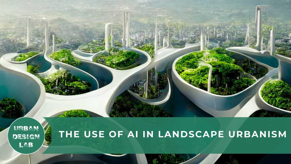
The Use of AI in Landscape Urbanism
Introduction
In the current contemporary society with the increase in rapid development, the design ideas and methods involved in the process of landscape design and architecture are increasingly enriched with improvement in technology and social needs. With this rapid continuous progress the understanding of Artificial Intelligence in the minds of humans’ is deepening, and intelligent technology is gradually integrated into all aspects of life (Cao, 2022). Architecture and its related fields have continuously over the period of time has sought after and experienced new and innovative processes to design and build places around the globe (Meier, 2012).
In the construction industry, AI is being used upon across different phases of a project from conceptualization to designing and modeling to the safety of the buildings on sites after completion, checking of cost and controls and also verification of errors during design and sometimes incorporation of augmented or virtual reality to ease the process of installation of components in sites (Souza, 2022). Artificial intelligence technology has also been rapidly applied into many fields of landscape architecture and urban design policies, because of its high-efficiency data knowledge transformation ability, strong analytical ability, strict reasoning, and accurate ability to select the best and feasible outcomes (Cao, 2022).
Artificial Intelligence (AI) and Remote Sensing – a tool for Progressive Landscape and Urban Design
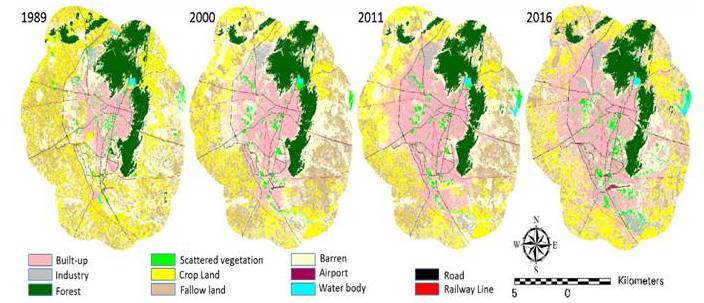
AI and Machine Learning technologies over the last decades have begun to shape and change the course of the design industry in all its disciplines and as cities continue to evolve and to adapt to contemporary issues such as climate change so as the design tools and processes (Rizeei , 2021). Currently cities around the globe are developing at an exponential rate; therefore there’s an increasingly growing demand for up-to-date land topography and land use maps, as well as other related spatial data sets and products. These maps are viable for the development of land use, water resource management and other engineering applications. Many projects of urban site planning are based upon the idea of multi-source remote sensing techniques which are able to ensure best quality data over wide range of areas. Mapping applications with urban environments are focused on using the latest and least time consuming approaches to provide a highest quality product at a lower cost (Borotkanych, 2019).
Applications of AI in Landscape Design
With the intervention of modern AI technologies in the field of Landscape Design and Construction, the design processes have transform in a successive ways and started to bring in new concepts and significance. In the initial stages of design implementation, AI is used to calculate the actual topography, climate, temperature, and other corresponding plant and structural material types through a large amount of data, so as to carry out site construction more scientifically and effectively, and achieve the purpose of improving the quality of the project (Cao, 2022).
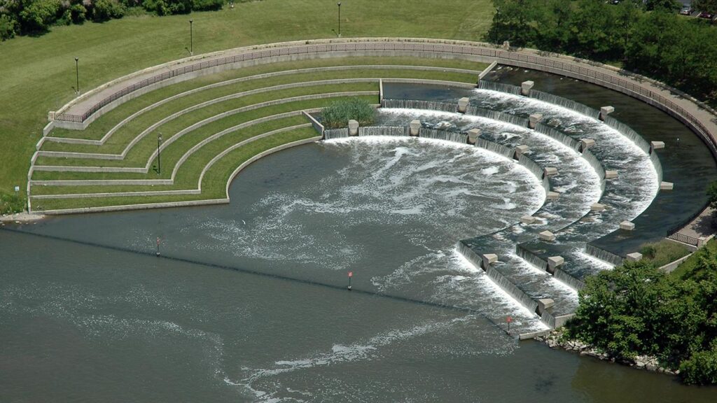
Water plays an important role in the field of landscape its design is often closely related to the effect of the whole landscape design. With the invent of AI, fake waterfalls, artificial hills, simulated fountains, and so on are introduced to expand and enrich the landscape and to also bring visual appreciation to a certain extent, as well as dealing with the issue of regular maintenance. In landscape, paving also have an significant effect on the overall surrounding by enhancing the overall visual aesthetics. Using large data in AI technology for colour analysis and changing the colour of the ground paving according to different natural light can make the paving not only have hardening effect, but also display certain visual effect, and achieve the unified design effect of aesthetics and function. The emergence of artificial intelligence technology also has brought a new visual experience to lighting design in relation to landscape. The application of artificial intelligence technology like smart lighting and monitoring systems can bring more rich visual experience to people and make up for the defects of lighting in landscape design in the past landscape architecture (Cao, 2022).
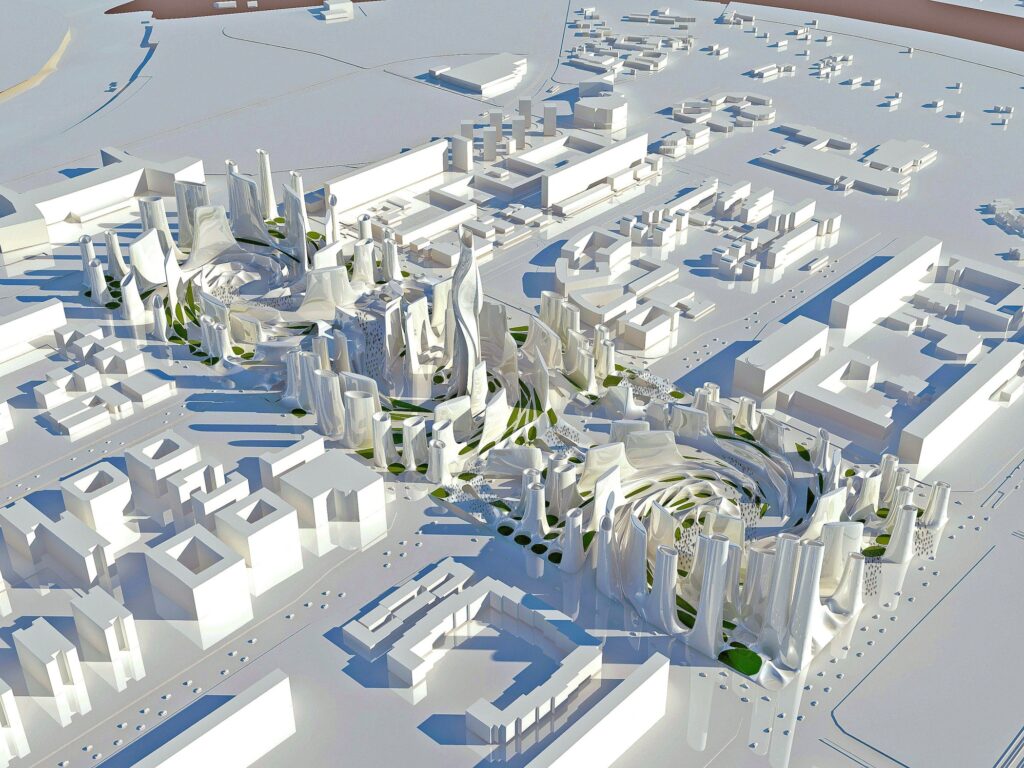
The idea of Generative Design in the field of Landscape Design, Urban Planning and Urban Design
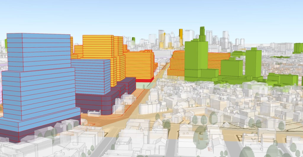
Generative Design combines the knowledge of parametric design and artificial intelligence together merging them with the sets of restrictions and data provided by the designer. The idea behind generative design is to go through every possible combination and precise appropriateness of the decisions made during the design stages in a short duration of time to overcome any future hurdles. The broader idea in process of generative designs is to explore the design alternatives that are generally derived from the designer for a proposed purpose (Souza, How Will Generative Design Impact Architecture?, 2020).
The Generative Design Process
Generative Design allows for a more integrated workflow between human and computers. The steps involve in these workflow process are as follows:
- Generate – This is the initial stage or the beginning, when design options are created or generated by the system, using algorithms and parameters specified by the designer.
- Analyze – The designs generated in the previous step are now measured, or analyzed on how well they achieve goals defined by the designer.
- Rank – Based on the results of the analysis, design options are ordered or ranked.
- Evolve – The process uses the ranking of the design options to figure out in which direction designs should be further developed or evolved.
- Explore – The designer compares and explores the generated designs, inspecting the results based on their original criteria.
- Integrate – After choosing a favourite design option, the designer uses or integrates this design into the wider project or design work. (Generative design for Architecture, Engineering & Construction)
Urban Development with the Help of AI
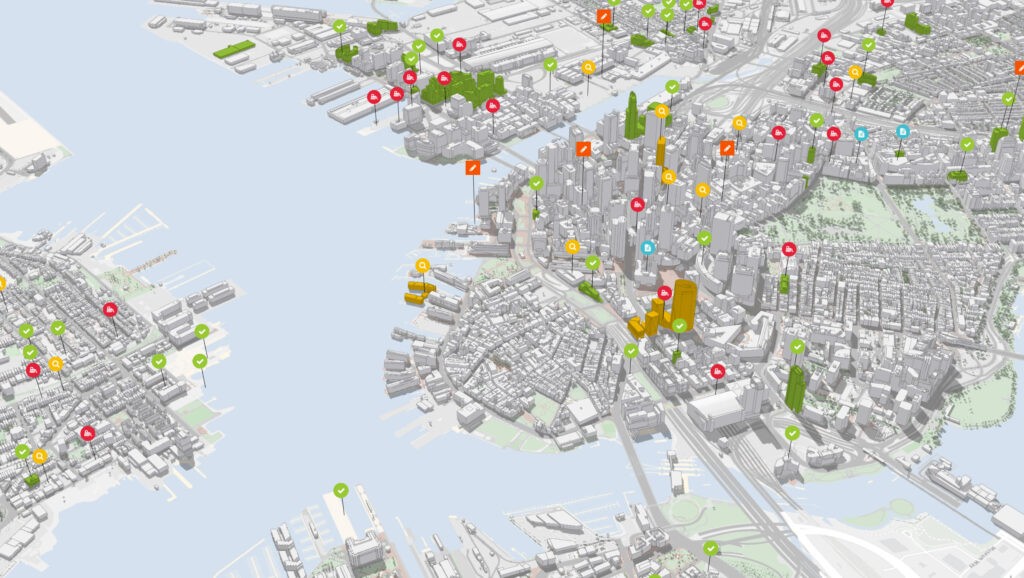
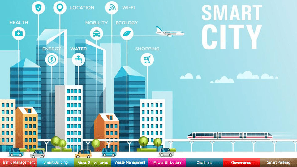
The use of AI in any urban context can help in providing numerous solutions in different areas ranging from improved urban management and support for decision-making to the release of new or improved services for citizens and the creation of new economic opportunities. In city management processes, the use of AI is often associated for its efficiency in solving problems. Some of the processes in city management where AI deals with include data collection, interpretation and analysis in support of policy decision-making and planning and improved delivery of services of public interest. The combination of AI and other digital technologies enables the development of smart cities. AI can bring the model of smart city to its full accomplishment by processes like provision of full interconnectivity with the help of self-driving cars and busses connect directly to smart highways to ease parking spaces and traffic lights the flow of traffic within the city premises (Pellegrin, Colnot, & Delponte, 2021).
The technology of AI is used in urban development in the sectors of:
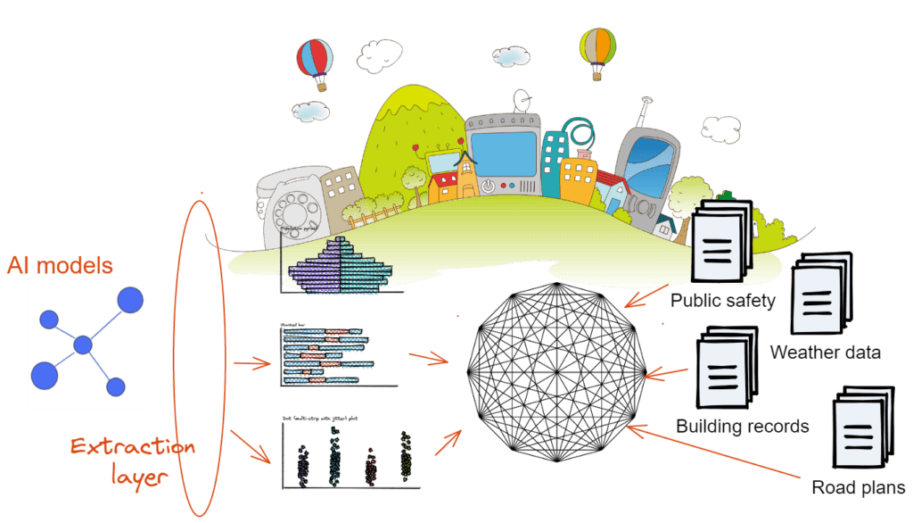
- Improve road infrastructure with AI based traffic systems
- To predict or forecast population
- Water resource management
- Mitigating problems related to sewage systems
- To gather and collect public information pertaining to schools, residential units, and businesses
- Collecting weather data
- Keeping records related to safety, housing and crime and urban planning maps (Sarkar, 2022)
AI and their social dimension in Smart City Model
Smart cities should combine the elements of better governance, inclusion and sustainability, alongside the digital transformation enabled by new technologies. They should respond to citizens’ concerns and ultimately contribute to improving their quality of life. According to the definition provided by ITU (International Telecommunication Union), a sustainable smart city can be described as, ‘an innovative city that uses information and communication technologies (ICT) and other means to improve quality of life, efficiency of urban operation and services, and competitiveness, while ensuring that it meets the needs of present and future generations with respect to economic, social, environmental as well as cultural aspects’. The idea of Smart City rests on three core concepts:
- smart governance, i.e., a framework that enables collaboration across city departments to ensure coherent and realistic city planning;
- smart policy, meaning the identification of those priority areas where smart concepts can be developed and applied; and
- smart technologies (Pellegrin, Colnot, & Delponte, 2021).
All these can be achieved through the proper and well guided implication of AI in urban development by the authorities. Specific application areas for AI in Smart Cities include:
- traffic management,
- road safety,
- water resource management,
- e-mobility,
- public safety and law enforcement
- newer automation system
- digital delivery of public goods and service (Sarkar, 2022)
The Future of AI in the field of Urban Development
The impact of AI in the sector of urban development and city development can be seen effectively through its contribution towards the expansion of smart-city initiatives. AI can help improve city management and the delivery of new services to citizens; most crucially, it can integrate, and exploit, the huge amount of data produced by normal city life, and thus bring the smart-city model to its full realisation. The field of AI has the potential to respond to many challenges that cities and towns must address in the years to come ahead. At the same time, there are also risks of unwanted outcomes and missed opportunities in this sector. If thorough guidance on its implications in the process of urban development is not observed or maintained by the governing authorities and the local government, they will lead a tangible territorial cohesion on the overall urban development stages. But through well guided initiatives contribute to linkages between urban development and AI for all types of cities, irrespective of size and capacity (Pellegrin, Colnot, & Delponte, 2021).
Reference
Borotkanych, N. (2019, 02 22). Smart Urban Planning With Remote Sensing Techniques. Retrieved from EOS Data Analytics: https://eos.com/blog/smart-urban-planning-with-remote-sensing-techniques/
Cao, Y. (2022, 10 05). Application Research and Case Analysis of Landscape Design in Artificial Intelligence Platform. (L. Li, Ed.) Scientific Programming, 22.
Generative design for Architecture, Engineering & Construction. (n.d.). Retrieved from AutoDesk: https://www.autodesk.com/solutions/generative-design/architecture-engineering-construction
Meier, D. (2012). Generative Modeling as a tool in Urban Riverfront Design; an exploration of Parametric Design in Landscape Architecture. The Ohio State University.
Pellegrin, J., Colnot, L., & Delponte, L. (2021, 07). Artificial Intelligence and Urban Development. Research for REGI Committee – Artificial Intelligence and Urban Development, European Parliament, Policy Department for Structural and Cohesion Policies, Brussels, 1-78.
Rizeei , D. (2021). AI and Remote Sensing for Progessive Landscape and Urban Design. McGregor Coxall.
Sarkar, T. (2022, 01 10). How AI can help smart city initiatives. Towards data Science.
Souza, E. (2020, 04 23). How Will Generative Design Impact Architecture? Retrieved from ArchDaily: https://www.archdaily.com/937772/how-will-generative-design-impact-architecture
Souza, E. (2022, 12 05). What Does It Mean to Future-Proof a City, Landscape or Building with AI? Retrieved from ArchDaily: What Does It Mean to Future-Proof a City, Landscape or Building with AI?
Ankur Jyoti Dutta is a landscape architect and academic who completed his master’s degree in landscape architecture from the School of Planning and Architecture, New Delhi in 2021. He has 3.5 years of experience in both industrial and academic fields, focusing on concepts of nature and culture in the Anthropocene, Cultural Landscapes and their social dimensions, Urban Ecology, Urban Regeneration, Landscape Urbanism, Ecological Urbanism, idea of Sustainability and Energy Efficient Landscapes. He has published articles on Efficient Landscape Design Practices for Universities, Wetlands for Ecological Development in Current Urban Areas, and Threats to Urban Landscape Resources. He currently works as an Assistant Professor (Contract) at the Department of Landscape Architecture at the School of Planning and Architecture, New Delhi.
Related articles
5-Days UDL GIS
Masterclass
GIS Made Easy – Learn to Map, Analyse, and Transform Urban Futures
Session Dates
14th-18th July 2025

Free E-Book
From thesis to Portfolio
A Guide to Convert Academic Work into a Professional Portfolio”
Recent Posts
- Article Posted:
- Article Posted:
- Article Posted:
- Article Posted:
- Article Posted:
- Article Posted:
- Article Posted:
- Article Posted:
- Article Posted:
- Article Posted:
- Article Posted:
- Article Posted:
- Article Posted:
- Article Posted:
- Article Posted:
Sign up for our Newsletter
“Let’s explore the new avenues of Urban environment together “




















One Comment