Adobe Illustrator is often used after a GIS export has already established the content of an urban map. At that stage, the challenge changes from geographic calculation to careful graphic editing: isolating a road alignment, cleaning labels, standardising symbols and producing consistent layouts. The apparent speed of Illustrator can be deceptive. A map may contain thousands of paths and nested groups, so a single uncontrolled selection or duplicated object can create mistakes that take longer to identify than the original edit.
Shortcuts help when they support a deliberate workflow rather than rapid clicking. The official Adobe Illustrator shortcut reference lists tool keys and object commands for both Windows and macOS, but shortcuts can be customised, and some commands behave differently when text is being edited or another tool has focus (Adobe Illustrator shortcuts). The combinations below refer to Adobe’s documented defaults. They are selected for cartographic tasks, not for their popularity in illustration tutorials.
A crucial boundary should be clear from the start: Illustrator is a vector-graphics editor, not the analytical source of the map. If a transport route, administrative boundary or land-use polygon is wrong, repair the data or GIS representation first. QGIS documents PDF and SVG export settings that can preserve vector artwork and sometimes organise output by source map layer (QGIS export documentation). Illustrator then becomes a suitable environment for refining the visual form of that evidence. The most useful shortcuts protect this separation by making edits local, reversible and inspectable.
Shortcuts 1 to 3: navigate dense urban drawings accurately
1. V: switch to the Selection tool
Press V to activate the Selection tool on either Windows or macOS (Adobe Illustrator shortcuts). This is the basic command for choosing and moving whole objects or groups. In an urban base map, use it when repositioning a map title, adjusting the alignment of a legend block or moving a completed route annotation. It is less appropriate for altering individual vertices in a building polygon. That distinction matters because large GIS exports can contain nested groups whose extent is not obvious when only a few paths are visible.
Begin by checking the Layers panel and the selection bounding box. If selecting a road appears to highlight an entire neighbourhood, the chosen object is probably a parent group rather than an individual segment. Switching tools is quick, but selection discipline is what prevents accidental displacement of source geometry. A practical habit is to lock stable background systems before arranging labels and foreground symbols.
2. A: use Direct Selection for individual anchors and segments
The Direct Selection tool is activated by A (Adobe Illustrator shortcuts). It is useful for correcting a path endpoint, moving one label callout anchor or adjusting a vector boundary at a clipping edge. Unlike the Selection tool, it can target specific anchor points. In mapping work, that is powerful but also risky. Moving an anchor on a genuine road centreline or property boundary may introduce a geographic error that did not exist in the GIS dataset.
Use A primarily for editorial graphics, manually drafted diagrams, symbols and annotation lines. If a path imported from QGIS needs systematic simplification or geometric repair, do that work upstream in GIS or maintain an explicit record that the Illustrator version is a schematic rather than a georeferenced representation. The apparent precision of a clean vector line should not be mistaken for verified spatial accuracy.
3. Ctrl+Y / Command+Y: inspect artwork in Outline view
This shortcut toggles Illustrator’s Outline and Preview views (Adobe Illustrator shortcuts). It is particularly valuable after importing a complex PDF or SVG from QGIS. Outline view helps reveal duplicated paths, hidden clipping structures and the difference between genuine vectors and placed raster artwork. A highly polished map can conceal these structural issues in Preview, especially when transparent textures or opaque fills cover unwanted components.
For a dense building-footprint export, toggle Outline view before attempting any large-scale cleanup. Ask whether the geometry is grouped logically, whether unnecessary paths extend outside the map frame and whether label contours have been converted into numerous objects. Return to Preview to evaluate the final appearance. This visual inspection cannot prove that a line has correct coordinates, but it can identify editing problems before they propagate through the publication file.
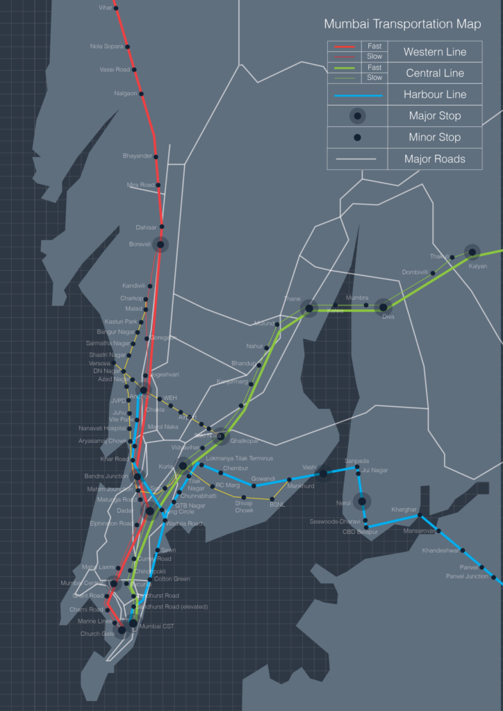
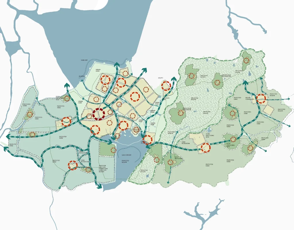
Dense transport artwork demonstrates why controlled selection and zoom are essential. Image: Aarushi mishra, CC BY-SA 3.0, via Wikimedia Commons.
Shortcuts 4 to 6: draft and restyle cartographic details consistently
4. P: activate the Pen tool
P opens the Pen tool, used to draw and reshape paths (Adobe Illustrator shortcuts). For an urban map, appropriate uses include a diagrammatic study-area outline, a manually drafted section marker or a callout leader. These editorial objects need to be visually accurate relative to the base map, but they need not masquerade as a surveyed feature. Place them on a labelled annotation layer so that a later reader or collaborator can distinguish them from exported geographic data.
The Pen tool is poorly suited to manually reconstructing an entire road network that already exists in GIS. Doing so sacrifices attributes, reproducibility and often alignment. If a schematic simplification is intentionally required, explain that the geometry has been diagrammatically edited. Faster drawing is useful when the role of the new path is explicit.
5. M: create a rectangle for controlled composition
Press M to activate the Rectangle tool (Adobe Illustrator shortcuts). A simple rectangle can establish a neat title panel, isolate a legend background, create a fixed image crop or serve as the uppermost shape for a clipping mask. In mapping, these ordinary compositional structures contribute substantially to consistency across a series of plates. They are often preferable to complicated graphic flourishes because their edges can align with the page grid.
Use rectangles for framing information, not for disguising missing areas of data. When two study maps are intended for comparison, their frames should communicate comparable extents and scales, or clearly explain why they differ. A rectangle is visually neutral, but the cropping decision it supports can change a reader’s interpretation. Keep the layout’s geometry deliberate and the data’s geography intact.
6. I: sample colour and appearance with the Eyedropper
The I key activates the Eyedropper tool (Adobe Illustrator shortcuts). It is useful for matching the stroke or fill of repeated map symbols, such as public-transport stops, heritage buildings or a selected pedestrian corridor. Consistency reduces accidental visual categories. If all proposed routes are intended to represent the same class, they should not acquire subtly different reds because each was styled independently.
Sampling appearance must be bounded by the legend. A choropleth class should be coloured according to its defined threshold rather than by whatever adjacent polygon looks attractive. Use global swatches or a written palette specification where possible, and reserve the Eyedropper for applying an already approved visual language. The shortcut accelerates consistency only when the classification itself is already sound.
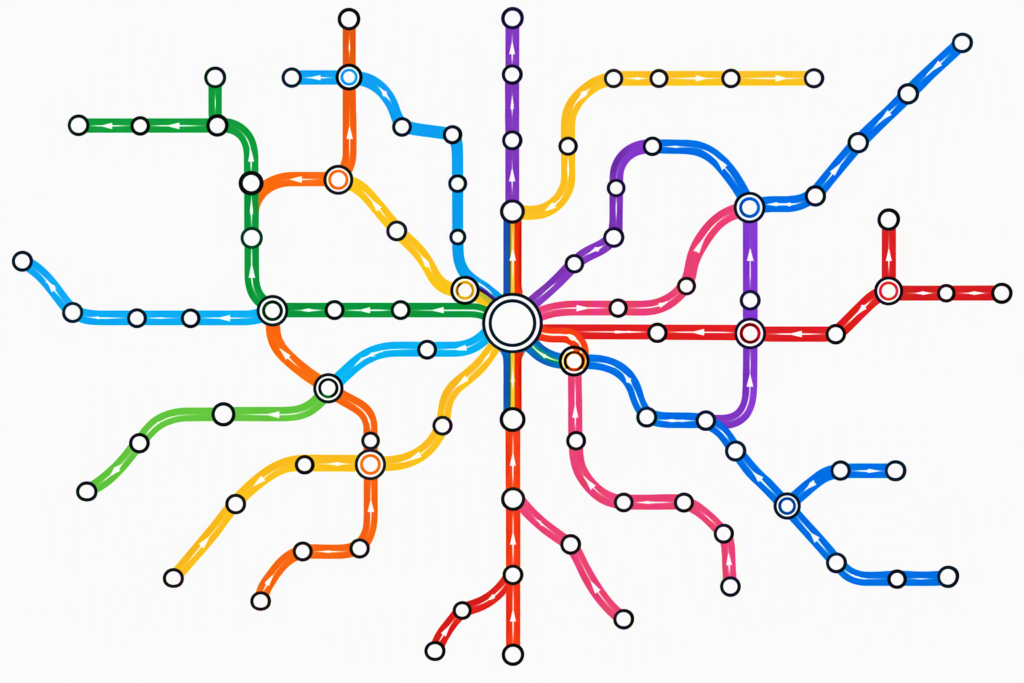
Repeated symbols and consistent strokes make small edits across a complex network easier to audit. Image: Nwongh, CC BY 4.0, via Wikimedia Commons.
Shortcuts 7 to 9: keep map structure safe during revision
7. Ctrl+G / Command+G: group related objects
Grouping selected artwork with Ctrl+G or Command+G lets related elements move and scale together (Adobe Illustrator shortcuts). In an urban study, a legend’s colour chips, values and title can form one controlled unit; a map annotation’s leader line and label can form another. Grouping reduces the likelihood that a symbol is moved without its text. It also allows a map series to reuse well-organised graphic elements without rebuilding them each time.
Do not indiscriminately group every imported vector into a single inaccessible mass. Maintain logical distinctions among buildings, roads, water and analytical overlays. QGIS can export layer-named SVG groups when that option is enabled, which may help retain meaningful structure before further edits (QGIS export documentation). The goal is a navigable hierarchy, not simply fewer visible items in the Layers panel.
8. Ctrl+2 / Command+2: lock stable artwork
This shortcut locks the current selection (Adobe Illustrator shortcuts). It is especially useful once the basemap, north arrow, frame or other approved element is in place. A frequent source of production mistakes is inadvertently moving background linework while trying to select a label. Locking the background creates a protected working plane for annotation and composition, reducing accidental geometric edits.
A lock is only a local interface safeguard. It does not guarantee geographic fidelity or prove that the underlying data are correct. Before locking, verify that the map has the appropriate extent, reference system and analytical layers. Then work above it on annotation and presentation groups. When a later revision requires changing the map itself, return to the relevant GIS data or source layer rather than quietly moving protected paths out of alignment.
9. Ctrl+Alt+2 / Command+Option+2: unlock all locked artwork
Adobe documents Ctrl+Alt+2 on Windows and Command+Option+2 on macOS as the default command to unlock all locked artwork (Adobe Illustrator shortcuts). After completing a round of annotations, the command can reopen previously protected material for a controlled revision. It is useful when adjusting the complete map extent or checking whether a clipping frame aligns correctly after a page-size change.
Because unlocking can make many objects selectable again, avoid using it reflexively during detailed editing. Work in a file with semantic layers and save a revision before broad structural changes. The shortcut is quick; the quality-control obligation remains to inspect what has become editable and whether the subsequent actions alter data-derived geometry.
Layer locking and grouping protect geographic geometry during aesthetic revision. Image: Heinz OSM, ODbL, via Wikimedia Commons.
Shortcuts 10 to 12: manage masks, repeated layouts and alignment
10. Ctrl+7 / Command+7: make a clipping mask
With a clipping shape above the artwork and the relevant objects selected, Ctrl+7 or Command+7 makes a clipping mask (Adobe Illustrator shortcuts) (Adobe clipping-mask documentation). A mask can crop a road network to a study boundary or keep a shaded-relief image inside a clean rectangular map frame without deleting the source objects. This is a reversible form of page composition, useful when a single urban dataset supports several differently framed figures.
The mask changes visibility, not the spatial extent of the underlying data. That distinction is important if the cropped map will be reused for analysis or if boundaries outside the visible frame explain accessibility relationships. Do not infer that hidden paths have been removed from a network model. Keep the analytical calculation in GIS and use the mask strictly for the presentation representation.
11. Ctrl+Shift+V / Command+Shift+V: paste in place
Adobe lists Paste in Place as Ctrl+Shift+V on Windows and Command+Shift+V on macOS (Adobe Illustrator shortcuts) (Adobe paste-in-place documentation). This command places copied artwork at the corresponding position rather than at a convenient but potentially different screen location. For urban maps, it helps build alternative diagram layers from an identical footprint. A copied study boundary can support one layer of mobility analysis and another of landscape annotation without requiring visual realignment.
The command only preserves position within the graphic document’s coordinate system. It does not establish georeferencing, and pasting between differently sized or transformed artboards can still require inspection. Use alignment guides and verify a few reliable control features after copying, especially when working across separate Illustrator files. A small drift may not be apparent until the figure is printed at full size.
12. Ctrl+U / Command+U: show or hide Smart Guides
This shortcut toggles Smart Guides (Adobe Illustrator shortcuts). During layout refinement, guides can help align text blocks, symbols, scale-bar components and comparison panels without repeated manual measurement. They are especially useful when preparing several related plates that should share a common typographic and margin system. Together with rulers and guide objects, they can make a graphic document more orderly (Adobe guide-alignment documentation).
However, guides are not an adequate method for snapping geographic features to their real-world positions. A line aligned beautifully to the page grid may still misrepresent the street network. Use Smart Guides for editorial composition and GIS snapping for spatial data. Distinguishing those two kinds of alignment is one of the simplest ways to protect analytical credibility during graphic finishing.
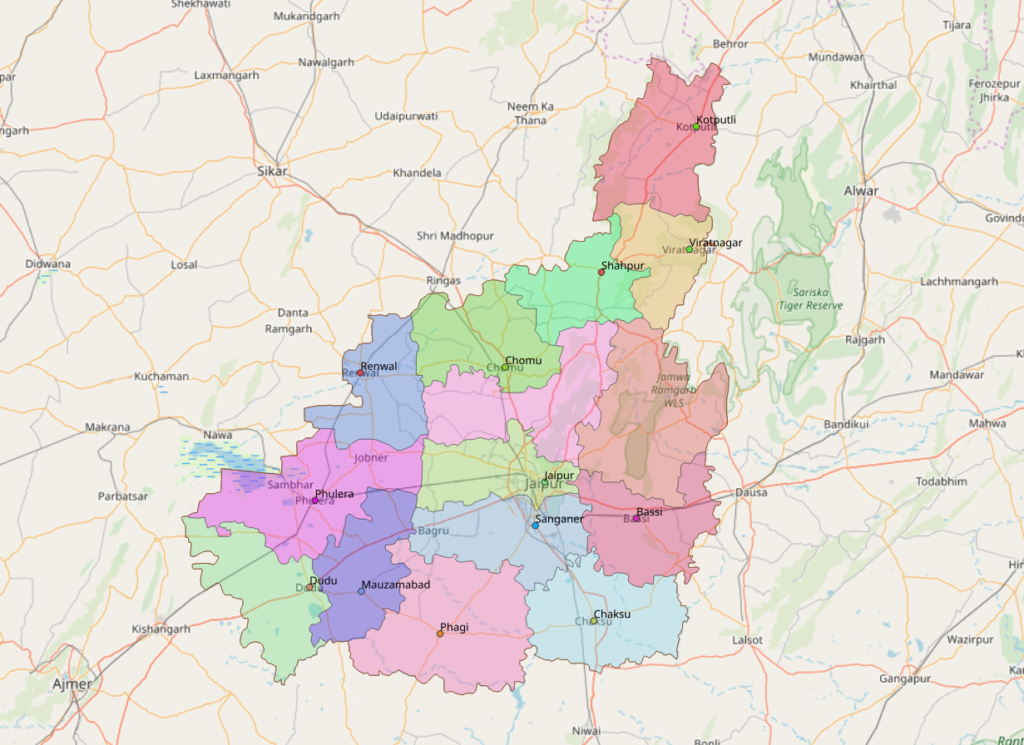
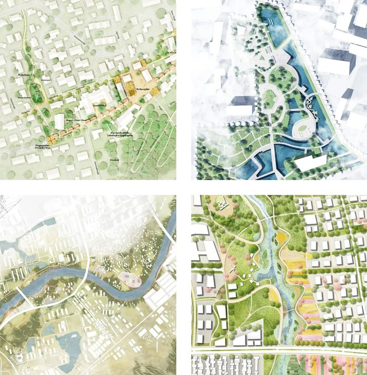
Clipping and alignment must preserve the boundaries of a meaningful thematic map. Image: Qiongjx, CC BY-SA 4.0, via Wikimedia Commons.
Shortcuts 13 to 15: revise repeated elements efficiently
13. Ctrl+D / Command+D: repeat the last transformation
Illustrator’s repeat-transform command is Ctrl+D or Command+D (Adobe Illustrator shortcuts). It can distribute equally spaced legend symbols, replicate a set of diagrammatic markers or establish a controlled rhythm in a graphic key. When a diagram has repeated elements with a known graphical spacing, repeating a transformation is more reliable than approximating each placement independently.
The technique should not be used to invent geographic regularity. Transit stops, trees, building plots and intersections rarely occur at perfectly uniform intervals. If their positions are analytically important, derive them from actual coordinates or documented measurements. Repeating a transform is appropriate for legends, explanatory schematics and clearly illustrative design elements, not for a measured spatial distribution.
14. Shift+Ctrl+A / Shift+Command+A: deselect current artwork
Deselect is a small but powerful editing safeguard: Shift+Ctrl+A on Windows or Shift+Command+A on macOS (Adobe Illustrator shortcuts). Dense Illustrator maps encourage accidental changes to whatever remains selected. Deselecting before editing a new label or inspecting the overall page reduces confusion between a previous operation and a new one. It also lets the editor judge hierarchy without coloured selection handles obscuring the drawing.
Use the shortcut between substantial operations: move a callout, deselect, inspect, then begin the next change. This deliberate rhythm may seem slower than uninterrupted clicking, but it makes errors easier to localise. In professional cartographic production, reducing unpredictable edits can matter more than shaving seconds off individual tool commands.
15. Shift+Ctrl+G / Shift+Command+G: ungroup for targeted repair
Ungrouping with Shift+Ctrl+G or Shift+Command+G allows an editor to access a particular symbol or label within a grouped element (Adobe Illustrator shortcuts). It is useful when an imported legend contains one incorrect class label or an otherwise approved annotation group needs a minor adjustment. Work on a duplicate when the group is complex, and regroup the relevant components after the correction to restore predictable behaviour.
Avoid repeated broad ungrouping of a large GIS export merely because a single polygon is difficult to select. This can create thousands of loose paths and make future maintenance substantially harder. If the issue originates from a QGIS export, investigate whether exporting map layers as groups or changing vector settings would produce cleaner source artwork (QGIS export documentation). Shortcuts speed refinement most effectively when the file’s structure has been intentionally designed.
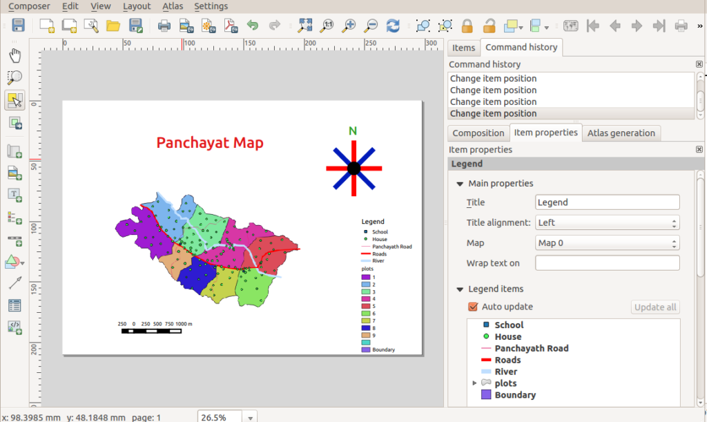
An organised export helps preserve the separation of map artwork and page annotations. Image: Path slopu, CC BY-SA 4.0, via Wikimedia Commons.
Conclusion
The fifteen shortcuts are valuable not because every mapping decision should be made faster, but because they reduce friction around accurate selections, protected layers, repeatable composition and controlled revisions. The essential principle is to keep analytical geometry traceable and use Illustrator for the things it does well: vector refinement, annotation, hierarchy and layout. A well-organised file supported by verified default shortcuts is more valuable than an impressive keyboard routine applied to unstable or unverified spatial data. Use speed to protect careful cartography, not to replace it.
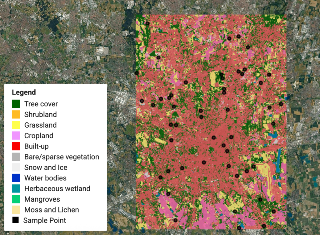
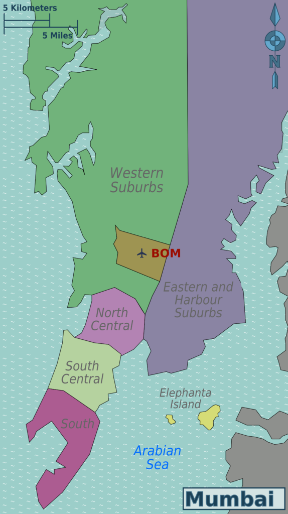
Efficient vector editing should leave scale-related and geographic relationships intact. Image: Saqib Qayyum (original), Sbb1413 (derived work), CC BY-SA 3.0, via Wikimedia Commons.
“Let’s explore the new avenues of Urban environment together “
We use cookies on our website to give you the most relevant experience by remembering your preferences and repeat visits. By clicking “Accept”, you consent to the use of all the cookies. Read More
This website uses cookies to improve your experience while you navigate through the website. Out of these, the cookies that are categorized as necessary are stored on your browser as they are essential for the working of basic functionalities of the website. We also use third-party cookies that help us analyze and understand how you use this website. These cookies will be stored in your browser only with your consent. You also have the option to opt-out of these cookies. But opting out of some of these cookies may affect your browsing experience.
Necessary cookies are absolutely essential for the website to function properly. These cookies ensure basic functionalities and security features of the website, anonymously.
Cookie
Duration
Description
cookielawinfo-checkbox-analytics
11 months
This cookie is set by GDPR Cookie Consent plugin. The cookie is used to store the user consent for the cookies in the category "Analytics".
cookielawinfo-checkbox-functional
11 months
The cookie is set by GDPR cookie consent to record the user consent for the cookies in the category "Functional".
cookielawinfo-checkbox-necessary
11 months
This cookie is set by GDPR Cookie Consent plugin. The cookies is used to store the user consent for the cookies in the category "Necessary".
cookielawinfo-checkbox-others
11 months
This cookie is set by GDPR Cookie Consent plugin. The cookie is used to store the user consent for the cookies in the category "Other.
cookielawinfo-checkbox-performance
11 months
This cookie is set by GDPR Cookie Consent plugin. The cookie is used to store the user consent for the cookies in the category "Performance".
viewed_cookie_policy
11 months
The cookie is set by the GDPR Cookie Consent plugin and is used to store whether or not user has consented to the use of cookies. It does not store any personal data.
Functional cookies help to perform certain functionalities like sharing the content of the website on social media platforms, collect feedbacks, and other third-party features.
Performance cookies are used to understand and analyze the key performance indexes of the website which helps in delivering a better user experience for the visitors.
Analytical cookies are used to understand how visitors interact with the website. These cookies help provide information on metrics the number of visitors, bounce rate, traffic source, etc.
Advertisement cookies are used to provide visitors with relevant ads and marketing campaigns. These cookies track visitors across websites and collect information to provide customized ads.