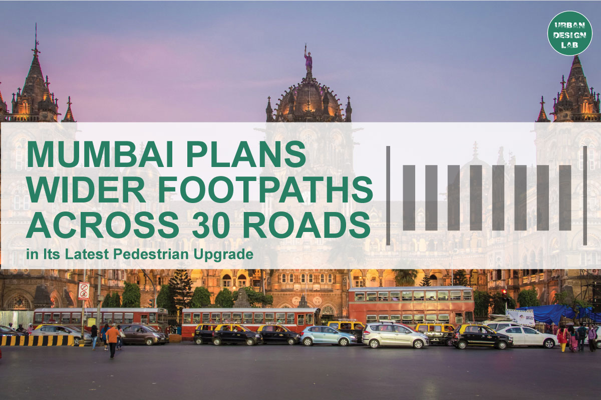


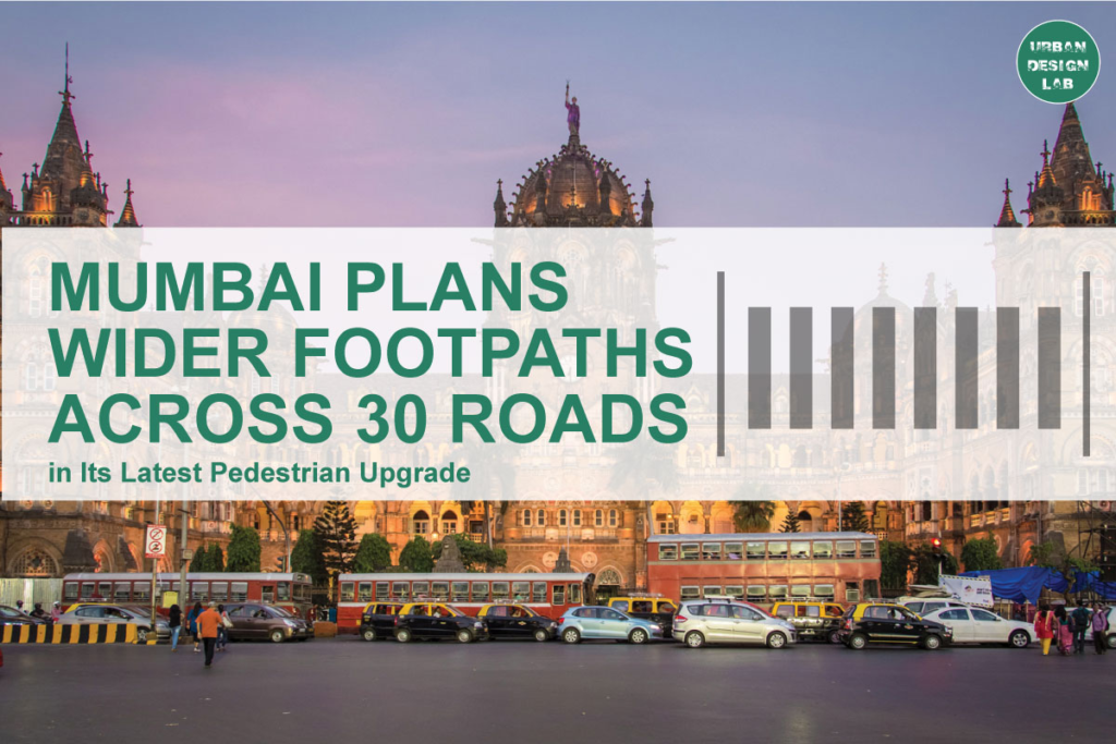
Mumbai’s latest pedestrian initiative is modest in geographic scale but potentially important in planning terms. The Brihanmumbai Municipal Corporation (BMC) is preparing to redesign footpaths and road edges along 30 roads in the eastern suburbs, covering parts of Ghatkopar, Bhandup, Kanjurmarg, Nahur and Mulund. The selected streets include routes around railway stations, markets, schools and bus stops, precisely the places where pedestrian movement is not an optional activity but a fundamental component of the transport system. According to BMC officials quoted in September 2026, the first phase focused on removing illegal encroachments, while the next phase is intended to reconstruct the pedestrian environment around a minimum footpath width of two metres, more uniform surfaces and redesigned junctions and traffic islands. The Indian Express: Mumbai never sleeps, but now it will walk better The Indian Express
The intervention matters because Mumbai’s pedestrian problem has never been simply a shortage of paving. It is a problem of continuity, usable width, station access, intersection geometry, drainage infrastructure, utility placement, parking, vending, universal accessibility and institutional maintenance. A footpath may appear adequately wide on a drawing and still function poorly if electrical equipment, bus shelters, parked motorcycles, shop extensions or abrupt level changes reduce its effective walking zone.
The central argument, therefore, is that the 30-road programme should be understood not as a footpath-widening exercise but as a test of whether Mumbai can treat pedestrian infrastructure as an integrated mobility network. BMC’s own policies already provide much of the necessary technical framework. The question is whether implementation will translate nominal width into continuous, accessible and appropriately sized pedestrian capacity.
The distinction is especially important at this stage. The most recent detailed public account located for the 30-road programme stated that construction was expected to begin in October 2026 after the monsoon receded. As of early October, publicly available evidence establishes the design intent and earlier clearance work more clearly than it establishes completed construction outcomes. Any assessment of success would therefore be premature. The Indian Express
From Encroachment Clearance to a 30-Road Pedestrian Design Programme
The significance of the scheme lies partly in its transition from enforcement to design. BMC officials said illegal encroachments had already been removed from the selected roads. What emerged after that clearance was revealing: pedestrian obstruction was not produced only by informal occupation. Transformers, fire hydrants and licensed stalls were among the objects that continued to constrain walking space. BMC subsequently involved urban planners to develop what officials described as an integrated pedestrian design. September 2026 report on BMC’s 30-road pedestrian redesign The Indian Express
The proposed redesign is intended to establish a minimum two-metre footpath width, create a more uniform walking surface, enlarge or reorganise pedestrian space around junctions and station traffic islands, physically separate walking areas from the carriageway and use markings intended to discourage unauthorised parking. Officials also said the design would be integrated with ongoing road-concretisation works. The Indian Express
That combination is more consequential than a simple widening programme. In urban design terms, the project begins to address the pedestrian route as a continuous section of public right-of-way. Road engineering, drainage, footpaths, intersection design, utilities and parking management are being forced into the same spatial problem.
This is also consistent with BMC’s 2023 Universal Footpath Policy, which explicitly states that footpaths should be treated as part of the transportation system and should be connected and continuous rather than provided intermittently where convenient. The policy calls for stable, firm and slip-resistant surfaces and says street furniture and utilities should be arranged so that a clear walkway remains available. BMC Universal Footpath Policy, 2023 MyBMC
The critical issue will be whether the 30-road programme implements that principle at network scale. Clearing one stretch while leaving a narrow bridge approach, inaccessible station forecourt or badly configured junction merely relocates the pedestrian bottleneck. Research on sidewalk networks increasingly argues for treating walking infrastructure as a connected mobility network rather than a collection of isolated segments. A 2023 review in Computers, Environment and Urban Systems similarly identified city-scale sidewalk-network data and multimodal integration as major areas of pedestrian research and planning. Rhoads et al., Sidewalk Networks: Review and Outlook DOI
The 30-road programme is therefore most valuable as a potential prototype. If BMC can demonstrate an integrated method for dealing simultaneously with drainage structures, permanent utilities, licensed activities, station interfaces, parking and walking space, the model could be more important than the initial number of roads suggests.
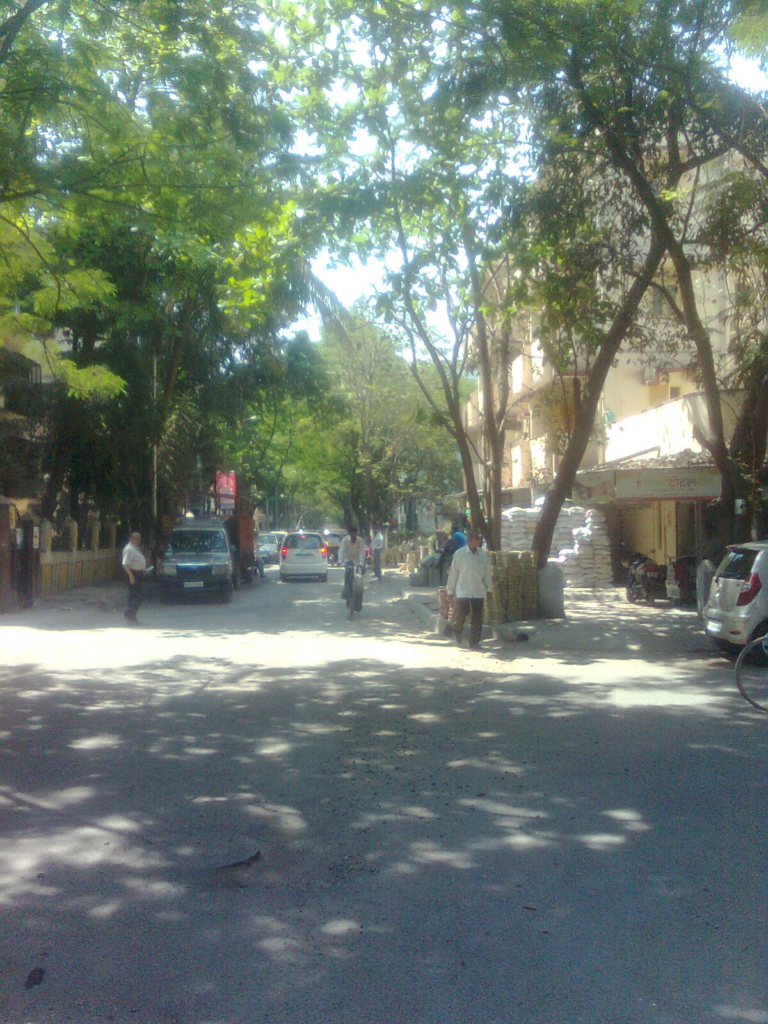
Walking in Mumbai Is Transport Infrastructure, Not a Streetscape Amenity
The case for investing in Mumbai’s footpaths becomes stronger when walking is viewed as part of the transport network rather than as an urban beautification measure.
BMC’s Comprehensive Mobility Plan provides an important, although now dated, baseline. Using its 2014 base-year travel analysis, the plan reported that walking accounted for 51 percent of total trips in Greater Mumbai and 72.5 percent of education trips. BMC Comprehensive Mobility Plan for Greater Mumbai MyBMC The figures should not be interpreted as Mumbai’s current 2026 mode share because travel patterns and transport infrastructure have changed substantially since the underlying survey period. They nevertheless demonstrate how structurally important walking was within Mumbai’s mobility system when the city’s comprehensive plan was prepared.
Even more important for the current project, the mobility plan estimated that around 60 percent of public-transport journeys necessarily began and ended with walking. More than 80 percent of walking trips to workplaces or schools lasted less than 15 minutes. MyBMC
Mumbai’s Climate Action Plan reinforces the same transport logic. BMC identifies walking as the preferred mode for last-mile access to most forms of public transport and links improved non-motorised transport infrastructure with greater accessibility to public transport. Mumbai Climate Action Plan: Sustainable Mobility Maharashtra Coastal Zone Management The 2022 plan also identified pedestrian infrastructure as part of its integrated-mobility strategy and proposed audits of existing walking infrastructure, including accessibility, encroachments and related conditions. Mumbai Climate Action Plan 2022 MyBMC
This changes how the 30-road project should be evaluated. A footpath connecting a suburban railway station to a market, bus stop, school or residential neighbourhood is part of the public-transport journey itself. Its capacity and continuity influence whether passengers can actually reach the railway system conveniently.
Academic evidence supports this broader interpretation, although causality requires care. A major review by Brian Saelens and Susan Handy found consistent associations between transport-related walking and factors including proximity to destinations, density and mixed land use. Pedestrian infrastructure and route connectivity were also identified within the wider evidence base, but the authors stressed that much of the literature was observational and could not establish simple causal relationships. Saelens and Handy, Built Environment Correlates of Walking: A Review PubMed
The implication for Mumbai is not that widening a footpath will automatically cause more walking. Behaviour is shaped by destinations, trip purposes, public-transport service, safety, climate, street activity and many socioeconomic factors. The more defensible proposition is narrower: where large volumes of people already walk to stations, schools, markets and buses, inadequate pedestrian space creates friction within an existing transport system. Removing that friction is therefore a transport-capacity and accessibility intervention as much as a public-realm improvement.
Why a Two-Metre Footpath Is a Useful Minimum but Not a Universal Solution
The proposed two-metre minimum is significant because it moves the project beyond the very narrow clearances commonly tolerated on constrained streets. It also broadly aligns with BMC’s existing accessibility framework.
The 2023 Universal Footpath Policy specifies a pedestrian zone with a clear width of at least 1.8 metres to accommodate two wheelchair users simultaneously and requires this zone to remain free of obstructions. It also states that widths leading to major railway and bus stations should be increased to accommodate heavier pedestrian movement during peak periods. MyBMC
The distinction between total footpath width and clear walking width is crucial. BMC’s policy divides the footpath conceptually into frontage, end-user and furniture zones. Trees, utility boxes, benches, manholes and other potential obstructions are intended to remain outside the pedestrian path of travel. MyBMC A two-metre paved strip that contains a transformer, tree pit or stall may therefore provide substantially less than two metres of functional pedestrian space.
This is where international comparisons are useful, provided they are not treated as directly transferable standards. Transport for London’s Pedestrian Comfort Guidance sizes footways according to pedestrian demand and surrounding activity. Its research-based recommendations identify total footway widths of approximately 2.9 metres for low-flow conditions, 4.2 metres for active pedestrian flows and 5.3 metres for high-flow environments when street furniture is present. Transport for London Pedestrian Comfort Guidance Transport for London
Those London dimensions should not simply be imported into Mumbai. Pedestrian behaviour, street vending, climate, building frontages, traffic conditions and right-of-way constraints differ substantially. Their value is conceptual: width should respond to demand and street function.
A two-metre minimum may work as a basic continuous clear zone on many local links. It may be insufficient immediately outside a railway station during the morning peak, beside a major school at closing time or along a market street where people stop, queue, browse and cross in multiple directions.
This is particularly relevant because BMC deliberately selected streets around markets, railway stations, schools and bus stops. The Indian Express These are precisely the locations where pedestrian movement is both high and behaviourally complex.
The strongest implementation model would therefore treat two metres as a floor rather than an automatic design target. Peak-hour pedestrian counts should determine where greater widths are required. Designers should distinguish movement space from waiting space, vending space, frontage activity, utility infrastructure and bus-stop operations. Otherwise, widening may improve nominal dimensions while leaving pedestrian comfort largely unchanged during the periods when capacity is most needed.
The Real Design Challenge Is Continuity at Junctions, Utilities and Crossings
Many pedestrian schemes underperform because attention is concentrated on the middle of the footpath while the most difficult points occur at its interruptions.
BMC’s Universal Footpath Policy explicitly recognises this issue. It identifies frequent level changes and kerb cuts as obstacles to continuous movement and states that kerb ramps are essential for footpath continuity. It also requires utility poles, electrical or telecommunications boxes and other obstructions to be removed from the walking space and placed in a furniture zone. MyBMC
The new 30-road project has already encountered exactly this problem. After illegal encroachments were cleared, BMC officials reported that transformers, hydrants and licensed stalls continued to obstruct pedestrian circulation. The proposed response includes not only wider footpaths but redesigned station traffic islands and junction spaces. The Indian Express
Mumbai has relevant local precedents. WRI India’s work with BMC on Bellasis Road proposed continuous pedestrian zones alongside multi-utility areas capable of organising functions such as street furniture, parking, trees, utilities and vending. It also incorporated curb extensions and pedestrian refuge islands into the street design. WRI India: Design Elements to Rejuvenate Indian Streets, Bellasis Road WRI India
A second BMC-WRI initiative redesigned three Mumbai junctions at Lalbaug, Kandivali and Worli. At Lalbaug’s Sant Jagnade Chowk, the design realigned traffic space, shortened turning geometry and created pedestrian waiting and refuge areas. WRI reported that the interventions shortened pedestrian crossing distance by almost 30 percent. At Namaha Junction in Kandivali, the redesign provided 90 square metres of pedestrian refuge space, 105 metres of protected pedestrian crossings, four accessible median refuge areas and wheelchair-accessible ramps on footpaths and refuge islands. WRI India: SaferByDesign Transformation of Three Mumbai Junctions WRI India
These examples demonstrate why the unit of pedestrian design should be the complete route rather than the pavement slab. A person may have an excellent two-metre footpath for 200 metres and then encounter a six-lane junction without adequate waiting space. From the pedestrian’s perspective, the quality of the entire trip can be determined by that single discontinuity.
The same reasoning applies to driveway crossings, station forecourts, bus stops and drainage transitions. The pedestrian surface should remain legible and continuous across locations where motor vehicles enter properties. Bus shelters should not force walkers into a narrow gap. Drain covers should not produce hazardous level differences. Junction corners should provide sufficient space for people waiting to cross without obstructing through-movement.
The strongest aspect of Mumbai’s current proposal may therefore be its stated intention to redesign junctions and traffic islands rather than merely repave existing sidewalks. If implemented consistently, this moves the project closer to network design.
Street Vending Shows Why Pedestrian Policy Cannot Be Reduced to Clearance
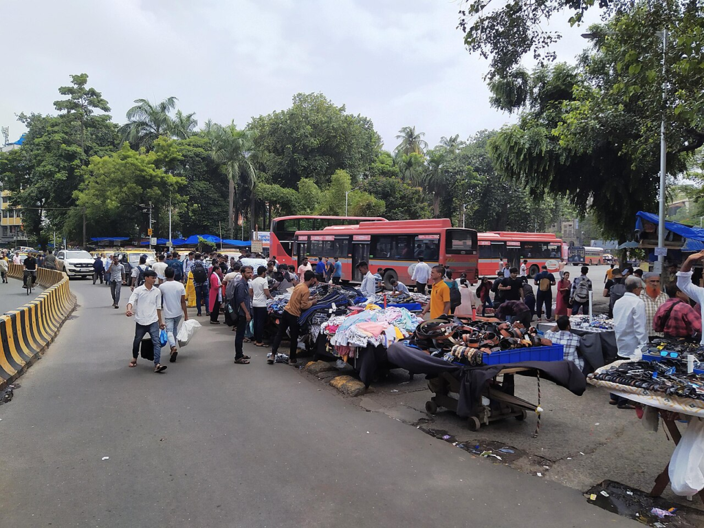
One of the most difficult aspects of sidewalk planning in Indian cities is that footpaths are simultaneously mobility corridors, economic spaces, infrastructural corridors and extensions of active building frontages.
The 30-road programme exposes this complexity. BMC officials distinguished illegal encroachments from licensed activities that remained after the initial clearance operation, including licensed stalls. The Indian Express This is important because the planning response to a transformer, an illegally parked motorcycle, a legally operating kiosk and a pedestrian queue cannot be identical.
BMC’s own Universal Footpath Policy recognises this urban condition. The document notes the longstanding presence of electrical equipment, fire hydrants, government-allotted stalls and licensed street hawkers within public-space environments. Rather than assuming that every such function can simply disappear, the policy proposes organising them along one strip so that a continuous pedestrian passage can be retained. MyBMC
This suggests a more sophisticated interpretation of “Pedestrian First”. Giving priority to pedestrians does not necessarily require designing a socially empty pavement. It requires protecting an uninterrupted movement zone while locating other legitimate street functions outside it.
Bellasis Road again provides a useful Mumbai precedent. The WRI design approach uses a multi-utility zone to consolidate functions that would otherwise migrate unpredictably into pedestrian space. Such zones can potentially accommodate utilities, seating, landscape elements, selected vending locations and other street furniture while preserving a separate clear path. WRI India
There is also an equity dimension. Street vending can provide inexpensive goods, food and livelihoods, while informal street activity can contribute to the intensity and convenience that make neighbourhoods walkable. Yet poorly located stalls can create severe accessibility barriers, especially for wheelchair users, older people and pedestrians travelling in groups.
The solution is therefore not to romanticise vending or treat it automatically as obstruction. The defensible planning principle is spatial allocation. Pedestrian movement requires a continuously protected zone. Other permitted activities require designated locations based on available width, demand, safety and legal status.
This is where the two-metre proposal will face its most practical test. On narrow streets, allocating a clear movement zone may require relocating utilities, removing unauthorised parking, reorganising vending and reconsidering carriageway space. Such decisions are political as well as technical because they determine which users receive scarce street space.
Universal Accessibility Is Now Both a Design Standard and a Legal Obligation
Pedestrian infrastructure should ultimately be judged by whether it can be used independently by people with different physical abilities, ages and mobility needs.
BMC’s 2023 policy explicitly frames barrier-free footpaths around universal access. It requires an even, stable, firm and slip-resistant walking surface and identifies Persons with Disabilities, senior citizens, pregnant women and adults using strollers among the users whose movement must be accommodated. It specifies 1.8 metres as the clear width necessary for two wheelchair users to pass simultaneously and states that the full width should be maintained behind bus shelters and in front of shops where possible. BMC Universal Footpath Policy MyBMC
The proposed two-metre minimum and more uniform surface therefore have a strong accessibility rationale, but dimensions alone cannot create a universally accessible route. A person using a wheelchair may still be unable to use a two-metre footpath if the kerb ramp is missing, the cross slope is excessive, a driveway creates a step, a utility chamber is uneven or the accessible route disappears at an intersection.
The legal context has also changed. In a judgment delivered on 19 June 2026, the Supreme Court of India characterised the right to walk as a fundamental right and linked that right to the provision of demarcated and properly maintained footpaths. The Court placed responsibility on public authorities, including municipal bodies, for constructing, maintaining and safeguarding pedestrian infrastructure. Supreme Court of India judgment, 19 June 2026 Sci API
That judgment raises the policy significance of projects such as Mumbai’s 30-road upgrade. Pedestrian provision is no longer appropriately framed only as a discretionary civic improvement. It sits within a stronger rights-based understanding of access to public streets.
For BMC, this means design auditing should examine the entire accessible chain: approach routes, clear width, surface quality, kerb transitions, crossings, traffic islands, bus stops and station interfaces. Designing each element separately can produce a technically compliant component but an inaccessible journey.
The experience at Namaha Junction illustrates how this approach can be translated physically. The BMC-WRI intervention combined protected crossings, refuge space and wheelchair-accessible ramps rather than treating accessibility as a single ramp added after the road geometry had already been determined. WRI India
A rigorous evaluation of the 30-road scheme should therefore ask not simply whether footpaths became wider but whether a continuous accessible route now exists between destinations. That is a substantially higher standard, but it is also closer to what BMC’s own policy and recent judicial reasoning require.
Mumbai Should Measure Effective Walking Conditions, Not Just Kilometres Upgraded
The most important stage of the programme may begin after construction.
BMC officials have indicated that the 30-road design could later be extended to other administrative divisions. The Indian Express That creates a strong reason to treat the eastern-suburb intervention as an evaluated pilot rather than immediately assuming that its design should be replicated unchanged across Mumbai.
Different streets perform different pedestrian functions. A residential connector in Mulund, a station approach in Ghatkopar and a market street in Bhandup may all need continuous footpaths, but they may require different widths, furniture arrangements, crossing treatments and management strategies.
The evaluation should therefore begin with effective clear width rather than constructed width. Measurements should identify the narrowest usable point along a route after trees, poles, hydrants, cabinets, bus shelters and permitted activities are accounted for. Continuity should be recorded across driveways and junctions. Peak-period pedestrian flows around stations and schools should be compared with available capacity. Accessibility audits should follow complete routes rather than isolated sections.
Monitoring also needs a temporal dimension. A newly constructed footpath may perform well immediately after inauguration but become progressively obstructed by parking, relocated vendors, damaged paving or utility work. Maintenance and enforcement are therefore part of the pedestrian design system.
Behavioural observation can provide additional evidence. WRI India’s more recent analysis of street-design interventions reported that at Namaha Junction, where 90 percent of the proposed design had been implemented, 73 percent of observed pedestrians used designated paths and 53 percent used designated crossings. WRI India: Designing for Instinct, How Streets Shape Behavior WRI India These figures do not prove that the design caused broader safety improvements, but they illustrate the value of measuring how people actually respond to redesigned space.
For the 30-road project, before-and-after observations could examine walking trajectories, crossing locations, pedestrian congestion, encounters with parked vehicles, accessibility barriers and recurrence of obstructions. Peak and off-peak conditions should be separated because a footpath that functions well at midday may fail during station rush hours.
BMC’s Climate Action Plan already proposed auditing pedestrian infrastructure and tracking indicators such as usable and accessible walkways and safe intersections. MyBMC The current project provides an opportunity to turn such monitoring into routine municipal practice.
There is also a methodological reason for doing so. Urban-design interventions rarely operate in isolation. If pedestrian volumes rise after reconstruction, the change could reflect improved footpaths, new transit services, altered land uses, economic activity, seasonal differences or several factors simultaneously. A before-and-after monitoring programme with comparable observation periods cannot eliminate every confounder, but it can produce substantially stronger evidence than photographs or construction-length totals alone.
That evidence should determine whether the two-metre standard works across different street types and where wider sections are necessary. Scaling a tested framework would be more defensible than reproducing a fixed geometric template.
Conclusion
Mumbai’s plan to redesign footpaths along 30 roads is significant because it begins to address a persistent weakness in Indian street planning: the assumption that pedestrian infrastructure can be added after motor-vehicle space, drainage, utilities and parking have already been allocated.
The available evidence indicates a more integrated approach. The proposed minimum two-metre footpaths are to be combined with uniform surfaces, redesigned junctions and station traffic islands, obstacle management and integration with road-concretisation works. The Indian Express These measures broadly align with BMC’s existing Universal Footpath Policy, which already defines footpaths as continuous parts of the transport network and requires clear, accessible walking zones. MyBMC
Yet two metres should not become the measure of success by itself. Station areas and markets may require substantially more capacity. Utilities and street furniture can reduce nominal width. Junctions can undermine otherwise continuous routes. Accessibility depends on transitions and crossings as much as pavement dimensions. Licensed economic activity must be organised rather than indiscriminately treated as obstruction.
The strongest outcome would therefore be institutional rather than cosmetic: a shift from building footpaths to managing a pedestrian network.
That network should be designed according to demand, audited for universal accessibility, integrated with public transport and repeatedly monitored after construction. If the 30-road programme demonstrates those principles and publishes evidence of how the streets perform, it could provide Mumbai with a credible model for wider pedestrian reform.
For now, however, the evidence supports conclusions about the ambition and design logic of the programme, not its eventual results. The latest detailed reporting stated that construction was expected to begin in October 2026. Whether wider footpaths become genuinely continuous, accessible and usable streets will depend on what happens after the drawings reach the ground. The Indian Express
References / Further Reading
- Brihanmumbai Municipal Corporation. Universal Footpath Policy, 26 May 2023.
- Brihanmumbai Municipal Corporation. Comprehensive Mobility Plan for Greater Mumbai: Executive Summary.
- Brihanmumbai Municipal Corporation. Mumbai Climate Action Plan 2022.
- Brihanmumbai Municipal Corporation. Mumbai Climate Action Plan: Sustainable Mobility.
- Supreme Court of India. Judgment concerning the constitutional right to walk and pedestrian footpaths, 19 June 2026.
- Acharya, Pratip. Mumbai never sleeps, but now it will walk better: Here’s what BMC plans for its roads. The Indian Express, 16 September 2026.
- Tak, Rohit and Lekshmy Hirandas. Design Elements to Rejuvenate Indian Streets: A Case of Bellasis Road, Mumbai. WRI India, 2020.
- WRI India. #SaferByDesign: Transformation of 3 Junctions in Mumbai.
- WRI India. Designing for Instinct: How Streets Shape Behavior.
- Transport for London. Pedestrian Comfort Guidance for London: Guidance Document.
- Saelens, Brian E. and Susan L. Handy. Built Environment Correlates of Walking: A Review. Medicine & Science in Sports & Exercise, 2008.
- Rhoads, Daniel et al. Sidewalk Networks: Review and Outlook. Computers, Environment and Urban Systems, Volume 106, 2023.
Related reading on Urban Design Lab: Top 10 Case Studies on Walkable and Socially Inclusive Public Spaces; Autodesk Forma Street Design Review for Urban Street and Mobility Planning