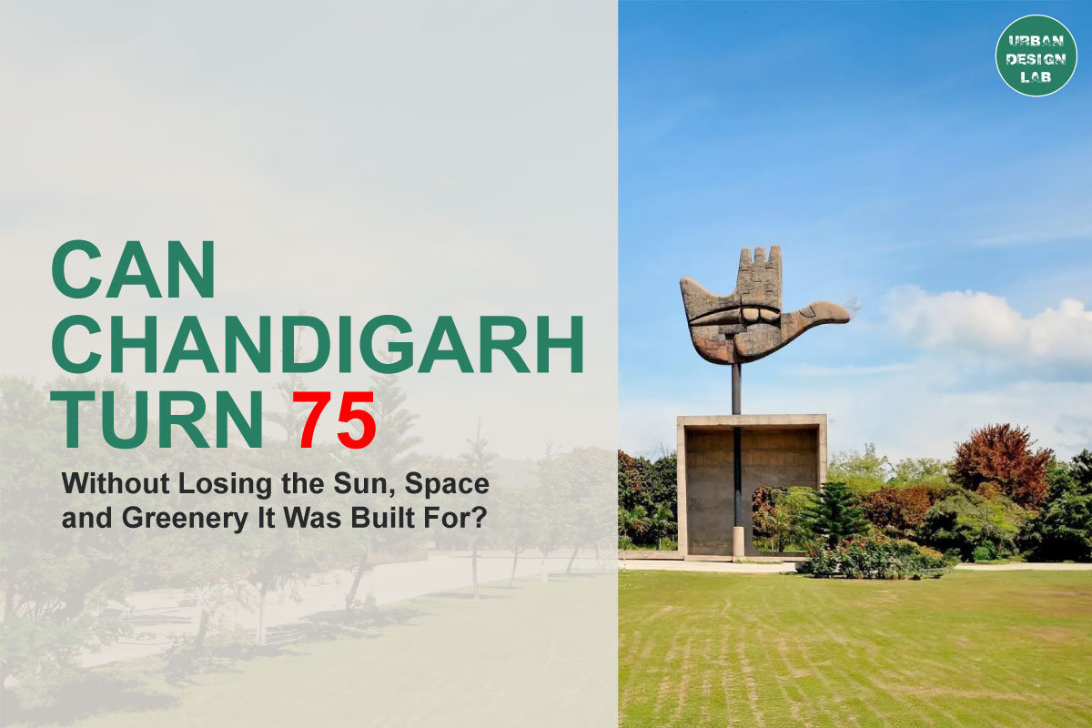


A city can preserve its most famous buildings while gradually losing the environmental qualities that made those buildings part of a coherent urban vision. Chandigarh’s anniversary raises precisely this question: can architectural heritage survive meaningfully if daylight, open ground, shaded routes and accessible greenery become increasingly difficult to experience?
The anniversary itself requires precision. In 2026, Chandigarh marks 75 years since the project was assigned to the architectural team led by Le Corbusier in 1951, according to the Chandigarh Administration’s historical account. This is an anniversary of a decisive planning milestone, rather than a claim that the entire city was completed in that year. chandigarh.gov.in
For an international audience, Chandigarh matters because it brings a wider planning dilemma into unusually sharp focus. How should a purposefully designed city accommodate changing needs without consuming the spatial resources on which its original quality depended? Conservation, housing, mobility and environmental protection cannot be resolved separately when each makes demands on the same land.
The familiar principles of sun, space and greenery offer a useful starting point, provided they are translated into observable conditions. Sun concerns access to daylight and the management of solar exposure. Space concerns the relationships between buildings, public ground and movement. Greenery concerns living landscapes, their ecological functions and who can reach them.
The argument developed here is that Chandigarh’s future should be judged through these relationships. Neither the preservation of a skyline nor an increase in development capacity is sufficient evidence of success. The stronger test is whether urban change maintains environmental performance while extending access to housing, services and public space.
Sun and Space Must Remain Working Principles
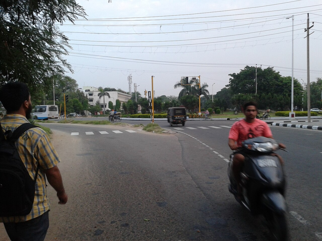
Chandigarh’s environmental identity was embedded in its planning structure. The administration describes the Capitol Complex as the city’s head, Sector 17 as its heart, and the Leisure Valley, sector greens and other open spaces as its lungs. Roads formed the circulatory system. Although metaphorical, this description establishes that landscape and movement were conceived as components of the city’s organisation, rather than additions to completed buildings (Chandigarh Administration, General Information). chandigarh.gov.in
The analytical significance lies in the relationships between these components. A protected building can retain its façade while its surroundings become less comfortable, less accessible or less legible. Likewise, a park can survive as a designated land parcel while the routes connecting it to homes deteriorate. Conservation therefore needs to examine how places function together.
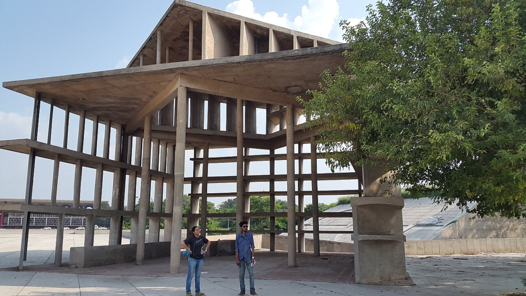
Solar design makes this relationship especially clear. UNESCO’s account of the Capitol Complex identifies sunscreens, double-skinned roofs and reflecting pools among its responses to environmental conditions (UNESCO, The Architectural Work of Le Corbusier). These features demonstrate that the architectural project involved moderating exposure as well as admitting light. UNESCO World Heritage Centre
Preserving “sun” should consequently mean maintaining useful daylight, appropriate seasonal solar access and protection from excessive exposure. It should not become a general argument for maximising unshaded surfaces. The distinction matters as climate risks change: the IPCC identifies increasing urban heat stress and recognises vegetation and other forms of green infrastructure among available adaptation measures (IPCC, Cities, Settlements and Key Infrastructure). That assessment establishes the relevance of heat adaptation, but does not quantify the performance of a particular Chandigarh street or building. ipcc.ch
A practical interpretation would require development proposals to demonstrate their effects on neighbouring daylight, outdoor shade and usable open ground. Such assessment should examine more than a single attractive rendering. Seasonal shadow studies, pedestrian-level measurements and the distribution of shaded waiting areas would reveal consequences that a height limit alone cannot describe.
The same reasoning applies to space. A setback occupied by vehicles provides a different public and environmental outcome from one containing permeable soil and mature vegetation. An open plaza without comfortable places to pause may offer visual generosity while serving some users poorly during hot periods. These are questions to investigate through observation, rather than assumptions to settle from a plan.
Chandigarh’s original principles therefore remain useful as performance objectives. They become weaker when treated only as stylistic rules. The conservation challenge is to preserve the conditions that make daily life comfortable and dignified, while allowing carefully justified adaptations where existing arrangements no longer serve that purpose.
The Density Debate Needs Legal Precision and Social Evidence
Chandigarh’s development debate requires a distinction between international heritage recognition and domestic planning controls. The Capitol Complex forms part of the transnational UNESCO property The Architectural Work of Le Corbusier, inscribed in 2016. The inscription does not designate the whole city as a World Heritage property (UNESCO property record). This distinction prevents an international designation from being used as an inaccurate description of every neighbourhood’s legal status. UNESCO World Heritage Centre
Domestic controls have their own significance. The Supreme Court’s judgment of 10 January 2023 addressed the fragmentation and apartmentalisation of residential units in Chandigarh’s Phase I. The subsequent Estate Office notice established administrative restrictions and expressly distinguished certain existing approved apartments from the properties affected by its decisions (Supreme Court judgment; Estate Office public notice). These documents should not be simplified into a claim that all apartment living throughout Chandigarh is prohibited. api.sci.gov.in
A further distinction concerns the status of planning reform. Discussion, committee consideration, administrative endorsement and a legally operative notification are different stages. The primary documents verified for this article do not establish a final, comprehensive 2026 amendment package. Accordingly, proposed development permissions should not be presented here as settled entitlements.
Beyond the legal position, the planning question is how additional accommodation would affect environmental quality and access. Density, building height and ground coverage describe different things. A taller building need not occupy more ground; a low building can still cover much of its plot. Neither condition, considered independently, establishes how much usable landscape remains or how well neighbouring homes receive daylight.
The relevant inquiry should therefore be specific: what is proposed, where, for whom, and with what supporting infrastructure? A proposal should identify additional households or activities, expected service demands, public-space implications and the responsibilities for delivering necessary improvements.
Housing affordability also requires evidence. Restricting redevelopment may protect valued spatial characteristics, but an assessment should investigate whether it excludes households who need access to the city. Conversely, allowing additional floor area does not establish that the resulting homes will be affordable to those households. That conclusion requires information about prices, tenure, dwelling sizes and intended occupants.
These are competing risks to assess, rather than predetermined reasons to approve or reject development. A defensible housing strategy would distinguish demand for luxury property from unmet rental needs, and owner interests from the needs of workers, students and other residents without property.
Heritage assessment should follow the same discipline. In its 2025 conservation review, the World Heritage Committee requested revised proposals and a new heritage impact assessment for specified Capitol Complex projects before further implementation decisions (UNESCO, State of Conservation 2025). The methodological lesson is valuable beyond that protected site: establish the consequences of change before committing to it. whc.unesco.org
Greenery Must Connect Everyday Destinations
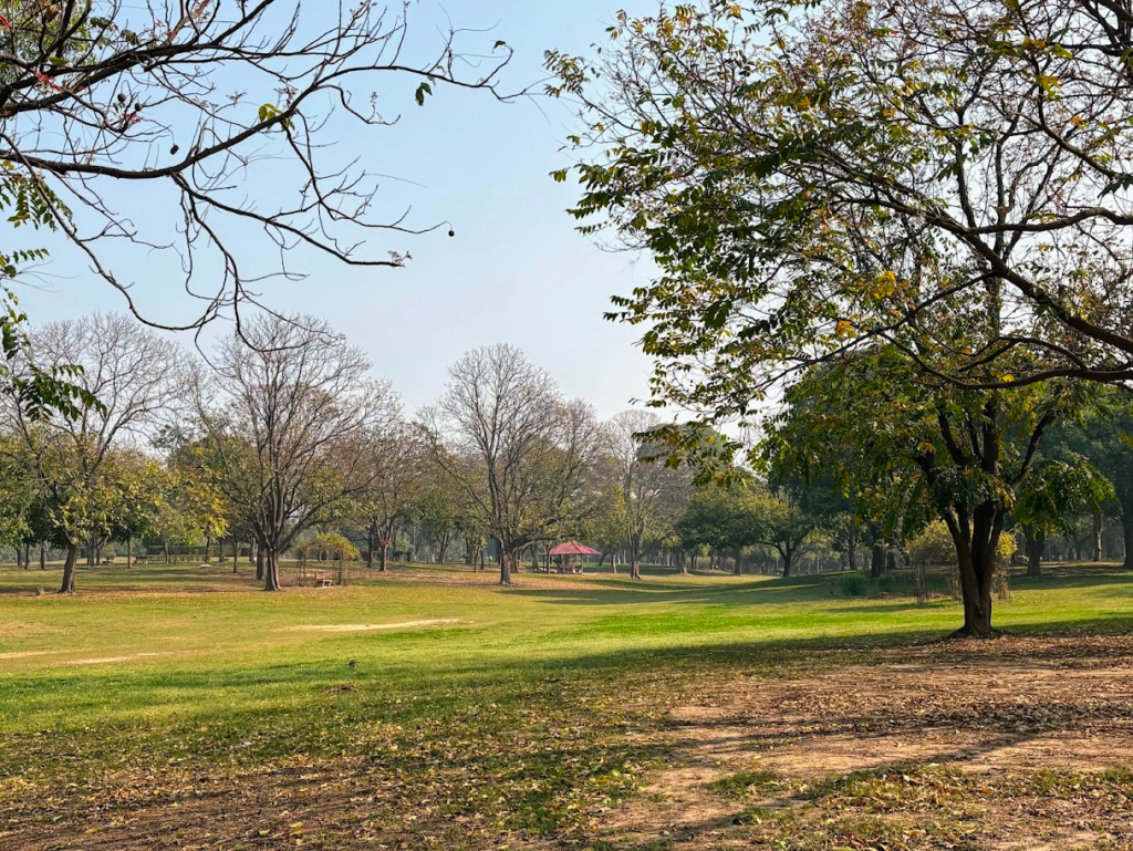
Chandigarh’s Master Plan describes the Leisure Valley as an approximately eight-kilometre landscape and identifies opportunities to improve pedestrian and cycle connections between its green stretches (Chandigarh Master Plan 2031, Open Spaces and Landscaping). The significance of that proposal is functional: the value of a landscape depends partly on whether people can move through it and reach it safely. chandigarh.gov.in
This suggests a more demanding standard than maintaining a citywide quantity of greenery. Aggregate area cannot establish whether a child can reach a playground without a difficult road crossing, whether an older person has a shaded route to a market, or whether a wheelchair user can enter a park independently.
The World Health Organization’s review identifies several pathways through which urban green spaces can support health, including physical activity, psychological restoration, social interaction and reduced exposure to environmental hazards (WHO, Urban Green Spaces and Health). These are potential pathways supported by a wider evidence base. They are not proof that every green parcel in Chandigarh delivers equal benefits, or that planting alone will produce a particular health outcome. who.int
The planning implication is to evaluate access alongside provision. Route continuity, entrances, crossing conditions, resting places and maintenance should become part of the evidence used to judge the green network. Surveys should also ask who uses these spaces, at what times and for what purposes. An apparently quiet park may reflect a preference for tranquillity, inconvenient access, poor maintenance or other factors; observation alone may not explain which.
Singapore offers a relevant institutional comparison. Its National Parks Board describes the Park Connector Network as a system of linear green corridors linking parks and nature areas, with recreational access and ecological connectivity among its purposes (NParks, Know Our Recreational Connectivity). The transferable principle is the deliberate management of connections. Singapore’s different climate, land institutions and governance arrangements limit any straightforward prescription for Chandigarh. pcn.nparks.gov.sg
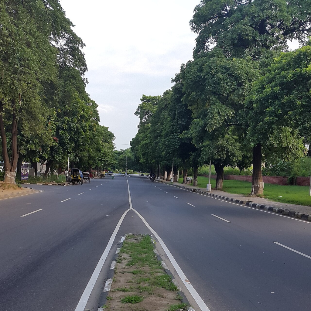
Chandigarh can examine this principle through its own circulation framework. The administration’s account of the road hierarchy includes shopping streets, neighbourhood streets, pedestrian paths and cycle tracks alongside major roads (Chandigarh Administration, Circulation). Improving walking and cycling can therefore draw on elements already recognised within the planning concept. chandigarh.gov.in
A useful programme would start with complete journeys: home to school, bus stop to workplace, market to neighbourhood park. It would locate the points where routes become uncomfortable, inaccessible or unsafe, then test targeted improvements.
Such an approach would also clarify investment priorities. A repaired crossing or continuous shaded footpath may resolve a documented access problem more directly than another isolated ornamental landscape. The decision should follow evidence about use and need, with subsequent monitoring to establish whether the intervention actually helped.
Sukhna Lake Reveals the Limits of City-Boundary Planning
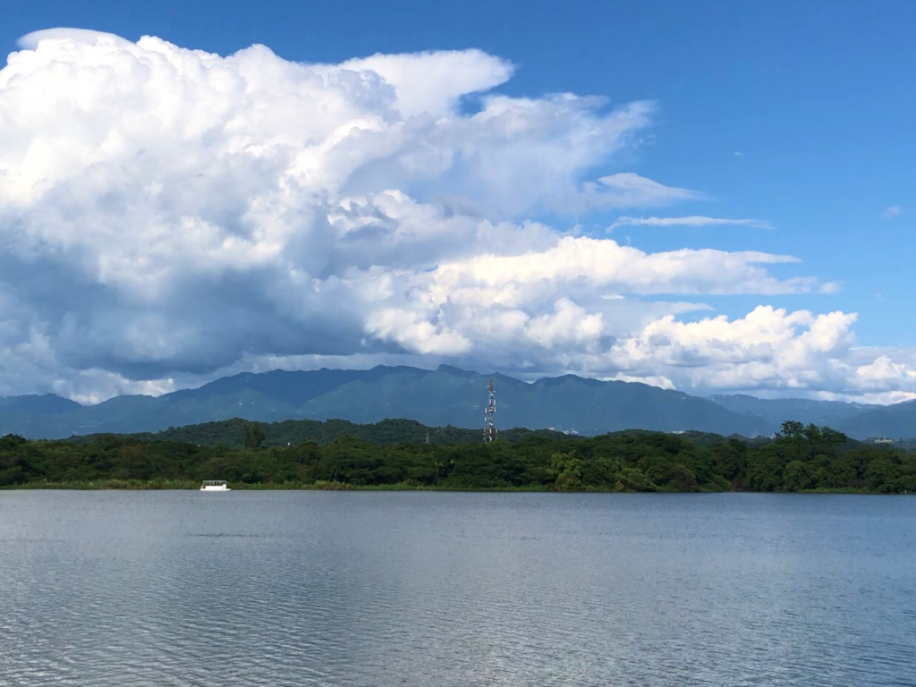
Sukhna Lake makes the relationship between urban landscape and regional governance particularly clear. The Master Plan’s ecology chapter records that parts of its catchment lie in Punjab, Haryana and Chandigarh. It also discusses the threat of soil erosion and sediment reaching the lake (Chandigarh Master Plan 2031, Ecology and Environment). The lake’s condition therefore cannot be understood solely by examining its visible waterfront. chandigarh.gov.in
The administration’s account of Sukhna Wildlife Sanctuary describes vegetative and engineering measures used to control erosion in the hilly catchment, together with afforestation (Chandigarh Administration, Sukhna Wildlife Sanctuary). This history establishes that landscape protection has involved intervention in the wider drainage system, not simply the maintenance of a recreational edge. chandigarh.gov.in
For contemporary planning, the implication is to evaluate changes at the scale of the processes they affect. A proposal close to the lake may require careful assessment, but distance alone cannot establish whether a development is harmless. Drainage connections, soil disturbance and the management of runoff also matter.
Equally, a claim that one project caused a particular deterioration in the lake would require evidence. Rainfall variability, land-use changes, sediment movement and maintenance practices may interact. A defensible assessment needs a baseline, a plausible mechanism and monitoring capable of distinguishing alternative explanations.
This is why beautification should be evaluated separately from ecological condition. Improved paving, seating or lighting may enhance a visitor’s experience, but those improvements do not establish better water quality or reduced sediment inflow. Each objective needs an appropriate measure. A successful waterfront project should be able to explain both what it achieves and what remains outside its scope.
The same regional perspective applies to the wider urban system. Chandigarh’s Master Plan explicitly calls for coordination with neighbouring planning areas and envisages a metropolitan approach (Chandigarh Master Plan 2031, Regional Context). Regional coordination is therefore already recognised in the planning evidence; it need not be introduced as a wholly new ambition. chandigarh.gov.in
The policy question is how to make that ambition operational. Shared monitoring of catchment conditions, compatible drainage standards and transparent review of development proposals would provide practical starting points. Housing and transport decisions should similarly be assessed for their effects across administrative boundaries.
There is a risk worth testing here: a conservation policy may maintain environmental quality within a protected area while shifting development pressures and travel burdens elsewhere. Whether this is occurring, and to what extent, requires regional evidence. It should neither be assumed nor excluded from evaluation.
A credible definition of Chandigarh’s environmental success must therefore look beyond the central city’s appearance. It should ask whether the wider settlement pattern supports the landscapes and daily journeys on which the city depends.
Make Environmental Quality a Publicly Testable Commitment
Chandigarh’s planning inheritance contains a strong concern for public space. The administration describes Sector 17’s city centre as organised around pedestrian promenades, while the Edict of Chandigarh explicitly addresses the protection of parks and the recreational purpose of the lake (Chandigarh Administration, Working; Edict of Chandigarh). These statements provide historical direction, but they do not substitute for evidence about present conditions. chandigarh.gov.in
An anniversary offers an opportunity to establish that evidence systematically. The following programme is a proposed approach to assessment, rather than a description of an existing citywide monitoring system.
First, Chandigarh should document environmental quality at neighbourhood and street scales. The baseline should distinguish tree canopy from other vegetation, permeable ground from paving, and publicly accessible space from land that merely appears green on a map. It should record the methods and dates so that later comparisons are meaningful.
Second, development review should assess cumulative effects. A small change may seem acceptable in isolation but form part of a larger pattern of lost open ground, interrupted routes or additional service demand. Assessment should therefore examine the relevant block, sector or drainage area as well as the individual property.
Third, access should be measured through usable journeys. A straight-line distance to a park or bus stop is an incomplete measure if the route includes barriers or inaccessible crossings. Audits should consider children, older residents, disabled users and people carrying goods, rather than assuming one standard walking speed and level of mobility.
Fourth, housing outcomes should be reviewed alongside environmental outcomes. Proposed increases in development capacity should identify what accommodation is expected, how infrastructure will be funded and how any affordability commitments will be enforced. Restrictions should also be evaluated for their distributional effects. The objective is an accountable relationship between the costs of change and its public benefits.
Fifth, maintenance must be included from the beginning. A landscape proposal should specify who will care for it, how performance will be monitored and what happens when planting fails or access deteriorates. WHO’s guidance on urban green-space interventions emphasises practical implementation and the need to maximise environmental, social and health benefits (WHO, Urban Green Spaces: A Brief for Action). who.int
Finally, the evidence should be public. Residents need access to the baseline, assumptions, alternatives and monitoring results behind consequential planning decisions. Consultation becomes more useful when participants can question a projected impact or compare options, rather than respond only to an illustration.
No single score should conceal these different dimensions. A project may improve access while reducing canopy, or provide housing while increasing infrastructure demands. Publishing the trade-offs makes the decision more honest and allows mitigation to be judged against specific problems.
This would give sun, space and greenery a continuing administrative role. Their protection would become something that can be examined, challenged and improved through evidence.
Conclusion
Chandigarh can carry its defining environmental principles beyond its seventy-fifth planning anniversary, but their survival requires more than architectural recognition. The planning record identifies a connected system of landscapes, public spaces and movement routes, while the ecological evidence demonstrates dependencies extending beyond the city’s administrative boundary.
The defensible response is to assess change through its consequences: daylight and shade, usable open ground, continuous access, catchment protection, infrastructure capacity and housing opportunity. Development should demonstrate its benefits and account for its costs. Conservation should explain which qualities it protects and how those qualities remain accessible.
The evidence does not support assuming that every increase in density is destructive, or that every retained open parcel delivers equal public value. It supports a more careful process of comparison, impact assessment and monitoring.
Chandigarh’s next chapter should make its original promise testable in everyday life. The strongest anniversary achievement would be a city in which environmental quality remains a shared condition of urban living.

References / Further Reading
- Chandigarh Administration: Historical Background
- Chandigarh Administration: General Information
- Chandigarh Administration: Edict of Chandigarh
- Chandigarh Administration: Circulation
- Chandigarh Administration: Working
- Chandigarh Master Plan 2031: Open Spaces and Landscaping
- Chandigarh Master Plan 2031: Ecology and Environment
- Chandigarh Master Plan 2031: Regional Context
- Chandigarh Administration: Sukhna Wildlife Sanctuary
- Supreme Court of India: Resident’s Welfare Association and Another v. Union Territory of Chandigarh and Others, Judgment of 10 January 2023
- Chandigarh Estate Office: Public Notice Following the Supreme Court Judgment on Apartmentalisation
- UNESCO: The Architectural Work of Le Corbusier, an Outstanding Contribution to the Modern Movement
- UNESCO: State of Conservation 2025, The Architectural Work of Le Corbusier, French-language record
- World Health Organization: Urban Green Spaces and Health
- World Health Organization: Urban Green Spaces, A Brief for Action
- IPCC: Climate Change 2022, Cities, Settlements and Key Infrastructure
- National Parks Board, Singapore: Know Our Recreational Connectivity
Related reading on Urban Design Lab: Sector 17 Plaza, Chandigarh: Modernist Urbanism; Le Corbusier: Modernist Visionary & Urban Planning Pioneer