

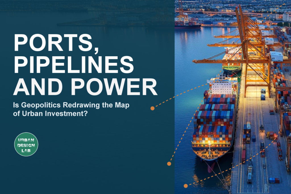
Global investment in infrastructure is entering a period in which the strategic value of a location may matter as much as its conventional economic advantages. Ports, logistics corridors, energy terminals and cross-border pipelines are no longer evaluated solely as instruments of commercial efficiency. Increasingly, they are also assessed through questions of national security, supply-chain resilience, energy independence and geopolitical influence.
For urban planners, this presents a significant challenge. Infrastructure decisions negotiated between national governments, multinational corporations and international financial institutions can reshape metropolitan regions for decades. Yet the consequences of these decisions, including industrial land conversion, freight traffic, environmental exposure, employment opportunities and demands on public infrastructure, are experienced locally.
The scale of the relationship between global trade and territorial development is considerable. According to the United Nations Conference on Trade and Development (UNCTAD), maritime transport carries more than 80% of world merchandise trade by volume. Consequently, disruptions to shipping networks can affect the economic prospects of port cities, industrial regions and inland logistics centres far beyond the locations where the disruptions originate.
Recent events have made these vulnerabilities particularly visible. UNCTAD documented substantial changes in shipping patterns following disruptions in the Red Sea and Suez Canal, while its 2026 analysis of the Strait of Hormuz identified how geopolitical conflict can transmit economic shocks through energy, fertilizer and maritime transport markets.
At the same time, governments are advancing alternative connectivity arrangements. The proposed India-Middle East-Europe Economic Corridor, India’s investment in Iran’s Chabahar Port, European liquefied natural gas infrastructure and emerging hydrogen networks demonstrate different ways in which geopolitical and economic considerations are influencing infrastructure priorities.
However, it would be premature to conclude that these initiatives collectively represent a completed transformation of global trade geography. Political announcements, infrastructure expenditure and operational changes are distinct forms of evidence. A proposed corridor does not necessarily become a functioning trade route, and investment in a port does not automatically generate prosperity in its surrounding city.
The central argument of this article is that geopolitics is changing the criteria through which infrastructure locations are valued, but its effects on urban investment remain conditional on existing networks, commercial demand, institutional capacity and local planning decisions.
Through cases from the Suez Canal, Piraeus, Chabahar, Rotterdam, Wilhelmshaven and India, the article examines how this changing geography is emerging, where the evidence is strongest and what it means for the future of cities.
Maritime Chokepoints: When Global Disruptions Become Local Investment Risks
Maritime chokepoints have always been strategically important because they concentrate substantial volumes of international commerce within geographically constrained passages. What has become particularly significant is the extent to which disruptions at these locations can influence decisions concerning infrastructure redundancy, supply-chain organisation and investment risk.
The Red Sea provides a clear illustration.
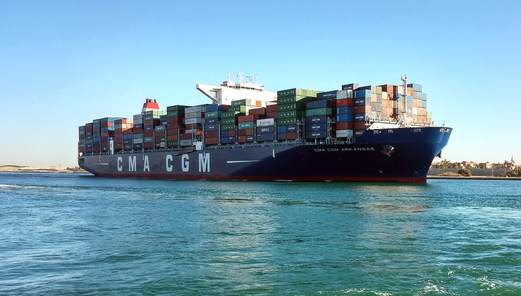
UNCTAD’s Review of Maritime Transport 2025 reported that, by May 2025, tonnage passing through the Suez Canal remained approximately 70% below its 2023 level. Shipping companies rerouted vessels around the Cape of Good Hope to avoid security risks, increasing voyage distances, operating costs and transit uncertainty.
The effects were evident in distance-adjusted maritime trade. While seaborne trade volume increased by 2.2% in 2024, the distance travelled by cargo, measured in tonne-miles, increased by approximately 5.9%.
This distinction matters because trade volume alone does not capture the infrastructural consequences of rerouting. The same cargo travelling farther occupies vessel capacity for longer, changes port-call schedules and increases the logistical resources required to maintain supply.
The vulnerability of maritime routes became an even more immediate concern during 2026. In its March 2026 assessment of the Strait of Hormuz, UNCTAD identified the passage as carrying approximately one-quarter of global seaborne oil trade and significant volumes of liquefied natural gas and fertilizers. Following military escalation, the organisation documented substantial disruption to maritime traffic and associated increases in shipping and insurance costs.
The International Maritime Organization also issued statements during 2026 addressing attacks on commercial vessels and the continuing risks facing seafarers in the Red Sea.
These developments demonstrate that maritime security is not simply an issue of international relations. It directly influences the operating conditions under which ports and their associated urban economies function.
A disruption can create several potential investment responses.
Shipping companies may seek alternative transshipment locations. Import-dependent industries may reconsider inventory practices or diversify supply sources. Governments may invest in additional port capacity, strategic storage or inland transport connections. Logistics operators may attach greater value to reliability and route flexibility rather than prioritising only the shortest journey.
Yet the relationship between disruption and investment is not deterministic.
A port receiving additional vessel calls during a crisis may experience a temporary increase in activity without attracting permanent investment. Conversely, an established port may maintain its commercial importance despite disrupted shipping patterns because of its industrial hinterland, specialised terminals or established supply-chain relationships.
The distinction between temporary rerouting and durable network restructuring is therefore essential.
A useful assessment would compare vessel calls, cargo throughput, route frequency and committed infrastructure expenditure across several years. It would also account for changes in global demand, shipping alliances and transport costs. Without such evidence, increases or decreases in port activity cannot confidently be attributed to geopolitical disruption alone.
For urban regions, the practical implication is that exposure to international maritime risks should be incorporated into long-term infrastructure planning. Port cities depend not only on the physical condition of their terminals but also on the stability and adaptability of the wider networks to which they are connected.
The Port as a Geopolitical Asset: What Piraeus Reveals About Infrastructure Ownership
The changing geography of infrastructure investment is not limited to the construction of new facilities. Ownership and governance arrangements at existing ports have also acquired strategic significance.
The Port of Piraeus in Greece provides an important case.
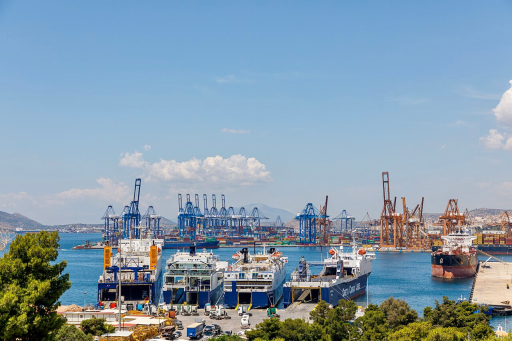
According to information published by the Hellenic Ports Association in 2026, COSCO Shipping held a 67% shareholding in Piraeus Port Authority S.A. The company’s financial disclosures establish that COSCO acquired majority control in 2016 and increased its voting rights to 67% in 2021.
Piraeus is an established port with container handling, passenger transport, cruise operations, ship repair and logistics activities. Its significance therefore extends beyond any single category of maritime trade.
The investment has attracted geopolitical attention because it connects an important European transport asset with a major Chinese shipping enterprise.
Nevertheless, the existence of Chinese ownership should not be interpreted as sufficient evidence that the port operates primarily according to geopolitical objectives. Shipping companies invest internationally for commercial reasons, including market access, terminal integration, productivity improvements and operational coordination.
These commercial incentives can coexist with strategic interests without being identical to them.
The relevant planning question is how ownership arrangements distribute decision-making authority over infrastructure that performs both commercial and public functions.
A port operator may influence terminal investment, land use within concession areas, cargo-handling systems and relationships with shipping companies. Public authorities remain responsible for important aspects of regulation, environmental protection, transport planning and the broader public interest, subject to applicable legislation and contractual arrangements.
The World Bank’s Port Reform Toolkit, updated in 2025, emphasises the need to distinguish between port ownership, management, regulation and private-sector participation. Different governance models distribute responsibilities and risks differently.
This distinction is particularly relevant when governments consider port investment as a means of advancing strategic connectivity.
An agreement that attracts investment may improve terminal facilities or strengthen shipping services. It may also introduce long-term obligations that shape future decisions about land, infrastructure expenditure and commercial competition.
Whether these arrangements generate favourable public outcomes depends on the contractual framework, regulatory oversight and relationships between the port and surrounding urban region.
Piraeus also illustrates why infrastructure investment should not be evaluated solely through cargo throughput or financial performance.
The port forms part of an inhabited metropolitan landscape. Its development intersects with the requirements of passenger transport, employment, environmental management and urban accessibility.
Economic performance at the terminal level does not necessarily establish the scale or distribution of benefits within the surrounding city.
A rigorous assessment would require evidence concerning local employment, public revenue, freight-related congestion, environmental conditions and the accessibility of economic opportunities to nearby communities.
The broader significance of Piraeus is therefore institutional.
Geopolitical investment may change who finances and operates strategically important infrastructure, but urban outcomes depend on who retains authority to regulate its relationship with the city.
For policymakers, this creates a need to evaluate concessions and investment agreements as instruments of long-term spatial governance rather than purely financial transactions.
Competing Corridors: India, the Gulf and the Politics of Connectivity
If maritime disruption reveals the vulnerability of existing networks, international corridor initiatives demonstrate how governments are attempting to influence future connectivity.
The proposed India-Middle East-Europe Economic Corridor (IMEC) and India’s involvement in Chabahar Port illustrate two different approaches.
The IMEC memorandum signed in September 2023 brought together India, the European Union, Saudi Arabia, the United Arab Emirates, France, Germany, Italy and the United States.
The agreement envisages an eastern corridor connecting India with the Arabian Gulf and a northern corridor linking the Gulf with Europe. It proposes a combination of maritime transport and railway connectivity, supplemented by electricity transmission, digital communications and infrastructure intended to facilitate clean hydrogen exports.
This is more than a conventional transport proposal.
The design suggests an ambition to integrate multiple infrastructure systems within a common geographical framework. Ports and rail terminals would support goods movement, while digital and energy infrastructure could create additional opportunities for industrial investment.
Such arrangements could increase the strategic importance of selected logistics hubs, especially where maritime access intersects with existing industrial activity and inland transport connections.
However, the agreement must be interpreted carefully.
A memorandum of understanding establishes principles for cooperation. It does not, by itself, demonstrate that the complete corridor has been constructed, that commercial services are operating across its proposed route or that anticipated economic benefits have materialised.
Some associated initiatives have advanced. For example, a European Commission communication in October 2025 identified the EU-Africa-India Digital Corridor, centred on the Blue Raman submarine cable system, as a concrete initiative associated with the broader IMEC framework.
This provides evidence of activity in the digital connectivity component. It should not be mistaken for evidence that the proposed multimodal freight corridor is fully operational.
The distinction is important for urban investment analysis.
A railway announcement can alter expectations about land values, industrial locations and future logistics opportunities. Yet actual investment decisions ultimately depend on operational reliability, border procedures, financing, political stability and sufficient transport demand.
Chabahar and the value of alternative access
India’s involvement in Chabahar Port offers a different but related example.
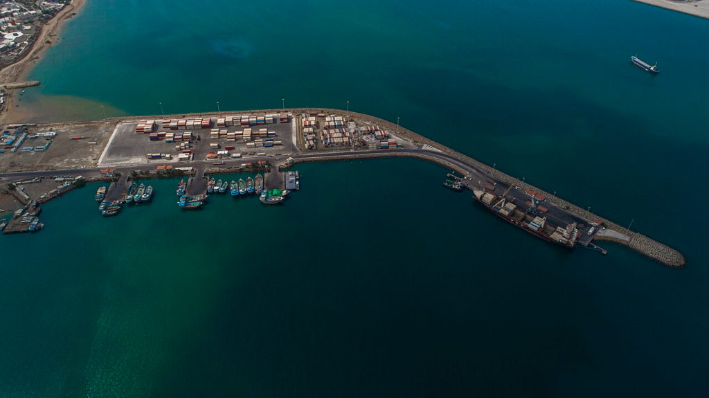
In May 2024, India Ports Global Limited and Iran’s Ports and Maritime Organization signed a long-term agreement for the Shahid Beheshti terminal.
The Indian government’s subsequent parliamentary disclosure confirmed that the agreement provides for equipping and operating the relevant cargo and container terminal for ten years.
Chabahar’s strategic importance lies partly in the alternative access it offers towards Afghanistan and Central Asia. India’s Ministry of External Affairs has explicitly identified its geographical position outside the Persian Gulf and its role in regional connectivity.
The contrast with IMEC is instructive.
IMEC proposes a new framework for linking South Asia, the Gulf and Europe through interconnected infrastructure systems. Chabahar focuses on establishing and strengthening access to different markets through an existing port location.
Both are associated with strategic diversification, but they are not identical projects, nor should they automatically be treated as mutually exclusive competitors.
They serve different potential markets and rely on different political, regulatory and transport arrangements.
Moreover, Chabahar’s commercial prospects depend on more than the operation of a maritime terminal. Its wider significance requires reliable inland connectivity, functioning customs systems, commercially viable freight movement and a stable international operating environment.
Geopolitical uncertainty can influence each of these conditions.
The urban implications are substantial. Successful transport corridors can encourage investment in warehouses, logistics parks, freight terminals, industrial estates and associated housing markets. However, a corridor can also pass through a region without generating significant local economic activity if freight movement remains highly specialised or poorly integrated with regional production.
This is the central distinction between territorial connectivity and territorial development.
A location can become more important within an international transport network without necessarily becoming more prosperous, inclusive or economically diversified.
For Indian planners, this suggests that evaluating international corridor initiatives requires attention to the entire logistics chain, including western coastal ports, inland rail connectivity, industrial clusters and metropolitan freight networks.
The question is not simply whether a new geopolitical route improves India’s international position. It is whether the resulting infrastructure creates sustainable economic linkages between ports, production systems and surrounding settlements.
Pipelines, Energy Security and the Changing Geography of European Infrastructure
While port investments frequently attract attention through their association with international trade, energy infrastructure provides some of the clearest evidence of geopolitical developments influencing investment priorities.
Europe’s changing energy supply arrangements demonstrate how energy security can alter the importance of coastal locations and transport networks.
Germany is particularly relevant.
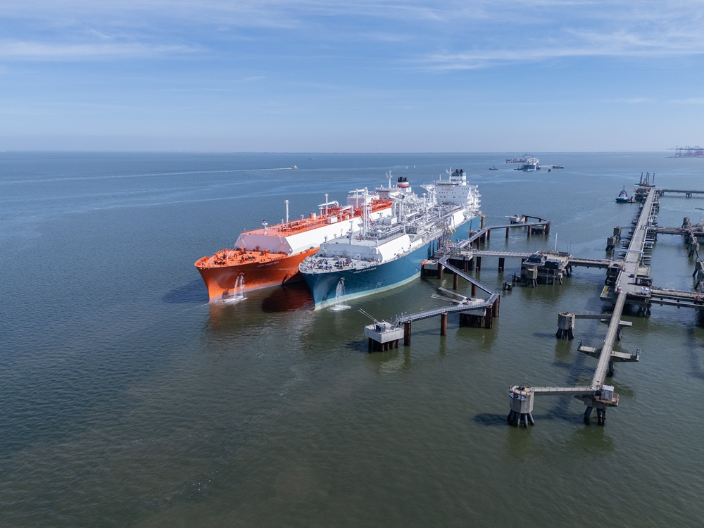
The reduction of dependence on Russian pipeline gas increased the strategic importance of alternative natural gas supply arrangements, including liquefied natural gas terminals and connections to the European gas network.
According to Germany’s Federal Network Agency, the country imported 106 terawatt-hours of natural gas through its LNG terminals in 2025. This represented 10.3% of total German natural gas imports.
The terminals included facilities at Wilhelmshaven and other German coastal locations.
These figures establish that LNG infrastructure had become an operational component of Germany’s supply system. They do not, however, establish the degree to which every individual terminal or associated investment has achieved its projected commercial return.
The development of LNG import capacity illustrates a change in the spatial requirements of energy security.
Pipeline-dependent supply networks are organised around fixed long-distance connections. LNG imports introduce a maritime interface that requires receiving facilities, regasification capacity, storage arrangements and onward pipeline connections.
This changes the infrastructural significance of coastal industrial areas.
However, the relationship between energy diversification and decarbonisation requires careful interpretation.
LNG is still a fossil fuel. Increasing LNG import capacity may improve flexibility in sourcing natural gas, but that does not make the associated infrastructure inherently compatible with long-term emissions-reduction objectives.
An energy-security investment may therefore create a planning trade-off between short-term supply resilience and the risk that capital-intensive fossil-fuel assets remain in use longer than intended.
The challenge is not simply choosing between security and sustainability. It involves designing infrastructure strategies that account for changing future demand, emissions constraints and the possibility of underused assets.
Rotterdam provides a complementary example through its emerging hydrogen infrastructure.
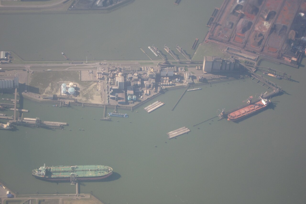
According to Gasunie, the first 32-kilometre section of the Dutch national hydrogen network, connecting Maasvlakte and Pernis within Rotterdam’s port-industrial area, was inaugurated in May 2026.
This infrastructure is intended to support connections between hydrogen production facilities and industrial consumers, with further network development planned.
Rotterdam’s port authority has also identified hydrogen production, import, storage and transportation as important components of its longer-term energy strategy.
The geographical significance of this transition lies in the relationship between existing industrial infrastructure and prospective new energy networks.
Ports with established pipeline corridors, industrial consumers, storage facilities and specialised terminals may be better positioned to accommodate new energy carriers than locations without comparable infrastructure.
Yet hydrogen infrastructure also involves uncertainty. Future utilisation depends on production costs, regulatory frameworks, industrial demand and the availability of competitively priced low-emission hydrogen.
The completion of a pipeline proves that transport infrastructure exists. It does not prove that an economically viable hydrogen market has reached the scale necessary to use it fully.
This distinction is especially important because energy infrastructure has long development and operating horizons.
The broader European experience therefore suggests that geopolitics may accelerate investment in alternative energy supply networks, but the resulting spatial pattern is shaped by existing industrial geography, public policy and technological transition.
The International Energy Agency’s assessment of European gas diversification reinforces the importance of cross-border infrastructure and procurement arrangements in determining energy security.
For planners, the consequence is a renewed need to coordinate ports, pipeline corridors, industrial land and environmental safeguards across administrative boundaries.
Energy networks cannot be understood exclusively as engineering systems. They are also long-term spatial commitments that influence industrial development, land availability and the environmental future of coastal regions.
The Urban Consequences: Why Strategic Infrastructure Does Not Guarantee Local Prosperity
The most important question for urban planning is not whether geopolitical considerations influence infrastructure investment. The evidence indicates that they can. The more consequential question is how these investments affect the regions in which they are located.
Ports can generate substantial economic activity, but their relationship with surrounding cities is complex.
An expanding container terminal may improve national trade capacity while simultaneously increasing freight traffic, land requirements and pressure on nearby transport corridors.
An LNG facility may improve the security of energy supply while occupying coastal industrial land and introducing additional environmental management responsibilities.
A new logistics corridor may strengthen regional connectivity without creating substantial local employment if its economic activities are concentrated in transport operations rather than diversified production.
The OECD’s study The Competitiveness of Global Port-Cities identifies the importance of port-related economic activity while also examining environmental externalities and the limitations of policies intended to produce port-city synergies.
Its findings challenge the assumption that improving port performance automatically results in equivalent improvements in urban prosperity.
This concern is especially relevant in an era when infrastructure can be financed or prioritised partly because of its strategic importance.
A national government may value a port for its contribution to geopolitical influence, supply-chain resilience or access to international markets. A city government may evaluate the same project through local employment, transport congestion, public services and environmental quality.
These objectives are not necessarily incompatible, but they are not automatically aligned.
India’s established maritime infrastructure provides a useful context for examining this relationship.
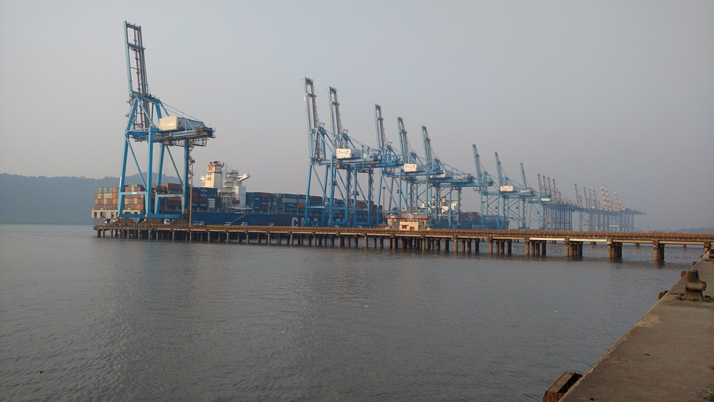
Jawaharlal Nehru Port in the Mumbai metropolitan region demonstrates the physical scale and operational specialisation of modern container-handling infrastructure. Such facilities form part of wider systems involving coastal shipping, freight terminals, warehousing, inland transport and industrial production.
The planning challenge extends beyond the port boundary.
Freight accessibility requires dependable connections to road and rail networks. Industrial expansion requires appropriately located land and utilities. Worker accessibility requires transport and settlement planning. Environmental management must address the relationship between operational areas and surrounding communities.
These issues are not unique to Indian ports.
The World Bank’s 2025 Port Reform Toolkit includes a dedicated module on the port-city interface. It identifies land-use conflicts, transport congestion, environmental impacts, stakeholder engagement and the relationship between port investment and urban development as central governance concerns.
This offers a useful framework for evaluating geopolitically significant projects.
A project should not be judged only by the amount of investment announced or the cargo capacity created. It should also be evaluated through its effects on the urban region.
For example, a planning assessment could examine the additional freight movement generated by a new terminal, the capacity of its inland transport connections and the likely distribution of traffic impacts across adjoining settlements.
It could evaluate whether local firms can participate in associated supply chains or whether most specialised economic activity remains controlled externally.
It could consider whether public expenditure on access roads, utilities and environmental mitigation is proportionate to the local economic benefits expected.
Critically, these assessments require transparent project-level evidence.
Statements that port investment creates jobs or promotes development may be reasonable objectives, but they are not substitutes for verified employment data, detailed economic analysis or evidence of actual changes in household welfare.
Similarly, environmental impacts should not be presumed simply because infrastructure is large. They should be established through appropriate baseline studies, impact assessments and monitoring.
The key issue is the distribution of benefits, costs and decision-making authority.
A strategically successful infrastructure project can still produce an uneven urban development outcome.
Conversely, well-integrated infrastructure can strengthen regional productivity when transport improvements are connected to existing businesses, local skills and complementary public investment.
For urban planners, the challenge is to make this integration an explicit objective rather than an assumed consequence.
Planning for a Geopolitically Fragmented Investment Landscape
The emerging infrastructure landscape creates difficult choices for metropolitan governments and planning institutions.
Historically, many infrastructure investment appraisals have focused on transport demand, operating efficiency, projected revenue, economic returns and environmental impacts. These criteria remain important.
However, projects exposed to geopolitical uncertainty also require explicit consideration of route security, international dependencies, supply diversification and changes in regulatory or diplomatic relationships.
The challenge is to incorporate these considerations without allowing strategic rhetoric to displace evidence-based appraisal.
A proposed port expansion should still demonstrate plausible demand. A pipeline should still have credible users. A logistics corridor should still establish why its proposed alignment is preferable to available alternatives.
Geopolitical importance cannot compensate indefinitely for weak project economics or inadequate local integration.
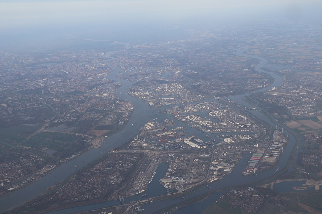
The experience of Rotterdam illustrates why existing infrastructure systems matter in this assessment. Its port-industrial landscape contains transport, storage, industrial and energy facilities developed over different periods and for different purposes. The emergence of hydrogen infrastructure builds partly upon these inherited spatial relationships.
An existing industrial network can therefore offer practical advantages that cannot be reproduced simply by designating a new strategic corridor.
Nevertheless, established infrastructure also creates constraints. Pipeline alignments, land-use patterns, hazardous-industry buffers, ecological restrictions and existing transport demands can limit future development options.
A defensible planning strategy should therefore proceed through several interconnected forms of assessment.
First, infrastructure proposals require scenario-based evaluation. Rather than assuming one geopolitical future, planners should examine how a project performs under alternative conditions, including disrupted shipping, changing energy demand, delayed corridor completion or unexpected increases in transport costs.
Second, strategic investment requires multiscalar governance. National ministries may negotiate international agreements, but metropolitan authorities often manage the roads, industrial areas, housing systems and environmental conditions affected by their implementation. Meaningful coordination between these institutions is necessary before major spatial commitments become irreversible.
Third, appraisal should distinguish between network connectivity and local value capture. A new transport connection may improve national or international accessibility without producing substantial benefits for the specific communities through which it passes. Local economic strategies, workforce development and appropriate land-use planning can influence whether those benefits are realised.
Fourth, environmental assessment should examine cumulative impacts, not just the footprint of individual facilities. A port terminal, freight railway, industrial estate and energy pipeline may be approved separately, while their combined effects alter air quality, ecological conditions, transport demand and land availability across a larger area.
Finally, infrastructure planning needs greater attention to adaptability. Projects designed around a single geopolitical assumption may become vulnerable if trading relationships, energy technologies or supply routes change.
Adaptability does not mean that every facility can be repurposed economically. Rather, it requires planners to evaluate possible alternative uses, future demand uncertainty and the financial consequences of underutilisation before committing public resources.
These principles are consistent with the emphasis placed on governance, risk management, environmental sustainability and port-city coordination within the World Bank’s Port Reform Toolkit.
They also suggest a broader shift in how planners should understand infrastructure resilience.
Resilience is not simply the ability to move goods along an alternative route. It includes the capacity of the wider urban and regional system to absorb disruption without imposing disproportionate costs on communities or public finances.
The geographical consequences of geopolitical investment should therefore be evaluated not only through the locations receiving capital but also through the relationships created between these locations and their surrounding territories.
Conclusion: Geopolitics Is Changing Infrastructure Priorities, but Cities Still Shape the Outcome
The evidence from maritime chokepoints, port ownership, international corridors and European energy infrastructure supports a qualified conclusion: geopolitics is influencing where infrastructure investment is directed and which assets governments consider strategically important.
The effects are not uniform.
Disruptions to the Suez Canal and Strait of Hormuz reveal the vulnerability of concentrated shipping networks. Piraeus illustrates the strategic implications of infrastructure ownership. IMEC and Chabahar demonstrate competing approaches to international connectivity, while Wilhelmshaven and Rotterdam show how energy-security and industrial-transition objectives can influence coastal infrastructure development.
These examples also establish the limits of geopolitical explanations.
Trade demand, industrial geography, infrastructure capacity, financing, regulation and technological change remain essential determinants of investment. Political significance does not guarantee commercial viability, and improved connectivity does not automatically ensure equitable urban development.
For architecture, urban design and planning, the critical issue is therefore not simply identifying which ports or corridors may become geopolitically important.
It is understanding how these investments interact with metropolitan land use, labour markets, environmental conditions and public infrastructure.
The emerging map of global investment may be increasingly influenced by geopolitical competition, but the developmental consequences of that investment will still depend on planning decisions made at regional and urban scales.
Geopolitics may determine which infrastructure receives strategic attention. Whether that infrastructure produces resilient and inclusive cities remains a question of governance, evidence and spatial planning.
References / Further Reading
- United Nations Conference on Trade and Development (2025). Review of Maritime Transport 2025: Staying the Course in Turbulent Waters.
- United Nations Conference on Trade and Development (2026). Strait of Hormuz Disruptions: Implications for Global Trade and Development.
- United Nations Conference on Trade and Development (2026). Strait of Hormuz Disruptions: Beyond Reopening, Lasting Impacts on Vulnerable Economies.
- International Maritime Organization (2026). Red Sea Area: Maritime Security Updates and Confirmed Incidents.
- World Bank (2025). Port Reform Toolkit, Third Edition.
- OECD (2014). The Competitiveness of Global Port-Cities.
- OECD (2013). The Competitiveness of Global Port-Cities: The Case of Rotterdam/Amsterdam, the Netherlands.
- Government of India, Ministry of External Affairs (2023). Memorandum of Understanding on the Principles of an India-Middle East-Europe Economic Corridor.
- Government of India, Ministry of Ports, Shipping and Waterways (2024). Long-term Main Contract for Development of Shahid Beheshti Port Terminal, Chabahar.
- Government of India, Ministry of Ports, Shipping and Waterways (2024). Development of Chabahar Port: Parliamentary Disclosure.
- European Commission (2025). Global Gateway Forum: Accelerating Digital Transformation through IMEC, EU-Africa-India Digital Corridor.
- European Union, Council of the European Union (2026). Global Gateway: EU Investment and Partnership Strategy.
- Germany’s Federal Network Agency (2026). Gas Supply Figures for 2025.
- Gasunie (2026). King Willem-Alexander and Minister Van Veldhoven Inaugurate First Section of the National Hydrogen Network.
- Port of Rotterdam Authority. Hydrogen in Rotterdam: Production, Import and Infrastructure Projects.
- International Energy Agency (2026). EU Phase-Out of Russian Gas Creates New Diversification Opportunities for Central and Eastern Europe.
- Piraeus Port Authority S.A. (2026). Annual Financial Report 2025.
- Hellenic Ports Association (2026). Piraeus Port Authority: Presentation of Financial Results for 2025.
Related reading on Urban Design Lab: Thane’s Data Centre Dispute: Who Decides Where the AI Economy Gets Built?; China Has Millions of Unsold Homes. What Does That Mean for Its New Cities?