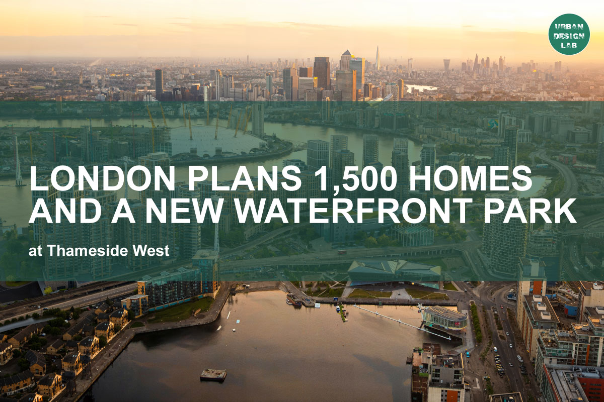


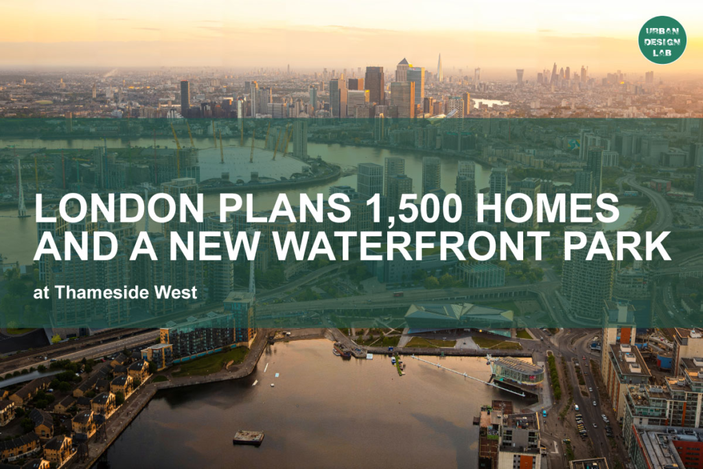
London’s eastern waterfront is entering another decisive phase of redevelopment. On 28 September 2026, developer Arada submitted a series of planning applications to the London Borough of Newham for the first stage of Thameside West, a major regeneration project on the western edge of the Royal Docks. The proposals cover nearly 1,500 homes across six buildings, a new seven-acre public park, around 1,000 trees, new streets and gardens, commercial ground-floor uses, and improved access to approximately one kilometre of waterfront. The first two residential buildings are proposed entirely for social rent, including three- and four-bedroom family homes. Arada Official Thameside West planning announcement
The numbers are substantial, but they are not the most important aspect of Thameside West. Its significance lies in the attempt to combine housing delivery, genuinely affordable tenure, landscape infrastructure, public access to the Thames, public transport investment and the reuse of strategically located former industrial land. It also sits beside the northern portal of the Silvertown Tunnel, within one of London’s largest regeneration areas, making the project a particularly revealing test of how contemporary London handles density, infrastructure and public value simultaneously. London Assembly
There is, however, an important distinction between ambition and delivery. The September 2026 proposals have been submitted for planning consideration. They are not yet evidence that 1,500 homes, a functioning public park, a new Docklands Light Railway station or a socially mixed neighbourhood will actually be completed as shown. The central question is therefore not simply whether Thameside West is large enough, green enough or visually attractive enough. It is whether its interconnected promises can survive planning, financing, detailed design, construction and long-term management.
Thameside West Is Not a Standalone Housing Scheme
Thameside West occupies more than 47 acres at the western end of the Royal Docks, near London City Hall and opposite Greenwich Peninsula and The O2. The wider site already has hybrid planning permission for at least 5,000 homes, making the current 1,500-home proposal the opening stage of a much larger urban transformation. Current Royal Docks and developer material values the overall development at approximately £2.5 billion. The Royal Docks Royal Docks project update, 28 September 2026
The site has a long planning history. A joint masterplan prepared for land controlled by GLA Land and Property Ltd and Silvertown Homes received consent in 2021. The Greater London Authority subsequently undertook land transactions required to coordinate the development with the Silvertown Tunnel, DLR land and adjacent Places for London property. A 2024 Mayoral Decision explicitly described Thameside West as a major housing site within the Royal Docks and Beckton Riverside Opportunity Area. London Assembly GLA Mayoral Decision MD3290 on Thameside West
The project was given new commercial momentum when Arada announced in November 2025 that it had agreed to acquire an 80 per cent stake in Thameside West. The earlier masterplan was associated with Foster + Partners, while the refreshed first stage is being progressed with Gensler, Arup and landscape practice Planit. Arada
This sequence matters. Thameside West is better understood as a long-duration infrastructure-led urban project than as a conventional residential estate. Roads, flood defences, public spaces, land ownership, transport systems and planning obligations have to be coordinated before individual buildings can function as a coherent neighbourhood.
That places the project within a much larger spatial strategy. In January 2026, the Mayor of London described the Royal Docks and Beckton Riverside Opportunity Area as having potential for more than 35,000 homes and 55,000 jobs. Thameside West is one of several strategic development sites expected to contribute to that expansion. London Assembly
The implication is important for evaluating the scheme. If Thameside West is judged only by the architectural quality of six residential buildings, much of its urban significance will be missed. The real test is whether it forms part of a connected piece of city extending beyond its ownership boundary.
Social Rent Could Be More Important Than the Overall Housing Number
The headline figure is nearly 1,500 homes, but the more consequential housing decision may be the proposed tenure of the first two buildings. Arada states that both would be 100 per cent social rent and would include three- and four-bedroom family homes. Arada Arada planning submission announcement
This is important because affordable housing is not a single tenure category. Social rent is generally more deeply discounted than intermediate products such as shared ownership or London Living Rent, and the London Plan explicitly identifies Social Rent and London Affordable Rent as low-cost rented housing allocated according to need and intended for Londoners on low incomes. London Plan Policy H6 requires affordable housing schemes to incorporate low-cost rented homes alongside intermediate housing, subject to the applicable planning route and local requirements. London Assembly London Plan Chapter 4: Housing
Family-sized social housing is particularly relevant in Newham. The borough’s Housing Delivery Strategy has previously identified overcrowding as a serious housing problem and linked it partly to poor affordability and insufficient family-sized accommodation. That evidence is not recent enough to quantify conditions in 2026 by itself, but it explains why bedroom mix as well as unit count matters when assessing a scheme such as Thameside West. Newham Council
There is also a source discrepancy that should not be concealed. Current Arada and Royal Docks material describes the existing Thameside West permission as providing 35 per cent affordable housing. A September 2024 GLA Mayoral Decision, however, stated that the scheme would provide 39 per cent affordable homes. Arada London The available public summaries reviewed here do not establish whether that difference results from altered calculations, phasing, tenure definitions or subsequent changes. It would therefore be methodologically unsound to present either percentage as an uncontested description of the whole project without reference to the underlying current planning schedule.
London’s planning context has itself been changing. The Mayor’s March 2026 Support for Housebuilding guidance introduced temporary adjusted thresholds, including a 35 per cent affordable-housing threshold for eligible residential schemes on public land, with at least 60 per cent of the affordable component required as Social Rent under that specific route. London Assembly Whether and how those provisions apply to individual Thameside West applications depends on their precise planning mechanism, given that the project builds upon an earlier hybrid consent.
The more defensible measure of success will therefore be completed homes by tenure, bedroom count and affordability, not a percentage announced at application stage. A large development can technically satisfy an affordable-housing target while failing to address particular local needs. Conversely, early delivery of secure family-sized social rent can materially change the social composition of a regeneration project before market phases dominate occupation.
A Seven-Acre Park Could Become the Project’s Most Important Civic Space
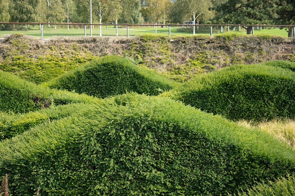
The public-realm proposal is unusually prominent within the first stage. Arada describes a seven-acre park containing around 1,000 new trees, complemented by smaller gardens, planted edges, woodland-style play areas, play trails and other spaces intended for everyday recreation. A group of 20 local residents is participating in workshops to help shape part of the park. Arada
These details shift the project away from a conventional tower-and-podium model in which landscaping fills residual land between buildings. The stated intention is landscape-led: buildings are arranged around streets, gardens, parks and shared spaces rather than treating open space purely as amenity associated with residential blocks.
That distinction matters because a park is most valuable when it performs several functions simultaneously. London Plan Policy G1 requires green infrastructure to be planned and managed as an integrated network that delivers multiple benefits. Policy G5 further expects major development to treat urban greening as a fundamental design component, incorporating measures such as trees, high-quality landscapes, green roofs and nature-based drainage. London Assembly London Plan Chapter 8: Green Infrastructure
Research supports this multifunctional approach but also warns against treating greenery as automatically beneficial. The World Health Organization’s review of urban green space associates accessible green environments with pathways including physical activity, social interaction, psychological restoration, lower heat exposure and reduced environmental stressors. It also stresses that accessibility, maintenance, safety, quality and actual use influence outcomes. World Health Organization
A useful local precedent is Thames Barrier Park farther east in the Royal Docks. Opened in 2000 on former industrial land, the seven-hectare park demonstrated how contaminated waterfront land could be transformed into a major publicly accessible landscape while retaining references to dockland history. The Royal Docks
Thameside West need not imitate that park formally. The lesson is institutional rather than stylistic. High-quality design at opening is only the beginning. Long-term maintenance, unrestricted public access, clear pedestrian connections, programming, shade, play, biodiversity and the ability to accommodate users who do not live in the development determine whether an open space becomes genuine urban infrastructure.
The project’s proposed 1,000 trees should consequently be judged not only by planting numbers. Species diversity, canopy establishment, soil volume, irrigation, replacement policies and survival after five or ten years will matter more than the planting-day total. Similar caution applies to biodiversity claims. A landscaped park may look green without functioning as a particularly rich habitat.
The New DLR Station May Determine Whether Density Works
High-density residential development is considerably easier to justify when it is integrated with high-capacity public transport. Thameside West’s transport proposition therefore deserves as much attention as its architecture.
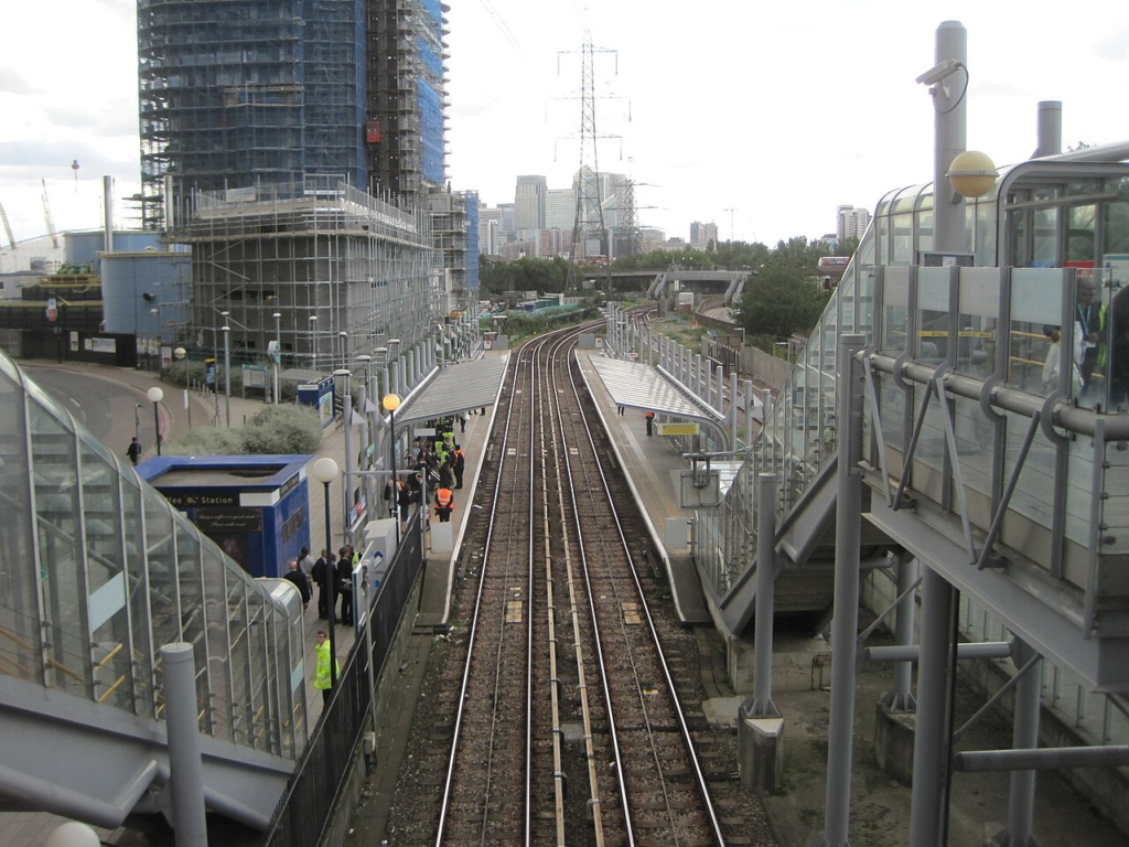
Arada states that it is working with Transport for London on the design development of a new Docklands Light Railway station, with the intention that it should open in time for the arrival of the site’s first residents. Importantly, the September announcement describes this as work in progress rather than an already operational or fully delivered station. Arada
That distinction should remain visible in public discussion. A proposed station can support planning arguments about density and reduced car dependence, but those benefits are only realised if the station is funded, approved, constructed and operating at the relevant stage of occupation.
The existing DLR is already central to the spatial structure of the Royal Docks. Thameside West also sits close to one of London’s newest pieces of road infrastructure. The 1.4-kilometre twin-bore Silvertown Tunnel opened on 7 April 2025 between Silvertown and Greenwich Peninsula. Transport for London introduced user charging at both Silvertown and Blackwall tunnels and expanded cross-river bus provision as part of the scheme. Transport for London Transport for London: Silvertown Tunnel
The juxtaposition creates an unusual urban-design problem. A new high-density neighbourhood is being planned beside major highway infrastructure while simultaneously aspiring to be transit-oriented and pedestrian focused. This means the internal street network, walking routes, cycling infrastructure and station entrances will have to counteract the spatial severance normally associated with large road portals and infrastructure compounds.
March 2026 Royal Docks Enterprise Zone Programme Board minutes recorded that the Thameside West plans included a new public park over the Silvertown Tunnel. The same minutes noted that the site had been used as a major construction worksite during the tunnel project. London Assembly
This is potentially powerful urban repair. Infrastructure that historically divided or sterilised land can sometimes be incorporated into parks, development platforms or new connections. Yet such interventions can also produce awkward residual spaces, noise constraints and pedestrian barriers if technical infrastructure dictates the public realm.
For Thameside West, the question is not therefore whether transport is nearby. It is whether transit access, walking, cycling and public space are spatially integrated closely enough that households can realistically organise daily life without routine car dependence.
The Waterfront Has to Work as Climate Infrastructure Too
Waterfront development creates a familiar tension. Proximity to water generates visual, recreational and commercial value, but it also creates exposure to tidal and climate risks that must be managed over timescales much longer than an individual development phase.
The Environment Agency’s Thames Estuary 2100 strategy states explicitly that rising sea levels and ageing flood defences will increase future flood risk along the Thames. Its adaptive strategy requires flood defences, land-use planning, habitat creation and infrastructure investment to evolve as climatic conditions change. GOV.UK Environment Agency: Thames Estuary 2100
The Royal Docks forms its own TE2100 policy unit. Environment Agency mapping notes that areas close to the Thames and other waterways would face significant flood risk without existing defences. GOV.UK
Thameside West’s planning history already recognises this condition. The approved outline proposals included a new flood-defence wall, ecological habitat adjacent to the River Thames, landscape works and public open spaces. London Assembly
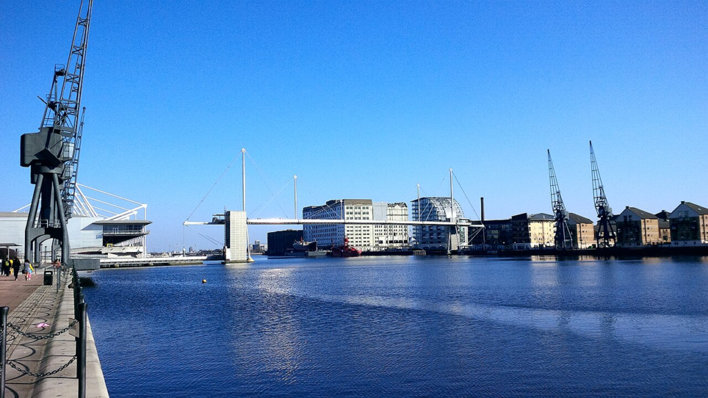
Consequently, the proposed kilometre-long active waterfront should not be conceived merely as a promenade with views. It is part of a dynamic river edge where public access, ecological function, flood protection and future adaptation must coexist.
There are useful international precedents. Hamburg’s HafenCity, another large regeneration project on former port land, integrates flood resilience into urban morphology. Instead of severing the district from the water with a conventional continuous dike, much of the new city is raised on flood-protected platforms while lower promenades are designed to retain direct contact with the Elbe and tolerate occasional inundation. HafenCity’s official development authority describes this approach as a means of combining resilient development with approximately 10.5 kilometres of waterside promenade. Hafencity HafenCity Hamburg: flood-resilient infrastructure strategy
HafenCity is not a template that can simply be copied onto the Thames. Hydrological conditions, flood-defence systems, legal responsibilities and site geometry differ. The comparison instead illustrates a principle: flood engineering should help shape urban space rather than appearing as a technical barrier added after urban design has been completed.
At Thameside West, the long-term value of the river edge will depend on whether flood resilience, biodiversity and pedestrian access are treated as one design problem. A waterfront that is attractive today but difficult to adapt later would represent a costly failure of temporal planning.
Urban Character Will Depend on Streets and Ground Floors, Not Just Towers
Contemporary regeneration is frequently presented through distant skyline views. Everyday urbanism operates at a different scale: the entrance, pavement, corner shop, playground, route to the station and transition between private building and public street.
This makes one aspect of the September proposals particularly relevant. Arada states that the six buildings are being organised around a network of streets, gardens, parks and shared spaces, while ground-floor units facing the park are intended to accommodate amenities including cafés and restaurants. The architectural treatment is also being adjusted according to whether buildings address the waterfront, park or Bell Lane. Arada
That approach has the potential to create spatial differentiation within a large development. A neighbourhood of 1,500 homes should not feel like six objects standing in one landscaped compound. It requires recognisable streets, corners, frontages and transitions.
Yet “active frontage” should not be treated as synonymous with rows of commercial units. Retail viability depends on population, footfall, rent, phasing and the wider economy. Too much commercial floorspace delivered before sufficient demand exists can result in shuttered units and blank streets. Conversely, community facilities, workspace, residential entrances and transparent shared amenities can create activity without relying exclusively on cafés and restaurants.
The industrial heritage of Silvertown offers another design resource. Arada says ropework-inspired details and paths will refer to the area’s history. Such references can add local specificity, but heritage becomes superficial if it is reduced to decorative motifs while surviving spatial, material or infrastructural evidence disappears.
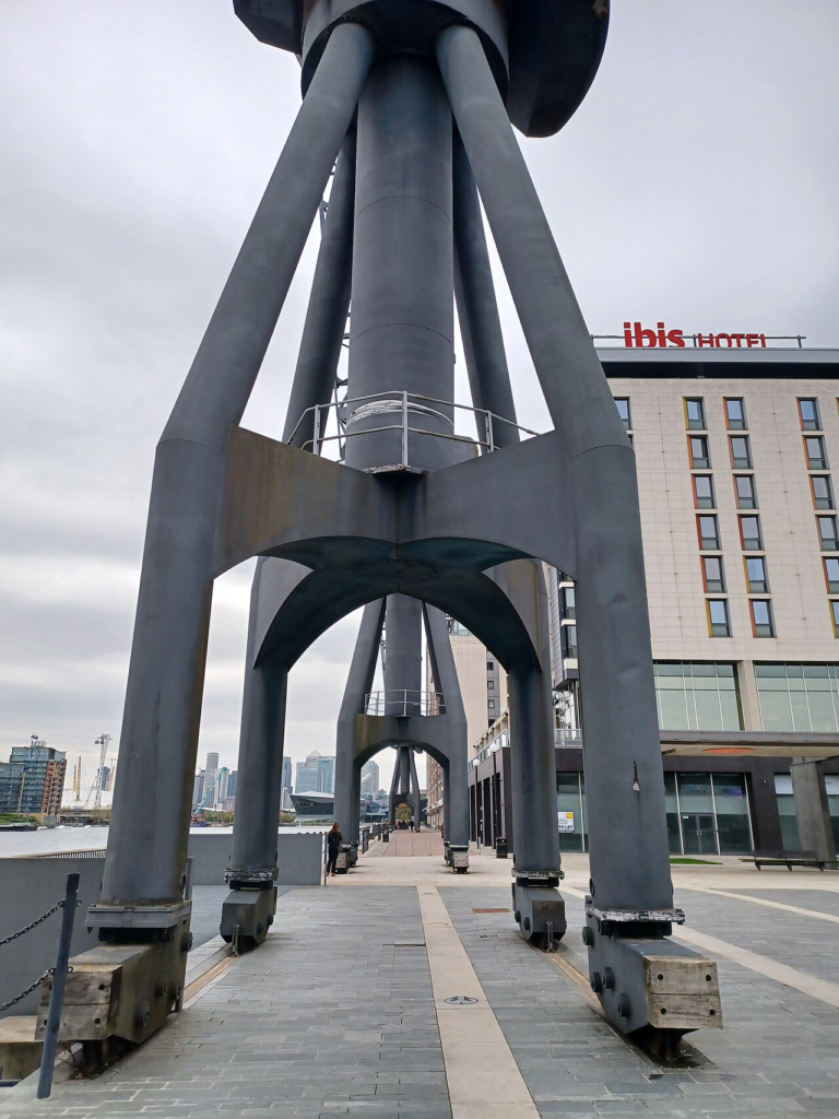
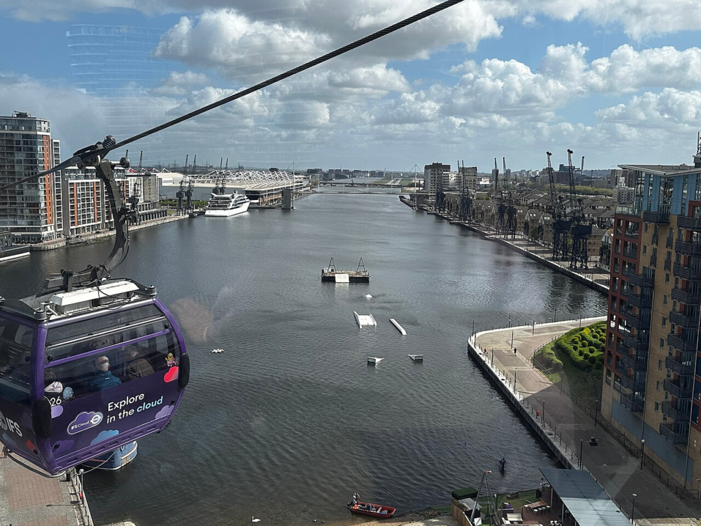
The Royal Docks still contains historic cranes, warehouses, dock edges and industrial structures that communicate the scale and function of the former port directly. The strongest redevelopment strategies normally use heritage to structure spatial identity rather than merely applying it as visual branding.
This also raises questions about density. Towers are not inherently hostile to good urbanism, nor does lower height automatically create better streets. The relevant relationship is between building height, block dimensions, sunlight, wind, entrances, frontage, public-space enclosure and pedestrian permeability. These attributes require assessment at human scale.
The first-stage redesign may therefore be more consequential than a change in architectural appearance. If it produces more permeable blocks, clearer routes, better ground-floor relationships and genuinely public spaces, it can improve the underlying urban structure. If the emphasis remains largely visual, its contribution will be substantially weaker.
Delivery and Governance Are the Real Tests of the Masterplan
Thameside West demonstrates why major urban projects cannot be evaluated solely through masterplan drawings.
The site involves multiple public and private actors, including Arada, Silvertown Homes, GLA Land and Property, the Royal Docks Team, Transport for London, Places for London and the London Borough of Newham. It also contains infrastructure associated with the Silvertown Tunnel and potential future DLR provision. London Assembly
That complexity explains the project’s long gestation. It also makes governance central to design quality.
In May 2026, the GLA approved an £84,000 Planning Performance Agreement with Silvertown Homes Ltd to support GLA planning work associated with the Thameside West proposals. London Assembly GLA Planning Performance Agreement for Thameside West Such agreements are procedural rather than evidence that permission will be granted, but they illustrate the amount of coordination required for a scheme of this scale.
The project team stated in July 2026 that it expected work on the first stage to begin in early 2028, subject to planning approval. The applications were subsequently submitted in September. Arada An early-2028 start should therefore still be understood as a programme intention rather than a guaranteed construction date.
Community participation should be examined with similar care. Twenty residents helping to co-design part of the park is a constructive mechanism, but it is not equivalent to demonstrating broad community consensus. The Thameside West consultation website itself describes engagement as ongoing and seeks feedback on greenery, walking and cycling, community facilities and spaces for young people. Thameside West
For an urban project expected to evolve over many years, participation must continue beyond planning submission. Future residents and surrounding communities will experience decisions about park management, commercial leasing, public-space rules, construction sequencing and transport access that may not yet be visible in current renderings.
The most meaningful monitoring framework would therefore follow outcomes over time: actual affordable homes completed, social-rent tenure retained, DLR infrastructure delivered, public access maintained, trees surviving, commercial frontages occupied, flood infrastructure performing, and pedestrian routes connecting successfully beyond the site.
Those are harder metrics than gross development value or unit count, but they are much closer to what determines whether a masterplan eventually becomes a functioning neighbourhood.
Conclusion
Thameside West is significant because several of London’s hardest urban questions converge on one 47-acre waterfront site.
The September 2026 applications propose nearly 1,500 homes across six buildings, two initial buildings dedicated to social rent, a seven-acre park with around 1,000 trees, new streets and shared spaces, a kilometre-scale waterfront connection and continued work toward a new DLR station. These proposals sit within an already consented masterplan for at least 5,000 homes and within a Royal Docks growth strategy encompassing tens of thousands of additional homes. Arada
There are good reasons to regard the first stage as potentially important. Social-rent family housing addresses a more specific need than generic “affordable” supply. A large public park could give the neighbourhood civic structure before full build-out. A new DLR station could align density with mass transit. Opening the Thames edge could turn previously inaccessible infrastructure land into public city space. Flood-resilient landscaping and biodiversity measures could make the waterfront perform environmentally as well as recreationally.
None of those outcomes should yet be treated as accomplished facts.
Planning permission, funding, detailed design, phasing and long-term management still separate the current proposals from the neighbourhood depicted in visualisations. The new DLR station in particular should be described as intended and under development with TfL, not as completed infrastructure. Construction beginning in early 2028 likewise remains subject to approval.
Thameside West will deserve attention precisely because the standards against which it should be judged extend beyond architecture. The most important evidence will emerge after construction begins: who can afford to live there, whether the park remains genuinely public, whether walking and transit outperform car dependence, whether the river edge adapts to climate risk, and whether 5,000 homes ultimately become a connected piece of East London rather than a collection of valuable buildings beside the Thames.
If those elements are delivered together, Thameside West could become an instructive model for waterfront regeneration. If they become separated during implementation, the project may still deliver housing, but it will have missed the larger urban opportunity.
References / Further Reading
- Arada, “Arada submits planning applications for Thameside West”, 28 September 2026
- Royal Docks, “Arada submits plans for 1,500 homes at Thameside West”, 28 September 2026
- Royal Docks, “Arada accelerates plans for 5,000-home Thameside West scheme”, 21 July 2026
- Greater London Authority, MD3290 Thameside West: Land Transfers and Acquisitions
- Greater London Authority, Thameside West Planning Performance Agreement, 2026
- London Plan 2021, Chapter 4: Housing
- London Plan 2021, Chapter 8: Green Infrastructure
- Greater London Authority, Support for Housebuilding London Plan Guidance, March 2026
- Transport for London, Silvertown Tunnel
- Transport for London, Travel in London 2025 Annual Overview
- Environment Agency, Thames Estuary 2100
- Environment Agency, Royal Docks Policy Unit: Thames Estuary 2100
- World Health Organization, Urban Green Spaces and Health
- World Health Organization, Urban Green Space Interventions and Health: Review of Impacts and Effectiveness
- Royal Docks, Thames Barrier Park consultation and historical information
- HafenCity Hamburg, Infrastructure and Flood Protection
- HafenCity Hamburg, Facts and Figures
Related reading on Urban Design Lab: Revitalizing Battersea: London’s Iconic Power Station Redevelopment; UN Habitat 2026 Global Housing Crisis and the Future of Housing Policy