Best Free Datasets for Urban Designers and GIS Users

Urban designers and GIS professionals rely on high-quality datasets to inform planning, analysis, and decision-making processes. Fortunately, numerous free resources are available to support these endeavors. Below is a curated list of top free datasets, categorized by their relevance to various design and analysis needs:

1. OpenStreetMap (OSM)

OpenStreetMap is a collaborative project that provides free, editable maps of the world. It offers comprehensive data on roads, buildings, land use, and points of interest, making it invaluable for urban planning and GIS applications. The data is continuously updated and can be downloaded in various formats, including GeoJSON and Shapefile.

2. Natural Earth

Natural Earth offers public domain datasets suitable for small-scale maps and cartographic projects. It includes vector and raster data on political boundaries, physical features, and populated places, which are useful for regional and global analyses.

3. Data.gov

As the U.S. federal government’s open data portal, Data.gov hosts over 500,000 datasets across various sectors, including agriculture, climate, education, and public safety. Urban planners can access infrastructure datasets, environmental monitoring records, and federal program performance data, facilitating comprehensive analyses and planning.

4. Esri Open Data Hub

Esri’s Open Data Hub provides access to over 250,000 free GIS datasets from more than 5,000 organizations worldwide. The platform offers a vast array of local and regional datasets, supporting diverse urban planning and GIS projects.

5. GeoAtlas

GeoAtlas is an interactive platform designed to help users discover high-quality public geospatial datasets from around the world. It organizes datasets by country and industry sector, facilitating access to authoritative GIS data sources for urban planning, environmental analysis, and infrastructure mapping.

6. DLR Global Urban Footprint (GUF)

The German Aerospace Center’s GUF provides a global 12m resolution built-up area mask derived from TanDEM-X radar data. This dataset offers one of the finest freely available global urban extent datasets, useful for urban extent mapping, settlement delineation, and urban growth monitoring.

7. Microsoft Building Footprints

Microsoft’s dataset includes 1.4 billion building footprints derived from Bing Maps imagery across 225 regions. Released under the CDLA Permissive 2.0 license, this dataset is valuable for urban planning and population estimation.

8. Google Open Buildings

Google’s open building footprint dataset covers Africa, South Asia, Southeast Asia, and Latin America, derived from high-resolution imagery. This dataset is useful for urban growth monitoring and infrastructure planning.

9. NextGIS Data

NextGIS offers ready-to-use datasets for GIS projects, including basemaps, elevation models, and building footprints. These datasets are compatible with QGIS, ArcGIS, and other GIS applications, supporting various urban design and analysis tasks.

10. Cityscapes Dataset

The Cityscapes Dataset is a large-scale dataset for semantic urban scene understanding, comprising stereo video sequences recorded in streets from 50 different cities. It includes high-quality pixel-level annotations, making it suitable for training and testing approaches for semantic labeling in urban environments.

11. ReCo Dataset

The ReCo Dataset is the first and largest open-source vector dataset related to real-world residential community layouts. It includes 37,646 residential community layout plans, covering 598,728 residential buildings with height information, useful for residential community layout planning and spatial evaluation.

12. Open Government Geospatial Data on Buildings

This dataset provides open government geospatial data on buildings, supporting the planning of sustainable and resilient cities. It includes over 100 million buildings from 28 countries, offering valuable information for spatial analyses and urban planning.

Conclusion

Access to high-quality, free datasets is essential for urban designers and GIS professionals. The resources listed above offer a diverse range of data types and coverage, supporting various aspects of urban planning, analysis, and design. By leveraging these datasets, professionals can enhance their projects and contribute to the development of sustainable and resilient urban environments.

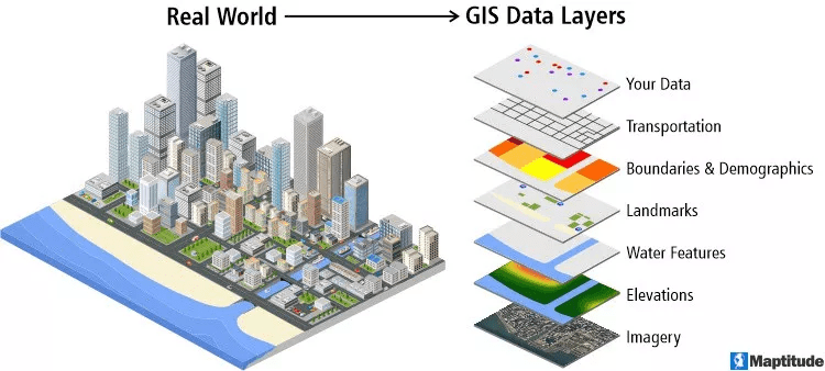
GIS, or Geographic Information Systems, is a powerful tool for urban designers and planners. It helps us analyze and visualize complex data, allowing us to make smarter decisions about our cities. By using different datasets, like information on land use, population, and transportation, we can get a complete picture of how a city works. But getting good data can be tough and expensive. The good news is, there are a ton of free resources available to help students and professionals get the information they need without the high cost. These free datasets cover a wide range of topics, from population and the environment to infrastructure and how people move around. By using these resources, we can do detailed site analysis, see how new projects might impact an area, and create proposals backed by solid evidence. This article will explore some of the most valuable free datasets that are essential for any urban designer or GIS professional. We’ll focus on reliable and useful data sources that are easy to use with common GIS , helping you solve complex urban problems with strong, evidence-based solutions.

The Building Blocks: Free Basemaps and Global Data

Every urban design project needs a good starting point, and that means having a solid basemap and access to global data. OpenStreetMap (OSM) is a fantastic, community-driven project that offers incredibly detailed, street-level data for the whole world. Unlike maps from private companies, OSM is crowdsourced, so it often has more current and local information, like building outlines, public transit routes, and local landmarks.

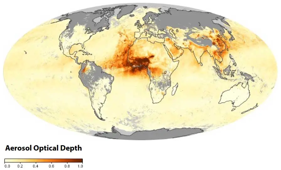
This makes it a priceless resource for small-scale urban studies. For bigger projects covering entire countries, Natural Earth provides free vector and raster map data at different scales. Its clean lines and built-in data layers are perfect for making professional-looking maps that are easy to read. And for understanding our planet’s environment, NASA Earth Observations (NEO) offers daily data on things like air pollution and sea temperature, which are vital for understanding a city’s environmental context. These datasets are the foundation of any GIS analysis, giving us the essential geographic background to build all other data layers on. 

NASA Earth Observatory GIS Data

Understanding People: Demographics and Economic Data

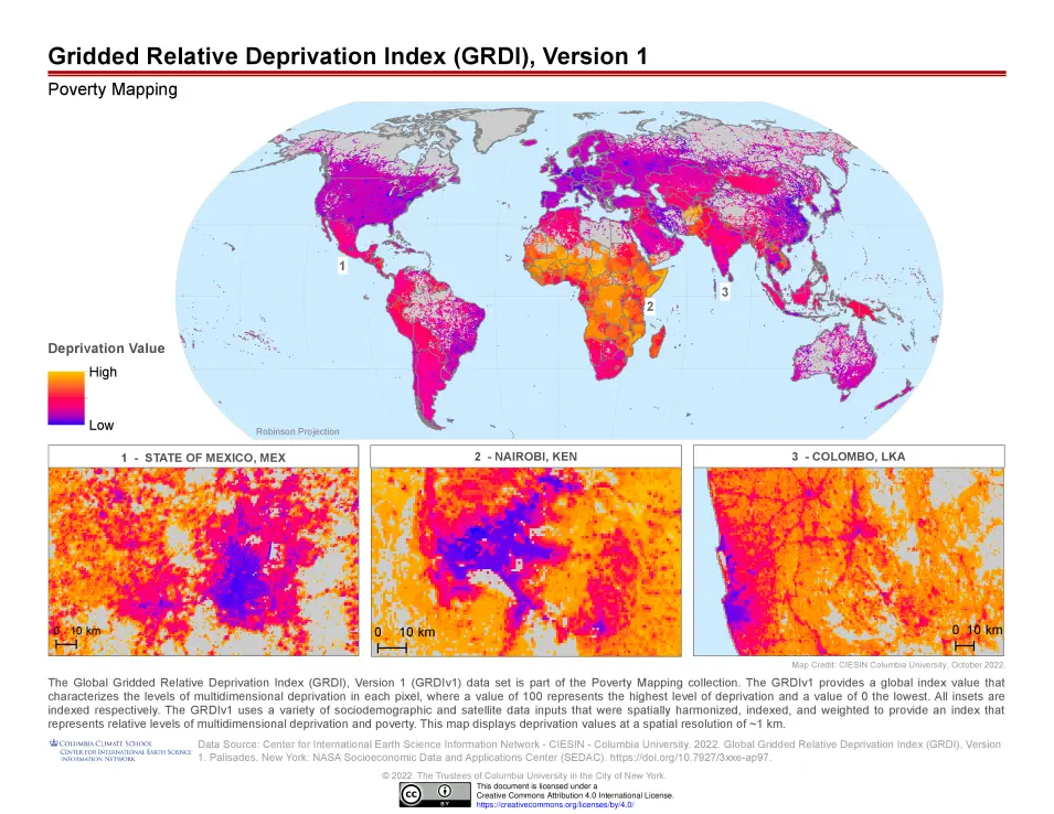
To design for people, you first need to understand them. Datasets on population and demographics are key to everything from planning public services to making sure new developments are fair for everyone. The Urban Institute Data Catalog is a great place for U.S.-specific data, offering open datasets on housing, race, and economic growth. For a global view, NASA’s Socioeconomic Data and Applications Center (SEDAC) provides population data and other information on how humans and the environment interact, which is super useful for big urban studies.
Plus, many government websites, like Data.gov, have a ton of information from various U.S. federal agencies, including data on transportation, health, and crime. By bringing all this data into a GIS, we can find out which communities need more support, check the social impact of our designs, and create plans that truly serve diverse populations. The availability of this data helps planners go beyond guesswork and make decisions based on real numbers and evidence. 

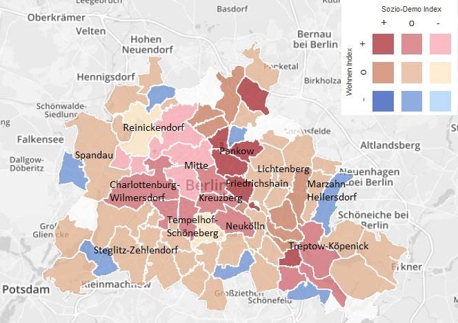
Global Deprivation Map from NASA SEDAC

Source: Website Link

Getting Around: Data for Transportation Networks

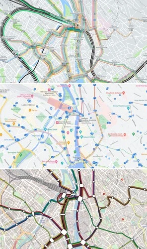
How people move around a city is a huge part of urban design, and we need good data to analyze traffic and plan new transport systems. Once again, OpenStreetMap is an incredible resource, providing detailed info on roads, public transit lines, and even bike paths. Because it’s crowdsourced, this data is often more up-to-date and specific than official sources. For public transit, the General Transit Feed Specification (GTFS) has become the standard for sharing bus and train routes and schedules.

This data, often provided by transit agencies, lets planners analyze how accessible an area is and optimize transportation services. For real-time traffic info, some private companies offer datasets, and portals like Esri’s Open Data Hub bring together over 250,000 datasets from various organizations, including some on transportation and infrastructure. By using these resources, urban designers can create smarter, more efficient, and fairer transportation systems that work for everyone. 

Visualizing Transportation and Mobility Data

Green Cities: Environmental and Land Use Data

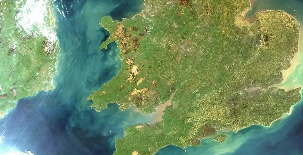
Today, environmental factors are key to urban design, and free datasets can provide crucial information for creating sustainable and resilient cities. The United States Geological Survey (USGS) Earth Explorer is a major source for high-resolution satellite and aerial images, which are perfect for mapping how land is used and seeing how it changes over time. It has data for areas all over the world, not just the U.S.. For a closer look at a city’s landscape, OpenTopography offers detailed terrain data, which is essential for understanding the lay of the land and for things like flood risk assessments.
The UNEP GEOdata Portal also provides a huge range of data on global environmental issues, including forest cover and climate. These tools allow designers to analyze environmental risks, like flood zones and urban heat islands, and plan for green spaces and conservation efforts. By using this data, we can promote sustainable development and build more resilient and eco-friendly cities. The fact that this information is free is a huge help for students and professionals on a budget. 


Satellite View of Great Britain and Ireland

Planning for the Future: Public Health and Community Data

Beyond physical infrastructure, urban designers must consider the well-being of a community, and free public health data is vital for this. By using datasets from sources like Data.gov, which includes information on health, crime, and social services, planners can identify neighborhoods with a lack of access to healthy food, green spaces, or healthcare facilities. This allows them to design interventions that promote better health outcomes, such as creating more walkable streets or adding public parks. Additionally, data on community assets, such as schools, libraries, and community centers, helps in mapping out social infrastructure.
The UN-Habitat Urban Indicators Database provides global data on various urban issues, including poverty and social equity, which is crucial for understanding social inequalities. By overlaying this information with demographic data, urban designers can create more inclusive and equitable spaces. This kind of data-driven approach ensures that our plans don’t just focus on buildings and roads, but also on the people who will use these spaces, making sure every resident has a chance to thrive. 

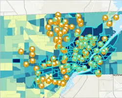
GIS Map of Community Assets and Public Health Data

The availability of free and open-source datasets has revolutionized urban design and GIS, making data-driven planning more accessible to everyone. The resources we’ve talked aboutfrom basic maps and population stats to detailed transportation and environmental dataprovide a powerful set of tools for both students and pros. By using these datasets, urban designers can create communities that are more informed, fair, and sustainable. But it’s important to remember that while this data is free, you should always check its accuracy, as crowdsourced information can vary. We need to combine this hard data with insights from community members to create designs that truly work. The future of urban planning is all about collaboration and being data-rich, and these free datasets are the building blocks we need to tackle the complex problems our cities face. It’s a field that’s always changing, and staying up-to-date on new data sources and technologies is key to your success.

Shatakshi Prabhakar Patil

Shatakshi Patil is a passionate urban designer with a strong foundation in architecture and a commitment to creating inclusive, sustainable spaces. She brings a global perspective to her work, combining strategic thinking with technical proficiency in urban planning and design. Known for her initiative and research-driven approach, she excels at transforming complex urban challenges into people-focused solutions. Her work reflects a balance of creativity, precision, and a deep sensitivity to context.

Leave a Reply

Your email address will not be published. Required fields are marked *

This site uses Akismet to reduce spam. Learn how your comment data is processed.

Related articles

UDL Thesis Publication 2025

Call for Abstracts now open!

UDL GIS

MASTERCLASS

Urban Mapping, Analysis and Representation

Session Dates

12th-16th October, 2026

Curating the best graduate thesis projects globally!

Publish your work and get recognized globally!

Free E-Book

From thesis to Portfolio

A Guide to Convert Academic Work into a Professional Portfolio”

Urban Design Lab

Be the part of our Network

  • Stay updated on workshops, design tools, and calls for collaboration

  • Thesis Report Writing for Architecture and Urban Studies

    Join Our WhatsApp Group

    Recent Posts

    Sign up for our Newsletter

    “Let’s explore the new avenues of Urban environment together “

    E-Book- From Thesis To Portfolio

    A Guide to Convert Academic Work into a Professional Portfolio