Evidence based article | Updated 30 September 2026
Urban street projects are decided at a difficult intersection of competing demands. A limited right of way may need to carry buses, cyclists, pedestrians, freight, drainage, trees, parking, emergency access and through traffic, while also supporting local commerce and public life. These conflicts are not new, but the need to resolve them early is becoming more urgent. The World Health Organization reports approximately 1.19 million road traffic deaths annually, with pedestrians, cyclists and motorcyclists accounting for more than half of fatalities.
Autodesk introduced Forma Street Design on 15 September 2026 as a cloud based early stage street design tool and opened a waitlist for a closed beta. This timing matters. Street design is often constrained not only by engineering standards but by fragmented workflows: GIS context sits in one system, preliminary geometry in another, vehicle path checks elsewhere, and stakeholder material in presentation software. By the time alternatives are assembled, the practical room for change may already have narrowed.
The central question is not whether a new digital tool can draw a bus bulb out or adjust a lane. It is whether it can improve the quality, transparency and democratic legitimacy of early design decisions. Forma Street Design may become valuable as a structured review environment for comparing geometrically credible alternatives in context. It should not, however, be treated as an automated mobility planning system or evidence that an option is safer, more equitable or operationally successful. Its contribution will depend on how agencies connect rapid geometric iteration to local policy, observed movement, safety analysis, accessibility review and post implementation evaluation.
Street Design Is a Public Interest Decision Not Only a Geometric Exercise
Contemporary street design has moved beyond the narrow objective of moving the greatest possible number of vehicles through a corridor. The Federal Highway Administration defines a Complete Streets approach as one that accommodates pedestrians, cyclists, public transport users, children, older people, people with disabilities, motorists and freight vehicles. This does not mean that every street must contain every mode. The same report recognises that right of way constraints can make this impossible and identifies connected networks, including complementary parallel routes, as a practical response.
That distinction is crucial for digital review. A street level plan may look balanced while concealing a network failure. A protected cycle lane that ends before a major junction, a bus lane without an accessible boarding environment, or a widened footway interrupted by poorly managed driveways may not provide meaningful access. The Global Street Design Guide frames success more broadly than traffic movement: access, safety, mobility, environmental quality, health, economic value and quality of life all matter.
Street design also involves conflict between valid public interests. A tighter corner radius may slow turning vehicles and shorten pedestrian crossing distance, yet it must still accommodate essential service or emergency movements where required. Removing curbside parking can create space for trees, cycle tracks or bus stops, but can also alter loading arrangements for shops and residents. Software can make these trade offs visible. It cannot decide their political or distributive acceptability. Early review must therefore be treated as evidence building rather than decorative visualisation.
Suggested visual: Forma Street Design interface showing an intersection concept within its surrounding context.
Image link: https://damassets.autodesk.net/content/dam/autodesk/www/images/cropped-1788212639.jpg
Suggested caption: Early stage review should make competing uses of limited right of way visible before design choices harden.
Credit: Autodesk. Copyrighted product image. Use only with Autodesk written permission and retain the source attribution.
What Forma Street Design Actually Offers
Autodesk describes Forma Street Design as an early phase tool for civil engineers and transportation planners. At the time of writing it remains in development and is available through a closed beta waitlist, not as a mature, independently evaluated public product. That limitation should shape professional expectations.
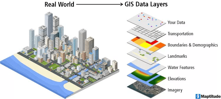
The announced capabilities are relevant to street review. Autodesk states that users can import GIS layers, terrain, adjacent buildings and property boundaries; alter alignments, curve radii, lane widths and grades; generate intersections; conduct swept path analysis through Autodesk Vehicle Tracking; and examine synchronised plan and section views. It also proposes handoff of alignments, assemblies and subassemblies to Civil 3D for detailed engineering.
These functions address a genuine workflow problem. Street projects frequently require repeated changes after a client, traffic engineer, transit agency or community representative raises a practical objection. If revising an alternative requires extensive redraw, teams may evaluate fewer options or communicate only the option that is easiest to produce. A parametric context linked model can lower that friction. It can allow a team to compare a bus bulb out against a conventional curb alignment, or a protected cycle facility against a mixed traffic arrangement, while checking whether a specified vehicle can negotiate the geometry.
The product claims should nevertheless be read precisely. Autodesk says the Street Design workflow itself does not use AI to design streets; AI powered rendering in Forma Board is intended for stakeholder visualisation. A rendered proposal may help explain intent, but it is not a simulation of future pedestrian activity, traffic safety, accessibility or street life. No public, independent evidence was identified of safety outcomes, travel time savings, construction cost accuracy or equity impacts attributable to the closed beta tool. Pilot comments are early implementation observations, not peer reviewed evaluation.
Suggested visual: Official Forma Street Design visual showing live review of street geometry.
Image link: https://damassets.autodesk.net/content/dam/autodesk/www/images/cropped-1788212639.jpg
Suggested caption: Parametric geometry can improve option comparison, but it does not itself demonstrate public outcomes.
Credit: Autodesk. Copyrighted product image. Use only with Autodesk written permission and retain the source attribution.
From Faster Iteration to Better Design Review
The strongest use of Forma Street Design would be within a disciplined review sequence. The first stage should be a policy and place brief, not a blank digital canvas. Teams should establish the corridor role in the wider network, its safety history, desired speed environment, public transport function, walking and cycling catchments, land use edges, freight needs, drainage conditions, tree canopy objectives and accessibility requirements. This prevents the software from optimising whichever variable is easiest to draw.
The second stage is option construction. Rather than presenting one preferred scheme and a nominal do nothing alternative, a review should test genuinely different spatial allocations. For a constrained commercial street, these could include retaining general traffic lanes with wider footways, creating a bus priority alternative, developing a protected cycle alternative, or using a timed shared curb strategy. Each option should be represented at the same level of detail and evaluated with the same assumptions.
Forma linked plan and section views may be especially useful here. A carriageway dimension can appear modest on plan but feel dominant in section if the footway is narrow, unshaded or obstructed. Conversely, a loading bay may seem like a minor line on a drawing yet determine whether shop deliveries block a cycle lane or footpath. Sectional review can make vertical and lateral relationships more intelligible to non specialists.
The third stage is design assurance. Swept path analysis can identify whether a chosen design vehicle can traverse a junction, but it should be treated as one test among several. A design that accommodates the largest imaginable vehicle at high speed may produce unsafe crossing distances and excessive turning radii. Agencies should explicitly specify vehicle type, movement frequency and operational necessity. Finally, the project team should retain a decision record stating objectives, source data, assumptions, standards, conflicts, consultation outcomes and reasons for selection or rejection.
Suggested visual: Intersection model used to compare alignment, lane and curb alternatives.
Image link: https://damassets.autodesk.net/content/dam/autodesk/www/images/cropped-1788212639.jpg
Suggested caption: The review value lies in documenting comparable alternatives and their assumptions.
Credit: Autodesk. Copyrighted product image. Use only with Autodesk written permission and retain the source attribution.
The Boundary Between Geometric Plausibility and Mobility Evidence
A major methodological risk is confusing a geometrically plausible design with a validated mobility intervention. Digital models can show that a lane fits within a right of way, that a vehicle path clears a curb, or that an alignment avoids a property boundary. These are valuable findings, but they answer only some of the questions relevant to public decision making.
Safety requires a wider evidence base. The Global Designing Cities Initiative identifies vehicle speed as the most important indicator of street safety. A design review should therefore examine target speed, operating speed evidence where available, sight lines, crossing distance, conflict locations, signal operation, illumination and continuity of facilities for vulnerable road users. A rendered image of a calm street cannot establish that drivers will travel at a safe speed.
Accessibility cannot be inferred from geometry alone. A wheelchair user route depends on gradients, crossfalls, surface quality, kerb ramps, obstructions, crossing timing, tactile information and maintenance. A bus priority scheme must be assessed through service operations, stop accessibility, dwell time, intersections, enforcement and passenger access, not simply through the visible presence of a bus lane. Equity is more demanding still. A design that improves the experience of through cyclists may impose hardship on street vendors, informal workers, older residents, delivery staff or people who rely on paratransit.
Tools such as Forma Street Design should complement, not displace, transport modelling, road safety audit, accessibility audit, drainage engineering, environmental assessment and engagement with affected communities. FHWA identifies better data collection, rigorous safety assessment, revised standards and performance measures as essential to Complete Streets implementation. Software can coordinate this work, but cannot substitute for it.
Suggested visual: Street design review image showing contextual constraints around an intersection.
Image link: https://damassets.autodesk.net/content/dam/autodesk/www/images/cropped-1788212639.jpg
Suggested caption: A design that fits geometrically still requires safety, accessibility, operations and equity testing.
Credit: Autodesk. Copyrighted product image. Use only with Autodesk written permission and retain the source attribution.
Implications for Cities Consultants and Academic Research
For public agencies, the relevant procurement question is not simply whether Forma Street Design is faster than existing software. It is whether it can be embedded in a review protocol that improves the quality of decisions. That requires approved source data, version control, stated modelling assumptions, defined review gates and named responsibility for final professional judgement.
Consultants should resist presenting rapid alternatives as certainty. The speed of option generation can be an advantage, but it can also encourage excessive option making without adequate validation. A useful professional standard would distinguish three categories of output: geometric findings, analytical findings and stakeholder judgements. A swept path is a geometric finding. A microsimulation result is an analytical finding conditioned by model assumptions. A community preference is a stakeholder judgement. Treating these categories as interchangeable weakens the integrity of review.
The opportunity may be especially significant in fast changing urban contexts where streets must be redesigned within constrained rights of way. Localisation remains essential. Indian cities often involve mixed traffic, informal curb activity, high pedestrian volumes, paratransit, varied enforcement conditions and highly differentiated street edges. Imported default templates or vehicle assumptions may be unsuitable. Local drawings, field observation, counts, accessibility walks and stakeholder engagement must guide the model.
For researchers, Forma Street Design creates a timely evaluation agenda. Independent studies should compare review processes with and without the platform while separating efficiency claims from outcome claims. Indicators could include the number and diversity of alternatives tested, time taken to reach an agreed concept, changes between concept and detailed design, participant comprehension, accessibility issues identified early, and post implementation safety and operational performance. Such research should include cases from different regulatory and urban contexts, not only well resourced firms or projects selected by the vendor.
Suggested visual: Autodesk street design visual prepared for stakeholder review.
Image link: https://damassets.autodesk.net/content/dam/autodesk/www/images/cropped-1788212639.jpg
Suggested caption: Digital review is most useful when it strengthens traceable professional judgement and meaningful public discussion.
Credit: Autodesk. Copyrighted product image. Use only with Autodesk written permission and retain the source attribution.
Conclusion
Autodesk Forma Street Design arrives when cities need to examine street alternatives earlier, more collaboratively and with greater attention to competing public needs. Its announced capabilities, including context import, parametric geometry, live plan section review, swept path analysis and Civil 3D handoff, could make early design review more responsive and less fragmented.
Its promise should be kept in proportion. The tool can make an alternative easier to construct, inspect and communicate. It cannot establish that the alternative will be safe, equitable, accessible, operationally robust or politically legitimate. Those conclusions require data, professional analysis, local standards, public engagement and post implementation evaluation. The most defensible adoption strategy is to use Forma Street Design as a transparent option testing environment within a broader Complete Streets and Safe System process, not as a substitute for that process.
Suggested visual: Integrated plan, section and contextual street design review.
Image link: https://damassets.autodesk.net/content/dam/autodesk/www/images/cropped-1788212639.jpg
Suggested caption: Better street decisions combine rapid option testing with accountable evidence and local judgement.
Credit: Autodesk. Copyrighted product image. Use only with Autodesk written permission and retain the source attribution.
References and Further Reading
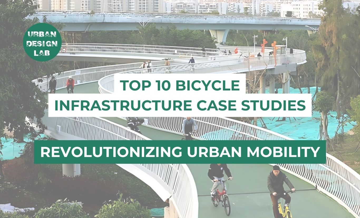
Related reading on Urban Design Lab: Designing the Last Mile Delivery Lane to Save Urban Streets; Top 10 Bicycle Infrastructure Case Studies