East Coast Boardwalk, Hong Kong, China – waterfront public realm project

East Coast Boardwalk is an instructive case for interpreting contemporary urban design as a combination of spatial form, ecological systems and public institutions. Located in Hong Kong, China, the project is associated with LWK+Partners. Its verified status for this editorial series is: Western section January 2025; eastern section December 2025. This distinction matters because a planned design, a completed landscape and a prize-winning older intervention provide different kinds of evidence. For practitioners, the project is most useful when examined for transferable methods rather than celebrated through photographs alone. Source: Official project or award record

The public harbourfront scheme provides around 2.2 kilometres of boardwalk, access points and pedestrian and shared-use spaces beneath the Island Eastern Corridor. The resulting public-realm questions extend beyond aesthetics: how are different users connected to the site, which ecological processes are addressed, who is responsible for maintenance, and how could outcomes be evaluated over time? These questions provide the analytical framework for the following case study. Source: Official project or award record

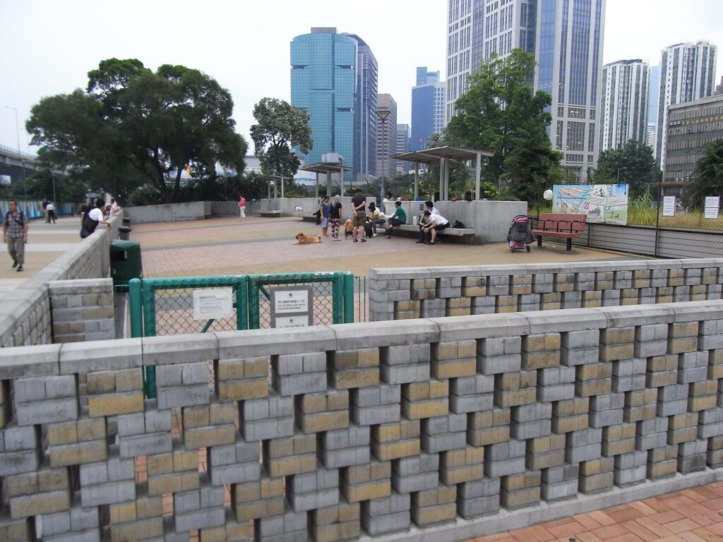
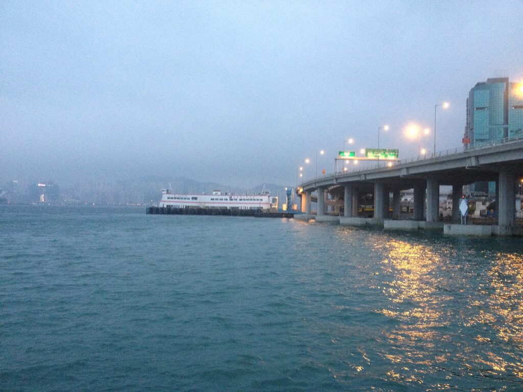
HK evening North Point Piers evening Promenade Pet Corner Sept-2012
HK evening North Point Piers evening Promenade Pet Corner Sept-2012. Image: Eafeonma, CC BY-SA 3.0, via Wikimedia Commons.

Project Context and Verified Status

The physical and institutional context is central to understanding East Coast Boardwalk. It is situated in Hong Kong, China, and the design attribution publicly reported for this project is LWK+Partners. The project is included in a 2025–2026 editorial series because of its opening, award recognition, approved plan or continued professional relevance within that period. Its category must not be confused with the date of initial design or construction. Source: Official project or award record

The key documented intervention is as follows: The public harbourfront scheme provides around 2.2 kilometres of boardwalk, access points and pedestrian and shared-use spaces beneath the Island Eastern Corridor. This statement summarises the source record rather than independent post-occupancy verification. Project presentations commonly describe intentions, which are important but different from observed outcomes. Reading the project through that distinction prevents a design vision from becoming an untested claim about sustainability, social life or mobility. Source: Official project or award record

Spatial Strategy and Urban Morphology

The spatial problem addressed by East Coast Boardwalk is best understood as the management of relationships: edge to centre, movement corridor to destination, built form to landscape, and neighbourhood to wider city. For waterfront accessibility, the most important analytical question is whether the new spatial sequence produces more connected, legible and usable public space. The response should be documented through plan analysis, section cuts and careful mapping of access points rather than inferred from a single perspective image.

A rigorous spatial assessment would compare the pre-intervention and proposed or existing street network, investigate walking distances to entrances, identify crossings and barriers, and measure the continuity of accessible routes. In projects organised around water or topography, cross-sections should also identify changing levels, flood elevations where relevant, edge conditions, planting structure and usable widths. These are proposed methods of assessment, not measurements already established for this case.

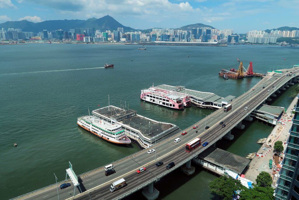
North Point Ferry Pier
North Point Ferry Pier. Image: Wpcpey, CC BY-SA 4.0, via Wikimedia Commons.

Landscape, Climate and Urban Ecology

East Coast Boardwalk also invites scrutiny of the relationship between constructed public space and environmental process. An ecological claim should identify the mechanism by which an intervention may work: retained soil permeability, water storage, shade provision, planting diversity, habitat continuity, or reduced conflict with motor traffic. Different mechanisms demand different indicators. For example, tree numbers alone cannot establish thermal comfort, while planted area alone cannot establish ecological health.

A defensible environmental study would specify the baseline year, relevant season, observation location and units. Possible indicators include surface-temperature distribution, canopy cover, soil sealing, stormwater detention, species richness, maintenance water consumption and exposure to flood events. None should be attributed as a proven outcome of the project without a published monitoring protocol or independently audited results.

Public Life, Equity and Governance

The civic value of East Coast Boardwalk depends partly on who can use it and under what conditions. A free-to-enter promenade can still be difficult for wheelchair users to reach; a new market can improve the public realm while threatening established traders if governance is weak; a heritage project can preserve fabric while narrowing local control. The applicable risk differs by place, but the general lesson is that spatial inclusion requires operational and social evidence.

Relevant fieldwork would include timed pedestrian counts, user interviews stratified by age and mobility, accessible-route audits, observations across weekdays and weekends, and documentation of security, trading permissions and maintenance arrangements. It is advisable to obtain participant consent and avoid interpreting non-participation as a lack of support. This would allow the published project narrative to be compared with everyday use.

Design Delivery, Technical Assessment and Transferable Methods

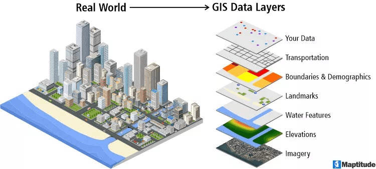
The project can be studied systematically with georeferenced historic imagery, cadastral or open street data, site photographs and official plans. A GIS baseline should record the project boundary, connected street network, public transport stops, entrances, slopes, waterways and green cover. A comparative drawing set could then combine figure-ground mapping, a pedestrian network map, an ecological systems diagram and an annotated section. Such diagrams are especially useful for comparing East Coast Boardwalk with cases in other countries.

Where the project has not been fully built, drawings should be labelled “proposed” and the research should avoid pre/post claims. Where the site is built, data collection should still distinguish a cross-sectional site visit from evidence of long-term change. GIS processing can describe measurable spatial configurations, but it cannot establish whether residents experience a space as welcoming without complementary qualitative methods.

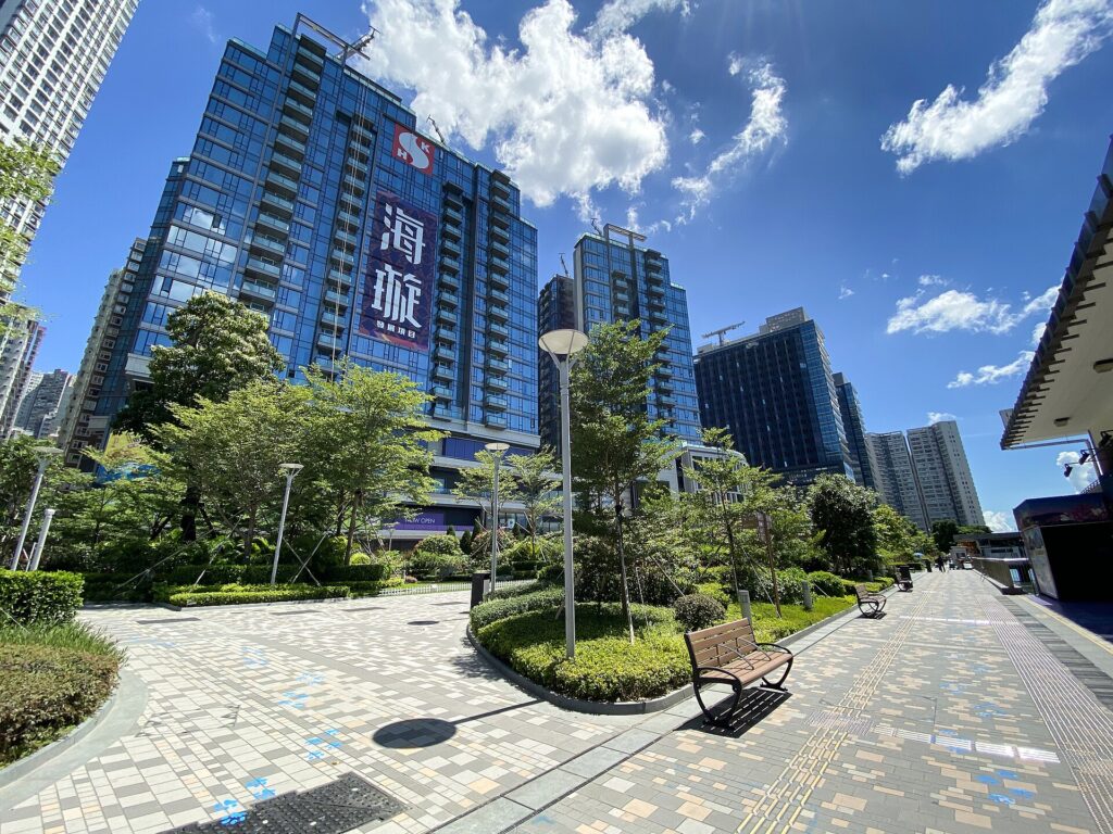
North Point Promenade
North Point Promenade. Image: Wpcpey, CC BY 4.0, via Wikimedia Commons.

Critical Appraisal and Research Limitations

Evaluate accessibility through arrival routes, ramps, wayfinding and conflicts between walking and cycling; length alone is not an adequate quality indicator. This is the most important qualification for an evidence-based reading of the case. A design award can indicate peer recognition of a compelling project or proposal, but it does not automatically certify carbon reduction, biodiversity recovery, universal access or social equity. Project-generated illustrations also differ from dated photographs of actual construction. Source: Official project or award record

A stronger assessment would make three evidence tiers explicit: verified project facts drawn from primary records; design intentions attributed to the authors; and independent outcomes demonstrated through monitoring or fieldwork. If only the first two are available, the project should still be discussed, but claims should be written conditionally and research gaps identified. This is preferable to substituting generic sustainability terminology for an evaluated result.

Lessons for Architects, Urban Designers and Planners

The transferable value of East Coast Boardwalk is not a shape or visual style that should be copied. It is a method of defining the urban problem, constructing a spatial response and testing whether that response meets public goals. For a comparable project, a design team should begin with a documented baseline of mobility, land use, hydrology where relevant, community needs and administrative constraints. The design brief should name measurable performance objectives before visual concepts are finalised.

During concept development, multidisciplinary review can identify conflicts between architectural detail, engineering performance and maintenance budgets. After delivery, repeatable observations and monitoring should report both successful outcomes and persistent exclusions. This approach makes high-profile international cases relevant to ordinary municipal projects where land, resources and implementation capacity are constrained.

This photo is taken in North Point
This photo is taken in North Point. Image: LN9267, CC BY-SA 4.0, via Wikimedia Commons.

Detailed Evaluation Framework for the Project

A useful project-specific assessment of East Coast Boardwalk would begin by defining a bounded study area and a documented period of comparison. For this waterfront accessibility case in Hong Kong, China, researchers should assemble an authoritative spatial base from municipal maps, official drawings and dated aerial records, then document which elements were already present and which are attributable to the intervention. An important initial check is whether the authoritative record describes an idea, a funded phase, constructed works or a completed operational facility. The answer governs whether a before-and-after evaluation, a design-compliance audit or a scenario appraisal is appropriate. Without an agreed boundary and date, percentages of green space, network length or new public access can become misleading.

The first field instrument should be an access and movement audit focused on East Coast Boardwalk. Record entrances, their opening arrangements, crossing safety, route widths, discontinuities, gradients, tactile guidance, surface quality, seating, lighting and transit connections. A transparent sampling design would separate high-activity access points from peripheral approaches and document at least different day types and time periods. If a route is labelled accessible, the claim should be tested against the appropriate local design standards rather than assumed from a published rendering. An accessibility audit should report the proportion and continuity of usable paths, not only count entrances. Because published design records typically highlight representative views, field photographs should include ordinary service edges and difficult intersections as well as celebrated landmarks.

The second instrument should assess the public-life dimension of waterfront accessibility. Observers can record stationary and moving activity in defined spatial units, distinguishing dwell time, activities and use groups without intruding on people’s privacy. Interviews can explore perceived comfort, safety, cultural meaning and the reasons non-users avoid the space. Any engagement sample must be described carefully; voluntary intercept surveys systematically miss some non-users and time-constrained residents. For East Coast Boardwalk, the aim is not to award an unqualified social-success score, but to distinguish visible patterns, reported experiences and unresolved questions. This is especially relevant where a project shifts land-use priorities, introduces tourism, restructures existing livelihoods or changes access to culturally significant settings.

The third instrument should match environmental indicators to the specific mechanism claimed for East Coast Boardwalk. Where stormwater is relevant, establish catchment limits, contributing impervious area, design storm assumptions, storage or infiltration pathways and overflow conditions. Where canopy or habitat is relevant, record existing and proposed tree survival, actual canopy cover, planting assemblages and seasonal maintenance. Where thermal comfort is relevant, distinguish air temperature, surface temperature and perceived radiant load rather than treating them as interchangeable. Indicators can be computed through GIS and site sensors, but remote-sensing pixels may be too coarse to evaluate small shaded paths or narrow urban edges. If project documents lack monitoring data, the article should describe design intent without claiming verified ecological gains.

The fourth instrument is an implementation and governance review. Identify which authority controls the land, who holds the capital budget, which organisation maintains the completed work and whether commercial or public access is subject to restrictions. This step is especially important for East Coast Boardwalk because the long-term value of waterfront accessibility depends on upkeep and equitable operation. Review procurement phases, publicly available consultation records, operating regulations and any evidence of design changes during delivery. If a masterplan is not yet built, record the legal planning stage and outstanding approvals; if a temporary intervention has ended, distinguish temporary activation from enduring urban change. In both settings, it is methodologically preferable to identify the implementation mechanism than to describe design images as achieved results.

Finally, publish the findings in an auditable case-study format. A one-page fact sheet for East Coast Boardwalk could include location, responsible design organisations, status as of the stated research date, verified area or length if available, publication sources, a dated base map and a map of evidence gaps. The analytical narrative should separate observations from interpretation, use comparable units in diagrams, and explicitly mark the claims supplied by project authors. A practical synthesis can then identify lessons for local planning contexts without universalising a site-specific solution. This method places an internationally recognised precedent within a replicable professional research process and creates a stronger basis for cross-project comparison than ranking cases by visual impact or award prestige.


Conclusion

East Coast Boardwalk contributes to debates about waterfront accessibility by demonstrating how a particular landscape or urban condition can be reframed as a public-design problem. The verified project record establishes a meaningful case to study, but it should not be overstated as universally successful or directly transferable to other settings. Physical context, governance, environmental conditions and project stage shape what can reasonably be learned.

The most productive next step is a documented evaluation of spatial access, everyday use and environmental performance appropriate to Hong Kong, China. For Urban Design Lab readers, this shifts attention from image-led admiration toward a more useful question: what can be tested, reproduced and critically adapted? Evaluate accessibility through arrival routes, ramps, wayfinding and conflicts between walking and cycling; length alone is not an adequate quality indicator.

Related Reading: Global 2025–2026 Project Series

Return to the pillar article: 20 Best Urban Planning and Urban Design Projects of 2025–2026 Around the World

Companion case study Word files are linked inside the supplied ZIP collection. WordPress permalinks cannot be provided until the posts are published.

Leave a Reply

Your email address will not be published. Required fields are marked *

This site uses Akismet to reduce spam. Learn how your comment data is processed.

Related articles

UDL Thesis Publication 2025

Call for Abstracts now open!

Urban Mapping

MASTERCLASS

Urban Mapping, Analysis and Representation

Session Dates

21st- 22nd November 2026

Curating the best graduate thesis projects globally!

Publish your work and get recognized globally!

Free E-Book

From thesis to Portfolio

A Guide to Convert Academic Work into a Professional Portfolio”

Urban Design Lab

Be the part of our Network

  • Stay updated on workshops, design tools, and calls for collaboration

  • Thesis Report Writing for Architecture and Urban Studies

    Join Our WhatsApp Group

    Recent Posts

    Sign up for our Newsletter

    “Let’s explore the new avenues of Urban environment together “

    E-Book- From Thesis To Portfolio

    A Guide to Convert Academic Work into a Professional Portfolio