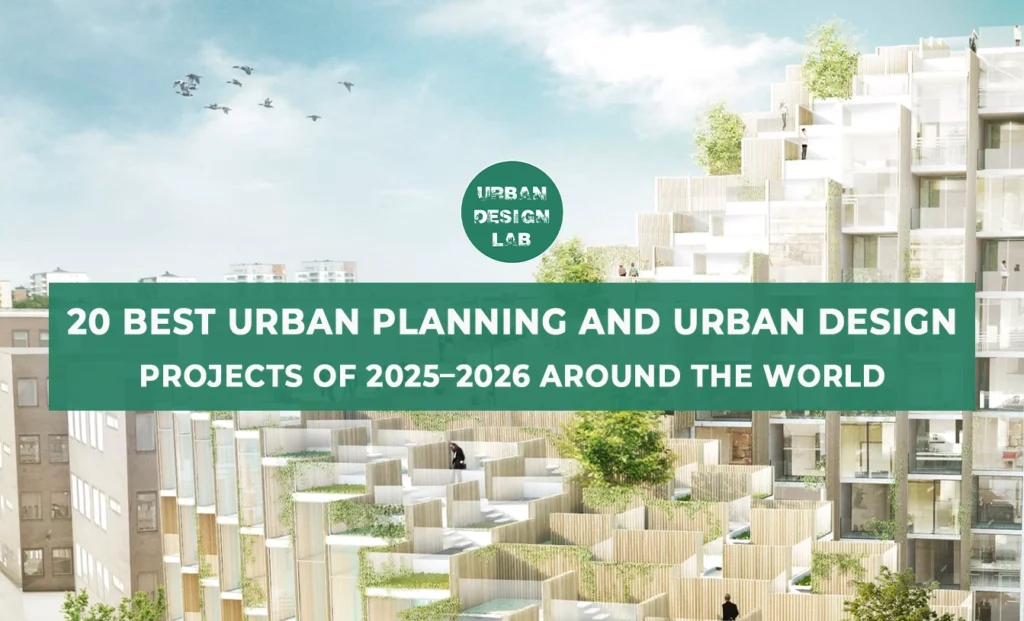
Across 2025 and 2026, urban design projects drew renewed professional attention to the relationship between public life, climate adaptation, infrastructure conversion and the stewardship of cultural landscapes. This selection considers 20 notable projects in North America, Europe, Asia, Africa, the Palestinian Territory, Oceania and South America. It is an editorial shortlist rather than a statistically defensible global ranking. The projects were selected because of verifiable activity or professional recognition during the period and their usefulness as case studies for contemporary practice.
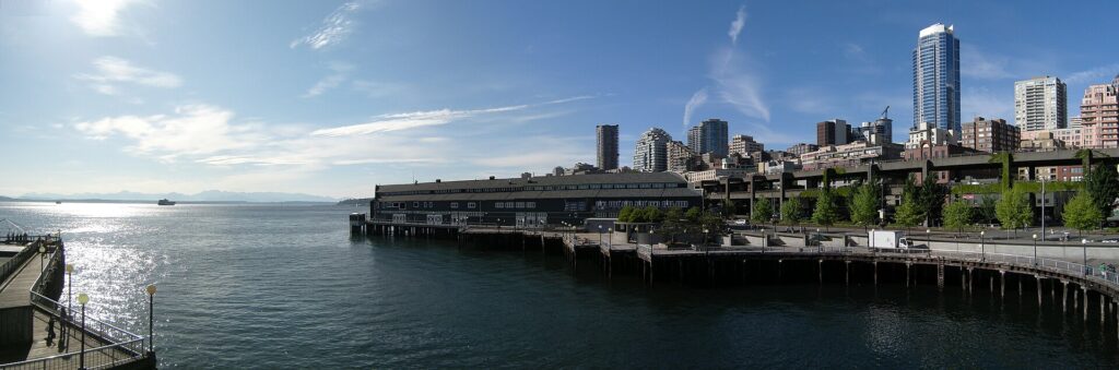
Seattle Waterfront Park, located in Seattle, United States, is associated with Field Operations. For this editorial selection, its project status is: Opened September 2025. Removal of the Alaskan Way Viaduct made possible a 20-acre public waterfront, with promenade, cycling facilities, piers and improved downtown connections.
The case is relevant to urban designers because it opens a larger discussion about waterfront regeneration, public accessibility and the capacity of built or proposed landscapes to address social and environmental needs. The central design achievement is an urban reconnection, but an attractive waterfront should not be treated as proof of equitable access without evidence about who uses it. For comparison with other cities, the useful analytical output would be an annotated plan of entrances and barriers, a spatial systems diagram and a clearly stated distinction between reported intentions and measured results. Source: Official project or award record
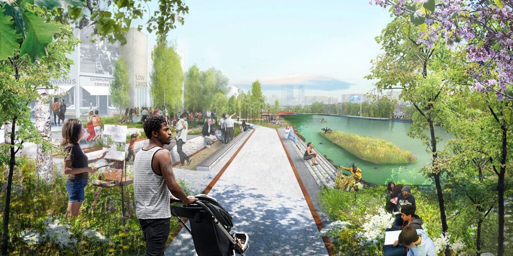
Gowanus Lowlands, located in Brooklyn, New York, United States, is associated with SCAPE. For this editorial selection, its project status is: Urban design framework, recognised 2026. A community-informed framework for an ecological and civic landscape system along the 1.8-mile Gowanus Canal, a Superfund site, in a district planning substantial housing growth. Source: Official project or award record
The case is relevant to urban designers because it opens a larger discussion about industrial regeneration, public accessibility and the capacity of built or proposed landscapes to address social and environmental needs. Remediation, flood risk and public access must be judged together; opened private-public landscapes do not demonstrate that the complete framework has been delivered. For comparison with other cities, the useful analytical output would be an annotated plan of entrances and barriers, a spatial systems diagram and a clearly stated distinction between reported intentions and measured results. Source: Official project or award record
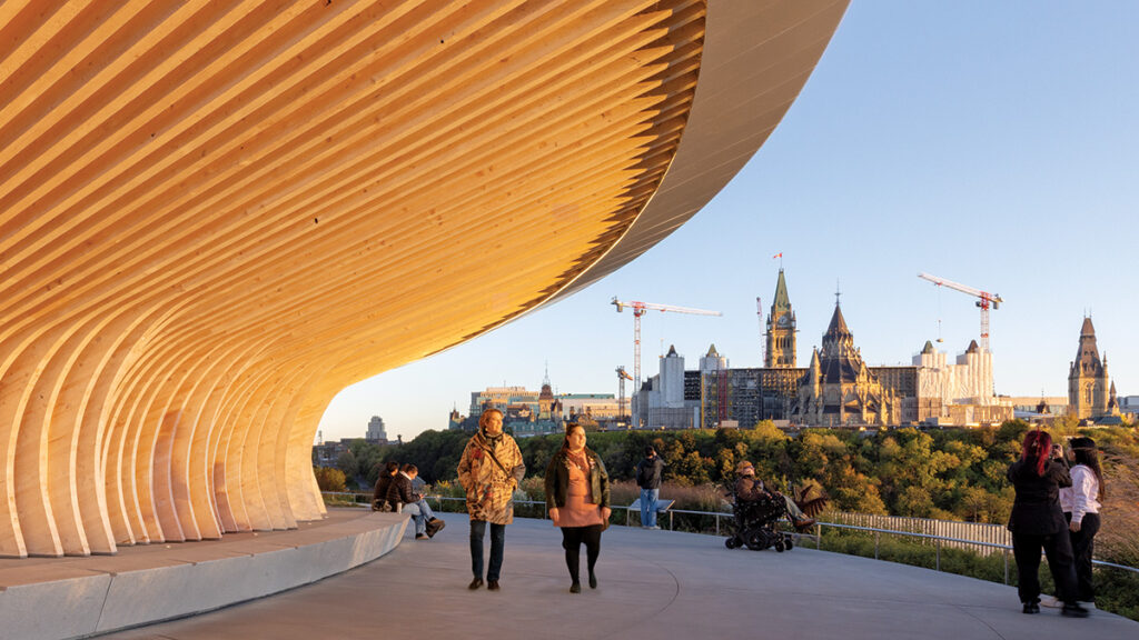
Kìwekì Point, located in Ottawa, Canada, is associated with Janet Rosenberg & Studio. For this editorial selection, its project status is: Built project, recognised 2026. The redesign of a national-capital promontory foregrounds the Ottawa River valley, ecological planting, gathering and Indigenous interpretation rather than monumental display alone. Source: Official project or award record
The case is relevant to urban designers because it opens a larger discussion about cultural landscape, public accessibility and the capacity of built or proposed landscapes to address social and environmental needs. Indigenous naming and engagement should be discussed as governance and cultural representation, not merely as a decorative identity layer. For comparison with other cities, the useful analytical output would be an annotated plan of entrances and barriers, a spatial systems diagram and a clearly stated distinction between reported intentions and measured results. Source: Official project or award record
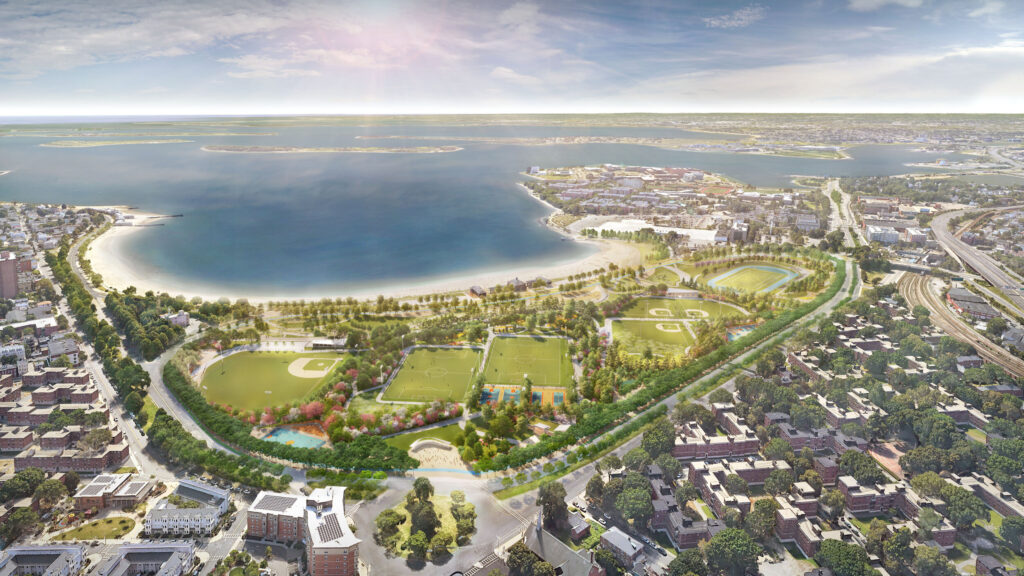
Moakley Park, located in Boston, United States, is associated with Stoss Landscape Urbanism. For this editorial selection, its project status is: Resilience plan, recognised 2025. A proposal to combine public recreation and open-space access with restored marshes, stormwater management, adaptive landforms and coastal resilience. Source: Official project or award record
The case is relevant to urban designers because it opens a larger discussion about climate adaptation, public accessibility and the capacity of built or proposed landscapes to address social and environmental needs. A planned resilience landscape is not equivalent to demonstrated flood prevention, and benefits depend on modelling assumptions, investment and maintenance. For comparison with other cities, the useful analytical output would be an annotated plan of entrances and barriers, a spatial systems diagram and a clearly stated distinction between reported intentions and measured results. Source: Official project or award record
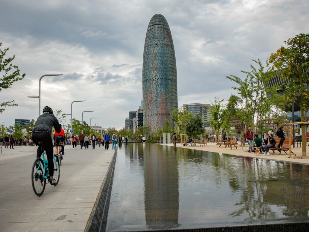
Plaça de les Glòries, located in Barcelona, Spain, is associated with Agence TER and collaborators. For this editorial selection, its project status is: Multiphase transformation active in 2025–26. A long-running urban transformation replaces the legacy of a major road interchange with green public space and reconnections between surrounding districts. Source: Official project or award record
The case is relevant to urban designers because it opens a larger discussion about street reclamation, public accessibility and the capacity of built or proposed landscapes to address social and environmental needs. Its relevance lies in the wider mobility and street network, not in park landscaping alone; a completion claim requires phase-specific evidence. For comparison with other cities, the useful analytical output would be an annotated plan of entrances and barriers, a spatial systems diagram and a clearly stated distinction between reported intentions and measured results. Source: Official project or award record
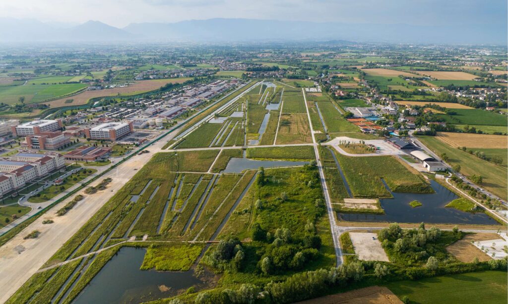
Parco della Pace, located in Vicenza, Italy, is associated with EMF, PAN Associati and collaborators. For this editorial selection, its project status is: Opened September 2025. The former military airfield has been remade as an extensive public park, with water-sensitive landscape design, trails, recreation and habitat opportunities. Source: Official project or award record
The case is relevant to urban designers because it opens a larger discussion about adaptive landscape reuse, public accessibility and the capacity of built or proposed landscapes to address social and environmental needs. Published area figures refer to different planning extents: the local tourism authority reports a 63-hectare open park, while an earlier designer scheme described 100 hectares. For comparison with other cities, the useful analytical output would be an annotated plan of entrances and barriers, a spatial systems diagram and a clearly stated distinction between reported intentions and measured results. Source: Official project or award record
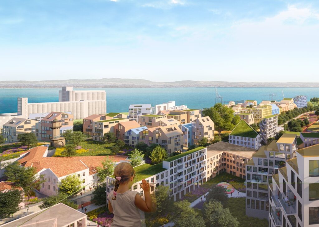
Marvila Masterplan, located in Lisbon, Portugal, is associated with MVRDV, OODA, LOLA and Thornton Tomasetti. For this editorial selection, its project status is: Masterplan approved 2026, not built. An approximately 28-hectare approved plan sets out 1,400 homes, four connected urban areas, parkland, public services and links across transport barriers. Source: Official project or award record
The case is relevant to urban designers because it opens a larger discussion about urban regeneration, public accessibility and the capacity of built or proposed landscapes to address social and environmental needs. There is a material gap between council approval, environmental assessment, delivery and measurable social outcomes. For comparison with other cities, the useful analytical output would be an annotated plan of entrances and barriers, a spatial systems diagram and a clearly stated distinction between reported intentions and measured results. Source: Official project or award record
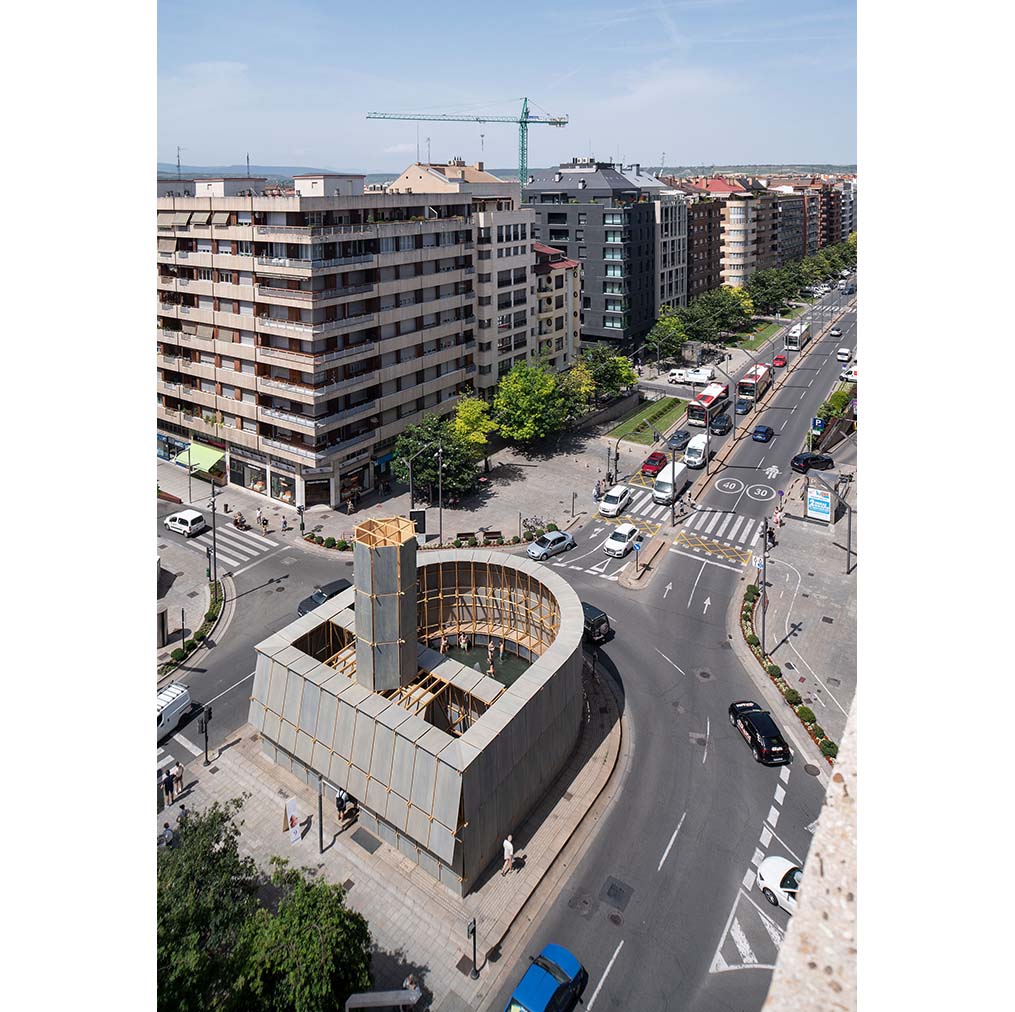
Round About Baths, located in Logroño, Spain, is associated with Leopold Banchini Architects. For this editorial selection, its project status is: Temporary installation, 2025. A 205-square-metre temporary communal bathing installation occupied an otherwise inaccessible central traffic island during the Concéntrico festival. Source: Official project or award record
The case is relevant to urban designers because it opens a larger discussion about tactical urbanism, public accessibility and the capacity of built or proposed landscapes to address social and environmental needs. Its brief existence makes it a powerful spatial provocation, but it is not evidence that a permanent traffic reallocation or heat adaptation programme followed. For comparison with other cities, the useful analytical output would be an annotated plan of entrances and barriers, a spatial systems diagram and a clearly stated distinction between reported intentions and measured results. Source: Official project or award record
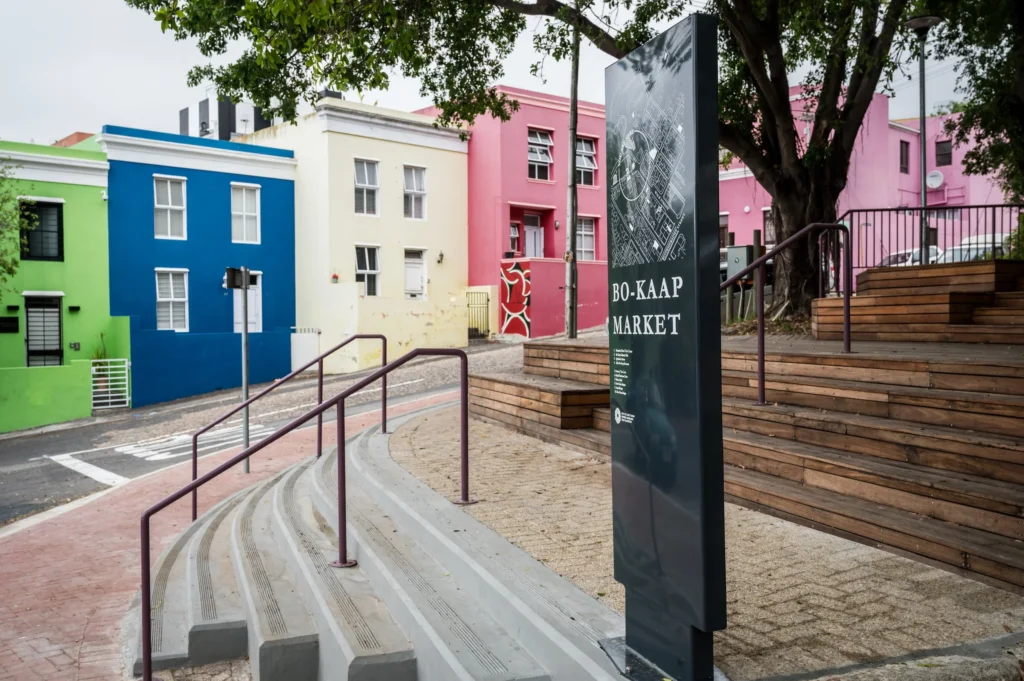
Bo-Kaap Market, located in Cape Town, South Africa, is associated with Yes& Studio. For this editorial selection, its project status is: Built phase, recognised 2026. Upgrades a neighbourhood gateway with seating, trading infrastructure and spaces for everyday gathering, with phase two reported in progress. Source: Official project or award record
The case is relevant to urban designers because it opens a larger discussion about inclusive urbanism, public accessibility and the capacity of built or proposed landscapes to address social and environmental needs. Design quality should be assessed in terms of traders’ tenure, affordability, storage, daily maintenance and social access, not visual appearance alone. For comparison with other cities, the useful analytical output would be an annotated plan of entrances and barriers, a spatial systems diagram and a clearly stated distinction between reported intentions and measured results. Source: Official project or award record
10. Old Dhaka Central Jail Conservation: Heritage adaptive reuse
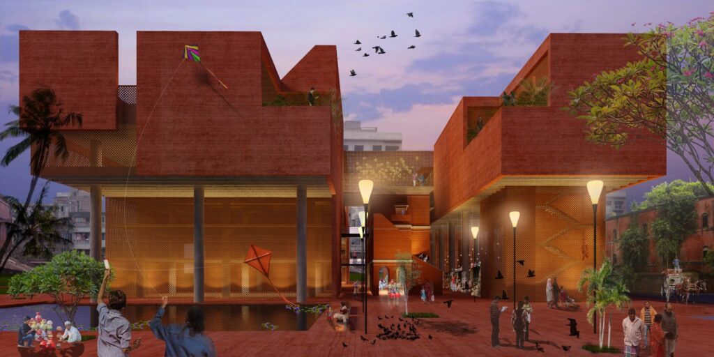
Old Dhaka Central Jail Conservation, located in Dhaka, Bangladesh, is associated with Form.3 Architects. For this editorial selection, its project status is: Design proposal, Holcim award 2025. A conservation and adaptive reuse proposal reframes an isolated historic prison as publicly accessible parkland and cultural infrastructure, integrating passive ventilation and material reuse. Source: Official project or award record
The case is relevant to urban designers because it opens a larger discussion about heritage adaptive reuse, public accessibility and the capacity of built or proposed landscapes to address social and environmental needs. Design-stage descriptions should not be written as completed conservation works, and public accessibility must eventually be tested in practice. For comparison with other cities, the useful analytical output would be an annotated plan of entrances and barriers, a spatial systems diagram and a clearly stated distinction between reported intentions and measured results. Source: Official project or award record
Old Dhaka Central Jail Conservation, design rendering illustrating one of the selected project approaches. Image: FORM.3 Architects; via Ceramic Bangladesh.
11. Qalandiya: The Green Historic Maze: Community heritage
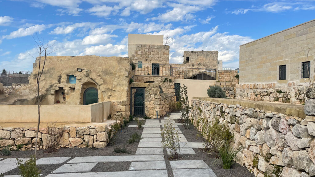
Qalandiya: The Green Historic Maze, located in Qalandiya, Palestinian Territory, is associated with RIWAQ. For this editorial selection, its project status is: Incremental rehabilitation and further detailed design, recognised 2025. A village-centre conservation initiative combines local stonework, traditional water management, community engagement and a reinvestment model for restored historic spaces. Source: Official project or award record
The case is relevant to urban designers because it opens a larger discussion about community heritage, public accessibility and the capacity of built or proposed landscapes to address social and environmental needs. Different components have different stages of progress; attribution of 13,800 artisan workdays and the 15-year lease model follows the award submission and should be identified as project-reported. For comparison with other cities, the useful analytical output would be an annotated plan of entrances and barriers, a spatial systems diagram and a clearly stated distinction between reported intentions and measured results. Source: Official project or award record
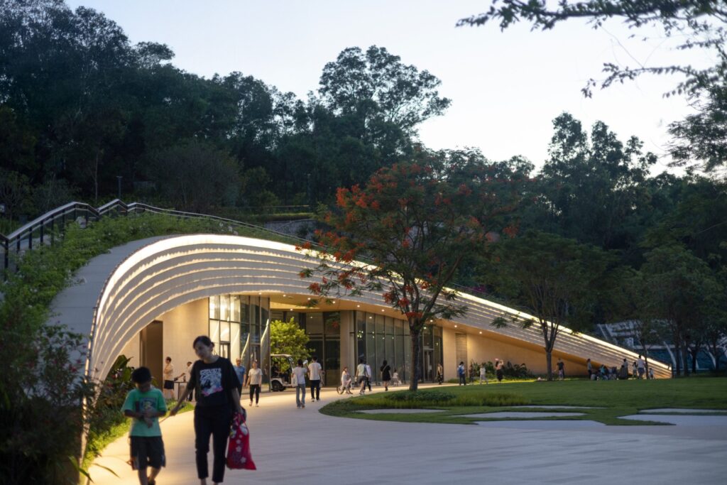
Honggang Park, located in Shenzhen, China, is associated with SWA Group. For this editorial selection, its project status is: Built, recognised 2026. SWA describes an 80-acre corridor set between two hills, with a connected trail network, outlooks and over 5,000 trees added or preserved. Source: Official project or award record
The case is relevant to urban designers because it opens a larger discussion about green infrastructure, public accessibility and the capacity of built or proposed landscapes to address social and environmental needs. Its hilly trails illustrate landscape-led design but do not inherently guarantee universal accessibility at every segment. For comparison with other cities, the useful analytical output would be an annotated plan of entrances and barriers, a spatial systems diagram and a clearly stated distinction between reported intentions and measured results. Source: Official project or award record
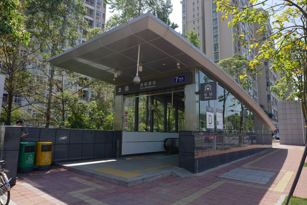
Xili Lake Greenway, located in Shenzhen, China, is associated with SWA Group. For this editorial selection, its project status is: Built, recognised 2026. Recognised in the 2026 WLA Built Sustainability and Resilience category, the greenway uses landscape networks as public and ecological infrastructure. Source: Official project or award record
The case is relevant to urban designers because it opens a larger discussion about greenway connectivity, public accessibility and the capacity of built or proposed landscapes to address social and environmental needs. Award recognition verifies project significance but does not substitute for independently measured biodiversity or connectivity outcomes. For comparison with other cities, the useful analytical output would be an annotated plan of entrances and barriers, a spatial systems diagram and a clearly stated distinction between reported intentions and measured results. Source: Official project or award record
14. Longgang River Blueway: Blue-green infrastructure
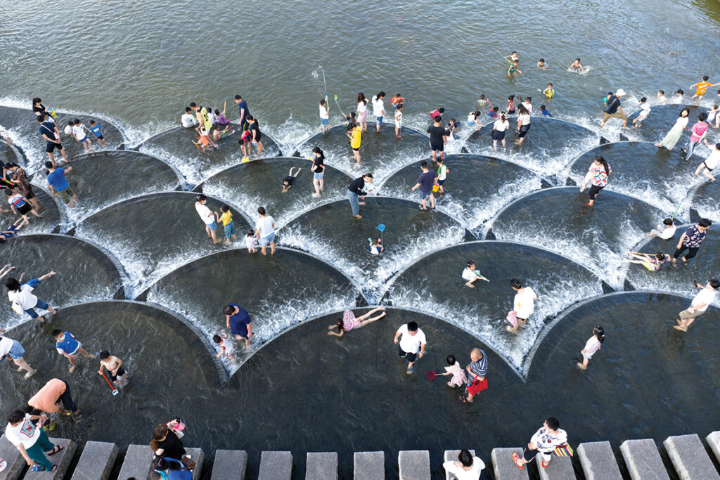
Longgang River Blueway, located in Shenzhen, China, is associated with SWA Group, HASSELL and partner institutes. For this editorial selection, its project status is: Built, recognised 2026. A collaborative river-corridor project recognised by ASLA in the 2026 urban design category for reconnecting urban public space and river landscapes. Source: Official project or award record
The case is relevant to urban designers because it opens a larger discussion about blue-green infrastructure, public accessibility and the capacity of built or proposed landscapes to address social and environmental needs. Claims about water-quality improvement, flood reduction and equitable access require measured baseline and post-project monitoring. For comparison with other cities, the useful analytical output would be an annotated plan of entrances and barriers, a spatial systems diagram and a clearly stated distinction between reported intentions and measured results. Source: Official project or award record
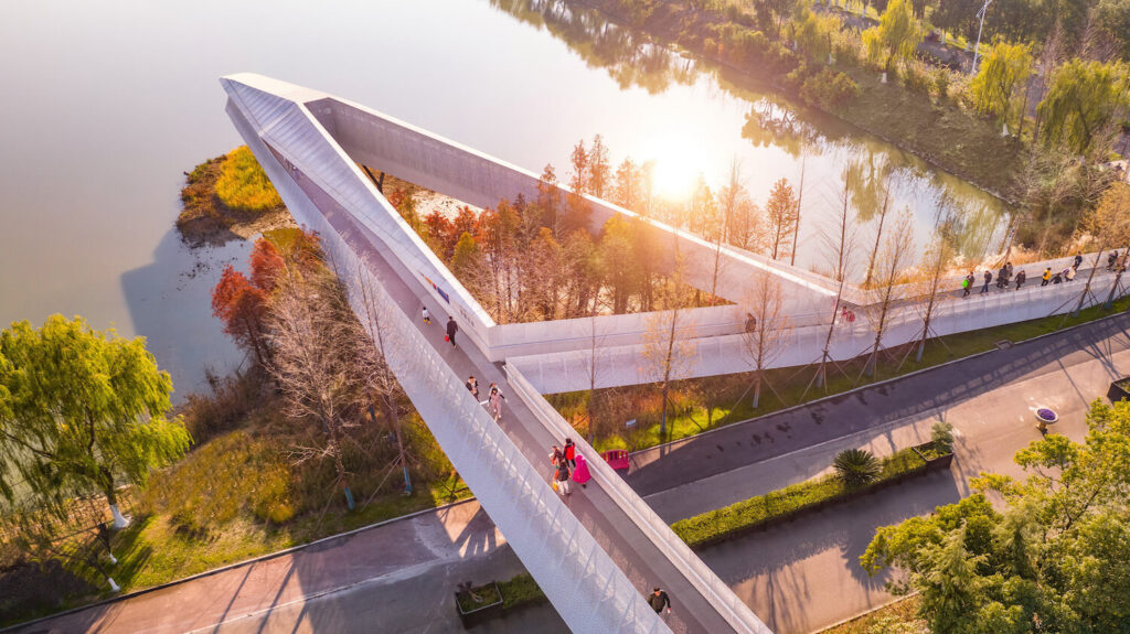
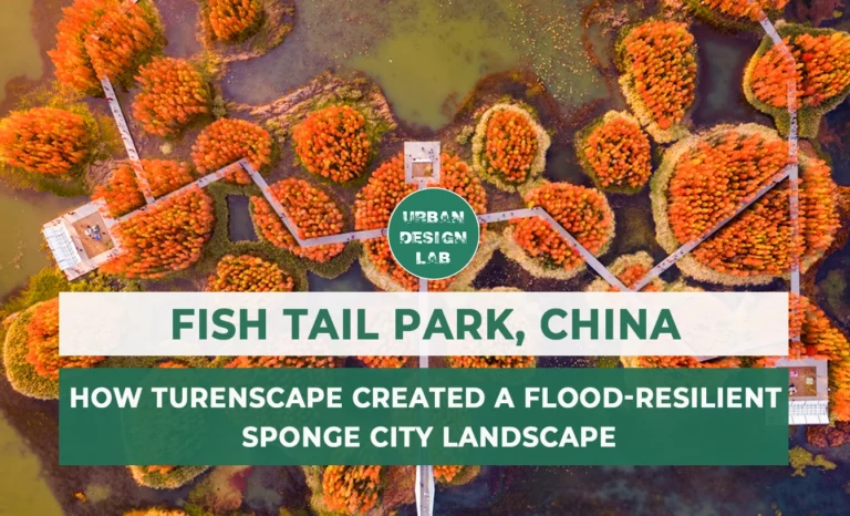
Fish Tail Park, located in Nanchang, China, is associated with Turenscape. For this editorial selection, its project status is: Built before 2025, awarded in 2025 and 2026. Transforms a degraded former fish-farming and coal-ash landscape into a water-based park; ASLA describes a 126-acre area, engineered islets and flood-adapted planting. Source: Official project or award record
The case is relevant to urban designers because it opens a larger discussion about sponge city, public accessibility and the capacity of built or proposed landscapes to address social and environmental needs. This is not a new 2025 construction project; the featured time period concerns professional recognition, and performance statistics should be attributed to the designer’s submission. For comparison with other cities, the useful analytical output would be an annotated plan of entrances and barriers, a spatial systems diagram and a clearly stated distinction between reported intentions and measured results. Source: Official project or award record
16. East Coast Boardwalk: Waterfront accessibility
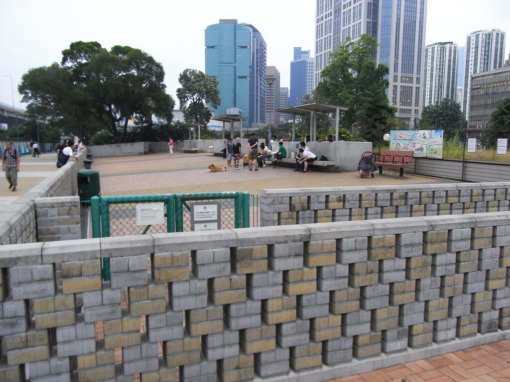
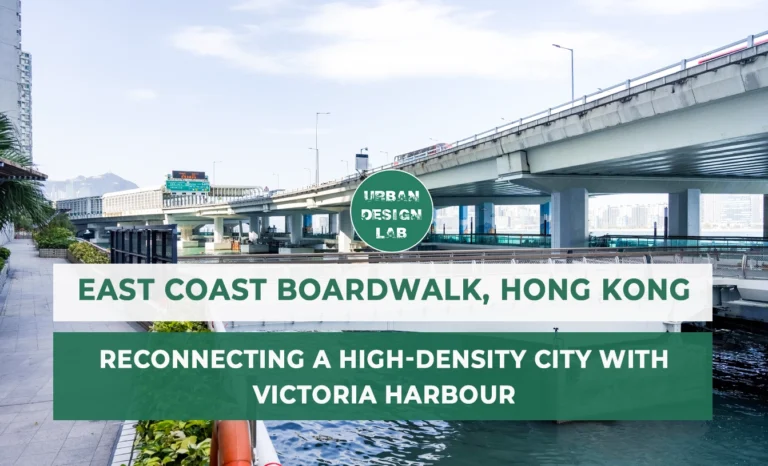
East Coast Boardwalk, located in Hong Kong, China, is associated with LWK+Partners. For this editorial selection, its project status is: Western section January 2025; eastern section December 2025. The public harbourfront scheme provides around 2.2 kilometres of boardwalk, access points and pedestrian and shared-use spaces beneath the Island Eastern Corridor. Source: Official project or award record
The case is relevant to urban designers because it opens a larger discussion about waterfront accessibility, public accessibility and the capacity of built or proposed landscapes to address social and environmental needs. Evaluate accessibility through arrival routes, ramps, wayfinding and conflicts between walking and cycling; length alone is not an adequate quality indicator. For comparison with other cities, the useful analytical output would be an annotated plan of entrances and barriers, a spatial systems diagram and a clearly stated distinction between reported intentions and measured results. Source: Official project or award record
17. Ly Thuong Kiet Street Urban Design: Street design
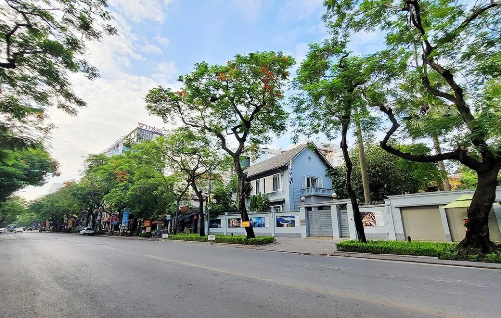
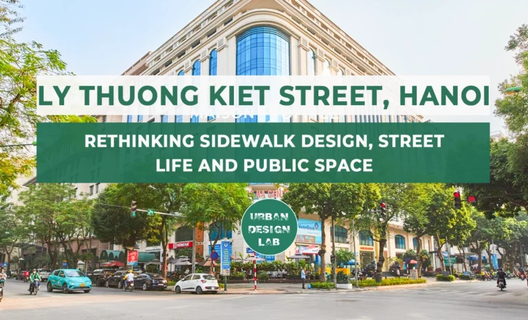
Ly Thuong Kiet Street Urban Design, located in Hanoi, Vietnam, is associated with VIUP and JC Viet Nam. For this editorial selection, its project status is: Urban design proposal, 2025 award. An award-winning street design proposal links culture, community activity and public connectivity through improved sidewalks, greenery, trading areas and transit interfaces. Source: Official project or award record
The case is relevant to urban designers because it opens a larger discussion about street design, public accessibility and the capacity of built or proposed landscapes to address social and environmental needs. The scheme should be presented as a proposal rather than assumed citywide implementation, and formalisation of sidewalk trade requires attention to livelihoods. For comparison with other cities, the useful analytical output would be an annotated plan of entrances and barriers, a spatial systems diagram and a clearly stated distinction between reported intentions and measured results. Source: Official project or award record
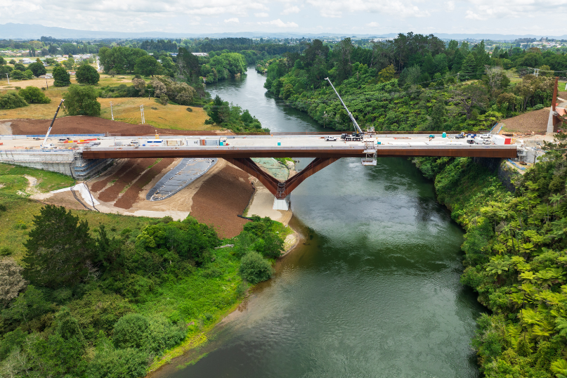
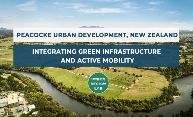
Peacocke Strategic Infrastructure Project, located in Hamilton, New Zealand, is associated with Adrian Morton Landscape Architects and collaborators. For this editorial selection, its project status is: Built infrastructure, 2026 award. A river crossing and connected parkland, streetscape and active-travel network guide southern growth, with cultural and ecological design considerations. Source: Official project or award record
The case is relevant to urban designers because it opens a larger discussion about urban expansion, public accessibility and the capacity of built or proposed landscapes to address social and environmental needs. It illustrates infrastructure designed as public realm, but its contribution to mode shift should be measured rather than inferred from facility provision. For comparison with other cities, the useful analytical output would be an annotated plan of entrances and barriers, a spatial systems diagram and a clearly stated distinction between reported intentions and measured results. Source: Official project or award record
Peacocke Strategic Infrastructure Project, photograph (construction stage) illustrating one of the selected project approaches. Image: Hamilton City Council.
19. St Kilda Pier Redevelopment: Coastal public space
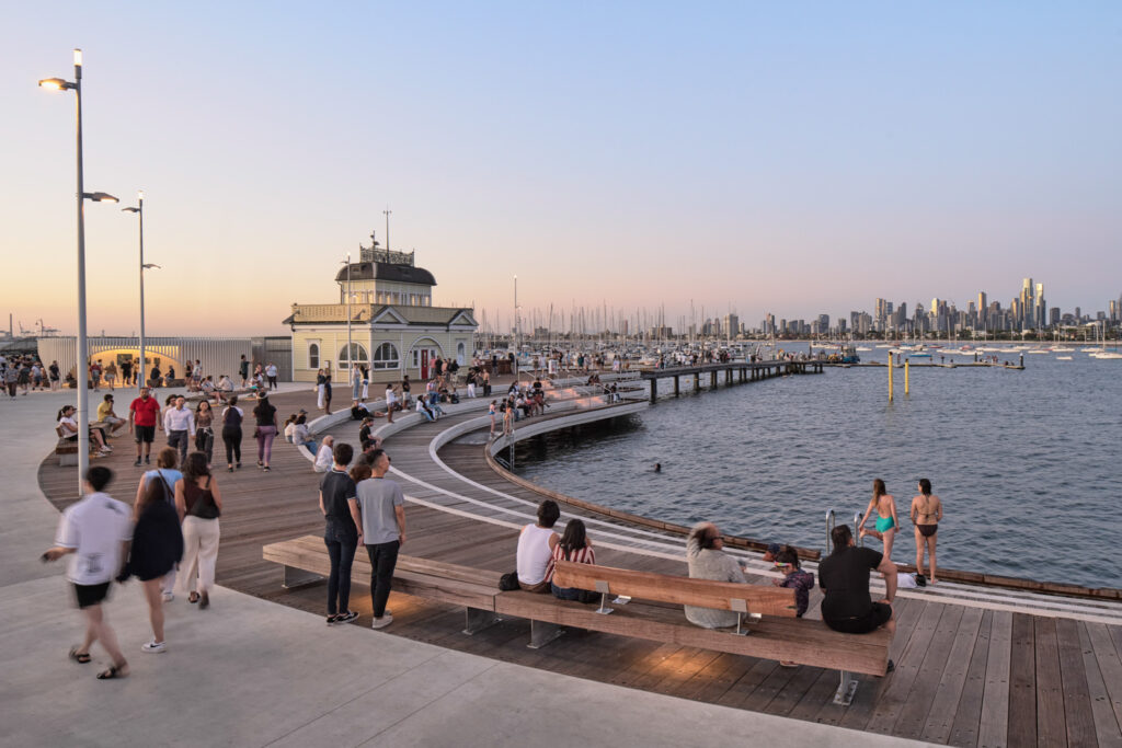
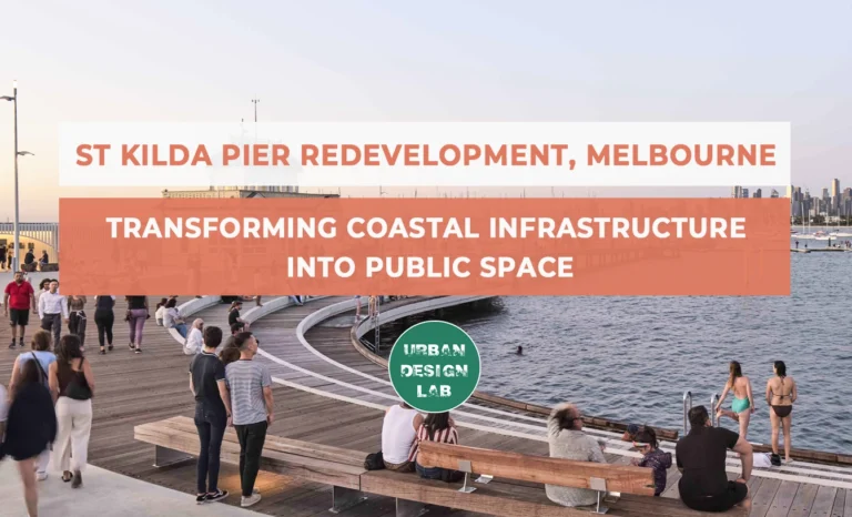
St Kilda Pier Redevelopment, located in Melbourne, Australia, is associated with Jackson Clements Burrows and collaborators. For this editorial selection, its project status is: Built redevelopment, 2026 award. A renewed coastal pier combines public promenade access, marine setting, recreation and infrastructure with management of sensitive waterfront conditions. Source: Official project or award record
The case is relevant to urban designers because it opens a larger discussion about coastal public space, public accessibility and the capacity of built or proposed landscapes to address social and environmental needs. Marine ecology, accessibility and visitor management matter alongside appearance; published design awards cannot alone demonstrate ecological success. For comparison with other cities, the useful analytical output would be an annotated plan of entrances and barriers, a spatial systems diagram and a clearly stated distinction between reported intentions and measured results. Source: Official project or award record
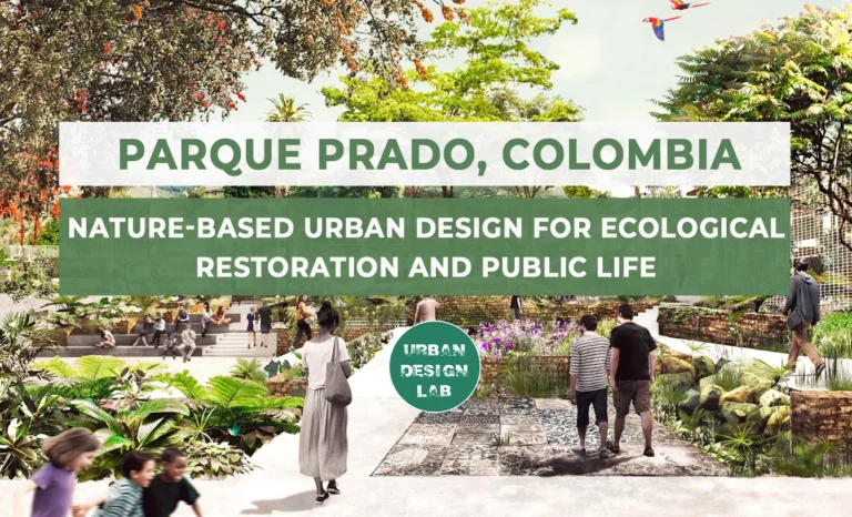
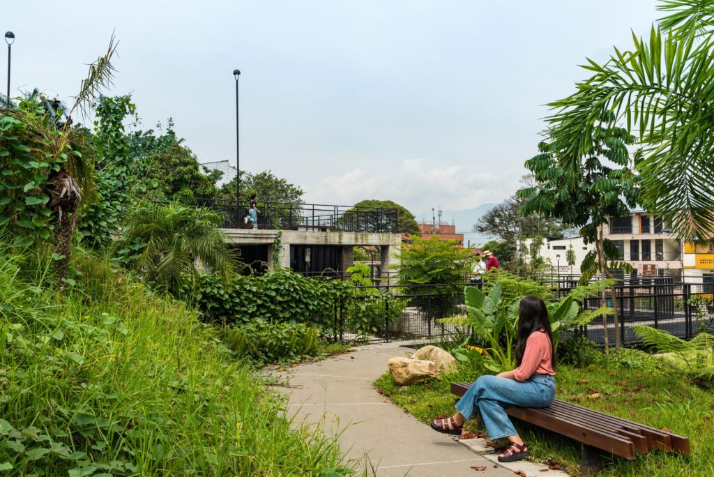
Parque Prado, located in Colombia, is associated with Connatural Arquitectura en el Paisaje. For this editorial selection, its project status is: Built, 2026 UIA award. Recognised jointly in the 2026 UIA 2030 awards category for access to green and public space, integrating water management, restoration and memory of place. Source: Official project or award record
The case is relevant to urban designers because it opens a larger discussion about nature-based urbanism, public accessibility and the capacity of built or proposed landscapes to address social and environmental needs. The official award rationale supports the design approach but detailed quantified post-occupancy impacts cannot be assumed without independent records. For comparison with other cities, the useful analytical output would be an annotated plan of entrances and barriers, a spatial systems diagram and a clearly stated distinction between reported intentions and measured results. Source: Official project or award record
Cross-Project Themes and What They Mean for Urban Practice
Waterfront reconnection appears in Seattle, Hong Kong and Shenzhen, but these projects address different urban conditions. A former elevated highway, constrained harbour infrastructure and a river corridor do not constitute a single typology. The transferable lesson is to begin with access and the distribution of public space, then test environmental and mobility outcomes against local conditions. Source: Official project or award record
Landscape-led resilience features in Boston, Nanchang and the ecological greenways. The term “resilient” should be unpacked into flood exposure, rainwater retention, heat mitigation, ecological continuity and the governance of maintenance. A visually green project may perform poorly under particular storm events, and a robust drainage intervention may not serve everyday public use well. Both performance domains require evaluation. Source: Official project or award record
Heritage conservation and inclusion are prominent in Dhaka, Qalandiya, Ottawa and Cape Town. These cases demonstrate why public realm design needs to consider authority, cultural continuity, property arrangements and livelihoods. The strongest research methodology combines mapping and architectural documentation with carefully conducted engagement and observation. Project-specific social outcomes should not be inferred simply from design-team claims. Source: Official project or award record
How to Analyse These Projects Using GIS and Urban Design Methods
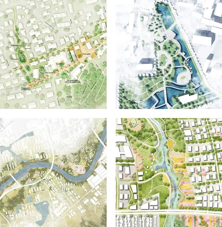
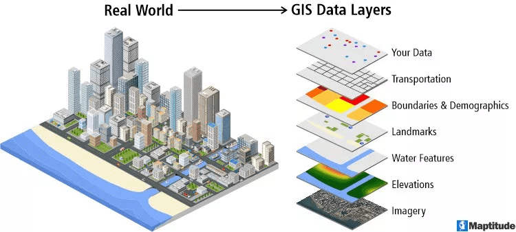
For a rigorous comparative study, first establish a consistent unit of analysis. Urban parks can be represented by accessible boundaries and entrances; corridors require route length and cross-sectional continuity; district masterplans require land-use parcels and transport connections. Avoid treating different project boundaries as equivalent. A GIS workflow can use official project plans and georeferenced basemaps to map street centrality, green-space proximity and land-cover change where valid inputs exist.
Second, distinguish process indicators from outcome indicators. A project can document that community meetings occurred without proving broad representation; it can add a cycle lane without proving a reduction in car travel; it can propose wetland planting without showing increased biodiversity. A strong research design defines the hypothesised effect, the observation method, an appropriate counterfactual if causal inference is attempted, and the limits of available data.
Third, communicate results through comparable drawings. Use consistent scale bars, north arrows, map units, dates and classification rules. For each case, the reader should be able to locate the project, understand the spatial transformation, identify the evidence supporting the claim and distinguish completed construction from conceptual illustrations. Such editorial discipline is particularly important when architectural media mixes photographs and renderings.
Conclusion
The strongest common theme across the selected projects is the expansion of urban design beyond formal composition. Infrastructure, hydrology, cultural identity, microclimate, public-space governance and social use shape how a place works. Some schemes demonstrate built transformations; others offer valuable proposals whose claims remain to be tested after implementation. Both are worth studying, provided their status is transparent.
For architects, planners and researchers, the shortlist is an entry point rather than an endpoint. Each case-study article in this series develops the principal design problem, the reported project strategy, methods for technical assessment and the limitations of currently available evidence. The resulting comparative framework can inform new project briefs without assuming that an internationally recognised precedent will produce the same outcomes under different social, climatic or institutional conditions.
“Let’s explore the new avenues of Urban environment together “
We use cookies on our website to give you the most relevant experience by remembering your preferences and repeat visits. By clicking “Accept”, you consent to the use of all the cookies. Read More
This website uses cookies to improve your experience while you navigate through the website. Out of these, the cookies that are categorized as necessary are stored on your browser as they are essential for the working of basic functionalities of the website. We also use third-party cookies that help us analyze and understand how you use this website. These cookies will be stored in your browser only with your consent. You also have the option to opt-out of these cookies. But opting out of some of these cookies may affect your browsing experience.
Necessary cookies are absolutely essential for the website to function properly. These cookies ensure basic functionalities and security features of the website, anonymously.
Cookie
Duration
Description
cookielawinfo-checkbox-analytics
11 months
This cookie is set by GDPR Cookie Consent plugin. The cookie is used to store the user consent for the cookies in the category "Analytics".
cookielawinfo-checkbox-functional
11 months
The cookie is set by GDPR cookie consent to record the user consent for the cookies in the category "Functional".
cookielawinfo-checkbox-necessary
11 months
This cookie is set by GDPR Cookie Consent plugin. The cookies is used to store the user consent for the cookies in the category "Necessary".
cookielawinfo-checkbox-others
11 months
This cookie is set by GDPR Cookie Consent plugin. The cookie is used to store the user consent for the cookies in the category "Other.
cookielawinfo-checkbox-performance
11 months
This cookie is set by GDPR Cookie Consent plugin. The cookie is used to store the user consent for the cookies in the category "Performance".
viewed_cookie_policy
11 months
The cookie is set by the GDPR Cookie Consent plugin and is used to store whether or not user has consented to the use of cookies. It does not store any personal data.
Functional cookies help to perform certain functionalities like sharing the content of the website on social media platforms, collect feedbacks, and other third-party features.
Performance cookies are used to understand and analyze the key performance indexes of the website which helps in delivering a better user experience for the visitors.
Analytical cookies are used to understand how visitors interact with the website. These cookies help provide information on metrics the number of visitors, bounce rate, traffic source, etc.
Advertisement cookies are used to provide visitors with relevant ads and marketing campaigns. These cookies track visitors across websites and collect information to provide customized ads.